We’re not out of COVID country yet, so protect and then play.
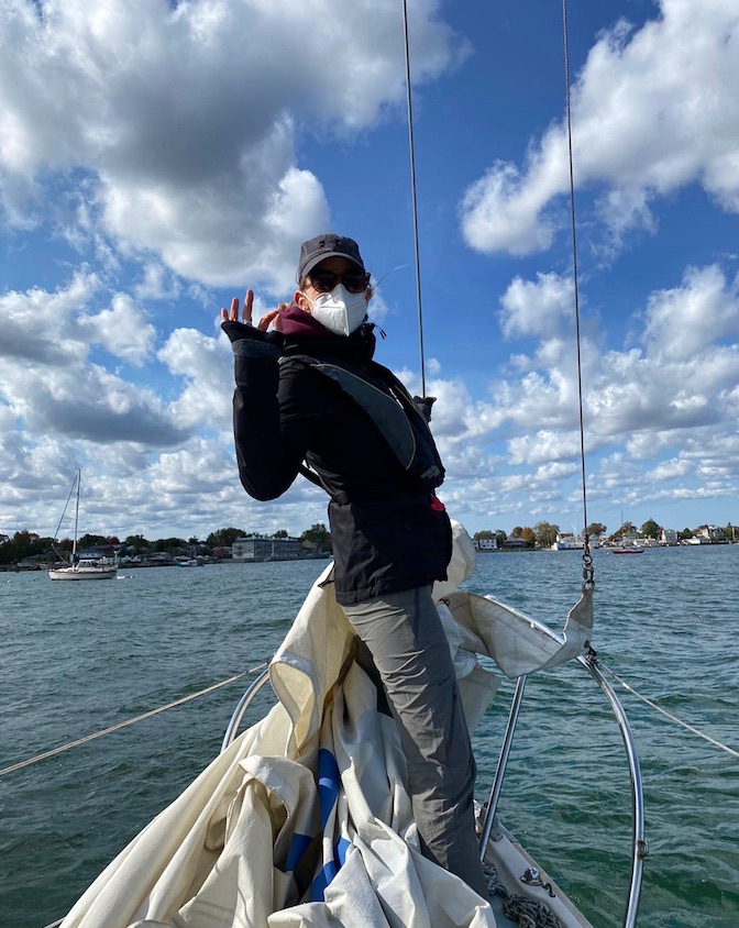
IN THAT PIC: Melody, Sunday, October 18, during a Start Cruising course (ASA 103). She did 101 with us this season as well!
It’s been a strange season, but as usual, we improvise, adapt and overcome. In March, we didn’t know if we’d have a sailing season at the Sailing Center! By June, we knew it would be closer to biz as usual on the water, in addition to our innovative and popular “Live 105” courses on Zoom for Coastal Nav (which no one else seems to be running). We figured we just had to play it safe.
We did. We limited class sizes beyond (below?) our normal capacities, further reduced classroom time for learn to sail courses, and mandated masks. Sometimes, people could take them off, but only when it made sense. Most people arrived at the Sailing Center pre-conditioned to wearing their masks all the time. (One or two prospective students were not invited to sign up after expressing a distaste or unwillingness to wear masks.)
Video clip for ya ! Mike and Kelly “deal with the heel” on a windy day…
We got through the season, which is winding down. It ends by early November for us. But, the country, and much of the world, is NOT through the pandemic. Politics aside, numbers don’t lie. People lying in ICU beds in hospitals are not faking it. Many countries are in their second or third waves or spikes, and winter is coming which will almost certainly make the pandemic worse. (And don’t forget the flu!!!) A COVID-19 vaccine is not immediately around the corner, nor is worldwide distribution of it when it arrives. So… wear that mask!
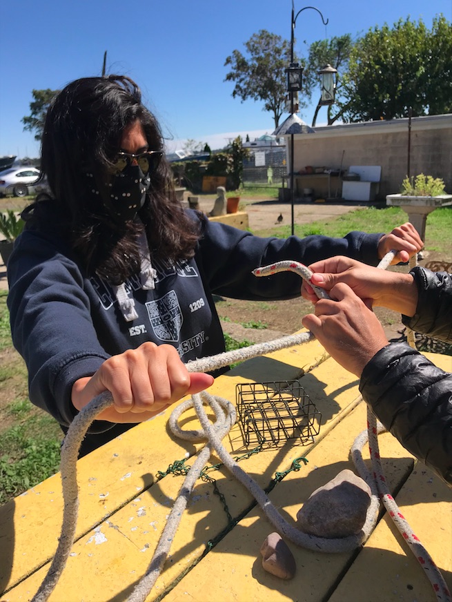
IN THAT PIC: Laura, behind all that mask and hair, joining two lines with a rolling hitch in tandem with Chris’ hands. Start Sailing, ASA 101, in September.
So…. it’s not over ’til it’s over. That sadly applies to the pandemic, but I’ll gladly take that this sailing season isn’t quite over and despite that, and eager anticipation of sliding down snow, we’re already looking forward to the next one!
It’s that time of year; weather is warming up, and thunderstorm activity is heating up as sailing club, school and rental activity opens up. We revisit this topic every year as a public service. One reason: people still don’t seem to ‘get it.’
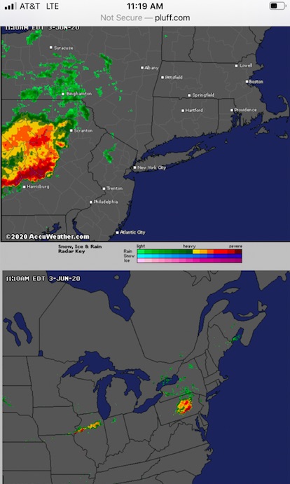
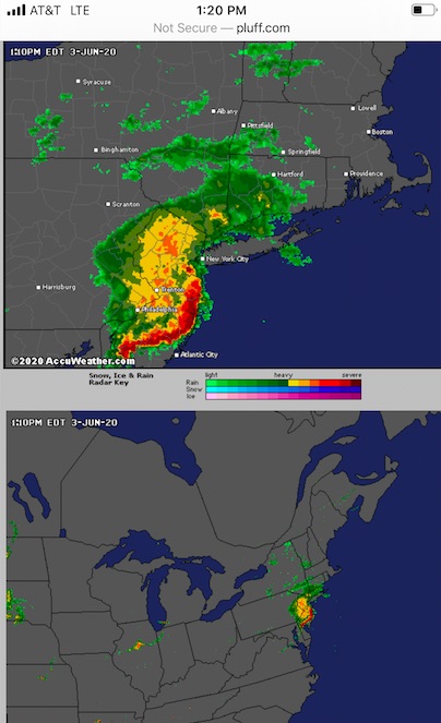
In that pic: screen capture of radar images on Wednesday, June 3, in the late AM. We had a private lesson booked that day with an experienced sailor. The forecast was for thunderstorms – not a chance, or a likelihood, but just… thunderstorms. And, they warned of potentially damaging winds and hail. Not a garden variety summer forecast, which is “chance of showers and thunderstorms” or similar language.
Oh, no… it’s ON!!!!
Below, I’ll share how the day of June 3 unfolded forecast wise, and also stories about two needless tragedies in the past that happened when people didn’t pay attention to the forecast.
The first step of the day is to check the forecast. That should be done several times as the day progresses to look for updates. The next step is to check the radar. Easier than you might think; just look at the pic above. Pretty clear that something is brewing. And, even if the forecast winds up being off, the radar doesn’t lie. It doesn’t take a meteorological degree to read a radar app. It just takes a little time and experience.
On two occasions since I’ve been operating New York Sailing Center, which I founded in the fall of 1997, there were particularly violent thunderstorm systems that passed through the region and resulted in a fatality at some other school/club. NOT AT MY SCHOOL/CLUB. At others.
The first was in 1998, before we all had smart phones and radar apps at our disposal. It was old school; check the forecast, check the sky, and listen to the VHF radio weather band for updates. The forecast was doom n gloom: thunderstorms, some of which could be severe, and which had a large outer perimeter of strong wind (meaning no way to see it coming). And, the storms had already started upstate and killed a few people.
Make no mistake; winter is coming…
Sky getting gray as we return to the mooring on Wednesday, June 3. Radar? Showed rain passing to north and east, and squalls approaching in the distance from the west and south. Might miss; might not. So, we cut the lesson short and played it safe.
So, I kept everything on a super tight leash that day in 1998. We had one class with a veteran instructor. We talked about it and decided to confine the boat to the anchorage. No further than the outskirts of the anchorage. The anchorage is small. More maneuvering, then! Marina customers were warned of the storms if they showed up. A few did and just turned around and went home. One woman chose to sit on her boat at the mooring for awhile and then go home.
Eventually, after frequently checking the sky to the north and west, I didn’t like the look and feel. I started radioing the instructor to come in, and saw he was already approaching the mooring. They took one shot, and fell short… and then it hit. BAM. Nothing to be seen in advance. Just wind laying the boat over and flogging the sails. They didn’t have a chance to sail back to the mooring; no way. The boat was basically blown down onto the next pier, and the instructor wisely off-loaded the students and left the boat. I went out with a few experienced people and two solid motor boats, and towed the sailboat off and moored it. It took two boats just to pull it off and suspend it into the winds, which were at least 60 knots and possibly as much as 70. When it subsided a bit, we moored the boat.
It was over quickly. It always is. But it takes little time to cause mayhem. We got away with a torn sail and a fright. Down in New York Harbor, they weren’t so lucky. One large club/school had allowed at least one member to go out with his family. The boat took a complete knockdown, and the man was in the water and separated from his family. He wasn’t wearing a PFD. His body was found a few days later in Gravesend Bay, Brooklyn.
Fast forward to August, 2010. Morning forecast: about the same as the 1998 incident. Thunderstorms. Severe. Moving fast. Clear band of strong winds. This time, however, we had smart phones and radar.
I kept the one class we had that day pretty close for our morning sail. I intended to do a short n sweet lesson, get off the water way early, and watch it all blow through during lunch and some extra classroom. While on the water, I got a call from a recent graduate hoping to come out for one of his practice sails that afternoon. Sorry; no. Bad forecast. He pushed; I explained the severity of the forecast. He tried some more.
“No fucking way! I’m not going to let you come out here just to die in some violent thunderstorm! You’ll come out another time – live to sail another day!” The first sentence is an exact quote; the second is approximate. The message is clear.
What happened then? We sailed back to be safe. Sky still looked fine. Checked the update radar while waiting for our launch ride. Whoah…. it was the largest Darth Vadar Death-Star-looking doom ‘n gloom ball of red, orange and yellow I’d ever seen – before or since – on a radar screen. It was moving south and clearly going to hit all of Western New Jersey, Westchester, NYC, and Nassau, Long Island. All of it; all at once.
Updated Radar imagery from Wednesday, June 3. Note the wall of band of red/orange just south of our area. That’s violent weather. The yellow with orange/red above? Not to be taken lightly either. Only takes a splash of red to dash your head on the rocks.
So, I shut down the operation until further notice. Told my launch operator to go somewhere inside for lunch on the avenue and stay there until I told him to return. I took my class to do the same, with some classroom props.
It did hit. We were basically done with lunch and b.s.-ing about other stuff. Suddenly, it was very dark. Stuff was flying around like that scene from the Wizard of Oz. Darker; windier. Eerily, we couldn’t really hear it as the place was well sound insulated and we were in the back looking down the hall at the front door. And, almost as soon as it started, it was over.
We paid up and walked back to the marina. None of us had ever seen so much random debris blown around by a squall. The waterfront was worse; the waterway itself was a shit show of stuff blown offshore by the storm. There was zero wind. Sun was back out. Surreal.
And then, I got a text from one of my instructors. He let me know that another school (again, not ours) had a class out during the storm. They lost one person. Literally. The body was found a day or two later. This was disturbingly close to home, in lower Westchester, within sight of my school on a clear day. it was day one of a learn to sail course (compared to day 3 for mine that day). They went out in the afternoon (as opposed to my coming in at around mid-day). No one aboard was wearing a life jacket, or PFD. (We spend extra money on comfortable automatic inflatables with manual overrides, and make people wear them.) The boat had no lifelines, which are wires or ropes that are elevated above the deck going around the boat. (Not all boat designs have them, but it’s riskier when they don’t – especially for beginners.) Everyone on that boat wound up in the water; all but one made it back to the boat.
All but one.
I knew several sailors who got caught out in that same storm. They all fared well, but got quite a fright. I heard of others who got caught as well (also survived). The common denominator? And, what was reported in the news regarding the fatality in Westchester?
“It happened so fast.” “You couldn’t see it coming.”
But, you could. On the bloody radar! And, you KNEW it was coming. Why wait to see it? Does that sound simplistic? Well, it really is that simple.
In that pic: all gone – out to sea, but I pity the fool who got caught out in that. It intensified as it neared shore and got over the water. Wednesday, June 3.
Remember the DUCK boat incident a few years ago? We did a blog rant about that. Same shit; different details. Only that time, many people died. I’ll link back to that blog post below.
The lesson: people don’t seem to learn the lesson. Here’s how I suggest you manage the risk of getting caught in a squall or thunderstorm on the water during the summer, which is when most of them happen, and also when most of you would likely do most of your boating.
start the day with the forecast online, cross referencing at least two sources.
If there’s some risk of thunderstorms, consider skipping boating that day.
If you go anyway, check the update forecast upon arrival at the marina.
Start checking the radar at that time as well. If it looks dicey, don’t go!
If it looks like it’s far off, or just not developed, stay close and check frequently – at least every 20′.
As soon as it’s looking worse, assume the worst. Head back. If you have an engine, turn it back on (yes, you should have checked it before). Stow sails.
Moor or dock the boat. Double check the radar and forecast.
If still no good go home! If the risk went away, it’s your call.
I’m not a meteorologist. I’m not a weather forecaster. I’m not a climate scientist (although I know one who’s a PhD candidate at Columbia). But, I am an expert and well-seasoned mariner. And, I have to make decisions all season that affect other people: whether they get to play or not that day. it comes down to whether they’re safe or at risk of death. And so, I check the weather and radar pretty obsessively.
“What do we say to the God of Death?”
“Not today.”
Arya was bad-ass enough to slay the Night King. But even she knew the universal truth:
“Don’t f*%! with Mother Nature!”
RESOURCES:
The Radar web site (not an app per se) that I like to use for the northeast…
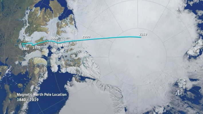
Scientists struggle to model the movement of the magnetic north pole. In our live, online ASA 105 coastal navigation course, a real instructor teaches you about this, and why you can basically ignore it.
We’re having a lot of fun with our “Live 105” classes on Zoom! Real instructor, real time, real students – in the same, small manageable class sizes we have for in-person courses. One of our current students sent a link to a BBC article related to the content of a 105 course, which is of course all about…
COASTAL NAVIGATION.
The link Cristina sent? A BBC piece about the movement, or wandering, of the magnetic north pole. We link to the piece at the end of this Rant. For now…
In that pic: the thin aqua line traces the approximate motion of the magnetic north pole from 1840 to 2019. It’s accelerated recently, creating a scientific buzz. (Pic is a still frame from a video in the BBC piece we link to below.)
THE IDEA: the magnetism of earth is both consistent and inconsistent. Compasses point to the same place on earth with minor wiggles. This is close to the geographic north pole, or the rotational axis of earth. If Atlas stopped shrugging, and spun earth on the tip of his finger like a Harlem Globetrotter, it would be on the South Pole, with the North Pole exactly at the other end – or “top.” But, “top” is arbitrary, ain’t it? Space has no direction. We’re floating in space. And, what’s more…
It might flip! Yup. Magnetic North and South have reversed from time to time. Maybe every few hundred thousand years. The question is whether this could happen within our lifetimes. And, partially due to accelerated movement of the Mag North Pole, scientists suspect it might.
1, 2, 3… SWITCH! Oops…
THE ARTICLE’S PATH: Scientists studying this have noted the acceleration of the drift of the Mag North Pole recently, and have updated the global model used for that as it relates to GPS, which is critical to precise navigation. That’s not always super critical itself; as we teach in Start Navigating ( ASA 105), it’s almost more important to check progress in real time than plan the path perfectly to begin with. Basically, they think they’ve identified two molten “hot spots” in the earth’s outer core that are having a tug of war over the magnetic north pole. Kewl! Or, very hot…
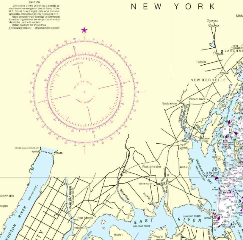
That gets into some chart nitty-gritty: the compass rose. It’s a tool to measure direction, and it looks pretty kewl too. Check it…
In that pic: a section of the 12363 chart of Western Long Island Sound, with City Island (“City I”) on the right, which is home to the Sailing Center. It’s about half the length of Manhattan away from it; northern MannyHanny is on the bottom left of the chart. It has a nice, large compass rose, or rings that measure direction. The outer ring is for true, or geographic, north – with a star at the top for Polaris, the actual North Star. The inner ring is for magnetic north, which is where compasses point more or less. In navigation classes, we teach how to use these to plot out a course to steer a boat.
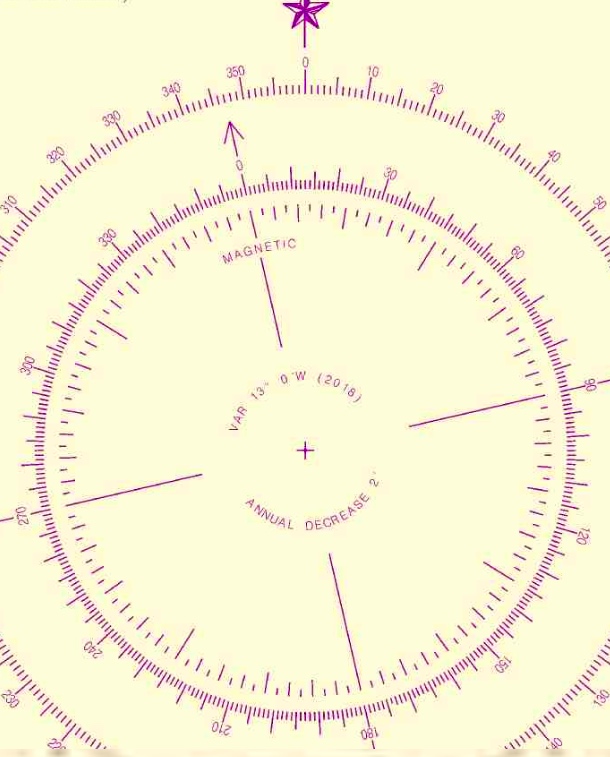
THE CONVENTIONAL WISDOM: look at the annual increase/decrease in the variation as listed in rose (the pic below blows it up for you). It’s usually a few “minutes” a year. Each minute = ..? It’s a measly 1/60th of 1 degree of the compass. Yup; slicing hairs with razor blades. Anywho… if your chart is out of date, the idea is to multiply the number of years of ‘stale’ by the number of minutes of change, and add or subtract accordingly. And, get the +/- right!
ABOVE: blown-up crop of the compass rose from the same chart above. Variation: 13 degrees West as of 2016. Annual decrease: 2 minutes (2 out of 60, with each compass degree having 60!). Splitting hairs…
NYSC knows better… our Director and HBIC (Head Bozo in Charge), Captain Card, had a suspicion about something years ago. He compared every training chart the government produced, which are all frozen in time going back a far as the early 1980’s, to the updated, real-life versions of those charts. The conclusion? It’s silly to try to project any annual increase or decrease into the future. We expand on that and reveal the goods in class, and in our own in-house text book that we supply to students (and sell on the side). Despite what other books say, just skip this step. Much smarter move: get a current chart, for all the more obvious reasons.
Maybe we’ll be lucky (?) enough to see the poles flip in our lifetimes! Will planes drop from the sky, and cars run off the roads? Well, if they can’t figure that their GPS and compasses are basically pointing backward, we can’t help them.
Your takeaway? Use updated charts to plot courses to your destinations, and casually follow along with the progress of Mag North Pole’s wanderings across cold areas most of us will never visit.
What would Newton do? (In a modern day pandemic.) Well, he actually did it, if one considers London’s Great Plague of 1665-66 modern enough. He did several things in fact.
Isaac Newton, eventually Sir Isaac, basically quarantined himself during this catastrophe, having recently completed undergraduate studies at the ripe old age of 23. He, like all privileged Londoners at the time, fled the city. At his family’s countryside retreat, he was a busy boy! What did he do that was relevant to navigation?
Newton, with some social distance from an apparently alarmed observer, as he experiments with prisms to understand the composition of light. Image shamelessly copped from stock.)
Well, truth be told, that’s a stretch – but we do need to stretch our imaginations to keep ourselves occupied during our social distancing and quarantining. We’ll try to get there. First, here is what Newton did with his time:
He studied gravity. Yep; that apple crap. This led to his eventual creation of the laws of motion and his career-defining work, Principia.
He started working on optics, proving that “white” light consisted of the complete color spectrum using a pair of prisms;
He picked up where Descartes and de Fermat left off with universal equations of fluctuating quantities, solving that dilemma with a series of papers and formalizing what we now call Calculus!
That was Newton. And that was then. And now, we have to find things to do and learn while keeping social distance and isolating. One option: Start Navigating SM: ASA Coastal Navigation (105). But we have to do it with social distance. So, we have to do it from home via Zoom, FaceTime, etc. That’s the Staples part (where we get some of our 105 supplies); that’s easy.
But what about the math? Newton did some complex math during his tenure away from town. How much math is involved with Coastal Navigation? That depends on who you learn it from. It can be fairly complicated – or, you can do it our way:
Plot the path without the math!
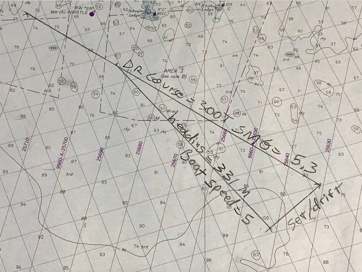
Path; no math. No arithmetic or math used to plot this set & drift ‘triangle.’ The geometry is built in. This is our preferred method. Cuz, you know… trig sucks on a boat! 1210 Tr chart (training; not updated), Block Island to Martha’s Vineyard. This is the solution to a practice plot submitted to us to refresh a memory on this technique.
We use as little math as possible when doing – and teaching – navigation. We teach the little bit of algebra needed for deduced, or ‘dead,’ reckoning, and we make it easy with a visual aid that’s intuitive to use. We refresh peeps on their long-hand division when they forget how. Can’t rely on a calculator on the water. But for the serious stuff? Set and drift of current while underway with no current tables to consult?
That’s where we plot the path without the math. Not even basic arithmetic. Just draw lines based on the concept, representing what the boat and the current do, and measure the final answer: course to steer! We even give you some toys to play with in the process…
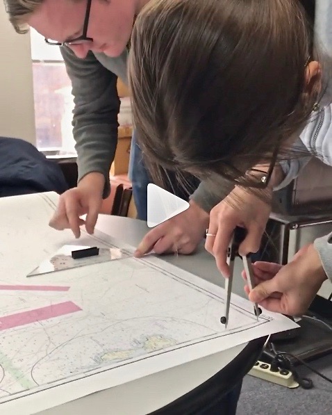
People plotting in one of our Start NavigatingSM courses this past winter. Pre-Corona. He’s working with a triangular protractor, or plotting tool. She’s manipulating the world’s finest one-handed dividers. Yes; she’s using two hands. Sometimes that’s helpful to set one point quickly and accurately. Then one rocks ’em with one hand! All being done on a real chart, not a training chart frozen in time to the 1980’s with incorrect coloring and needless extra clutter.
Here’s how it works – think of it as a sample of the 105 Nav course. Yes, it’s an advanced topic; no, there will be no quiz to you as the reader afterward, and I’m sure you can follow along!..
Step 1: Draw a line from “point A” to “point B.” That’s the path you want to sail. It’s like drawing your own road on a map; your only job after that is to stay on it. In the chart pic above, it’s the top line labeled “DR Course” (not A to B, but think of it that way).
Step 2: Now, draw a line from point A showing the path the current will flow. How do you know? Let’s just assume you knew how to look it up and find its speed and direction. (Yes, we teach you all that in the course.) Draw it in that direction, for the distance it moves in one hour. Tool used? Any straight edge such as a ruler, or the nautical plotting tool we send you in advance! Distance? Use the dividers, or nautical drafting compass, to mark this. (No math – we promise!) In the chart pic, it’s the bottom right line labeled “Set/Drift.” So, for example, if the current is 2 knots, set the dividers to 2 nautical miles – the distance it flows in one hour.
That shows were your boat will be if you just let it drift helplessly from point A for one hour. We don’t want that, do we? Of course not! So, we have to figure out how much to offset our course to fight the current and stay on our intended track. How?
Step 3: Figure out the boat’s speed in knots (nautical mph). Then, we set the dividers to that speed. How? Same as with the current in step 2 above. It’s all based on one hour: an hour of the current’s motion, and an hour of sailing (or motoring) while in that current.
Step 4: Now, set one point of the compass/divider on the spot where the current line ends. Swing the other end over to the DR, or nautical road map line, you drew from A to B. Set the point down; draw in that line. In the pic, that’s the third leg of the triangle formed, labeled “heading” and “boat speed.”
Step 5:Boom. That line is also the angle to steer by the boat’s compass to fight the current! Measure that with your plotting tool. Steer that when you sail, and you’re on track to point B.
Is it slightly more complicated than that in real life? No… but you do need to work up to it by starting with more basic info and practice, and then the steps above are very straightforward… just like your boat’s trajectory over ground in real life/real time to arrive at your point B!
And, yes – we can teach this to you live and interactively. We’ll do that for now; eventually, we’ll be cleared for takeoff on taking off the masks, cutting the social distance, and resuming life as normal as it gets post-pandemic. In the meantime, if Newton played with prisms, here is a prism for you to ponder navigationally…
Remember the porrtait of Newton playing with prisms? No? It’s literally at the top of… Nevermind. Here’s a hand-held compass that’s one of the most popular models in use. It uses a prism! The funny metal thing on the right is a fancy-lad pair of dividers. Elegant but not as practical as the ones shown above. We teach you how to use a hand-held compass like this in the course.
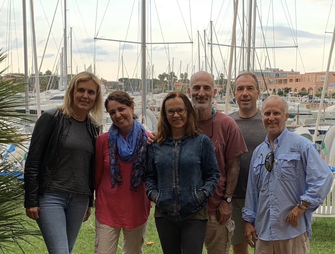
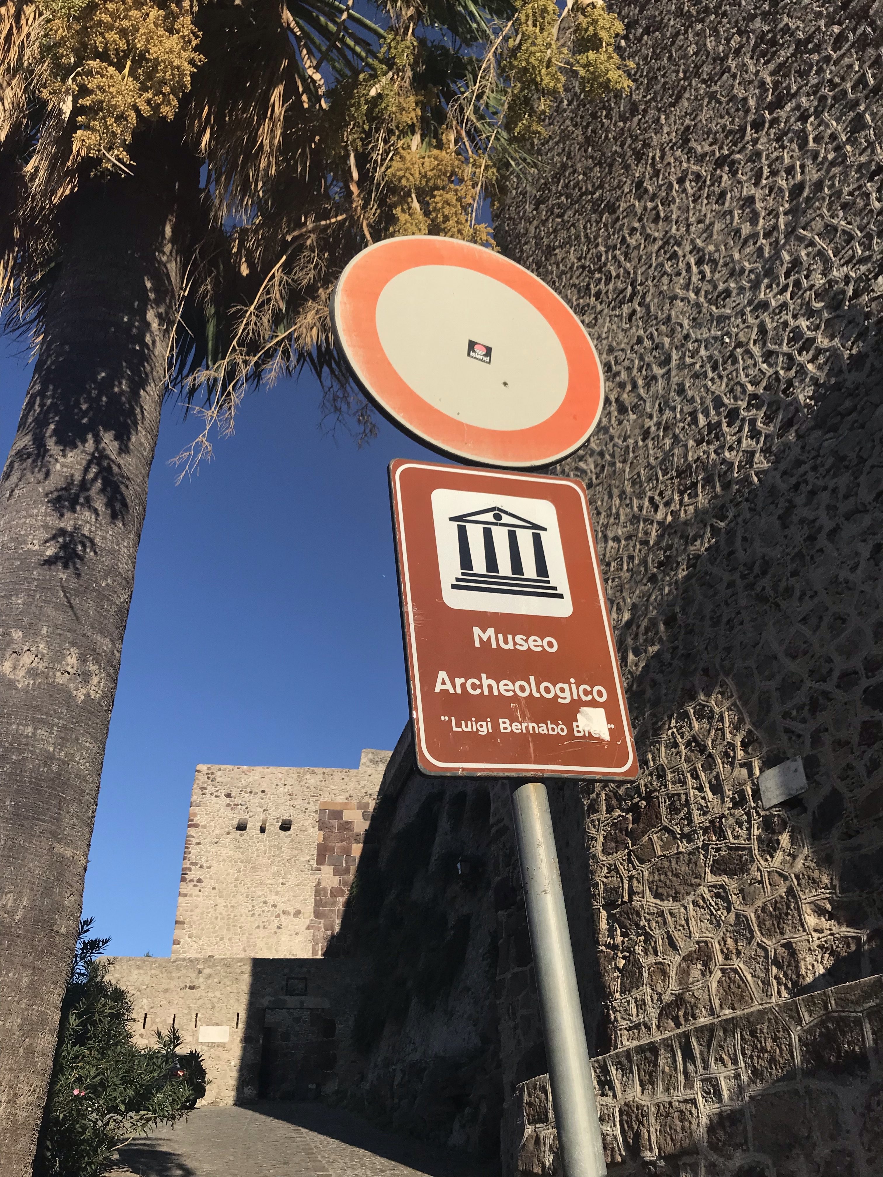
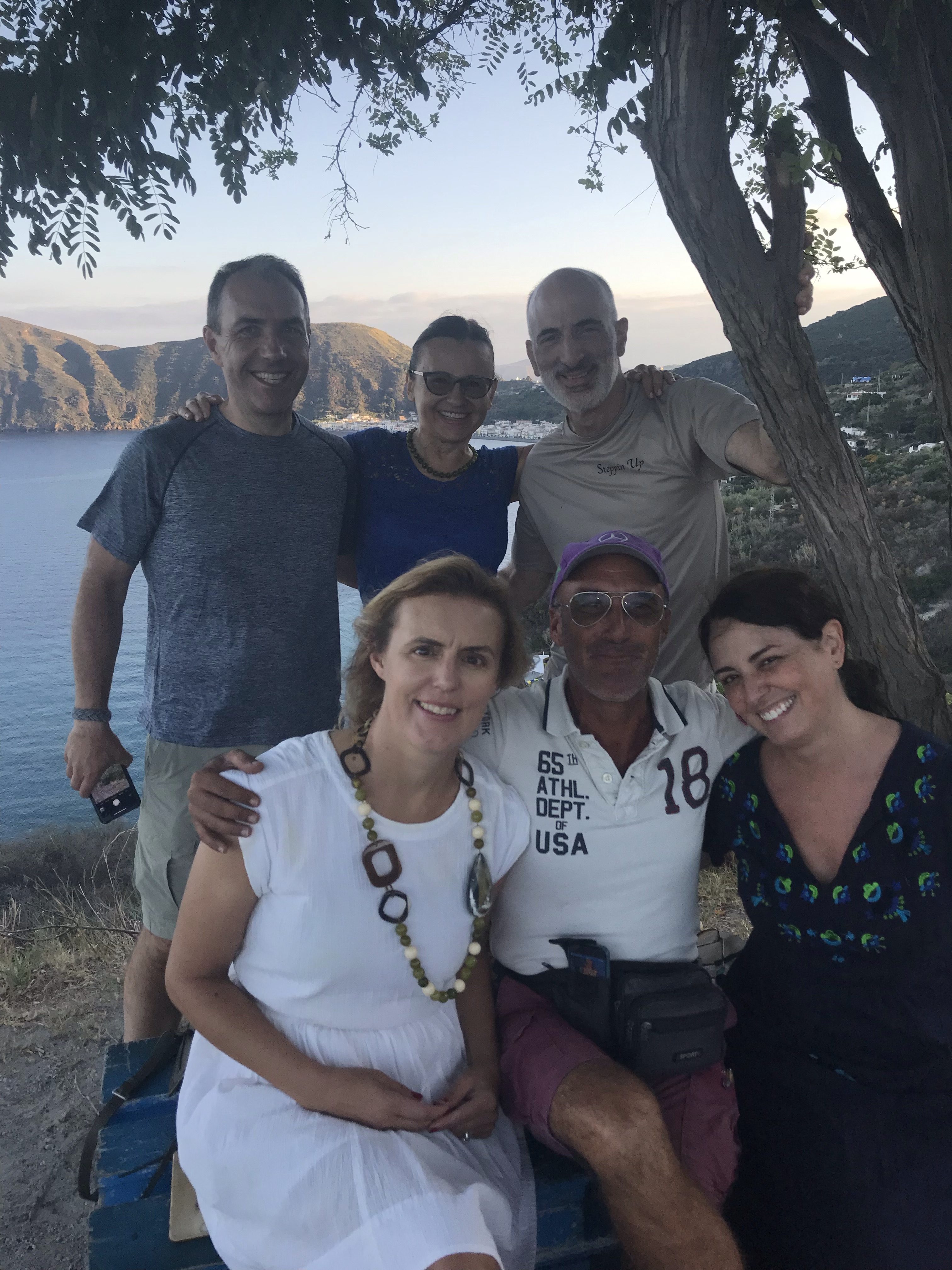
The gang! Our HBIC (Head Bozo in Charge), Captain Card, on the right. We’re at the base in Portorosa, Sicilia, the afternoon before departure.
(all photos in this post, for better or for worse, with the exception of the above by a passerby at the base under supervision, by Captain Stephen Glenn Card.)
We recently got back from our second trip to Italy! We were all sad to see it end, but all had to get back to make mo money for the next trip…
Last time ? Islands off the Gulf of Naples, Pontine Islands, Amalfi Coast. Sweet trip; years ago.
This time?
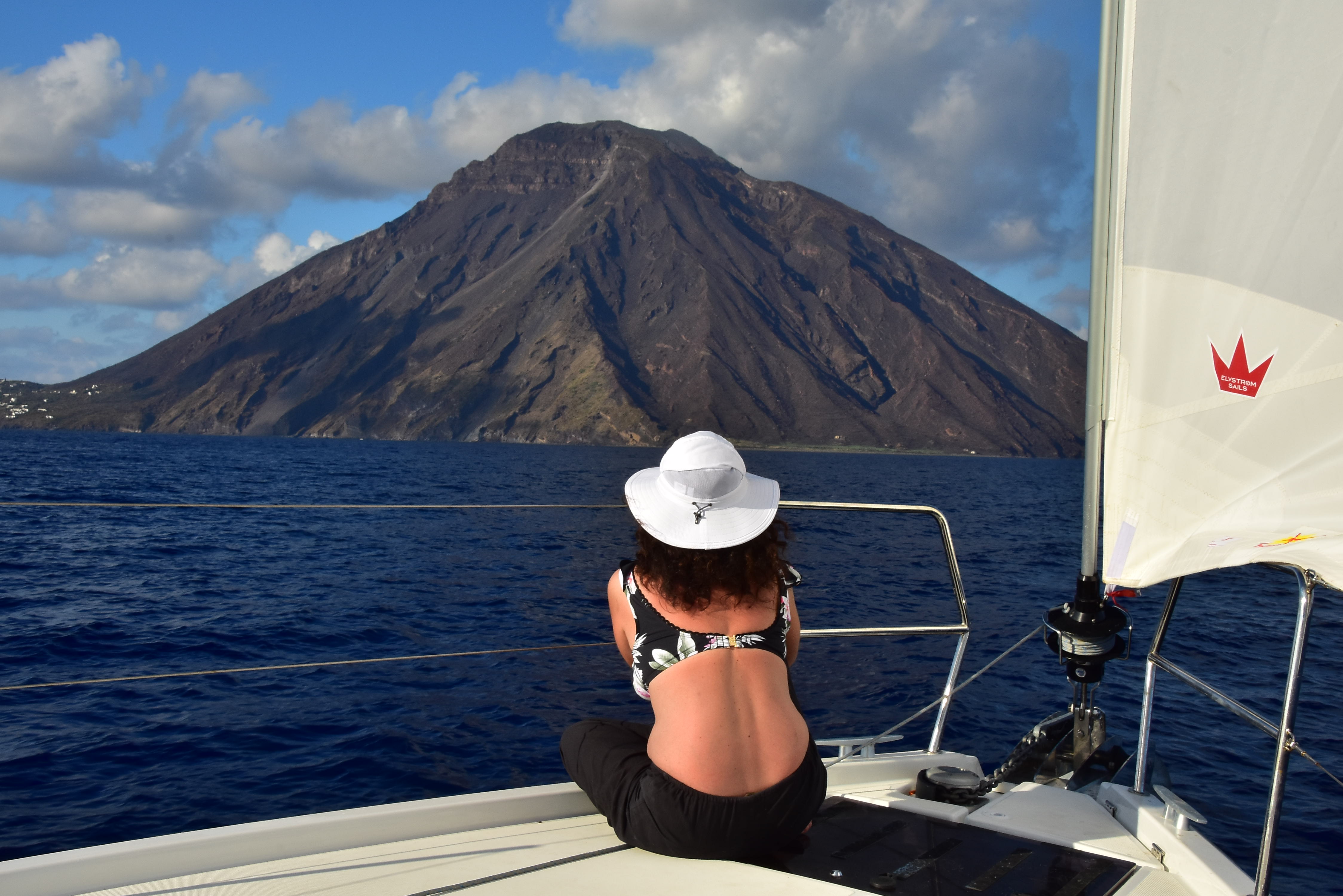
Sicilia and outlying islands, with the Isole Eolie forming a sort of Y pattern off the northeast coast (with Lipari labeled).
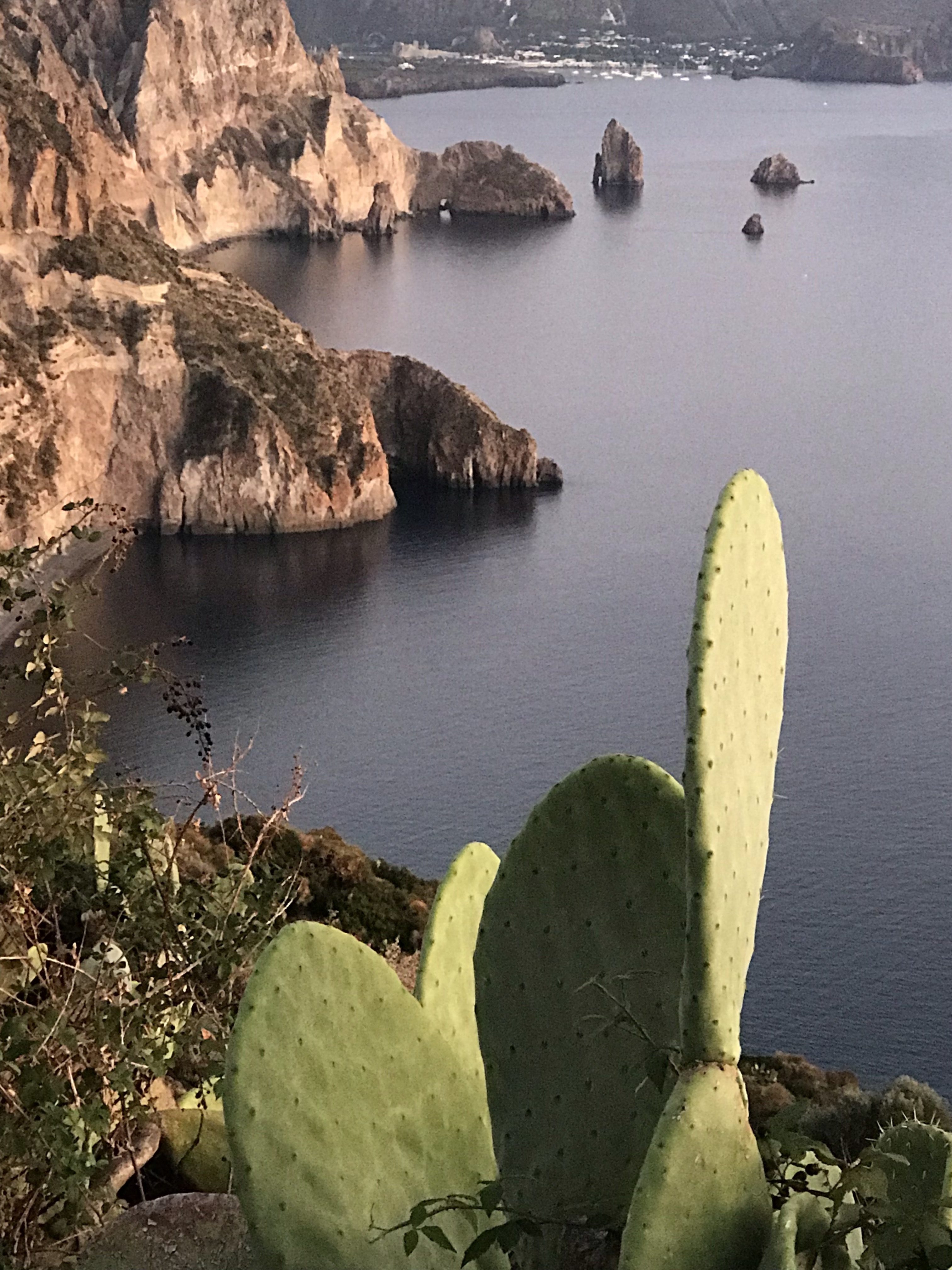
The Isole Eolie off Sicily, which are a UNESCO World Heritage protected area. The waters were perhaps the clearest any of us had ever seen in our travels, and super saline to the point of us feeling like we just floated higher when swimming and snorkeling. The islands are a beautiful combo of rugged, volcanic majesty and plush, verdant beauty. Nice peeps, plates and ports of call.
Zoomed in somewhat on the Eolie for general perspective. Ginostra, top right, is a tiny village on Stromboli. There are seven main, inhabited islands in the group, which spans about 30-35 nautical miles diagonally in any direction.
We all arrived the afternoon in advance of departure at Portorosa to get settled and prepped. The “Sunsail” base here is operated jointly by Sail Italia, which operates some or all of Sunsail’s operations on a day to day basis in Italy, and Turistica Il (il) Gabbiano Yacht Charter. It was confusing at first, but the folks there were consistent and very nice to deal with.
We made sure there was a boat (check), got our boat briefing out of the way early, and waited on an area brief/skippers’ meeting. This got consolidated into too many boats in one briefing late in the day, but we all dealt with it and managed. Afterward, and again the next morning, there was time to ask more questions.
As we paid plenty for a near-new boat (less than 1 year old), there was almost nothing to address about its condition. One hinge for one vanity adjusted, and done! Only unresolved question was what to name the boat. Seriously. No name! So new, that… no name. So, off to the make believe land of GoT to come up with something. Plus, one that came up organically in convo with one of the Italian staff. That one? Solo Sicilia (Only in Italy). The one that stuck and was put down on paperwork in port after being used on the VHF?
“A Girl HAS No Name.”
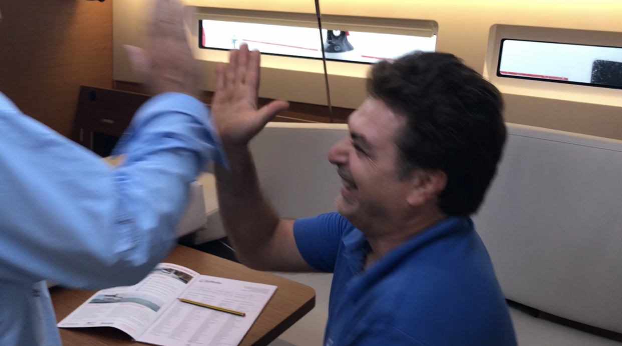
Our Director and Head Bozo in Charge, Captain Card, on left goin for the high 5 with Natale, our boat briefing tech. Card cracked him up on numerous occasions.
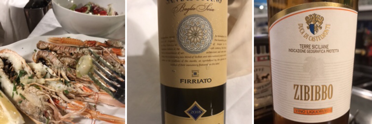
Wonderful dinner ashore at a restaurant in the complex, with excellent local wine. One of our crew is somewhere between an connoisseur and a sommelier, so we never had to worry about wine choices.
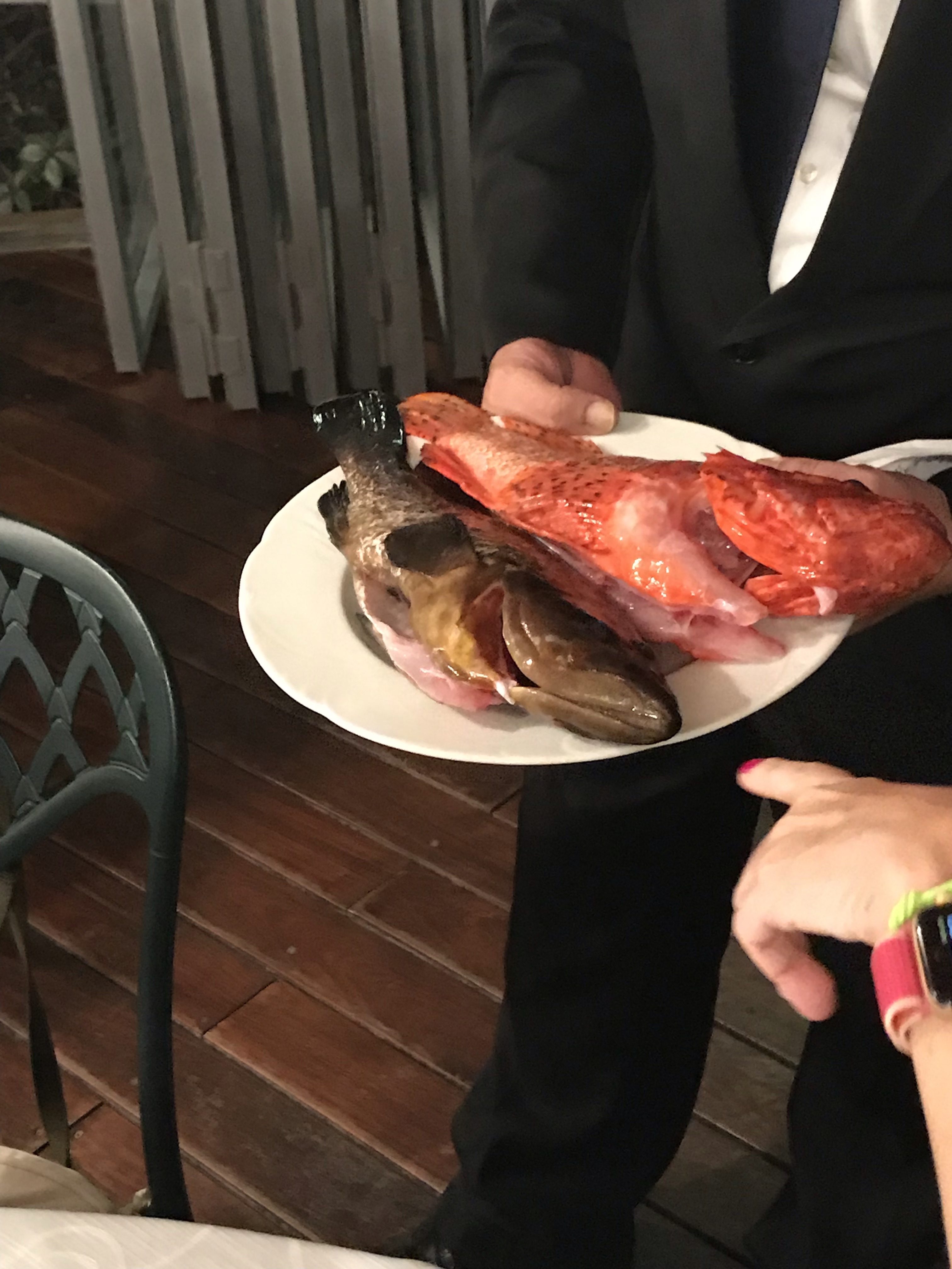
Screen shot of pics from HBIC Card’s phone. Left: on the tine of the fork is a small local shrimp from a pasta dish. On the plate? Prawns the size of lobsters. Worth zooming in on this! Then, middle and right, are our wine selections of the evening.
DAY ONE: Coffee, breakfast in stages, and get ready to RUMBLE! The first two or three days were forecast to be pretty calm, so we anticipated light and variable winds in the mornings that ought to become light but sailable midday or in the afternoon. (Nailed that.) Then, mid-week, we’d get a “storm” in their words. It was imperative to have a parking spot in one of the few sheltered marinas in the islands, and wise to not plan long legs during that time frame. Our imperative? Get to Stromboli and knock that out, so to speak, before getting mid-chain and hedging / assessing next steps.
So, to jump start things, we planned to bypass the first island, Vulcano, and stop at Lipari instead as a first step toward Stromboli for night two. We reserved a berth at Lipari and a mooring at Stromboli toward that end. Lipari is the largest of the Eolie, and has a protected port and plenty of sights to see while parked there.
Sicily in the background; Siciliana steering (actually more D’Abruzzi, but who’s counting??). En route to Lipari.
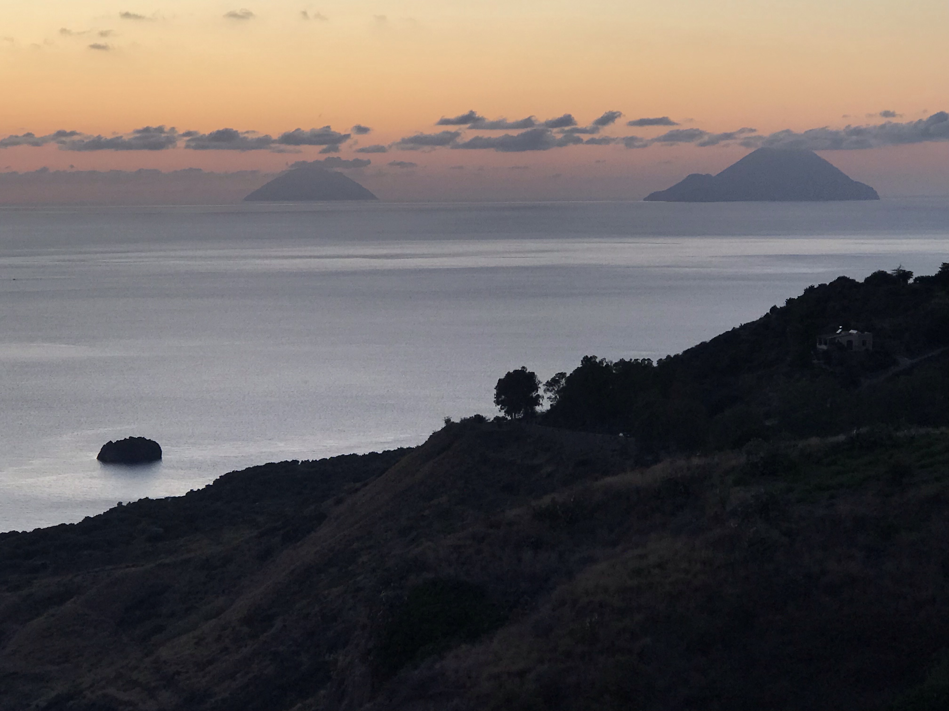
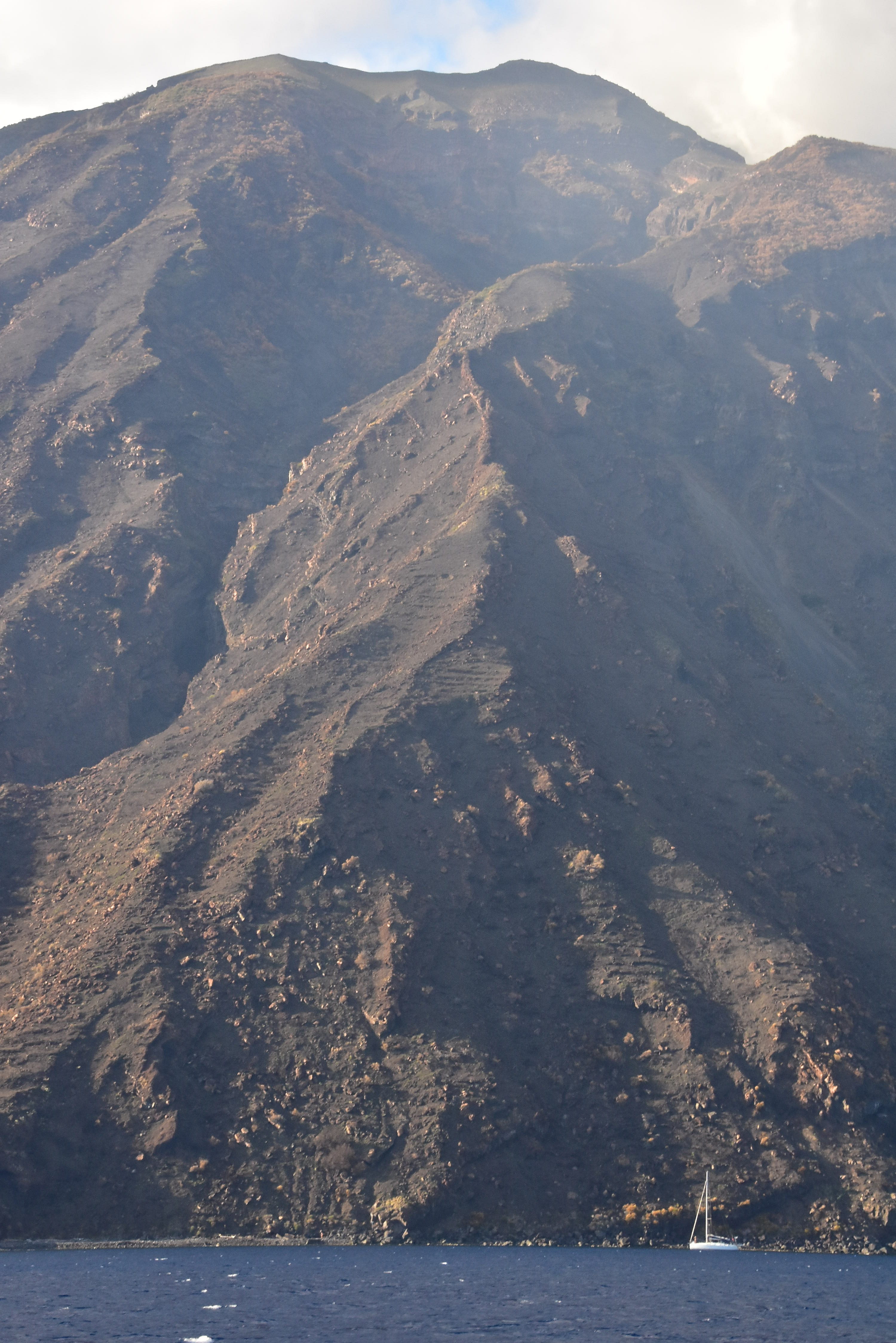
As predicted, the wind was light and variable as we left port, and for most of the way to Lipari. We motored the whole way. Some boats tried to sail but were standing up straight and stubbornly sailing for the sake of sailing … slowly. Very slowly. We wanted to get in the vicinity of Lipari and then maybe do a pleasure sail once there rather than a delayed delivery. That worked. The wind came up enough to be meaningful and, with Stromboli smoking in the background, we did a fun shakedown sail for awhile before radioing in to the marina for final instructions.
Pano shot off the boat. CLICK this one for full size/res! The dark gray arc above the water? That’s the smoke from Stromboli, stretching at least 25, maybe 30 miles toward Sicily! Where it starts on the left is a cloud over the island, which is a constantly active volcano.
Lipari’s chief parking spot is Porto Pignataro. It’s well protected from most directions, but it’s a bit tight inside and can require confident maneuvering in close quarters. The wind had picked up a bit, but it was off the dock so easy to back up and Med moor in our assigned spot – especially as the marina had a man on on hand to pass us the laid line (mooring line that makes using an anchor unnecessary).
Approaching Isole Lipari, the largest of the Eolie. Dinghies are generally stowed on deck unless it’s a relatively short passage and also calm. The engine is mounted on the stern pushpit on the yacht and only put aboard the dinghy when about to be used. (In areas with larger, heavier dinghies, such as BVI, the whole rig is just towed behind except on cats with davits to hoist it up.)Pic of chart from base briefing: Lipari, with our intel officer, Gianni, pointing to our port on Lipari: Porto Pignataro.
We wanted to explore ASAP, so after plugging into shore power and adjusting stern lines, off we went with yacht paperwork and passport to check in at the marina office before wandering into town. Once on foot we happened upon a friendly, professional looking driver with a Mercedes taxi-van, Danielle, who proposed a tour of the Island for a set fee after we asked for a ride into town. Sounded like a fair deal and a great way to explore efficiently, and we took it. Highly recommend this: it’s a large island and there are great vistas available if you roam around this way. Plus, Danielle was free flowing with factoids and perspective about the island and the area. We stopped several times, including an opportunity to just walk around the main pedestrian thoroughfare for a spell before moving on. This part was slightly rushed, but still worth it. Personally, I roamed up in between buildings and got a tour not unlike Old Town, Dubrovnik’s walled city. A few scenic stops later, we’d gone around the Island.
Porto Pignataro as seen from the road en route to town, shortly after we arrived that afternoon. In the background on right is the island of Vulcano.Looking u[ a typical intersection of the pedestrian/moped area of town. At the top? The archaeological museum that’s an old fort!Entrance ot the museum, which we later walked at night after dinner.The gang with the testa di barca (head of the boat) taking the shot. Our awesome tour guide, Danielle, is sandwiched in the front row. Cacti e faraglioni di Lipari.The islands of Panarea, near right, and Stromboli, far left, matching the colors of the clouds at dusk as seen from well up on Lipari.
Dinners? To be done dockside… or more likely, a little further away. So, we took Danielle’s suggestion and went to a place up on a hill just outside town called Filipino’s. It looked like an expensive tourist trap, but it wasn’t. Everything was reasonable; fresh fish by the gram was a bit pricey but not outrageous, and it was fresh and well prepared.
Stefania pointing as she discussed fish options with the waiter. Town church as seen from a viewing/firing port in the wall of the old fort.
DAY TWO: TO STROMBOLI
With a stop along the way to snorkel, of course! We hit the smaller islands off Panarea on the way. There’s a spot where gas is escaping from the seabed to the surface, and it’s super kewl to snorkel through the streams of bubbles. We found the suggested anchoring spot (very fussy and small area; highly weather dependent to do). Then, we found the bubble area, which is not visible easily from the surface if at all.
A cruising cat gives scale to the mountain rising from the sea here. Typical scene in the Isole Eolie.Another typical scene: beauty in the eyes of the beholder, in this case the fotog who liked both the foreground and background here.
That, plus some bites, and we were off to Stromboli. We chose to motor to the snorkel spot to save time as, again, there was little wind. But we sailed all the way to Stromboli from there. How majestic and beautiful.
Celebration under sail. Good wine; good times. Approaching Stromboli; several of us were mesmerized for prolonged periods.
Stromboli is a constantly active volcano with two small toe-holds of civilization. There’s a mooring field with some room to free anchor off the northeast shore, where the larger village is (and were the ferries zoom in and out creating wakes except during the night).
More scenery under sail.
One must plan carefully and visit here only when the weather is favorable as it’s exposed from three cardinal directions. Totally worth it: stunning to see up close and personal.
At the southeast end of the island; wind picking up and shifting; cruising monohull for perspective.
Our resident Italiana spoke to the locals and scoped out a sweet spot for dinner, which took some exploring to find. It was worth it. Trattoria ai Gechi. (Think GEICO gecko with his mouth shut while folks eat.)
Doesn’t get any fresher than this: local fisherman frozen after tossing his pot. What’s gonna be in it? Whatever’s the fresh fish on the menu at the local restaurants in the village, and on the villager’s dining tables. Taken while we were moored at Stromboli.
That’s a wrap for this installment; we’ll do another one or two to share the rest of this trip with you! Ce vediamo, eh?
A client of ours is originally from Canada, and two buddies and he did 103 and 104 with us one season before doing their first bareboat charter in the BVI.
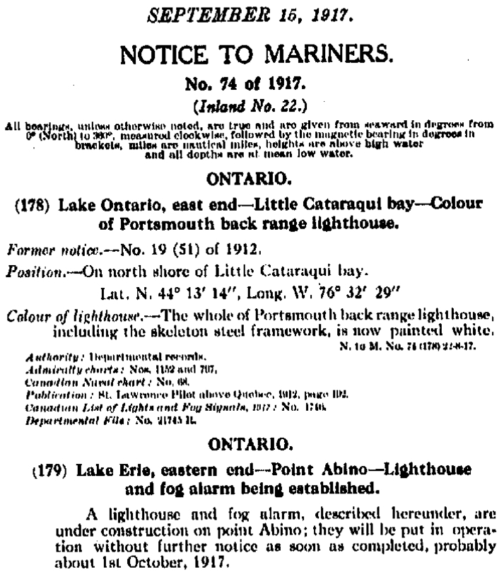
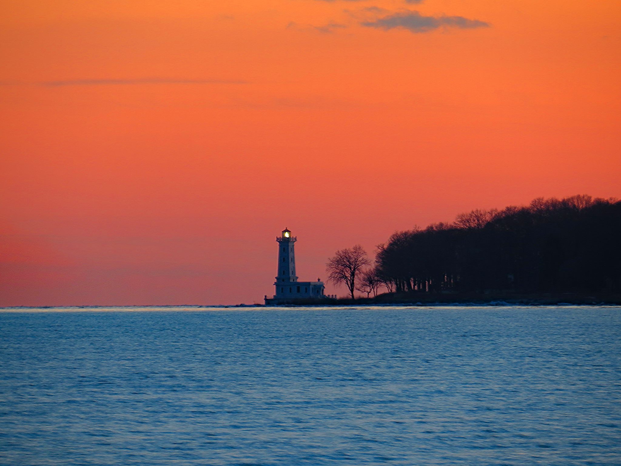
Adam’s uncle got involved with a latent lighthouse in Ontario, Canada. He’s on the local preservation committee, and had been trying to get it lit back up. Apparently, it was a somewhat uphill battle as there were concerns about the light shining on shoreside homes at night and being intrusive. The major’s office was involved and favored the light being back on, so that helped.
Here’s an excerpt from the original Notice to Mariners in 1917 that announced the construction of this light!..
For its return, the compromise was to aim the light across the bay at another peninsula rather than sweep across the shore or just aim 360 all around. Our mission: confirm the exact bearing, and show/explain why we came up with the magic number.
(Truth be told, Adam was more than capable of doing this himself, having successfully taken and passed 103, 104 and 105 with us and then applied it in the BVI. But this had to come from us as the outside experts.)
Anywho, Adam enlisted us to be the alleged experts to plot the angle of the light and show how we’d done it.
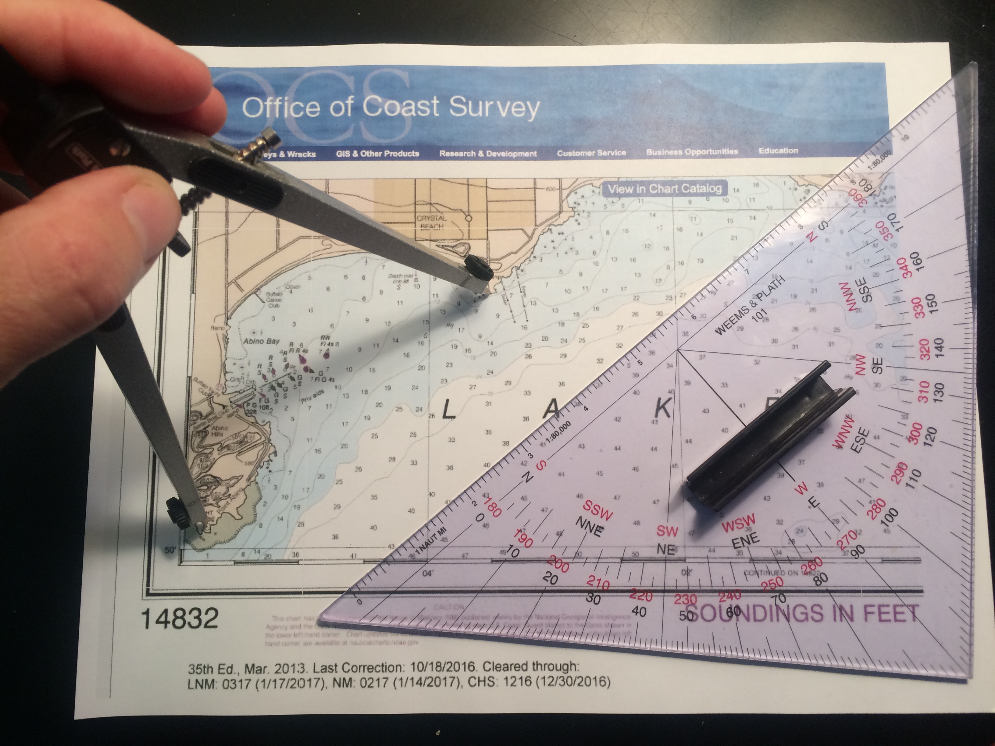
Dividers (nautical drafting compass) set exactly on the two points; protractor triangle was laid carefully against them to be on the correct bearing. Then, triangle was carefully moved to a meridian of longitude to read the bearing in true degrees. This was converted to magnetic so bearings could be taken from either point in real time to confirm.
1. Get the right chart. Adam took care of this: NOAA #14832, Upper Niagara River, ending in Lake Erie.
2. ID the light in question: “Light House,” on Point Abino. No characteristics shown as it’s idle.
3. ID the exact spot the new light is supposed to be aimed at: SW corner of the peninsula across the bay at the other end of Crystal Beach.
4. Measure the bearing painstakingly several times with at least two methods and get a consistent answer: 61 degrees magnetic.
There you have it. And thar she glows…
The light house at Point Abino, Ontario, with its beacon aimed back across the bay.
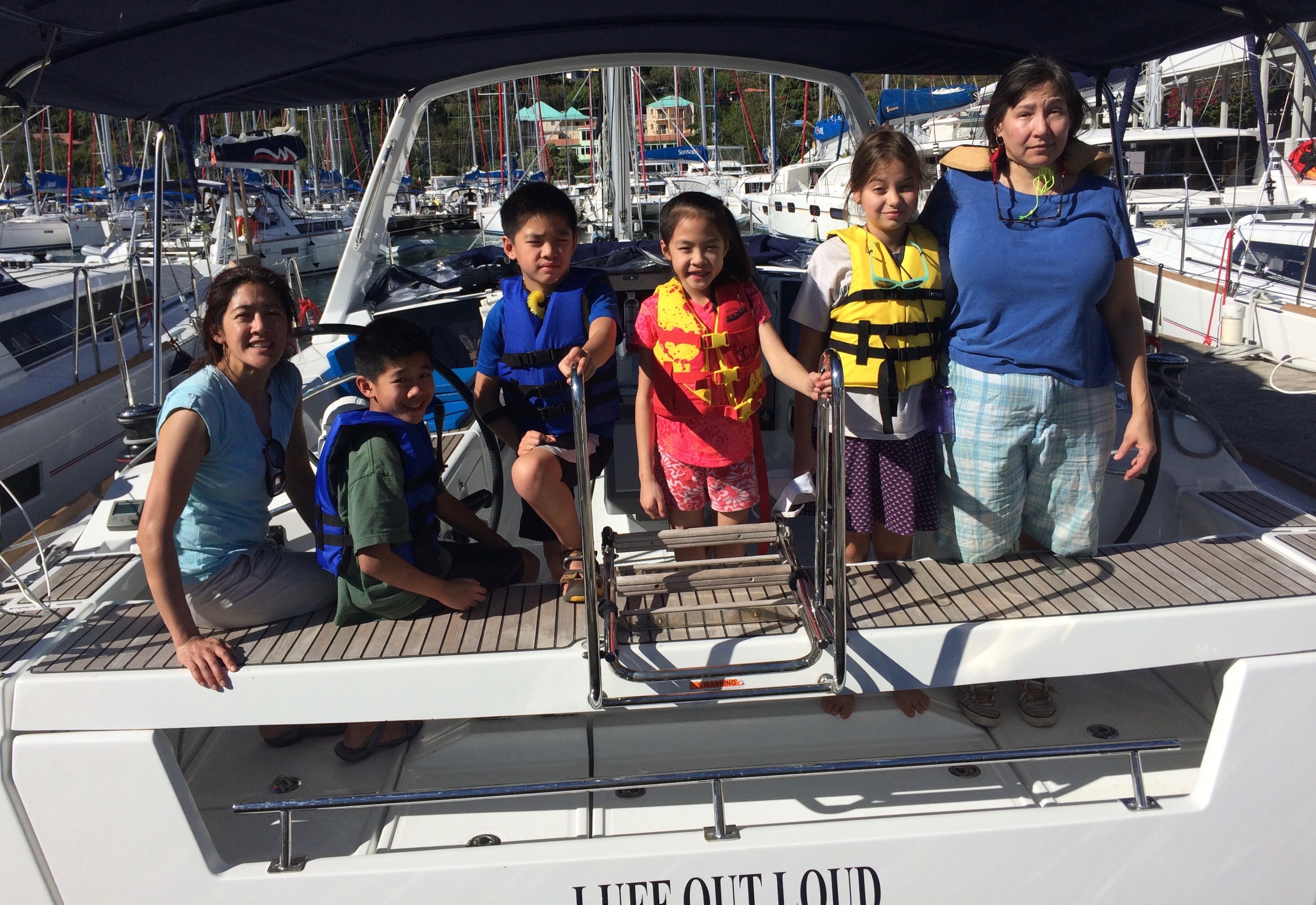
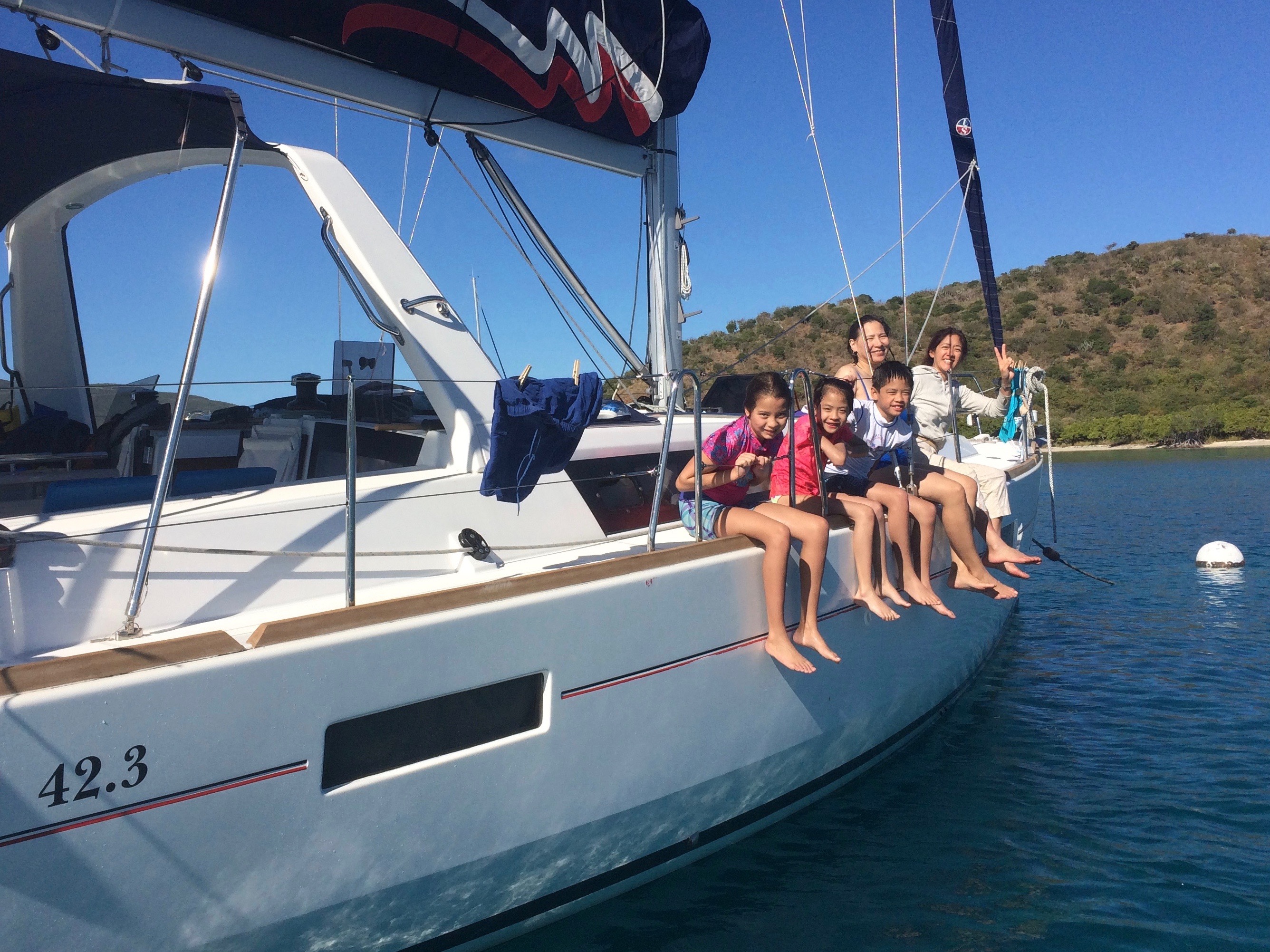
Our inaugural Kid/Parent trip is in the books, and it was a resounding success. We’d been planning to do this for awhile. It’s always nice when a trip exceeds your expectations, and that’s what happened. Now, we’re thinking of an annual Kid/Parent flotilla during the Presidents’ Week.
Meet the First Families… (Note: click any pic for full size/res – can click twice on lap/desktops)
The afternoon sun had us all squinting but it’s all good. Just about to depart!
Both Moms were graduates of our adult learn-to-sail program and continued sailing with us. One had already gone on to get her own 27 footer locally in the northeast. All the kids had some exposure to sailing, and were mostly the same age, so it was a good fit. We scheduled a slightly shorter week than normal for logistical reasons and at the end of it, we were hearing,.. ” I don’t want to leave.” That’s a good trip.
While it was mostly oriented at the kids, in this case aged 10-12, the difference between a kids’ itinerary and one for adults is mostly details. The allure of the watery and warm environment, swimming and snorkeling, and some hiking and sight seeing works for all.
Grins are good. Running along the north shore of Tortola en route to Jost Van Dyke.
We managed to get in a fairly typical itinerary of islands and anchorages, even including Anegada as the winds were relatively calm. Jumping in from the swim platform seemed to rank highest in customer satisfaction. Snorkeling and running around like banshees on the beach placed and showed respectably. One medium hike and one that was arguably a little too long went over surprisingly well.
Marine sightings included one dolphin, several large sea turtles, more large tarpon than usual, a spotted eagle ray that came flying out of the water like a bat out of hell chasing bait fish, a fairly curious ‘cuda (just for the Captain who was off on a snorkeling flyer), and numerous colorful and oddly shaped reef fish found by several of the kids and adults
Winds were light this time, and we didn’t have to reef once. We saw others with reduced sail plans on occasion but we didn’t see the need, even with kids. The boat just didn’t heel much. When it was ‘sailing for the sake of sailing,’ the kids were fond of pointing out when the boat speed dipped below a few knots, and when it made more sense, we occasionally motor sailed to keep it moving.
Day One: mid-afternoon departure, after receiving the boat at noon, so lucky to get to an anchorage at all and happy to punch it under power. Went to Marina Cay, a good jumping off point for other anchorages. Great shake-down snorkel for all, all of whom were brand new to it with one exception.
Captain Casual, trying to not be Captain Obvious (as in not over coaching, as she got it right away). First leg of trip, less than half an hour out.
Day Two: off to Anegada. Forecast seemed to favor it, and once we poked our nose out past the main islands, it was confirmed in real time. This was one of the best sails of the trip, never needing to motor to keep up a good cruising speed. All who wanted to steer got plenty of time. Some ocean swells, but nothing we couldn’t handle from a comfort standpoint.
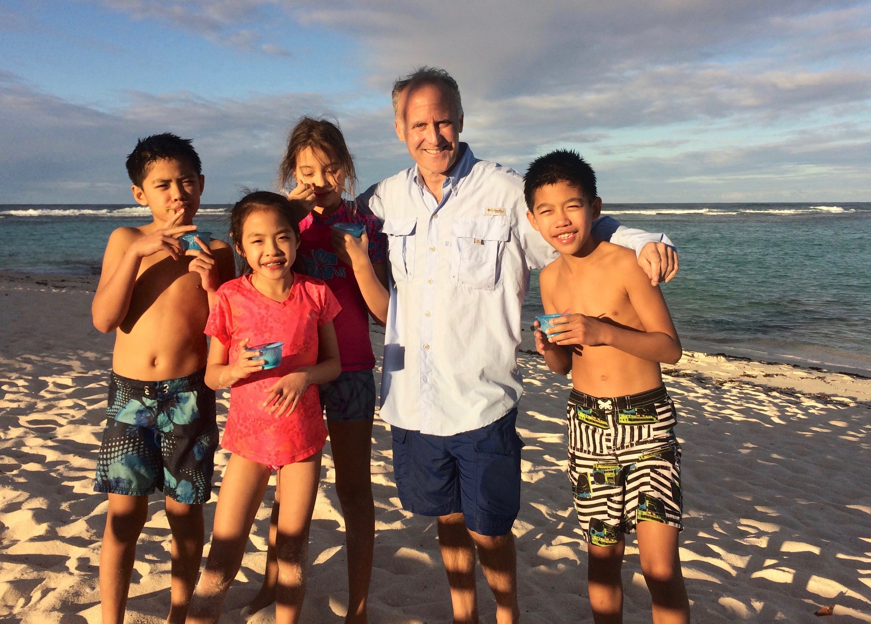
Made lunch and then took an open-air taxi ride to Loblolly Bay and Beach on the north shore, one of several great spots. Across the inland pond we were able to see part of the resident pink flamingo colony of the island. Far away, but they were there. Snorkeling, scrubbing energy on the beach, tightrope and hammock games, and a little ice cream didn’t hurt.
Apres snorkel ice cream. Loblolly Beach, Anegada.
Day Three: Virgin Gorda. not enough wind to justify trying to sail back so we motored and made the time pass with games and snacks. Moored up at Saba Rock, then the kids did what they do best: jump off the boat for awhile. The Captain organized a day trip for the group to The Baths, the famous boulder formations at the other end of Virgin Gorda. They had a blast while the Captain caught up on correspondence, scoped out a new snorkeling spot, and shot some pool with pepperoni pizza for sustenance.
Not a typical scene anywhere – except at The Baths on Virgin Gorda. This is just one of many spectacular pools amongst the boulders.
Day Four: on to Jost Van Dyke. Combo of sailing and motoring to get the miles under the keel, but it was a fun ride. Gentle ocean swells at times and otherwise flat. First, we moored off Sandy Cay and did a dinghy drop of passengers to play and explore the small island, which was donated by Rockefeller in 2008. It’s a delightful swim over a sandy bottom to get ashore, then one can take a short scenic hike to the top and back down the other side for great vistas and getting the wiggles out. Huge hermit crabs are scattered around the trail here.
Much taller than it looks, little Sandy Cay is a great day stop. Swim in from your moored or well anchored yacht; hike up the trail to the top and back around the other side.
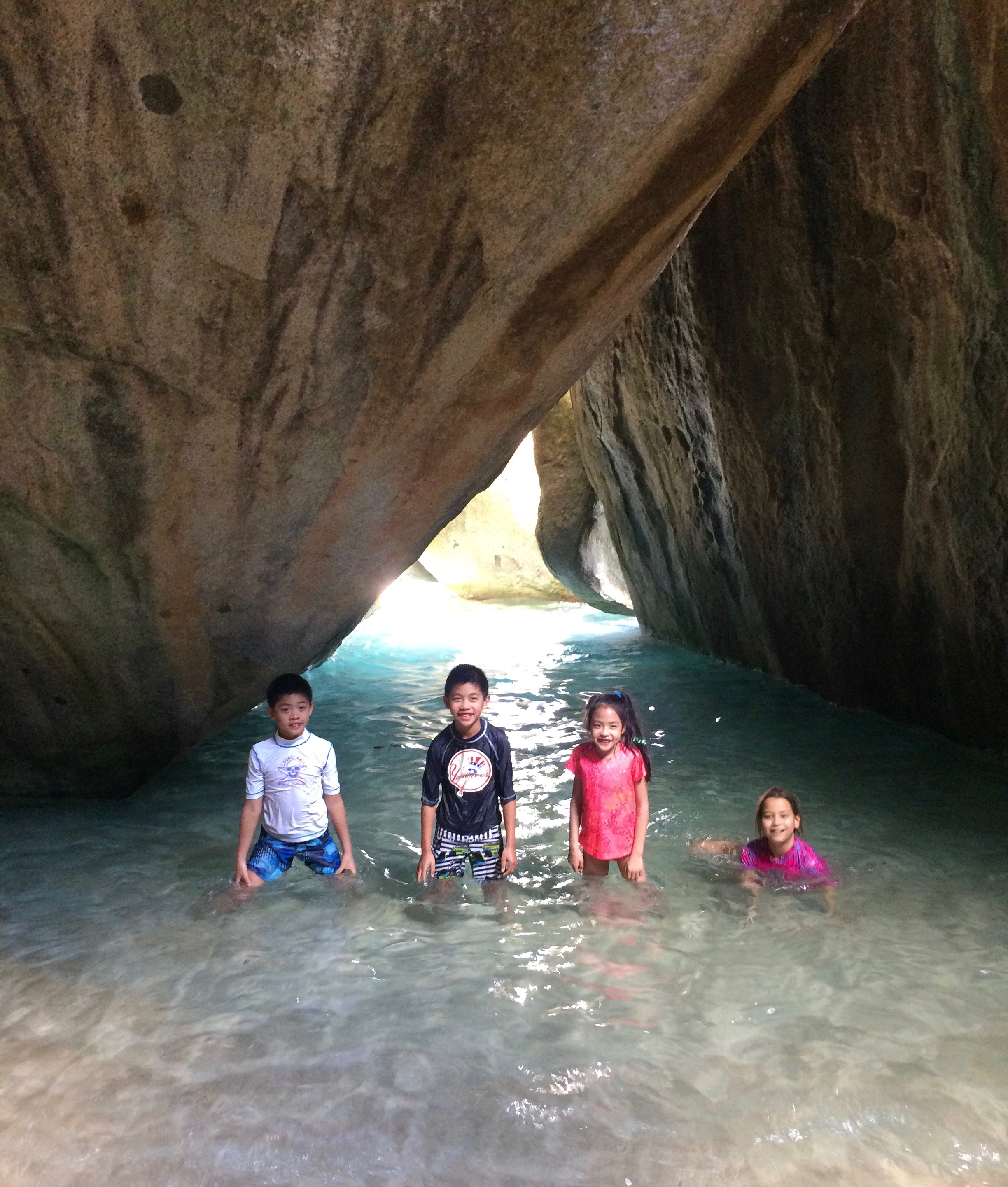
We anchored off Little Jost Van Dyke for the evening, affording more diving maneuvers (mostly cannonballs) off the swim platform before we did a group trip to he Bubbly Pool, a moderate walk from the dinghy dock. This is a small beach almost completely enclosed with lava formations and rocks, through which the open Caribbean surf rolls in from time to time making a foamy whirlpool of things. Very fun and relaxing; well worth the walk.
The Bubbly Pool, Jost Van Dyke. Waves break through the rocks and tumble in, creating a foamy, refreshing bubble bath.
Day Five: more snorkeling and swimming before weighing anchor and setting sail for Norman Island, our last anchorage of the trip. We sailed most of the way, furling up before negotiating Thatch Cut at the west end of Tortola, and then enjoying our first real beat of the trip with several tacks thrown in as we zig-zagged along St. John.
After mooring in the Bight at Norman, we dinghied in for the long hike to Money Bay towards the other end of Norman. One kid/parent turned back after making a good show of it and played at the main beach, including a kayak rental. The rest of us trudged on and made it to Money Bay for a secluded snorkeling expedition followed by lunch and a more downhill return. Followed, of course, by ice cream and virgin daiquiris…
One of the scenic overlooks on the Norman Island hike.
Next up: snorkeling at the Caves off the headland of the Bight. Excellent visibility this time; not many schools of fish but plenty of large parrot fish, a few trumpets, and other individual and paired sightings. Followed, of course, but scores of jumps off the back of the boat once we returned.
Rinse & repeat. And repeat. This never got old for them.
What didn’t we do? The Willy T, appropriately. There’s always the March 18-25 trip (still room for two more people…).
Kids & Parents in the BVI. it was meant to be, and will be again next year. Many of you have asked about this; we’ve been preparing for it; and now it’s a reality that we’ll keep exploring with you in the BVI and elsewhere.
See some more pics and clips from this and other trips on ourInstagram!
…or is it no location? Or too many, so a school is confused about where it is?
Do two (or three) wrongs make a right (location)?
Wonder what percentage of you get the GoT reference of this post’s title. (If you don’t get GoT, let us know and we’ll bring you up to speed.)
Hint…
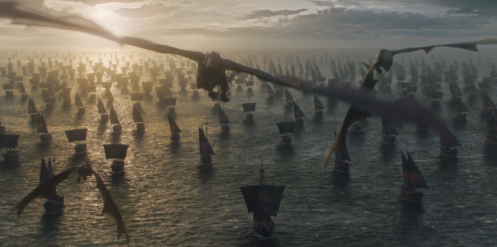
Wings over water – on sailboats and soaring dragons. Final scene of season six finale, Game of Thrones.
WTF am I talking about? Sailing schools who are geographically challenged and are either so confused they don’t know where they are – or want you to be so you sign up for their school at one of their dubious digs.
Example: a school is named after a geographic location. An island. They had to move from that island to a neighboring state. They still reference teaching at that original island in their blurb on the ASA School’s page. But a girl has to cross a river to get to them. (oops; there’s another GOT reference…)
Another example: a school has three locations, none far from the others (and all in our state). One moved across the bay it’s located in. Map page still shows it where it isn’t. At least it’s the right bay. One is entirely new. It’s listed on the ASA page as being in a particular Bay, where they say the sailing is Great. But a school is not in this bay. It is in another, far away, and the sailing is not in this tiny bay. A school sails in an inlet on an ocean. (And a school cannot hide from that ocean’s swells.)
What do we care? We like good old fashioned, straight up honest advertising. Plus, we’re very proud of our location. It’s extremely accessible from so many places, both by public transit and car. The area is insanely good for teaching sailing and just enjoying a day sail or a cruise.
Some schools have multiple locations. Some locations have multiple schools. Tiny little City Island, barely a mile and a half long, has historically been home to two sailing schools – sometimes just one, and for a time, three. Plus, it has two college sailing teams. Both those universities have campuses on Manhattan. But, they sail out of City Island. Finally – we have three yacht clubs on the Island and the vast majority of their members’ toys are sailboats.
We have had opportunities to add a satellite location at the “bay on the ocean,” on the Hudson, etc. We have always declined. Not worth having a location slightly more convenient to Manhattanites, or to spread ourselves around hoping to capture another demographic, just to take clients’ money and give them a piss-poor education and experience that, if they even learn properly from, they’ll soon outgrow.
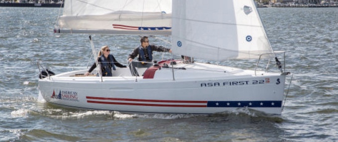
We recently came across this review of our learn-to-sail boat, the Beneteau First 21.0. It’s sometimes called the First 210. Many Europeans call it the Baby Ben.
One of our Beneteau First 21.0 sloops at New York Sailing Center.
It’s the smallest sailboat made by the largest (and oldest) sailboat manufacturer in the world. It’s two and a half editions, or generations, or models old depending on how one defines that. Started with the First 21.0; became the First 20. (Boat didn’t shrink.) Then, Beneteau and ASA (American Sailing Association) teamed up to produce a slightly modified version – that’s the “half” to which I refer – called the ASA Trainer or First 22. (Again, the boat didn’t grow.) The chief difference on this one is that they made a smaller cabin and larger cockpit.
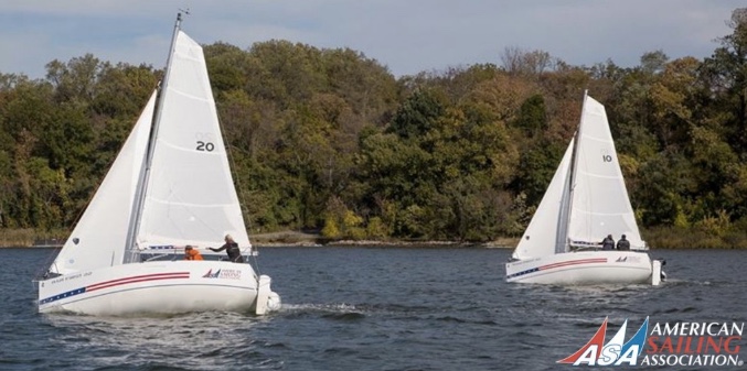
A pair of ASA First 22 sloops duking it out somewhere. Note sail number: “20,” same on both, leftover from Beneteau’s standard production model – the First 20. They’re all the same size boat.
But, all versions have these things in common:
Hull. (Boat body) The size and shape are the same.
Keel. (The fin that stops the boat from going sideways and from flipping over.)
Rudders. (Steering fins.) Yes, plural. There are two.
Rig. The spars (poles that hold the sails up, out, etc), and basic sailplan, are the same except for the squared-off top of the mainsail on the newer boats.
Bob Perry, a highly esteemed naval architect and author, with a regular column on design in Sailing magazine, penned this article some time ago. Here are his words, and some pics we saw fit to slip in…
Perry on Design: the Beneteau First 21.0.
(Bob’s prose appears below in quotes. Any editorial notes I couldn’t resist are indented in parentheses as I’ve done here.)
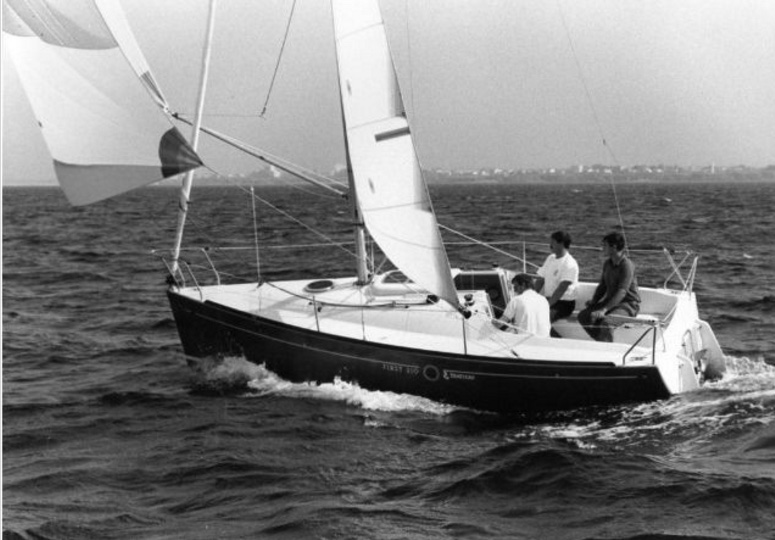
“Let’s go small and look at a trailerable boat. This one is from the board of Group Finot and built by Beneteau. It is a very different approach, abandoning tradition and going after speed and convenience with modern design features.
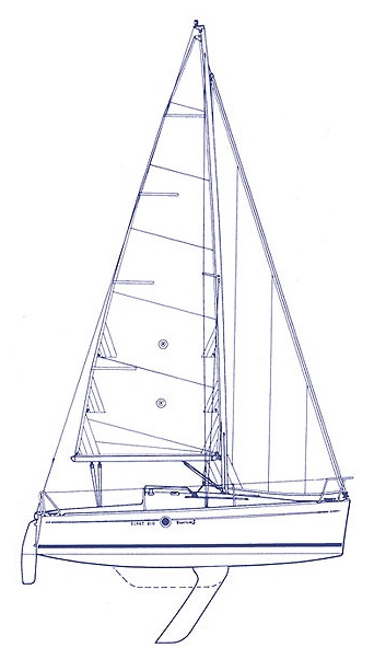
ABOVE: Blueprint of the Beneteau First 21.0, showing the swing keel in both extremes of its range. This is a ‘high aspect’ design: the sails and the keel (foils) are tall up and down, and short fore and aft.
“The benefit of this type of boat is the ability to move easily to exotic or semi-exotic locations for regattas. The 210 will make a great daysailer or a camp-style cruiser. While trailerable sailboats are seldom examples of refined design, the First 210 shows design innovation aimed at sparkling performance and eye appeal. This boat is also unsinkable.
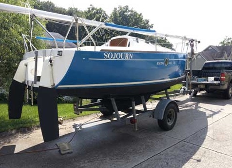
Keel fully retracted, a First 21.0 on its trailer and ready to roll.
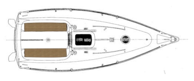
“With an LOA of 21 feet, the First 210 shows a modern, round bilge hull form with a very broad transom to give it dinghylike proportions. Look carefully at the plan view, deck layout or interior. Note the location of maximum beam. In most modern designs the maximum beam is located at or around station six. If you use the same system of establishing stations and break the 210’s DWL into 10 segments, you will find the max beam around station nine! There is even a curious little hook in the deck line right at station nine. The result of this shape is extreme maximization of the small volume available in 21 feet and a wide platform aft to optimize the righting moment effect of crew weight.
(We’ve always called this boat a big dinghy with a keel on it. A dinghy is a sailboat that can flip over and requires the crew’s weight on the rail to hold it down. The Beneteau First 21.0 is very sensitive to crew weight, and reacts immediately to changes – but it won’t flip over if the crew fails to react. That makes it ideal for learning and training.)
Bird’s eye of the Beneteau First 20 plan. Note how wide the back, or transom, of the boat is and also the twin rudders on the back. All this is the same configuration as the First 21.0.
“The extremely high-aspect-ratio centerboard (ed. note: it’s a ballasted swing keel, not a centerboard or centerboard keel) is housed in an odd shaped nacelle below the hull for a board-up draft of 2 feet, 3 inches. Almost every appendage is a candidate for “ellipticalization” these days, and I find it interesting that the designers have ended this board in a sharp point. In profile, the rudder looks ridiculously small until you realize that there are in fact two rudders. They are canted outboard at 15 degrees. With this extreme distribution of beam aft a normal rudder would pull almost clear of the water at high degrees of heel. With the two rudders, when the boat is heeled one of the rudders will still be at an effective working angle with the water. This is a slick way of reducing the required draft of the rudders. Note that the draft of the twin rudders is the same as the draft of the board housing. The rudders are linked through the member at the top of the open transom.
A First 20 in fine form upwind. Note the rudder barely touching the water. The other one is all the way in and fairly straight, meaning it works well. When a sailboat leans to the side, its rudder loses some effectiveness and this twin rudder design reduces that.
(The design was great by itself, but what puts it over the top is the twin rudders. Sailboats lean to the side naturally, as shown in the pic above. The more they lean, however, the less effective their rudder (steering fin) becomes. It loses its bite on the water, so it has to be held to one side to go straight. This creates drag and further reduces its effectiveness. But the twin rudders on the First 21.0, each one angled outward, become straight when the boat heels a normal amount, and when the boat heels too much, the rudder angle isn’t bad. This makes for a forgiving feel that allows students to learn from mistakes rather than be confused or overwhelmed by them. And that makes them better able to sail any boat afterward.)
“There are no overhangs on this little packet. The bow profile shows a hint of concavity to allow some flare into the forward sections. There is also a tiny amount of tumblehome in the midsection with a moderate BWL.
“The shrouds are taken to the deck edge allowing a small jib to be sheeted inside. The mainsheet sheets to a single attachment point on the cockpit sole. All halyards lead aft to jammers within easy reach of the helm. The spar is deck stepped with a hinged step. The interior is a one piece GRP molding with small sink and one burner stove. The portable head is under the V-berth. The small interior space is divided by a trunk that carries that top of the swing keel. A hinged leaf table is attached to this trunk. The four berths are all adult sized.
“On deck, the swim ladder and outboard bracket fit neatly between the twin rudders. The two cockpit lockers contain a space specifically for the outboard fuel tank. The bubblelike desk is striking and set off by a varnished mahogany toerail.
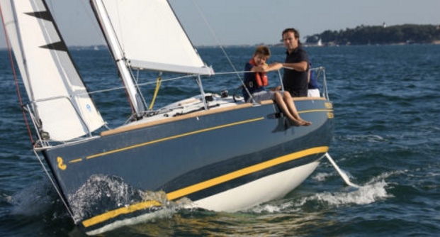
Closer view of the newer ASA First 22. Larger cockpit, smaller cabin, and Stars n Stripes graphics are the key differences between the original First 21.0 and this version.
“The First 210 appears to combine careful styling with performance and safety. The general approach to this design is similar to the Mini-Transatlantic Class, but the boat is not as radical in proportions as a true mini-transat racer. Beneteau’s tooling of molded parts is as good as any in the business and their approach to finish and style is perhaps the best in the business. These aspects combine to ensure that the little 210 will be a standout.”
(“Mini-transat” refers to the Mini 6.5 class boat: 6.5 meters, basically the same as the first 21.0. It’s a serious racer. How serious? They are raced singlehanded across the Atlantic – with spinnaker. No shit. They have twin rudders like the Beneteaus. This class is also raced doublehanded for some regattas.)
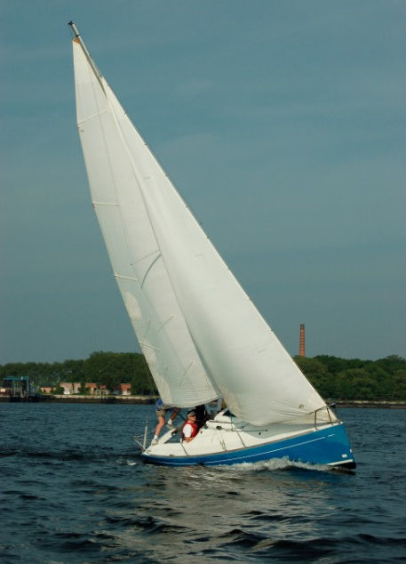
Black & white is so timeless! Here’s a great shot of the First 21.0 flying along while flying a kite (spinnaker). Note the simple, spacious cockpit, balancing well with the open deck space making it easy to go forward to moor, anchor, rig a non-furling jib (which is best for learning to sail), etc.
We love this boat, and while they’re fewer and farther between, and much more expensive to buy than the boats more commonly used in sailing schools (J-24’s and Sonars come to mind), they’re worth it as they just work better for teaching.
“Don’t take our word for it!” Everyone says they have the best boat. But this is the only design ever endorsed for sailing instruction by a national sail training or sailing school organization such as ASA or US Sailing.
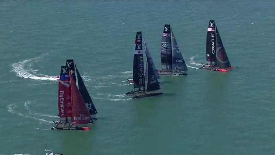
Looks like Team Oracle (USA) leads here, right? Wrong. Watch the video clip to see how Land Rover rolled right through this group and blew them away. Use the link below to go to the AmCup site and get the app.
The cup action has moved to Portsmouth, England and is exciting as usual. Local team Land Rover BAR, led by Sir Ben Ainslie, was in the lead after Saturday’s round of racing. Ainslie is without a doubt one of the best sailboat racers in recent history, with Olympic medals and world championships under his belt in such tough classes as the Laser and Finn. Add foiling catamarans to the list, and his path to glory starts to resemble that of ‘The Great Dane’ – Paul Elvstrom.
‘The Great Dane,’ Paul Elvstrom, in the 1960 Olympics in Rome. He’s in a Finn dinghy – the world’s hardest boat to sail. Period.
Elvstrom is arguably the most successful sailor in racing history.
Quick stats…
Sailed in 8 Olympiads
Won Gold Medals in 4 consecutive Olympiads, a feat duplicated by only 3 other athletes, including Ben Ainslie and Carl Lewis;
Medaled (1st, 2nd or 3rd) in 11 World Championships;
Did all this in 9 different classes of boat, running the full gamut: singlehanded dinghies, double handed dinghies, 2-man keelboats, 3-man keelboats, and catamarans. Only thing he didn’t do was sailboards which became popular too late in his career.
Here is a list of racing classes he did all this in:
Firefly (singlehanded dinghy)
Finn (singlehanded dinshy)
Snipe (doublehanded dinghy)
505 (doublehanded dinghy)
Flying Dutchman (doublehanded beast of a dinghy/boardboat)
Star (doublehanded keelboat)
5.5 Metre (3-man keelboat)
Soling* (3-man keelboat)
Tornado (doublehanded catamaran)
*The Soling was a true pedigree racing class, but was also very commonly used in adult sailing school programs for a long time. We used them in our first school. Sweet ride, but not particularly comfortable or ergonomic for beginners.
On top of all that, he just missed an Olympic bronze medal by one place in the Tornado class catamaran in his 50’s with his teen daughter, Trina, crewing for him. He also victored in numerous Pan-European Championships, including in the Dragon class keelboat which was very competitive back in the day.
On and off the race course, Elvstrom was developmental in many ways., ranging from sail and spar design and manufacturing to improvements in components (such as self bailing mechanisms), training techniques (his ground breaking hiking bench), and race organization (such as using gates, or two marks to pass between, for large fleets). He wrote a few books too including Expert Dingy and Keelboat Racing.
Anyway, the times and boats were somewhat different, but all can agree that these are two of the greatest names in the sport of sailboat racing. Sir Ben Ainslie has the distinction of competing in the America’s Cup, the premier small fleet/match-racing event in the sport, and is doing a very good job.
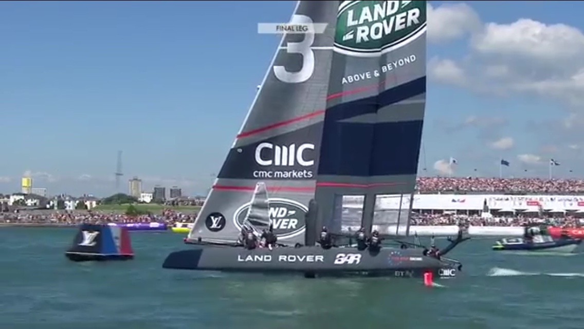
CUPDATE: Ainslie and Team Land Rover (pictured below) won the Portsmouth regatta and have the America’s Cup trial series lead. That makes them currently the boat to beat and if they maintain their lead, they challenge Team Oracle for the actual Cup.
Team Land Rover foiling along during the July 23 action on the Solent. Note the stadium seating in background.
To watch previous races, both real-time with commentary and a variety of viewing angles, and really kewl virtual renditions, go to the official America’s Cup site and browse around or better still, get their app. Racing resumes on Sunday (July 24). Check it out…