Which came first – the chicken, or the egg?

When learning how to navigate or sail a boat, currents and tides sometimes have something to say. Which causes the other – current, or tide?

We ask this in each schedule of Start NavigatingSM, our ASA 105 Coastal Navigation course. I have a strong opinion on this. Apparently, it agreed with NOAA and NOS. They had a “Did you know?..” posted on one page, and it said what I thought already: one causes the other, despite the conventional wisdom being otherwise.

IN THAT PIC: a visualization of the Gulf Stream, spanning the vast areas from the Gulf of Mexico to the shores of Western Europe! It’s shown here with different colors reflecting sea surface temperatures. Courtesy of NASA. The Gulf Stream is a prevailing, steady-ish current (not a ‘tidal’ current).

Of course, when this topic arose again recently, due to ASA sending an e-blast concurring with the conventional wisdom, I was ready to sink my chops into it. Here’s what they said…

Tides are the vertical movement of water caused by the gravitational fields of the sun and the moon acting on bodies of water. Tidal Currents are the result of water moving between high and low tides.

Zeke Quezada, “TIPS FROM THE TEXT ‘TIDES & CURRENTS,'” on ASA’s site and in their January 27 e-blast.

So… celestial gravity raises earth’s waters, forming currents that fill in the gap? Nahhh…. Hard no, IMHO. Where was that NOAA page? I went looking for it.

Two weeks later: still looking. They seem to have deleted that page, and / or edited it and others. And, they have mixed statements about how this all interrelates. That got me thinking again about the topic, and further researching it. Most explanations I came across seemed somewhere between lame and oversimplified. But, most of them shared a common assumption of facts that were supported by an astrophysicist who I’ll cite below. He sought to debunk the common explanations of those facts. As did I.

I wrote him but haven’t heard back yet. I also reached out to a good friend who’s a PHD candidate in climate science at Columbia. She supported my explanation, and also noted that it’s a tricky topic to teach and that her students usually have trouble with it.

Let’s try to decipher this. What are currents and tides generally? What’s the difference between them? That part is simple.

CURRENT is any horizontal motion of earth’s waters across the face of it (back and forth; in and out).

TIDE is any vertical motion of earth’s waters (up and down).

What causes this to happen? Let’s limit this to interrelated current and tide, and leave out anything about wind driven currents or those caused the the rotation of earth (both of which are separate phenomena from tide and tidal current). Back to cause and effect:

The gravity of the moon mostly, with a little less than half of the forces caused by the sun.

Yup. “It is known.”

But, that’s both the beginning and the end of what people pretty much agree on. So let’s flesh out what the author here – me – thinks. Methinks. (Yes, grammatically incorrect x 2. So sue.)

What causes the “motion of the ocean?”

The gravitational pull of the moon, mostly, with less than half the total force being from the more powerful but far more distant sun. Their combined gravity pulls the earth’s waters around, causing cycles every day. We have two high tides and two low tides each day as the waters bunch up in response to celestial gravity. Because the tides are based on the moon much more than the sun, it takes a little over one “day” for the completion of all the cycles – around 50 minutes or so. (The moon rises later each night, in case you hadn’t noticed. That’s due to the moon’s orbit around earth.)

As the water chases the gravity, it flows horizontally across the earth’s surface, which is what we call current. As water leaves one area, it drops vertically, and as it bunches up in another, it rises. Therefore, current flow causes the rise and fall we call tide.

The Motion of the Ocean, excerpt from “Navigation for Numbskulls,” or How to get from A to B Without Hitting C. Captain Stephen Glenn Card (I authored the text in 2002, updating occasionally, and it’s the companion textbook we use for the ASA 105 Coastal Navigation course, Start Navigating. )

When people say that tide causes current, it implies that the moon stretches or lifts earth’s waters vertically, and pulls in water from other areas in the form of current. Neither the moon nor the sun has the gravitational force to actually lift earth’s waters.

Analogy, for those who like them: imagine the force required to push a boat through the water at a dock with one hand on a calm, still day. It’s pretty easy. Then, imagine lifting that boat out of the water and up into the air. That requires a multi-ton hoist. The concept is the same for cosmic gravity moving earth’s waters. It’s easy to pull them across earth, and impossible to lift them up and away from it.

But, don’t take my word for it… here are two videos and a pulled paragraph that sort of resonate with what I’m saying…

Neil deGrasse Tyson, a man who needs no introduction, speaking on Star Talk.

Gabe Perez-Giz, an astronomer and astrophysicist at NYU, on PBS’ Space Time

And, here’s a quote pulled from NOAA’s site (National Oceanic and Atmospheric Administration)…

TIDES

If you live near the coast or have ever visited the beach, you are probably aware of tides. But did you know that tides are really big waves that move through the ocean in response to the forces exerted by the Moon and the Sun? Tides start in the ocean and move towards the coast, where they appear as the regular rise and fall of the sea surface. How much the water level changes over the day varies depending on where you are and what day it is.

NOAA, in their abstract / synopsis of tides and currents. https://oceanservice.noaa.gov/navigation/tidesandcurrents/

Here’s another… also NOAA: Physical Oceanographer Greg Dusek, a senior scientist at NOAA’s Tides and Currents Office…

…And that affects water levels too, because you’re pushing either water away from shore so you have a little bit of a decrease in water level, or you’re pushing water towards shore and you have an increase in water level.

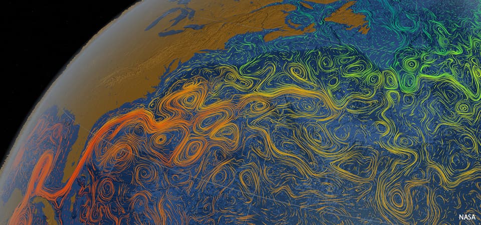
…When the Gulf Stream slows down, you can see increases of water level along the Southeast coast by several inches to maybe a foot. In some cases, it happens pretty regularly. So in North and South Carolina, you get a regular increase in water level in the fall because the Gulf Stream tends to be a little bit slower during those time periods.

Greg Dusek, NOAA Ocean Podcast Episode 15, “Tides and Currents: the Motion of the Ocean” (not to be confused with this author’s identical section title from his book, as I came up with the phrase on my own. So there.) Dusek’s topic here was mostly ocean currents like the Gulf Stream as caused and influenced by earth’s rotational force.

I repeat: “tides start in the ocean and move towards the coast” (translation: current)

…where they appear as the regular rise and fall of the sea surface.” (translation: tide.)

So, on a simply descriptive basis, with or without the terms current &/or tide, NOAA’s explanations agree with mine. And, everyone agrees that current is horizontal and tide vertical.

Add all this up…

Tyson: earth revolves through the tidal bulge caused by the moon (horizontal motions of earths surface and/or waters)

Perez-Giz: the moon does not lift or stretch the earth’s waters.

NOAA: ocean waters travel toward the coasts, where they rise and fall.

Card’s Conclusion: current causes tide.

Hopefully, this clears it up more than clouding it. What do you think? Weigh in!

How are we scoring in ASA surveys?

Our Director, and most prolific instructor, scored 3.92 out of 4 so far in 2022! THIS is how we teach people how to sail in Brooklyn and City Island.

Year to date, 2022: Captain Stephen Glenn Card, our Director, “Dockmaster” and author of our Blog Rants, has a near-perfect record thus far. Unless there’s a seriously negative ballot-box drop in the next few week, which basically can’t happen, that’s that with that.

Captain Card explaining the gift of lift – or, how sails work most of the time. Quick shoreside preview before going out and doing it for real.

And, we’re not talking about an average of 1 or 2 reviews. 20 were submitted, which is a meaningful amount statistically (and particularly in our industry.)

How does this work? ASA sends a confidential email survey to all students who have course certifications processed. Some students respond, and answer key question about how their course went. Their responses are strictly confidential: schools and instructors never know who said what about the where now. Instructors can only see how many reviews were done, and when, plus a breakdown of scoring for each question (not each student).

Dinghy Captain (every trip has one) Steve clowning for the camera while simultaneously towing a stranded dinghy from another cruising yacht (the little outboard that couldn’t). Off Marina Cay and Scrub Island, BVI, literally days before the pandemic lockdown in ’20.

And, ASA issues Instructor of the Year awards based on these. Assuming an instructor gets a minimum number of responses (ASA doesn’t’ disclose what that is), they’re in the running based on their cumulative score for the calendar year.

Will 3.91 be enough to win one for our Dockmaster? Doubt it; he’s always scored quite highly and hasn’t won one yet. So, the margins at the upper end are tight. But, that’s splitting hairs. It’s like when the final race in a regatta comes down to a few top sailors, and they all finish within a few places of each other in the final race in a large fleet. Someone gets the win, even if there’s really no difference in their overall performance. But, Steve hasn’t won. (Yet?)

Bareboat 104 course; Long Island Sound. 20-25 knots (building to 30 by the time we approached home port) and a long haul back to City Island from Oyster Bay. Beat back, or beat it.

What does this mean to students looking for a school to learn how to sail, or take their sailing up to the next level? As the owner, and most prolific instructor of late, top scores translate into a top-tier program. Our Director sets the pedagogy of the school, plans the places and the props, and keeps adapting the program based on results and feedback. And, the weather! As that’s been changing, schools must adapt or decline.

“My dad started a sailing school back in 1968. He sold it in the late 80’s. Eleven years later, I started a new school. I modeled it after his program. Yes, I changed and tweaked, but cautiously and creeping, not with reckless abandon.

The new and subsequent owners of the school dad sold? They took something that wasn’t broken and tried to fix it. It took awhile, but the more they messed with it, the worse it got. They ran it into the ground. Ultimately, they just abandoned the boats. Sad.”

Captain Stephen Glenn Card

… who shall remain in first person mode for the remainder of the Rant. I guess at that point, it wasn’t fun for them anymore. True, it was a business. But if this type of business isn’t fun, you’re not doing it right. To quote one of the most highly respected snowboard instructors at Okemo Mountain resort when I was part-timing there…

“You’re going to be safe, and you’re going to have fun. And, maybe you’ll learn something!”

spoken at the start of a beginner group lesson

I’m afraid I don’t remember his name – only his face. I’m bad that way. Not so hard with groups of only 3 people max for our learn-to-sail courses (and 4 for cruising). But, when teaching up to 8 students in a group snowboard lesson, with faces often covered, and no name tags, names get lost. Yes; I taught snowboarding part time for 3 winters. It was mostly to prove I could teach better than I’d been taught (only 2 years before). It was also for instructional cross-training, getting good as fast as possible, and a free pass to a quality mountain. I didn’t do it for the money; it’s safe to say I lost money on this deal.

In my first lesson, I felt vindicated on the teaching part. From day one, supervisors were watching me intently, clearly wondering what I was doing and why. But, they just watched. My students didn’t fall (certainly not a lot, and some never fell). And, the feedback I was getting from veteran instructors who inherited my students for their next level, and later my supervisors, was super positive.

This one from our inaugural Kid/Parent cruise in the Virgin Islands (BVI), with two moms and 4 kids between. Wildly successful!

Did I figure out a new model for how to teach snowboarding? No. I picked it up from a video series! Anyone who’s even curious about maybe learning to snowboard should watch this. It’s entertaining. Highly qualified instructors, one of whom was a pro rider for Burton for a spell. Brother and sister. Their system made sense from my own experience trying to learn, and from their presentation. It wasn’t a complete departure from the conventional progression, but they made key changes in the early stages that appeared to make far more sense. So, I did it that way. It’s not what the mountains seem to be doing, and that’s why they have students falling all the time trying to learn (as opposed to occasionally). Have an open mind, and when stuff doesn’t make sense, consider rejecting it.

It took me another few years to accept something another veteran instructor said one day, but due to his experience and the respect he commanded, I kept thinking back on it. Turns out… he was right. And, he was voted Instructor of the Year by his peers! But, whether I ever earn that in sailing circles doesn’t really matter. Delivering an excellent lesson, every time, is the goal. The proof is in the people when they can sail off the mooring, do all the skills, and sail back – without brakes, without a reverse gear – and stop their boat.

And, we do it for them every time.

Live 105 on Zoom, November 15, 2021. Pets and drinks are welcome. We have fun! But, we also get shit done. It’s quite efficient especially as no one needs to travel. We were the first school to switch to Zoom for coastal nav courses when the pandemic hit. None of our local competitors did this; we have yet to confirm any school that actually has. In-person 105 courses are likely to resume this winter in addition to Zoom

Living with Thunderstorms – & Not Dying in Them.

It’s that time of year; weather is warming up, and thunderstorm activity is heating up as sailing club, school and rental activity opens up. We revisit this topic every year as a public service. One reason: people still don’t seem to ‘get it.’

In that pic: screen capture of radar images on Wednesday, June 3, in the late AM. We had a private lesson booked that day with an experienced sailor. The forecast was for thunderstorms – not a chance, or a likelihood, but just… thunderstorms. And, they warned of potentially damaging winds and hail. Not a garden variety summer forecast, which is “chance of showers and thunderstorms” or similar language.

Oh, no… it’s ON!!!!

Below, I’ll share how the day of June 3 unfolded forecast wise, and also stories about two needless tragedies in the past that happened when people didn’t pay attention to the forecast.

The first step of the day is to check the forecast. That should be done several times as the day progresses to look for updates. The next step is to check the radar. Easier than you might think; just look at the pic above. Pretty clear that something is brewing. And, even if the forecast winds up being off, the radar doesn’t lie. It doesn’t take a meteorological degree to read a radar app. It just takes a little time and experience.

On two occasions since I’ve been operating New York Sailing Center, which I founded in the fall of 1997, there were particularly violent thunderstorm systems that passed through the region and resulted in a fatality at some other school/club. NOT AT MY SCHOOL/CLUB. At others.

The first was in 1998, before we all had smart phones and radar apps at our disposal. It was old school; check the forecast, check the sky, and listen to the VHF radio weather band for updates. The forecast was doom n gloom: thunderstorms, some of which could be severe, and which had a large outer perimeter of strong wind (meaning no way to see it coming). And, the storms had already started upstate and killed a few people.

Make no mistake; winter is coming…

Sky getting gray as we return to the mooring on Wednesday, June 3. Radar? Showed rain passing to north and east, and squalls approaching in the distance from the west and south. Might miss; might not. So, we cut the lesson short and played it safe.

So, I kept everything on a super tight leash that day in 1998. We had one class with a veteran instructor. We talked about it and decided to confine the boat to the anchorage. No further than the outskirts of the anchorage. The anchorage is small. More maneuvering, then! Marina customers were warned of the storms if they showed up. A few did and just turned around and went home. One woman chose to sit on her boat at the mooring for awhile and then go home.

Eventually, after frequently checking the sky to the north and west, I didn’t like the look and feel. I started radioing the instructor to come in, and saw he was already approaching the mooring. They took one shot, and fell short… and then it hit. BAM. Nothing to be seen in advance. Just wind laying the boat over and flogging the sails. They didn’t have a chance to sail back to the mooring; no way. The boat was basically blown down onto the next pier, and the instructor wisely off-loaded the students and left the boat. I went out with a few experienced people and two solid motor boats, and towed the sailboat off and moored it. It took two boats just to pull it off and suspend it into the winds, which were at least 60 knots and possibly as much as 70. When it subsided a bit, we moored the boat.

It was over quickly. It always is. But it takes little time to cause mayhem. We got away with a torn sail and a fright. Down in New York Harbor, they weren’t so lucky. One large club/school had allowed at least one member to go out with his family. The boat took a complete knockdown, and the man was in the water and separated from his family. He wasn’t wearing a PFD. His body was found a few days later in Gravesend Bay, Brooklyn.

Fast forward to August, 2010. Morning forecast: about the same as the 1998 incident. Thunderstorms. Severe. Moving fast. Clear band of strong winds. This time, however, we had smart phones and radar.

I kept the one class we had that day pretty close for our morning sail. I intended to do a short n sweet lesson, get off the water way early, and watch it all blow through during lunch and some extra classroom. While on the water, I got a call from a recent graduate hoping to come out for one of his practice sails that afternoon. Sorry; no. Bad forecast. He pushed; I explained the severity of the forecast. He tried some more.

“No fucking way! I’m not going to let you come out here just to die in some violent thunderstorm! You’ll come out another time – live to sail another day!” The first sentence is an exact quote; the second is approximate. The message is clear.

What happened then? We sailed back to be safe. Sky still looked fine. Checked the update radar while waiting for our launch ride. Whoah…. it was the largest Darth Vadar Death-Star-looking doom ‘n gloom ball of red, orange and yellow I’d ever seen – before or since – on a radar screen. It was moving south and clearly going to hit all of Western New Jersey, Westchester, NYC, and Nassau, Long Island. All of it; all at once.

Updated Radar imagery from Wednesday, June 3. Note the wall of band of red/orange just south of our area. That’s violent weather. The yellow with orange/red above? Not to be taken lightly either. Only takes a splash of red to dash your head on the rocks.

So, I shut down the operation until further notice. Told my launch operator to go somewhere inside for lunch on the avenue and stay there until I told him to return. I took my class to do the same, with some classroom props.

It did hit. We were basically done with lunch and b.s.-ing about other stuff. Suddenly, it was very dark. Stuff was flying around like that scene from the Wizard of Oz. Darker; windier. Eerily, we couldn’t really hear it as the place was well sound insulated and we were in the back looking down the hall at the front door. And, almost as soon as it started, it was over.

We paid up and walked back to the marina. None of us had ever seen so much random debris blown around by a squall. The waterfront was worse; the waterway itself was a shit show of stuff blown offshore by the storm. There was zero wind. Sun was back out. Surreal.

And then, I got a text from one of my instructors. He let me know that another school (again, not ours) had a class out during the storm. They lost one person. Literally. The body was found a day or two later. This was disturbingly close to home, in lower Westchester, within sight of my school on a clear day. it was day one of a learn to sail course (compared to day 3 for mine that day). They went out in the afternoon (as opposed to my coming in at around mid-day). No one aboard was wearing a life jacket, or PFD. (We spend extra money on comfortable automatic inflatables with manual overrides, and make people wear them.) The boat had no lifelines, which are wires or ropes that are elevated above the deck going around the boat. (Not all boat designs have them, but it’s riskier when they don’t – especially for beginners.) Everyone on that boat wound up in the water; all but one made it back to the boat.

All but one.

I knew several sailors who got caught out in that same storm. They all fared well, but got quite a fright. I heard of others who got caught as well (also survived). The common denominator? And, what was reported in the news regarding the fatality in Westchester?

“It happened so fast.” “You couldn’t see it coming.”

But, you could. On the bloody radar! And, you KNEW it was coming. Why wait to see it? Does that sound simplistic? Well, it really is that simple.

In that pic: all gone – out to sea, but I pity the fool who got caught out in that. It intensified as it neared shore and got over the water. Wednesday, June 3.

Remember the DUCK boat incident a few years ago? We did a blog rant about that. Same shit; different details. Only that time, many people died. I’ll link back to that blog post below.

The lesson: people don’t seem to learn the lesson. Here’s how I suggest you manage the risk of getting caught in a squall or thunderstorm on the water during the summer, which is when most of them happen, and also when most of you would likely do most of your boating.

  • start the day with the forecast online, cross referencing at least two sources.
  • If there’s some risk of thunderstorms, consider skipping boating that day.
  • If you go anyway, check the update forecast upon arrival at the marina.
  • Start checking the radar at that time as well. If it looks dicey, don’t go!
  • If it looks like it’s far off, or just not developed, stay close and check frequently – at least every 20′.
  • As soon as it’s looking worse, assume the worst. Head back. If you have an engine, turn it back on (yes, you should have checked it before). Stow sails.
  • Moor or dock the boat. Double check the radar and forecast.
  • If still no good go home! If the risk went away, it’s your call.

I’m not a meteorologist. I’m not a weather forecaster. I’m not a climate scientist (although I know one who’s a PhD candidate at Columbia). But, I am an expert and well-seasoned mariner. And, I have to make decisions all season that affect other people: whether they get to play or not that day. it comes down to whether they’re safe or at risk of death. And so, I check the weather and radar pretty obsessively.

“What do we say to the God of Death?”

“Not today.”

Arya was bad-ass enough to slay the Night King. But even she knew the universal truth:

“Don’t f*%! with Mother Nature!”

RESOURCES:

The Radar web site (not an app per se) that I like to use for the northeast…

www.pluff.com

Our Blog Rant about the DUCK boat tragedy…

Which North are you? North 1 or North 2?

Scientists struggle to model the movement of the magnetic north pole. In our live, online ASA 105 coastal navigation course, a real instructor teaches you about this, and why you can basically ignore it.

We’re having a lot of fun with our “Live 105” classes on Zoom! Real instructor, real time, real students – in the same, small manageable class sizes we have for in-person courses. One of our current students sent a link to a BBC article related to the content of a 105 course, which is of course all about…

COASTAL NAVIGATION.

The link Cristina sent? A BBC piece about the movement, or wandering, of the magnetic north pole. We link to the piece at the end of this Rant. For now…

In that pic: the thin aqua line traces the approximate motion of the magnetic north pole from 1840 to 2019. It’s accelerated recently, creating a scientific buzz. (Pic is a still frame from a video in the BBC piece we link to below.)

THE IDEA: the magnetism of earth is both consistent and inconsistent. Compasses point to the same place on earth with minor wiggles. This is close to the geographic north pole, or the rotational axis of earth. If Atlas stopped shrugging, and spun earth on the tip of his finger like a Harlem Globetrotter, it would be on the South Pole, with the North Pole exactly at the other end – or “top.” But, “top” is arbitrary, ain’t it? Space has no direction. We’re floating in space. And, what’s more…

It might flip! Yup. Magnetic North and South have reversed from time to time. Maybe every few hundred thousand years. The question is whether this could happen within our lifetimes. And, partially due to accelerated movement of the Mag North Pole, scientists suspect it might.

1, 2, 3… SWITCH! Oops…

THE ARTICLE’S PATH: Scientists studying this have noted the acceleration of the drift of the Mag North Pole recently, and have updated the global model used for that as it relates to GPS, which is critical to precise navigation. That’s not always super critical itself; as we teach in Start Navigating ( ASA 105), it’s almost more important to check progress in real time than plan the path perfectly to begin with. Basically, they think they’ve identified two molten “hot spots” in the earth’s outer core that are having a tug of war over the magnetic north pole. Kewl! Or, very hot…

That gets into some chart nitty-gritty: the compass rose. It’s a tool to measure direction, and it looks pretty kewl too. Check it…

In that pic: a section of the 12363 chart of Western Long Island Sound, with City Island (“City I”) on the right, which is home to the Sailing Center. It’s about half the length of Manhattan away from it; northern MannyHanny is on the bottom left of the chart. It has a nice, large compass rose, or rings that measure direction. The outer ring is for true, or geographic, north – with a star at the top for Polaris, the actual North Star. The inner ring is for magnetic north, which is where compasses point more or less. In navigation classes, we teach how to use these to plot out a course to steer a boat.

THE CONVENTIONAL WISDOM: look at the annual increase/decrease in the variation as listed in rose (the pic below blows it up for you). It’s usually a few “minutes” a year. Each minute = ..? It’s a measly 1/60th of 1 degree of the compass. Yup; slicing hairs with razor blades. Anywho… if your chart is out of date, the idea is to multiply the number of years of ‘stale’ by the number of minutes of change, and add or subtract accordingly. And, get the +/- right!

ABOVE: blown-up crop of the compass rose from the same chart above. Variation: 13 degrees West as of 2016. Annual decrease: 2 minutes (2 out of 60, with each compass degree having 60!). Splitting hairs…

NYSC knows better… our Director and HBIC (Head Bozo in Charge), Captain Card, had a suspicion about something years ago. He compared every training chart the government produced, which are all frozen in time going back a far as the early 1980’s, to the updated, real-life versions of those charts. The conclusion? It’s silly to try to project any annual increase or decrease into the future. We expand on that and reveal the goods in class, and in our own in-house text book that we supply to students (and sell on the side). Despite what other books say, just skip this step. Much smarter move: get a current chart, for all the more obvious reasons.

Maybe we’ll be lucky (?) enough to see the poles flip in our lifetimes! Will planes drop from the sky, and cars run off the roads? Well, if they can’t figure that their GPS and compasses are basically pointing backward, we can’t help them.

Your takeaway? Use updated charts to plot courses to your destinations, and casually follow along with the progress of Mag North Pole’s wanderings across cold areas most of us will never visit.

And now, as promised, the link to the BBC piece…

https://www.bbc.com/news/science-environment-52550973

Happy hunting!