Climate change is affecting weather everywhere, but when we learn how to sail or cruise, new apps give old (and new) dogs kewl tricks
It’s all about the weather… whether we’re skiing, riding, or sailing. And while the weather is more volatile, the apps to check it are more robust.

I was getting a bit of a rep for forecasting on City Island. I’m no meteorologist. My experience, history and insight (if any) range from “red sky at night; sailor’s delight” stuff from back in the day to “which app is that?” Patterns have changed, and technology has taken strides. Anyway, I’m on the water a lot so there’s that.
With everyones smart phones come apps. However, what’s included stock is sketchy. We all have some kind of basic weather app. But, how does it work? What’s it good for? Do we trust it for snowsports in the winter, sailing in the summer, or neither?
The answer is probably a little of both, and not neither. But, those basic apps need to be used judiciously, and paired with something more robust and specific to the sport at hand.
First, a story…
As you probably know, I’m a snowboarder. I got tired of not getting fresh pow, even when traveling out west to do so. I used to think that out west, they didn’t get ice, and a ‘bad’ day there was like a packed powder/hardpack day on the Ice Coast (northeast). Not soooo… EVERYONE gets ice! Everywhere. It’s just a matter of how often. I learned the hard way: we booked a trip to Solitude (& Brighton) in Utah and not only got skunked (no fresh while there), but ICE. Crappy conditions. It hadn’t snowed in over a month!!!! I call it the Great Drought of ’22, and it affected much of the west in between great starts and finishes to the season.
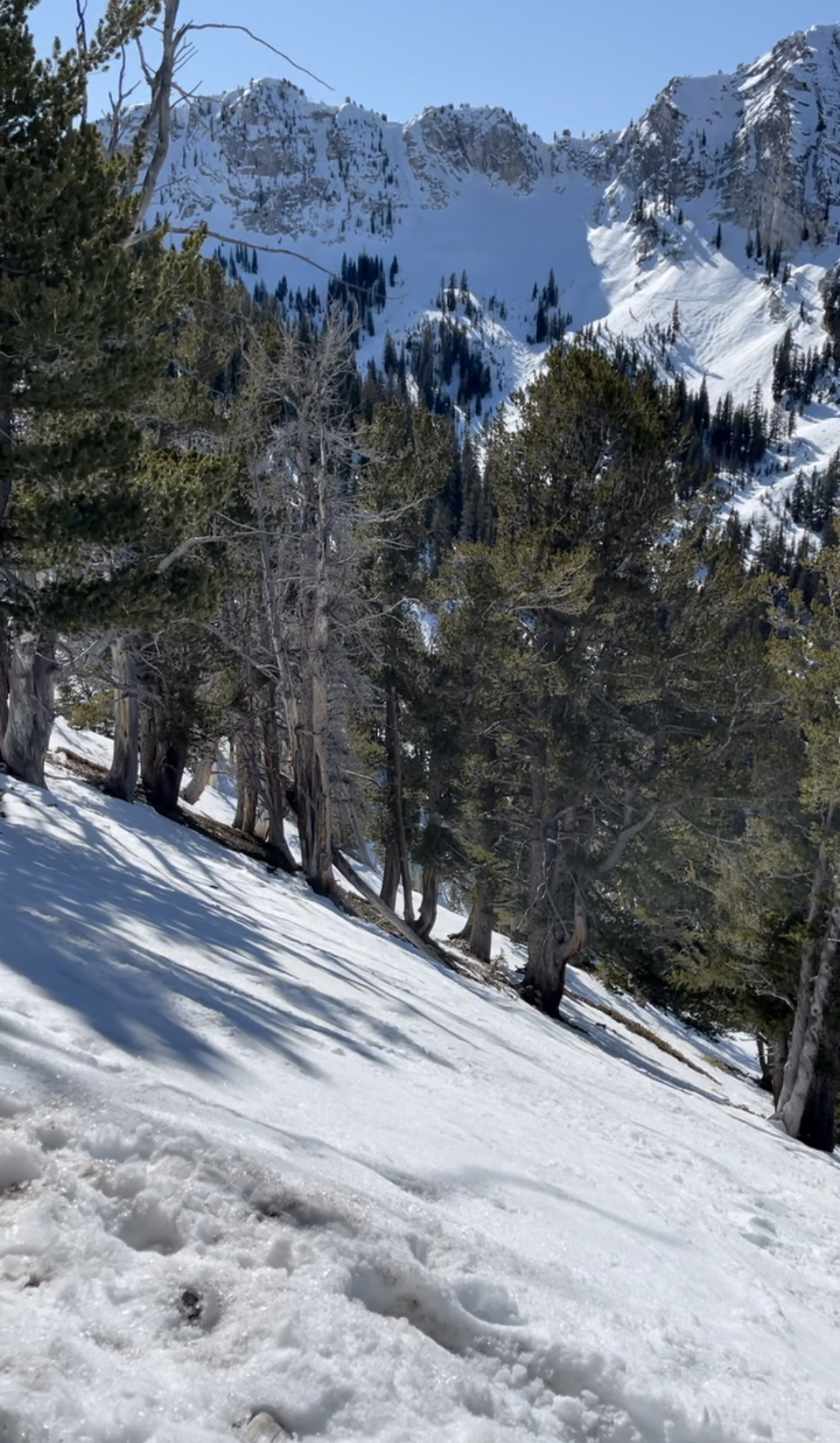
Short-term forecasting doesn’t help when you have to plan a trip months in advance. I’d done the right thing; I picked a place that’s hard to get a drought, and which gets a ton of snow each season (annual average of around 500,” as opposed to 175-250 in Southern Vermont). Plus, a ‘minus:’ subtract rain (and add that the snow is light and dry). While it didn’t work out on that trip, at least it didn’t rain. Plus, the trip was still very enjoyable. Just no fresh snow. Historically speaking, it was a not a gamble but a good idea.
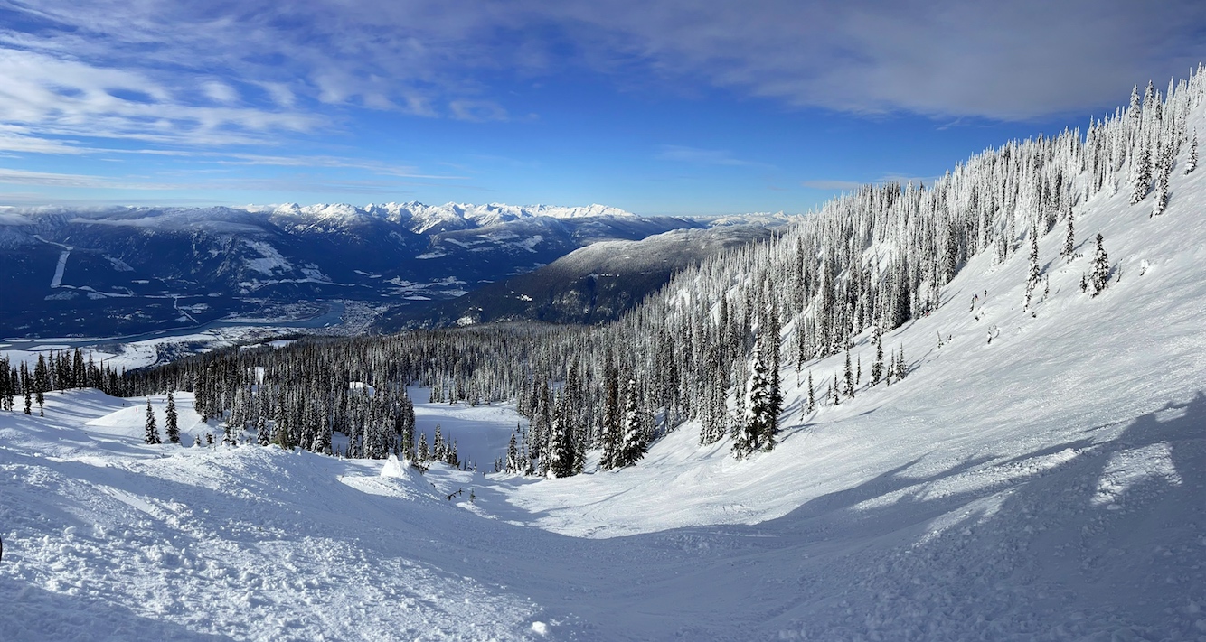
Next trip? We still had to plan in advance, and decided that variety plus consistency were good ideas. ‘Variety’ was a totally different area with unusual terrain, scenery, etc: Revelstoke, B.C. Also, it’s known for good annual snowfall averages of good quality, and consistent smaller amounts of fresh snow (“free refills”). It delivered – sort of. Compared to their previous season, they were about 2 metres below when we arrived, and there hadn’t been much recent snow. Bottom of the mountain was icy. Top was zero ice and some soft powder to be found, but no bonanza. Fine; it was still a good trip and half way through, we got some fresh that fixed the lower mountain. Lesson: a little fresh goes a long way at Revelstoke!
By then, I was looking around for better apps for the mountains. I had a new strategy in mind, and needed new last minute tactics. Strategy? “The Formula.” Basically, identify two, maybe 3 mountains or areas where the following conditions had a chance to all align at the same time…
- Lots of fresh snow in the forecast (on top of good recent snowfall and no drought);
- Good flight itineraries with low risk of weather delays;
- Cheap, practical lodging
- Safe, reliable and affordable transit to the mountain.
Lodging and transit could be figured well in advance. Snowfall was mid and short term dependent on weather. Same for flights. But, how to forecast the upcoming snow reliably? I had to do better than try to extrapolate from weather dot com (which I do use for some boating), and NOAA forecasts, neither of which are comprehensive enough at the local mountain scale.
I searched around and found two candidate apps to use and cross reference. If they were reasonably in agreement, and the trend looked good, I could pull the trigger.
They were; I did.
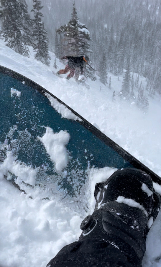
It worked. Third time’s the charm! I got 3 powder days in the Wasatch Mountains of Utah (Brighton and Snowbird). Conditions were anywhere from excellent to epic (heli-quality), with the exception of later in the day on one of the faces of Snowbird where it had been heavily trafficked and skied off with horrible visibility due to fog. Almost a problem! But, I took another route out through chopped up pow, another lift to top, and the tram back down to the base.
The apps?
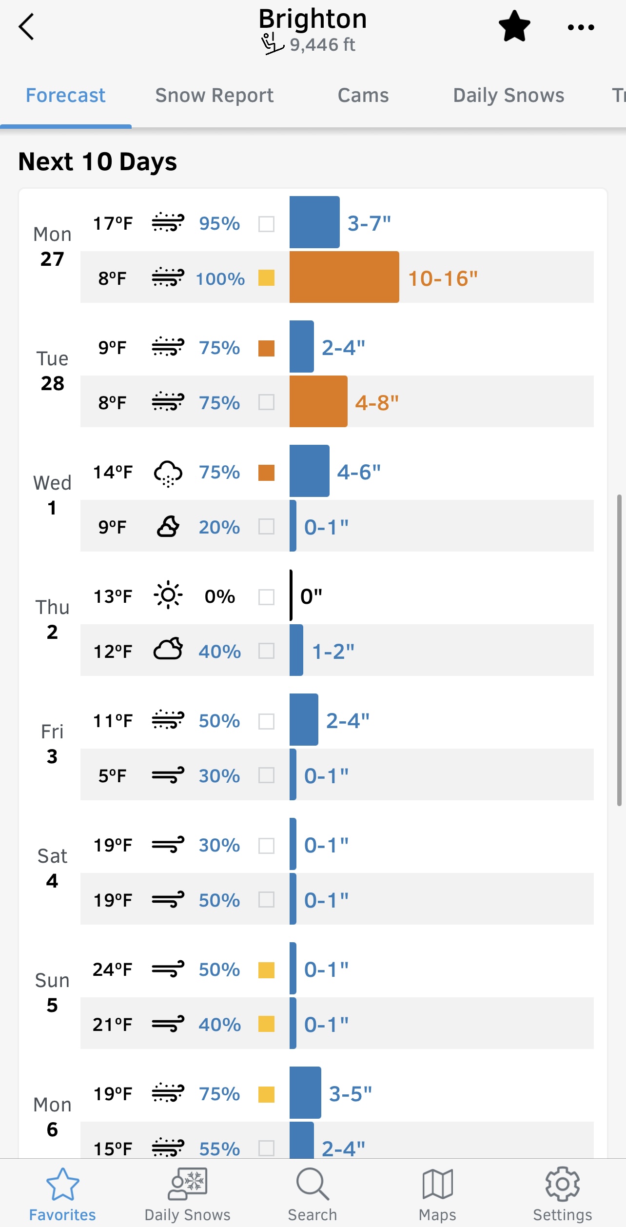
Open Snow, primarily. It’s a paid app with a 2-week trial period. For $29/year, you get detailed conditions report, regional forecast narratives, and super detailed forecasts for snow, wind, temps, etc at just about any ski hill you’d care to go to. Turns out the guy I met on the UTA ski bus, who had the same “Formula” as I, had been using Open Snow for some time.
Cross reference? On The Snow. Not as robust, but serves the double-check purpose. I also follow Powder Chasers, although there’s no app involved but the option of a paid concierge service (that could be well worth it in the context of the cost of an actual trip).
“What if I don’t ride or ski? What about on-water weather?”
First, let’s talk about some forecasting basics -what you’re looking for in evaluating weather for boating. Once you know that you can narrow down the app choices.
Marine forecast. It’s at least somewhat different from the standard weather forecast most people use on a day-to-day basis (including me). Marine forecasts focus on wind direction & strength, sea state (waves), and risk of precipitation – particularly thunderstorms. That’s what you really need. If you do nothing else, consult the NOAA / NWS Marine Forecast for the general area you’ll be boating, and also keep checking a radar app if there’s any risk of thunderstorms.
Radar. The greatest risk for most people boating inshore and along the coast is thunderstorms. In the northeast, for example, most people do most of their boating in the warmer months, which incurs risk of thunderstorms (especially mid afternoon and later). So, using some app to track potential approaching storms is critical. In the old days, we relied on the morning’s published forecast and our trained eye on the sky. Eventually, Marine VHF radio helped, but when it did, it was almost too last-minute. Radar can see what you can’t, and when real-time stuff changes, so does the radar imagery. It’s not perfect- it can’t always keep pace with small pop-up squalls at water’s edge, but large, seriously bad-ass systems don’t get missed.
History and trend. Don’t just open your iPhone, look at the included weather app, and see what the current temperature is. Look at what happened for at least a few hours prior, and what will happen into that evening/midnight. This applies to temperature, wind direction & strength, and if the area is exposed, the wave heights. Also, look at the forecast and the actual radar imagery for risk of precip and especially thunderstorms. If the forecast for later doesnt’ make sense in the context of the recent history/trend up to ‘now,’ the forecast could be stale or just plain wrong.
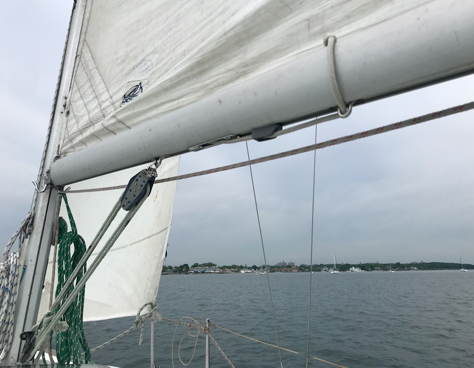
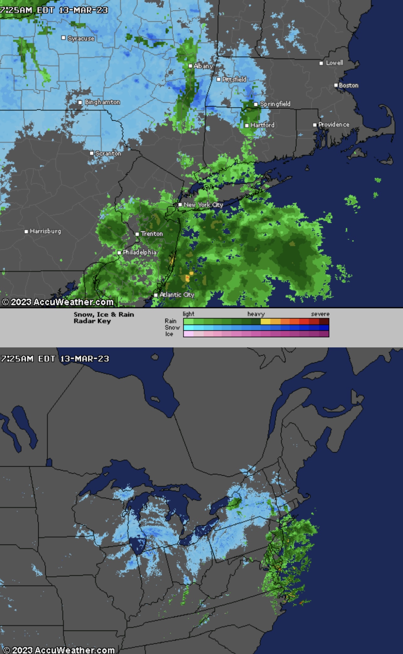
Of course, there are many apps and sites to choose from. Personally, I have mostly used weather dot com, searching for stations that most closely reflect the area I plan on boating. Example: I cross reference Brooklyn and Long Beach when evaluating conditions for classes out of Sheepshead Bay. (See top photo in post for an example.) The reality is somewhere in between, but favoring Long Beach which is close and also most similarly situated: an Atlantic Ocean inlet. Weather dot com gives hourly breakdowns and, for the very short term, 15′ breakdowns. To get the full suite of features and skip adds, it costs around $30/year. Annoyingly, it logs one out too frequently so choose an easy, short password.
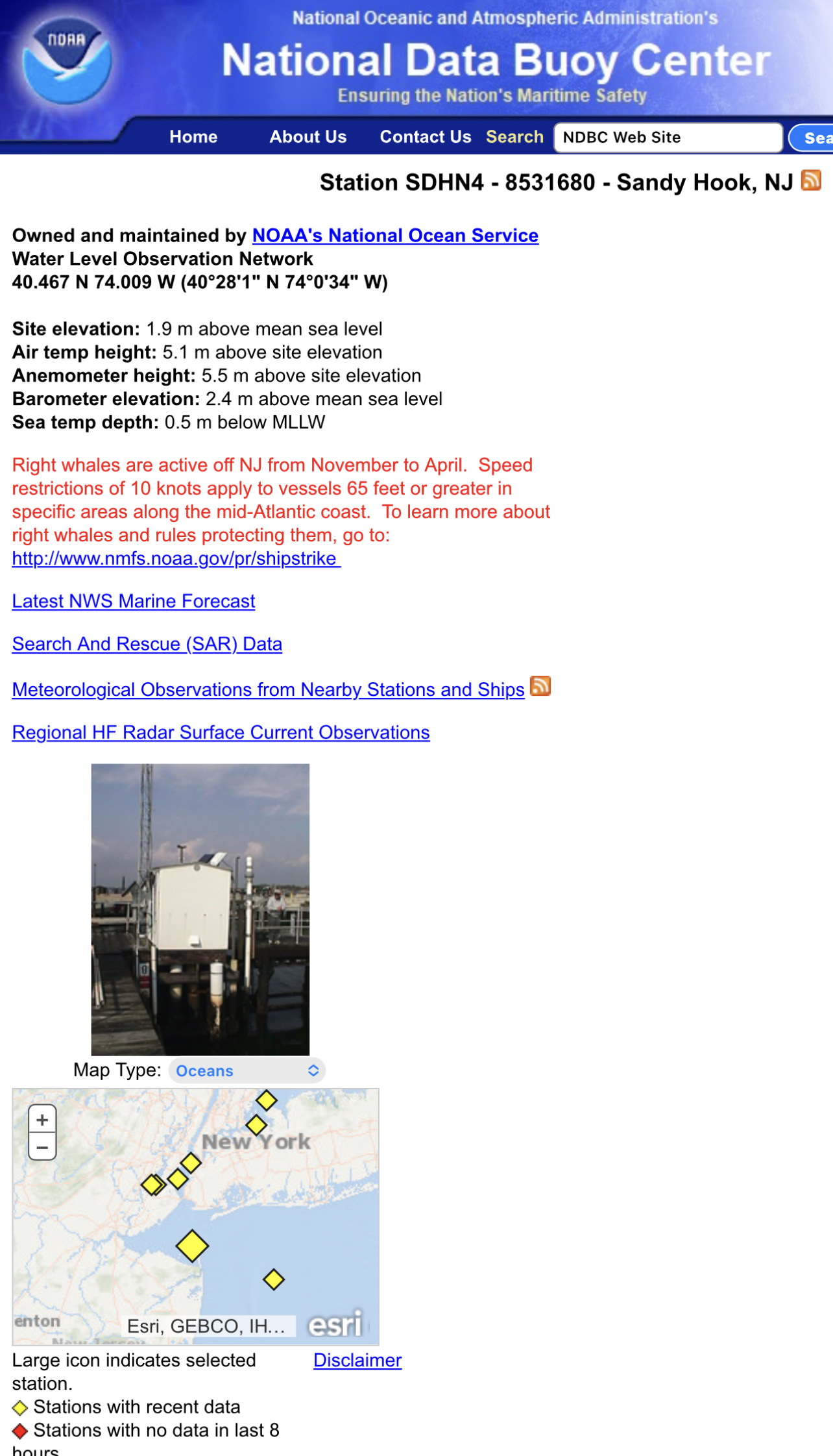
I also cross reference that with the NOAA NWS Marine forecast for the area. No app here – just find the right web site starting point, bookmark it, and return often. Important: to get the history/trend, one must go to the NDBC page (National Data Buoy Center). This is a list of stations on and off the water that give frequently updated live data feeds for wind direction, strength gusts, wave heights, etc, etc. This, plus the forecast for the area (linkable from the NDBC pages) gives a good overall picture. The history of the live feed remains up, revealing the trend up until the user checks it.
What else is popular?
Windy. This was recommended during our Croatia trip at the skippers meeting to go over weather for the week, itineraries, etc, etc. The First Mate of record for our trip, Dave, and I both downloaded it immediately. Personally, I find it counterintuitive and annoying, and seldom use it. Having said that, many if not most people disagree with me and it’s certainly a robust app. Plus, it’s supposed to be good for snowsports!
And… there are two. Yup; two Windy apps. A good friend and client of the school, who’s a United pilot by profession, uses Windy.com as opposed to Windy.app. the dot com is an app for mobile as well. (I have on rare occasions used the other one, so now I’ll play around with the one the Pilot uses.)
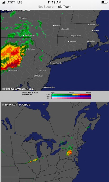
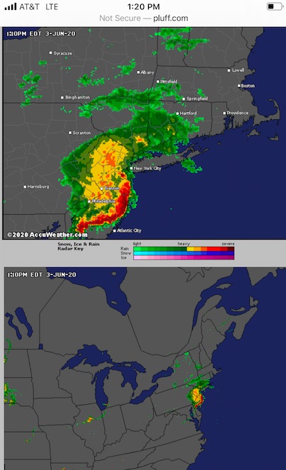
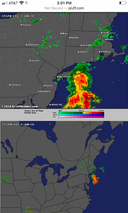
How about a Radar app? For the Northeast, I use not an app, but a bookmarked site few people know about. My dentist, who’s a sailor, turned me onto it. It’s called CT Precip, and more commonly just called PLUFF. (pluff dot com) A University, in conjunction with Accuweather, arranged a feed of images for the northeast and much of the continent, plus other evaluative feeds that I don’t understand and probably don’t need. The first two screens take care of all my local and regional needs. When I travel out of the range, and need radar, I figure that out in the moment.
Old school?
VHF Marine Radio. Apps aside, one should understand how to get weather updates that are broadcast on VHF radio, including ‘push’ severe weather alerts where available. If your smart phone dies or falls overboard, VHF could save the day proverbially – or literally.
On the water, the stories aren’t the same. We either get the green light to go, or we don’t. It’s not the same as a serious powder day at a mountain. But, it lets us go out when the sky looks doom n gloom, but nothing shows on the radar or in the forecast. And, more importantly, it lets us know when conditions favor the development of thunderstorms, or they’re strongly predicted – and lets us see them beyond the horizon when the weather looks just fine. For now…
And, now that you have more of an idea what to look for, start comparing history/trend with both forecasts and what actually happened for the local area you do most of your boating in. That will teach you how to forecast based on trends, and not totally rely on the apps. It will also show how reliable your choice of forecasting app is. And, it will make you a safer and more confident boater.
UPDATE: storm chasing with the app worked again… this time for Southern Vermont. This was a week ago. For the second time, I hit Stratton when it was likely to get the most snow in the region during a big storm. It did, and so did I. Car was socked in so deep I couldn’t see anything but the side view mirror. But, I was at the mountain snowboarding when most people couldn’t get there. It dumped overnight, and kept nuking as the day – and night – went. Free refills. And, it was Open Snow that made it a go, letting me see that I could safely drive up on Monday and get there before driving was not a good idea. 2-3 feet. Enough left over the next two days to keep hitting pow on side hits and in the trees, plus two incredible runs at Magic Mountain on Wednesday when they opened just because of the storm. Maybe they looked at Open Snow…
If you made it this far, here are links two a couple of Insta clips I posted. Come take part of a run with me down Brighton and Stratton Mountains from those recent trips! In the Brighton clip, I’m shooting Jack drop before I follow. It’s me, myself and I at Stratton.
Brighton: dropping into the double diamond bowl off the top of Great Western…
https://www.instagram.com/reel/CpgK7hQPLF7/?igshid=YmMyMTA2M2Y=
Stratton: heading down Upper Standard from the peak…
https://www.instagram.com/reel/CpyQhJMt_ke/?igshid=YmMyMTA2M2Y=
App Links:
CT Precip (pluff): http://pluff.com/
NDBC (for data buoys/stations and marine forecast): use the map to gradually zero in on a region and find stations relevant to you… https://www.ndbc.noaa.gov/
Weather Channel: https://weather.com/weather/tenday/l/5c587ec94779bcfe6616225e92289ce94424df07399952538d503ee6260592fb
Windy: there are two… windy.com and windy.app. You know what to do there.
And, to help decide and see some other apps, here’s an article I came across…
Happy hunting!