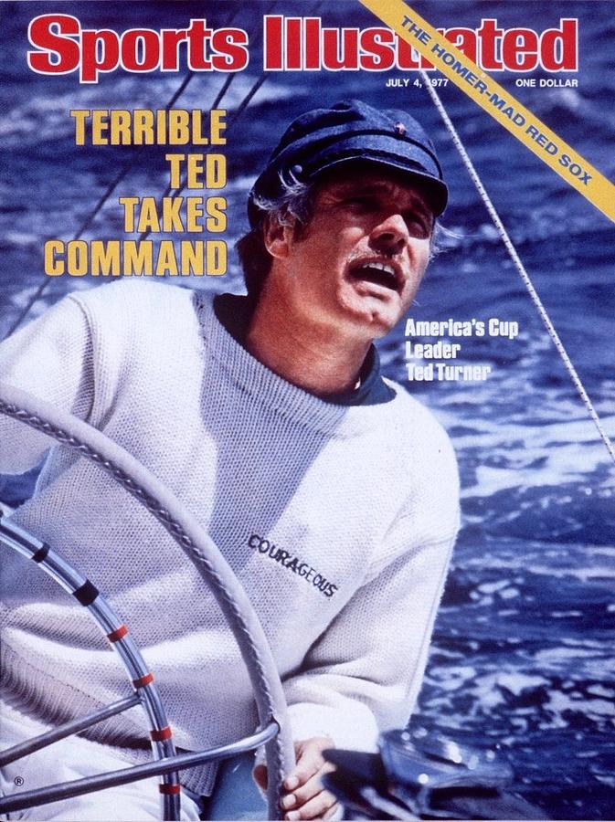
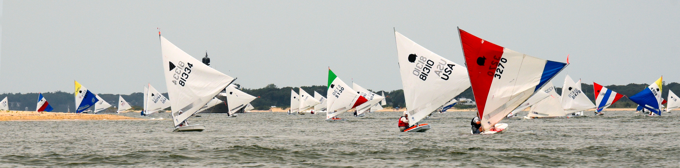
This was a man who knew how to sail a boat, and he sailed a variety of them to victory.
By the way, do you still sail?
No, I’m a fly fisherman. I’m your neighbor up in Montana. When are you gonna come see me?
So began the sailing segment of Ted Turner’s appearance on Late Night with David Letterman awhile back. When? I dunno. Letterman’s YouTube Channel reposted a portion upon Turner’s passing at age 87. You can look it up based on Turner’s book that was out at the time, “Call Me Ted.”
I saw it live when it first appeared. I got all excited, because I fully expected Letterman to tell Turner he was a sailor himself. How did I know this?
David Letterman went to our sailing school in the 1970’s! No, he wasn’t as famous then – it was “Late Morning with David Letterman” at the time, but everyone knew who he was. I was a kid, but I still remember him decked out in the yellow foul weather gear we sold at cost to students for wet weather, grinning after coming in out of the elements post-class one day. But, he never brought it up in the segment. Damn…
Turner had quite a life. “My whole life has been a sea of trouble,” he quipped on the show. It wasn’t without its trials and tribulations. But it was also peppered with success. A lot of it. Most people know he started CNN, owned the Atlanta Braves, etc. Everyone knows he wasn’t afraid to speak up. But, did you know he was quite the conservationist? As the 4th largest private land owner in the country, I’m sure a good chunk of that was purchased toward that end. And, yes – I’m sure he did some fly fishing on some of that land.
IN THAT PIC: Letterman holding a photo of Turner on one of the America’s Cup boats.
Turner’s sailing career started out inauspiciously, apparently. He sailed Penguin dinghies and earned the nicknames “Turnover Turner” and “The Capsize Kid.” That means he flipped the boat a lot and wound up in the water. But, he improved. Soon, he was successful at the regional and national levels, including a hot streak at Brown University, where he captained the sailing team.
Turner put together one of the most impressive racing resumes of all time. It wasn’t how many Olympic medals he won (none, and didn’t get to the Olympics). It wasn’t the number of world championships he won (a handful; impressive of course). It was the broad spectrum of sailboats he was successful in, and the types of races he won:
Small dinghies (whatever he raced at Brown for example)
Large dinghies (Flying Dutchman world champ)
Small one-design keelboats (5.5 Metre Gold Cup/World Champ)
America’s Cup semi-one design keelboats (won one of three Cup campaigns)
Ocean racing: plenty of accolades here, but most impressive?
That would be the Fastnet Race of 1979. This is an annual offshore regatta off the British Isles. In ‘79, a bad storm popped up and caught the whole fleet by surprise. The goal becamse survival, and finishing the race was very optional. Fifteen sailors died in that storm. Many boats were rendered helpless. I forget what percentage of starters actually finished, but you can look that up for yourself. Two impressive finishers: John Rousmaniere, author of The Annapolis Book of Seamanship (a must-have broad-spectrum sailing reference in my not-so HO), and Ted Turner. “Captain Outrageous,” as he was sometimes called, won on corrected time in the yacht “Tenacious.”
I was in two storms that I wasn’t sure we’d make it.
-one was the NY to Hatteras, mentioned on the Letterman Segment. The other wasn’t mentioned, but was almost surely the ‘79 Fastnet.
The Americas Cup is the oldest contest in the wide world of sports. Turner won in 1977, making the cover of Sports Illustrated. He competed in the trials for the Cup events before and after this one, but didn’t win. No matter. He won in ‘77, and whether it’s a tough trials, a tough Cup, or both, it’s commendable.
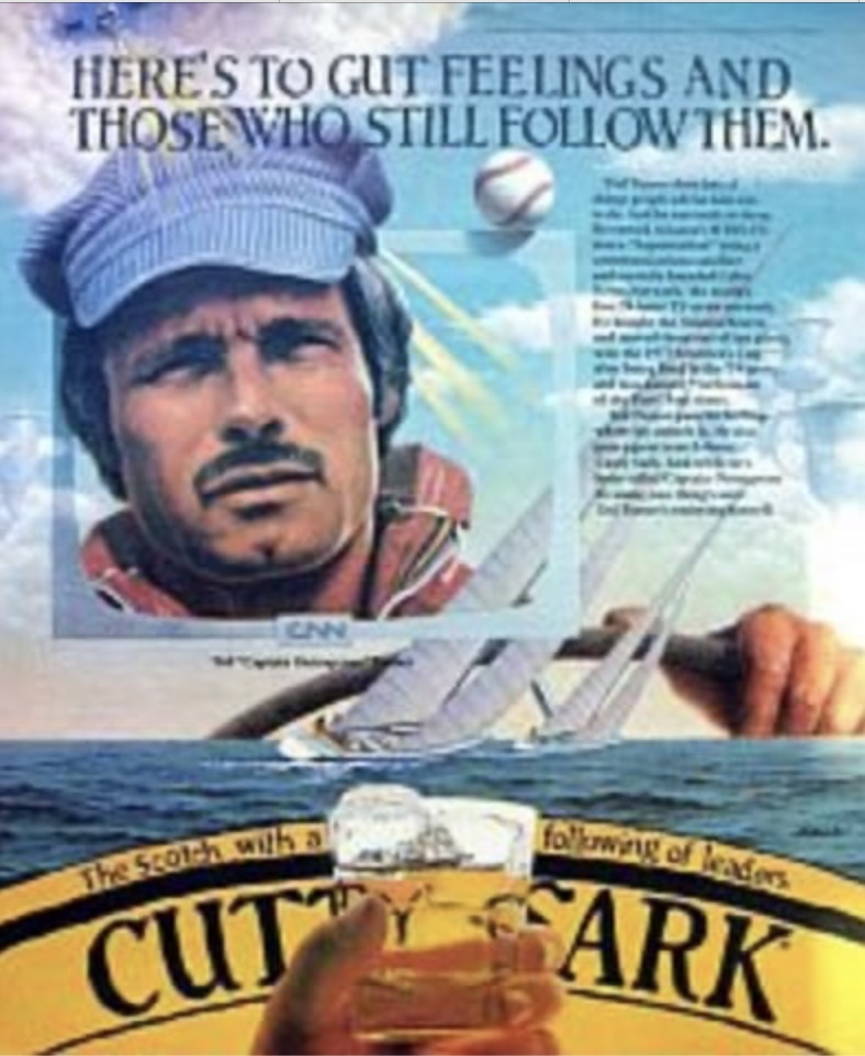
IN THAT PIC: Tuner in an old Cutty Sark scotch ad.
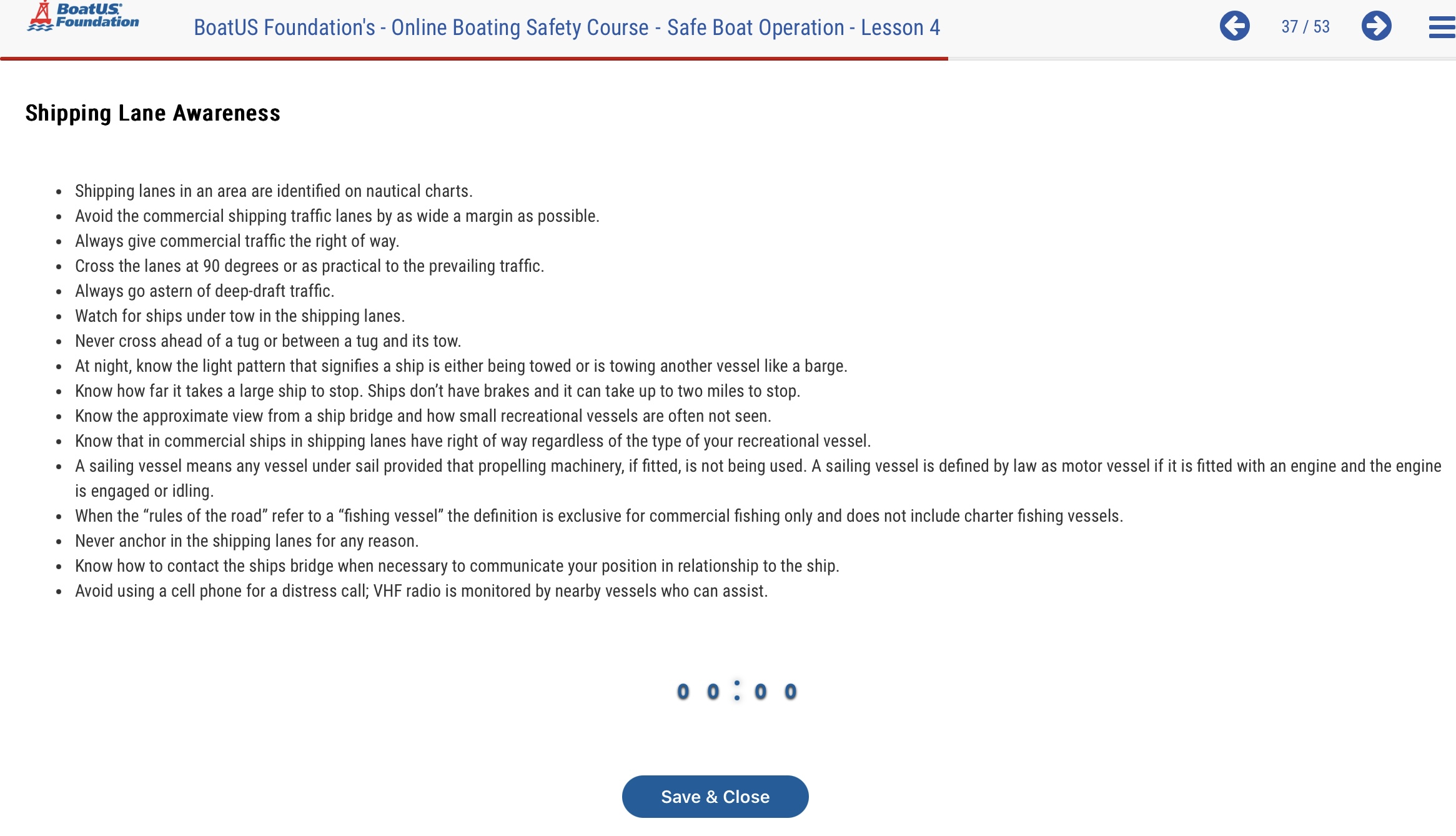
Fun facts:
Turner was the 2nd to last American to successfully defend the Cup after we won the inaugural event in 1858. (Dennis Connor won in 1980, and lost it in 1983, then won it back and defended it another time. “Mr. America’s Cup.”)
Turner’s boat, Courageous, was the first built of aluminum. The naval architect? Sparkman & Stephens. Turner actually bought this boat off the 1974 campaign rather than commission his own boat.
It was also one of five or so consecutive America’s cup defenders built at Minneford Yacht Yard on City Island, former home to New York Sailing Center! S&S had an office on the Island for a time; it eventually became a hybrid of cafe and diner owned and run by a lifelong friend of this author before she sold and moved on to first running and then buying/operating another eatery on the Island. There aren’t many good places to eat on City Island, despite the rep, but The Black Whale is one!
America first lost the America’s Cup the first time the defending yacht was NOT built on City Island. Waa waa.
How great and important is the America’s Cup, really?
As Turner himself said (not in these exact words), the Flying Dutchman world championship was arguably a more competitive and noteworthy accomplishment than winning the America’s Cup. The FD was also raced at the top level by folks like Buddy Melges and Paul Elvstrom – arguably the two most successful sailboat racers in history. And, Turner won the worlds once. The FD is a beast of a dinghy; it’s so large it’s hard to think of it as a dinghy. It’s 20’ long; sail plan is main, genoa (not jib), and spinnaker; crew on a trapeze. The class was in the Olympics for a very long time. (Turner competed in the US Olympic trials in the FD but didn’t get a berth.)
IN THAT PIC: not, that’s not Tuner. But, it’s a great shot of a Flying Dutchman in action and gives a sense of how hard this boat might be to sail. Can’t find a pic of Ted other than big-boat shots so this has to do for now. Photo: Flying Dutchman Class Association.
He was also world champion in the 5.5 meter (another old and very competitive class of keelboat). He won several US national championships in the Y-Flyer class, which is less well known than any of the other classes listed above, but due to its sailing qualities and ongoing popularity, was selected for the US Sailing Championship of Champions invitational regatta in both 2018 and 2024. It’s a double handed dinghy that’s more like a scow than anything else (super flat with a wide bow).
Our local sailmaker from City Island, Mark Ploch, competed in this as crew in 2018 for his daughter who was on a hot streak in college racing at the time and earned a wild card spot! Ploch (rhymes with “low”) won the j/24 North Americans once when that meant something, and sailed all manor of boats including the world’s toughest – the Finn dinghy. So, all high-pedigree/good company.
IN THAT PIC: 2024 Championship of Champions… for the 2nd time in less than a decade, in the Y Flyer class! That says something about the boat’s qualities. No, can’t find a pic of Turner in one but he won the nationals several times. Photo: US Sailing.
What’s the expression?
8 bells for Ted Turner, whose many legacies live on as a education and/or inspiration for all.
It’s the same everywhere we go. People struggle. But they – and you – don’t have to when you learn how to sail and cruise with the experts.
Ever go fishing?
Ever have the line foul up in the reel?
Yeah ya did. We all did. Inevitable.
Roller furling, the system widely used around the world to deploy and put away headsails (jibs and genoas, the ones in the front), is super simple. But, it’s not easy. And it often tangles up like a fishing reel.
”Let’s go to the video tape!”
-Warner Wolf
Never underestimate technique and conditioning;
Never confuse simple with easy.
IN THAT CLIP: I was sitting in Ivar’s on the Seattle waterfront having fish n chips + oatmeal stout, and this was one of the many boats that went by. They sailed in elegantly, then re-appeared going up into the wind trying to roll up their genoa (front sail) to no avail.
It all starts with the installation. That goes wrong most of the time, and then it’s often difficult or impossible to get good results. This goes way beyond tidiness, or level of difficulty. It gets down to safety. If you need to deploy or put away the headsail NOW, and you can’t cuz the f-in furler fouled, your f-d. Straight up.
Let’s break it down a bit.
How does a “furler” work (assuming it is in fact working)?
Instead of raising the sail from the deck when it’s going to be used, and then dropping it when done, this system leaves the sail up for the season. It’s rolled up when not used, and unrolled when deployed. This is much quicker and physically easier.
The sail is opened by pulling the control line, or sheet, until the sail unrolls (usually all the way but sometimes we play with less than a full sail). When done, we pull on the line that wrapped up in the spool below the sail (think fishing reel) when we deployed the sail. Simple!
The tricky bit is getting that line to wrap up snugly without digging into itself and jamming when we deploy the sail. (Again, think fishing reel.)
The sail is hoisted by a normal halyard (hoisting line) that’s attached to a swivel at the top of the sail, with another swivel at the bottom (head and tack, respectively for those who know or want to know the terms). The drum, or spool (fishing reel) sits below that bottom swivel.
These systems are complicated to customize and install in the first place, except for the single most important thing: making sure the angle of attack of the furling line (fishing string) is set to the one, simple, correct angle: perpendicular to the spool. Any slight variation on that causes trouble; any significant variation on that angle ruins it. Yet, rigger after rigger fails at this simple task. It might not be easy to figure out how to get the line to wind up aimed perpendicular to that spool, as boats are proportioned and laid out very differently from each other. But, the song remains the same.:
“Perpendicular if you please, Mr. ____” (Think, The Sea Wolf, The Bounty, The Caine Mutiny, etc).
I’ve rigged a few of these systems over the decades. Never again. I’ve adjusted them on people’s boats, including ones I acquired for the Sailing Center. I’ve even adjusted them on boats we’ve chartered in the Caribbean and Mediterranean so that we’d have no problems on our trips for the Sailing Center. It can be as easy as loosening two bolts, sliding a block (pulley) up or down along the tube it’s attached to, and re-tightening the bolts. Or, not so easy. But it has to be done.
That’s mission critical item #1. There’s an item #2 on the checklist: don’t let the string go loose. If you do that with fishing line, it’s gonna table, and you’re not gonna have a good time. Same with roller furling. If you let the line dance about the deck loose when unrolling the sail, you’re gonna have a bad time furling it back up later.
Solution? Keep tension on the furling line when pulling on the sheet to begin deploying the headsail. When enough is deployed that it wants to continue on its own (assuming enough wind), one allows this by controlling tension on the furling line. Let it win, but grudgingly. It’s no different than easing a sheet (line used to pull a sail in or let it out). You probably can’t safely control it by hand. So, wrap it on a winch, or turn on the ratchet of the fairlead block for the furling line.
Have neither a winch nor a ratcheting block? Fucked. Straight up.
PRO TIPS once you’ve had just enough experience to comprehend my meaning (stolen from some nautical movie):
Have gloves. If the sail starts getting away from you and you reflexively resist, you can get a nasty rope burn.
If the headsail is a wonky unfurling and/or furling, try fully deploying and re-furling a few times with as much tension on the furling line as you can and still get it do do its job. That sometimes also solves for the back corner (clew) of the headsail not completely rolling up on itself.
Or, it makes that part worse, but you at least got the furling line sorted. If the clew isn’t wrapped up a few times around itself before you run out of furling line, easiest quick fix is to untie the sheet, manually roll up the sail, then wrap the sheets around a few times before re-tying (careful to get the direction right). Then, test by unfurling/refurling a few times to sort out the wrinkles literally and figuratively.
It all starts with the fairlead line being ___?____ to the furling drum (spool). If you can fill in that blank, you can probably deal with a furling system. If not, re-read the above. Better yet, make sure your first experiences with one are on OPB’s: Other People’s Boats. Sailing school is best, but any experienced, reputable sailor (have to ask around) should be able to get you started.
Learning how to sail a boat in Brooklyn moves paper airplane distance, plus a few other changes!
Another season is soon upon us. I started writing this from beautiful Bellingham Bay, Washington, not far from Canada. It’s been mostly sunny and delightful! Not snowing in them thar hills, nor has it been for a minute. And, nothing on the horizon. Forecast was flatlining. Waa, waa…
IN THAT PIC: single sloop motoring with luffing main at dusk, Bellingham Bay.
Boats were out sailing on the Bay last weekend, and I expect so see some this one as well. Light wind, but that’s okay in the winter. Define “winter.” It’s not what the Northeast is getting hit with as I write this (Arctic cold with major dump pending). Afternoon temps have been int the mid 40’s to around 50. Overnight lows? Upper 20’s to mid 30’s. The cold can linger in the shade, and frost is common in park areas. But it’s great. Maybe it will snow again before we leave. Maybe not.
IN THAT PIC: stopped and staring down The Canyon, a black diamond zone/run at Mt. Baker Ski Area. It’s an “easy” chute and super scenic. My trusty Lib Tech Orca snowboard is making a cameo on the bottom.
What’s going on with the Sailing Center?
It’s moving next door to Miramar’s friendly neighbor, Sheepshead Bay Yacht Club. And, it’s getting a new helmsman! Alex Mallari, who’d been helping out with making new sailors last year, is buying it from me. I’ll be heavily involved in the transition year of 2026, so very little will change right away (if ever). Main difference is that it all kicks up to Alex rather than Steve. And, diff dock.
Alex and I favored moving next door to Sheepshead Bay Yacht Club (SBYC) for one chief reason: they are in growth mode, and Miramar is not. Growth ties in to the Sailing Center’s need to have one-stop shopping for its students. Learn here; progress here. Sheepshead Bay wants to grow both its general membership and its sailing club program. Miramar wants to cap its membership. Waa, waa…
IN THAT PIC: Alex with some of his (always) happy campers. Two Ensign sloops are behind them in the Bay as they take the launch (aka tender) back to the dock.
Miramar has been a solid home base for the Sailing Center for the past few seasons. SBYC is more similar than different. It has a pool (so what?). It has a bar. That’s nice for apres. The clubs share launch service on weekdays; they take turns running it for both clubs. The boats are moored randomly in the Bay, so both launches go both directions. The docks are so close, it’s hard to maneuver anything in between them and I’m always tempted to try a running jump from one to the other. (Never gonna happen, but it looks tempting.)
So, I’m retiring! Semi, at least. That was the impetus to explore new ownership for the school. 2026 will be busy, but just as with last fall, when I was tired of missing out while my friends played on Jamaica Bay racing dinghies out of Sebago Canoe Club, I won’t miss any race days this spring unless it’s just too damn windy for my hobbit ass. (I skipped most of the spring series for that reason and had conflicts on the other days.) I’ll still be teaching in 2026, too. Cuz, you know… I actually like it.
IN THAT PIC: plenty of these flying around on lakes and bays and sounds in WA. Bellingham Bay, as seen from the boardwalk paralleling the shoreline (with a Woods Coffee in a 2-story wood building at one juncture).
Alex is the perfect steward for the school. He has the background and experience; teaching with us last season was not his first rodeo. He’s young and energetic enough. He’s has zero ambition to take something that isn’t broken and try to fix it.
That happened in my family already. When Dad sold his school back in the late 1980’s, that’s exactly what happened. Don’t get me started…
“You’re making me angry. You wouldn’t like me when I’m angry.”
-Dr. Bruce Banner
Anyway, nothing to get all green about here. Nothing much is changing despite a gradual changing of the guard. If winter gets its smashing done early in the northeast, we’ll see you down on the Bay early in the spring!
IN THAT PIC: grinning idiot I be, semi-buried at Baker. (Yup; it snowed!) Mt. Baker Ski Area gets the most snowfall of any hill in North America, and set the world record one year with 1140 inches. (600-700 is more common, with the leanest year I saw in the stats closer to 300.) Yes, it’s heavy/wet snow most of the time. Yes, it gets rain and melt/freeze cycles. No, it doesn’t have much vert. No, there isn’t lodging at the “resort.” Those who know like it that way. I’m one of those. Think Magic Mountain in Vermont, but add a fuck-ton more snow, take away a lot of the glades, add every gnarlier terrain with cliffs, and finish it off with vast areas of adjacent, lift-served backcountry.
Actually, it’s here based on current conditions, but who’s counting?
On Saturday, we had our annual Put the Fleet Away Day at Sebago Canoe Club. (My name for the event, not theirs.) It was sunny, 60-ish, and light winds. Shoulda gone sailing. But, somewhere between really bad form and no fucking way on the etiquette continuum. Any boat I might have tried to take, someone would have said “we need to work on that, and why aren’t you helping?”
So, I did the time instead (4 volunteer hours, counting toward a total of 15 required for the 2026 season as they do a fiscal year rather than calendar). Here’s a clip of the activity at one point:
In that clip: Sunfish and Lasers, plus some kayaks, being looked over, cleaned up, repaired, and put to bed for the winter. (We can still take them out to play until the water is turned off, as it’s required to wash them down after use.) Sebago Canoe Club, Canarsie, Brooklyn.
The next day, it got cooler, windier and rainy.
“I went to Moscow once; it was closed.”
-Napoleon, in one of his worst endeavors, when he marched there to find the city strategically abandoned. It was September. Despite that, the next day it started to snow. That was the beginning of the end. Of course, history repeated itself there in WWII…
A few nights ago, November 10, the temps dropped to around freezing in MannyHanny. We had snow flurries on and off all day. I broke out the Eddie Bauer down parka with snorkel hood. And, I did a little snow dance, as…
It’s ON! Skiing/snowboarding has begun on the East Coast already. It started with Sommet Saint-Sauveur in Quebec, followed by a little place called Sugar Mountain in North Carolina (some high peaks that get good snow, including the highest elevation ski resort on the Ice Coast if memory serves). Plus, Jay Peak has had good powder form those willing to earn the turns, and Killington opened today as well, with some flurries visible at the base (maybe more up top?). Not top to bottom, with more terrain than usual for opening day and eyeing top to bottom for later in the week possibly.
What about sailing? Yes, there’s still sailing. It never stops. Opportunities are fewer and farther between. Example: I was just offered a gig delivering a brand new 60-foot sailboat from Liberty Landing, NJ to somewhere in Norwalk. “No.” I don’t dig on deliveries, and it’s now too cold for my taste for a long haul being basically still much of the time and noticing the cold.
It’s Frostbite Season!
Frostbiting is winter racing from November through March, maybe April. It’s popular in the Northeast and I’ve written about it to an extent here before. It’s mostly on dinghies, but there might be a keelboat program that I don’t know about. (Manhasset Bay Yacht Club on Long Island does it in Ideal 18’s as well as the 2-person Interclub dinghy but it’s members only and not very accessible/approachable so if you see that online, skip it.)
Want to see what it looks like? Looks like the clip below, but add winter attire and quite possible some icy spots on the water. This is a starting sequence from a Sunfish race in October, plus about a minute into the race beyond that. I threw myself on the sword and did RC duty that day – could have raced, but only found out at last minute after volunteering, and decided to just get the obligation to help out out of the way. Cost me a light-wind day (I need those as I’m Hobbit-sized), but it was fun and got me good will at Sebago.
Here we go!..
I’m surprised that the clubs in Sheepshead Bay don’t have a program. But, they don’t. They’re better suited to it than many locations, with a generally super-protected mooring field with close proximity to areas to race. Maybe that will change.
Links: All these programs are, or appear to be, open to anyone willing to pay the frostbiting fees and either bring, borrow, or charter a boat. Most are traditional yacht clubs. Connetquot River Dinghy Club is a low key year-round association with a frostbiting program. Mamaroneck Frostbiting Association, which only exists for the one purpose, is hosted by a somewhat hoity-toity club, but you don’t have to join it to do the frostbiting. They simply do MFA a solid, which is nice.
Happy hunting, and don’t forget to get that drysuit!..
Finally got a proper podium spot racing Sunnies at Sebago
I did some prior Blog Rants about my experiences racing Sunfish dinghies out of Sebago Canoe Club. This one finishes the trilogy.
In that pic: some of the Sunnies rigging up for the last day of the racing season at Sebago Canoe Club on October 25, under the watchful eye of the bear carved into a tree stump by water’s edge. Steve Card, photo.
Sum of all prior posts: was having fun, with occasional moments of brilliance in between long interludes of mediocrity or downright fuckery. Was reminded of my Dad’s and my inconsistency on the race course and penchant for risk taking and general lack of convention.
This season, I was still Mr. Inconsistent. Family history. My Dad and I were like yo-yos on the race course, always winning well or losing badly, or somewhere in between, but seldom any consistency. Often rounded marks the wrong way. Often went for the wrong damn mark. I did these things again a few times this fall, when I made the time to do all the racing: distance race in late September, and weekly racing for late September through October with another distance race on November 1 that I’ll have to miss.
And, again, all over the place. Poor starts; nailing starts; fouling out; hitting marks; even getting stuck in irons like a newbie and losing 4 boats in the process. (Nb: Sunfish are easy to get caught in irons with and very hard to get out of once there. Much worse than a Laser.)
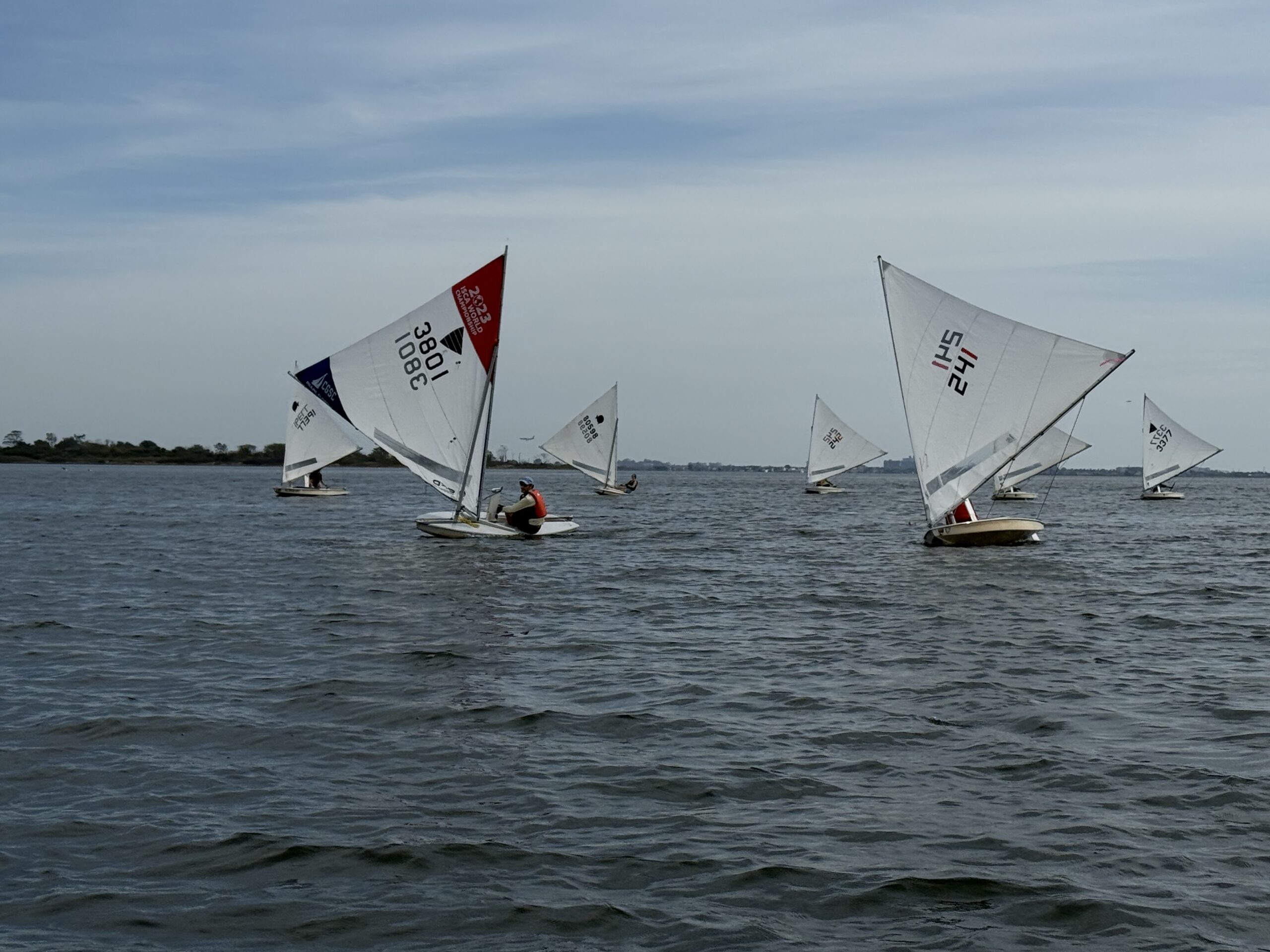
RACE START! Mixed fleet of dinghies about to start the Sebago Cup distance race in mid September. This is and 8-9 mile race in Jamaica Bay. Captain Card is lurking in the background (far left of the fleet) in a Vanguard 15; started first of the three in the fleet that day, but wound up 2nd in class. The Vanguard is a sloop; if you look deep in the distance, you might see it hiding amongst other boats. For reference, a Vanguard passes very close to the camera a little late after the start. (Collette and I would have been 5th overall, meaning 2nd if you don’t count the RS Aeros that are so fast, and were sailed by guys who do world travel to compete, that they pulled ahead of the entire fleet with zero chance to catch. They wound up 15’ ahead of the entire rest of the fleet! Forget them. They won. Next was Isis in a Vanguard 15, and Torben in a Laser. We were ahead of Torben until I rounded a mark the wrong way and had to double back… So, not bad!
I can live with the inconsistency. But, I need to feel good about an occasional 1st place, or winning a start convincingly, or at least a few solid near-the-top finishes. This fall, despite putting in the time, and even practicing in between race days, I wasn’t getting any. I was having fun, but wondering if I really remembered how to race properly and if age had caught up with me (just turned 61 this summer). Sailboat racing is a game; straight up. It’s a game where we try to have fun trying to win the race. So, winning once in awhile really helps.
Two weeks ago, I showed up for racing only to have… NO racing. Only two competitors showed, with a third there for RC duty. We needed a third sailor to have any racing. Instead, we BS’d over bagels and coffee and they split. I rigged the boat and went for a sail. No one had showed up thinking the wind would be very light and die out. I’d gone on record that the very light wind was going to diminish more, but switch to the south. That gave us a more than 50/50 shot at a sea breeze developing as it was still warm-ish for October and there would be sun.
I was right. Plenty of wind; more than on another of the racing days we had, and more than enough to have good racing. I even had to hike out a few times to keep the boat level. Fun; good practice which is def important. But, no one to race and try to beat. Running out of time; one last shot at the title and the season would be over.
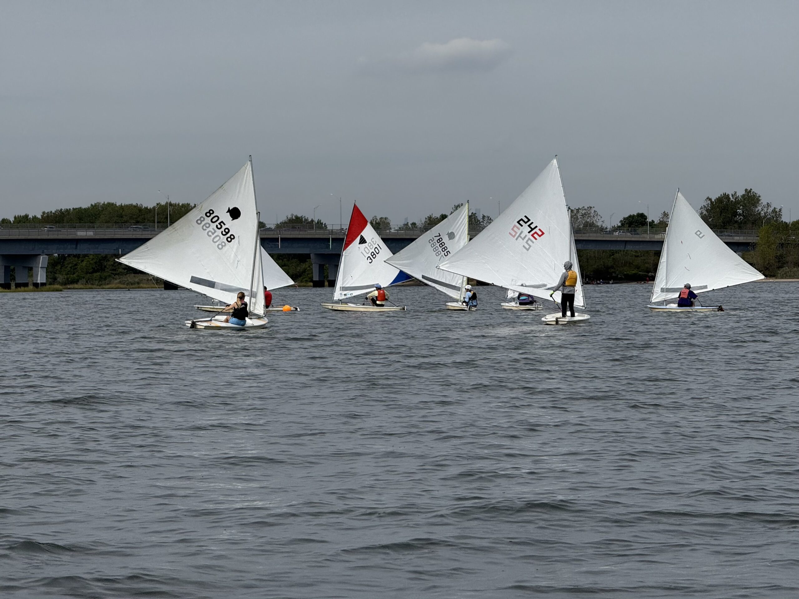
In that pic: racing from a few weeks prior, when I was PRO for the racing that day (ran the boat under watchful eye of the guy who makes it all happen, Howie, and set the courses by mutual agreement. The two nearest boats were neck and neck in the lead of that race and often for the day (finishing 1st and 2nd overall). Steve Card, photo.
That shot came this past Saturday. The wind was looking light again, and a poll showed that maybe 5 people would attend. Kinda weak, but more than enough to do some racing. I showed up. And, so did 8 others – more than enough to run some races!
Wind was light and shifty from the northwest – my specialty. I’ve always been good at reading wind, particularly in light conditions. Always used to do well racing in them. So, I tried to approaching with confidence and get in the zone.
First start: good approach, but a little late. I was behind a few boats. That would have kept me buried except that they tacked early and cleared my air for me, as well as gifting me room to tack if I wanted to later. I was free to read the wind and play the shifts. I caught up and was near the top. After the last mark, heading to the finish, I found more wind on the left and used it to my advantage, catching up further. One boat ahead of me by passed the finish line, thinking the race was twice around. When some of us figured out that’s what he was doing, we hailed him, and he came back – but he lost a spot or three in the process.
I thought I wound up 2nd or third; didn’t hear RC call me name. Good start to the day either way.
In that pic: more racing from a few weeks ago; might have been the same leg as the previous pic. The two lead boats seen above are just rounding the bottom (downwind) mark before heading up to the finish, where the shot was taken. Steve Card, photo.
Next race, and each one after, I totally nailed the starts. I switched up the starting strategy a few times, but always accounted for the current, and the need to be able to adapt instantly to changes in wind speed and direction. That meant not doing traditional starts where the fleet all comes in more or less together on starboard tack, jockeying for position, hoping to be able to accelerate at the last minute and cross the line at the gun (horn, in our case). Coming in on the ‘lemming line’ didn’t work for me in the first race.
I hate it anyway. I prefer going against the grain. I favor dip starts and port-tack approaches to the line. My Dad loved to dip. Did it more often than not. It can be risky, as one can get forced over early easily, but it avoids the other boats until the last minute.
VIDEO! Time out in between races, October 25. I’m shooting from my Sunfish (actually, club boat called Bobo).
The current that day was starting to ebb out of Jamaica Bay, and it was accelerating as the racing went along. That meant when there was a lull right before the start, everyone would get set down by the current and pushed away from the line. Strategy: be able to come in full speed to fight the current, and also be free to tack if the wind shifted so that I could aim straighter across the line and into the current.
Second race: don’t remember how I started, but it was either traditional and done well, or a port-tack start. That means coming in from the left side on port tack, with no hindrance from other boats, and seeing where I could cross other boats and start at full speed, possibly getting blocked out and having to tack to leeward of one or more other starboard tack boats and settle for that. I sailed a good race, and thought I was 3rd or 4th. (Again, didn’t hear my name called – possibly because I finished on the port side.)
In that pic: some of the fleet in between races on October 25. Steve Card, photo.
Third time’s the charm: I saw how the fleet just wasn’t accounting for the current, and decided to play my little trick – dip start. I would only do it once. Why not more often? Element of surprise works best the fist time in a small fleet. Also, at Sebago, they never seem to understand how it works, and RC calls me over the line early before the starting gun which is irrelevant and distracting. I figure I surprise them with it once, and leave it at that. (Winter project: make them understand that it’s perfectly legit unless the 1-minute rule is in effect due to a general recall in the prior staring sequence.)
Did the dip. Nailed it. No one said anything on RC boat. I got it. One competitor said, “he‘s got it.” I won that race, leading at all marks. But, after finishing, the RC hailed me and said something about me possibly not starting correctly. I forget the language. I hailed back, “I totally did. I dipped down below the line, checked, and then started. Someone else said, “he got it.” And, you didn’t call me over early. Can’t do that now.” (Glad I was definitive; they had initially scored me DNS, for did not start, but changed it to 1st place. They might well have thought I was over early, but recognized that they can’t fail to hail at the start and simply tell me at the finish. For what it’s worth, I was NOT over early – I checked carefully and made sure to leave a little extra room, as I had plenty to spare anyway compared to the rest of the fleet.)
In that pic: break between races. Paloma kicking back here; she’s a guest who came twice for racing this season and likes to dangle her feet over board or just put them up. Steve Card, photo.
Each race after that, I did port-tack starts – usually ahead of the whole fleet. In one race, Max copied my swagger and also came in on port. He was slightly ahead at the start.
The difference was that I really watched the wind and basically ignored the fleet. No covering; no hedging. Go where I saw wind. and, that was always left. When new wind came in, it almost always rolled down from left to right. So, it didn’t matter which way it shifted; all that mattered was being in that much stronger wind. One could double or triple their speed. Sure, one could tack on the headers and stay lifted – but only after getting into the new wind. Out of phase with the shifts? Who cares when you’re going 2-3 times the speed of the rest of the fleet?
Last race was the pies de resistance. I went hard left after that wind. It came in. I was literally planing toward the top mark; the rest of the fleet was sucking for oxygen. I rounded so far ahead of the fleet that there was probably no way I could lose, even if I wound up in a hole later and a new breeze brought them closer. And then, the opposite happened: before anyone else got to the top mark, the wind died down and they were struggling to even reach it. I still had wind the rest of the way down to the bottom mark and more or less after that to the finish. It was the widest lead I’d ever experienced or even seen in my life, and my racing life goes back to the mid 1970’s. It was a proper whupping.
Here’s a quick clip I took while approaching the bottom mark. Few people ever carry a cell phone in our fleet. I rarely do. Light wind that day, plus thought I’d need to take work calls from the school. Instead, I shot pics and clips! I was so far ahead it was reasonable to distract myself and risk capsizing by taking a clip. (Phone was waterproof and tethered to me.)
Three of the boats didn’t finish that last race due to the lighter wind and strong current. I asked if it was the last race, and RC said yes. I confirmed by re-phrasing it to be sure; same result. I started sailing back. (No surprises later; it was indeed the last race.)
I wasn’t first back to the dock – I was 3rd. Wind got wonky coming into Paerdegat Basin as it always does, and a Fresh breeze brought the fleet in closer. But, who cares. No score for who docks first.
More importantly, I’d redeemed my wonky ways and had a super consistent day. I figured I had to be in the top 3, 4th at worst.
In that pic: still grab from the clip above. I’m looking back upwind toward the fleet. You can see the start/finish line here: orange ball and motorboat. All the rest of the boats are still going the other way working toward the top (1st) mark. I’m almost down to the bottom mark. Steve Card, photo.
Turns out…
I WON!!!
I wound up with two bullets (1sts), three deuces, and a 4th. Tracy was super similar, also winning two races, but she also had a 3rd and 4th. That put her one place behind me with or without a throwout. (A throwout is when your worst finish is not tallied in the results; it’s almost always used if there are enough races completed in a day)
Two of the best sailors in the fleet were absent that day. But, I’m not sure that would have changed the outcome. I hope to have another day or two with the same conditions in the spring with more of the fleet present, including all the usual suspects to beat, and see if I can’t duplicate or triple this result!
Sunnies (Sunfish) keep popping up in the mutual experiences of instructors, sailmakers, and students coming to us to better learn how to sail.
I wasn’t sure I’d ever wind up sailing a Sunfish… until I did. I’ve told that story before; quick recap:
But first, a pic of course…
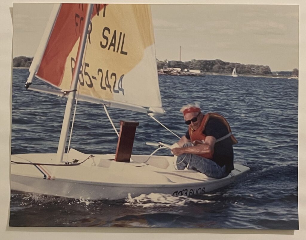
In that pic: Dad, in the early ‘90/s, sailing a Sunfish. Actually, it’s a cheap knock-off, but it’s basically the same with a smaller sail. Simple; safe; fun.
I show up for the last day of the fall series at Sebago Canoe Club two seasons ago. As I start to uncover a Laser, the gang proposes that we all sail Sunfish so it’s strictly one-design. I say sure, why not? But: caveat – I’ve never sailed one before and am therefore NOT CERTIFIED by the Club on one! (Ya know; strict rules.) Response? “You’re good.”
I was. Won the first start and led at all the marks. Good start was one thing; enough boat speed to maintain was also helpful. Of course, I pulled a WildeCard: rounded the last mark the wrong way so I was disqualified at the finish. No problem. More races to sail and fail that day and others.
In that pic: yours truly, in the Ukraine colors, leading the fleet with a beater boat and practice (versus race) rig. First time I sailed a Sunfish, Sebago Fall Series, ‘23. We had 13 boats on the line for races that day. One or two are hiding behind others in this pic; another two or one are out of the frame. Chris Bickford, photo.
The next season: rinse and repeat. Last day of fall series. Win the start. Round first mark in 1st. Max earned an inside overlap at the bottom mark so got to round first, and he won. (I won the next; mixed bag after that including me quitting early due to light and variable winds and getting bored.)
Haven’t sailed one since. Was signed up for the 2nd annual BUSC, or Brooklyn Urban Sunfish Championship. Both this season and last, the podium was filled with non-members meaning it was competitive! This year a guy who was 9th at the North Americans, and who qualified for the upcoming World’s, won. He offered to do a clinic at our Club and the reception to that suggestion has been quite enthusiastic and grateful.
In that pic: one down, one going around, and a chase boat just-in-case boat. 2nd annual BUSC regatta, Sebago Canoe Club, spring 2025. It was blowing consistently over 20 with gusts well into the 30’s. I sat this one out.
I skipped the next date (spring series) as it was too windy for my 130-pound ass to hold the boat down. Next week? Same. Next? I was about to leave and drive over from the Sailing Center. Got the word it was canceled due to too much wind.
“So it goes.
-Kurt Vonnegut
I’ll sail them again and again, as well as a Laser and the single Vanguard 15 the club has; two members have their own so 3 is enough for some one-design fun.
Back to Sunnies. It seems that every other sailor or student I speak to lately has sailed them, and then some. So far this season, around 50% of the new students have had time on a Sunfish. So, there’s that.
I hopped on a a call with our preferred sailmaker, Mark Ploch (oh, not otch), from Northeast Sailmakers’ Doyle division in Mamaroneck. Needed to order a spare batten and pusher. Got to chatting sailing. Turns out… He learned to sail on Sunnies in Corpus Christi, Texas! He went on to other things of course, like sailing Finns (world’s toughest boat to sail), winning the j/24 North Americans once, etc, etc. But it all started on a Sunny.
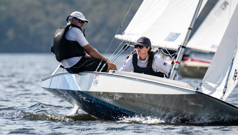
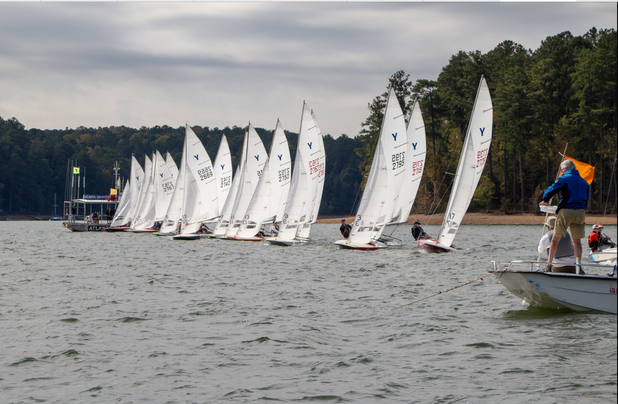
Mark Ploch crewing for his daughter, Megan Ploch, at the 2018 US Sailing Championhsip of Champions. No, this aren’t sunfish, but one can see a slight resemblance from this angle, right? Flat, hard chines, etc. These are Y Flyers, a very fast double handed sloop rigged dinghy/scow hybrid. This is a super competitive regatta. To be considered, one must be champion at the national or world level in a well respected class of boat. One wildcard “gust skipper” is invited each year as well, based on their top tier achievements in racing. Megan was the invite that year, as she’d won the US Sailing Women’s Keelboat Championship at age 17 (a national level regatta that, like it’s dinghy equivalents, pits champion sailors from a range of different boat designs. That means it’s less about how well you know one boat and all about how well you sail and race overall. Diane Vandeputte, photo.
Just for better perspective, here’s a shot of a starting sequence for that regatta: this has to be 5 or fewer seconds before the start. Super tight at the windward (far) end as it’s favored (advantageous either inherently or at the moment due to a wind shift)…
In that pic: tight start in Y Flyers. US Sailing Championship of Champions, 2018. Diane Vandeputte, photo.
A former student of the school, Alicia, posted a pic on FB recently. It showed a Sunfish cut in half on the back of a truck somewhere. I made a quip about it in the context of my recent start in the class. Out of the blue, I then hear from Mike, a former instructor at my DAD’S school! That goes way back. I remembered Mike fondly. We started catching up on ourselves and also some of the other OG. He also pointed out that he knew Alicia, which is how he saw me pop up: he’s a photographer, and he shot the Around Shelter Island race last year. It’s a 26-mile (approx) distance race… in Sunfish! Here’s Julie Lindell, as shot by Mike, in that event…
In that pic; Julie, flying buy the fotog boat. The 2024 Around Shelter Island race, annual long-distance (over 25 miles), sailed in Sunfish. Large turnout every year and it’s full soon after it’s announced. Several members from my club, Sebago, go each year. Michael Mella Photography, East Hampton
Then, there’s Jim. He’s one of our instructors; started teaching with us last season. He knocked out his instructor certification this week. The ASA instructor evaluator (now called Master Instructors or some such) asked the candidates to chime in about their sailing backgrounds in order to best assign topics for a classroom presentation to be critiqued. What boat did Jim have time in that I didn’t know about? Sunfish! Or, at least a knock-off of one called a Phantom. (Close enough.)
Jim actually learned from us a long time and has been an avid sailor since, owning a boat or three along the way and coming along on one of our destination trips to Sicily’s Isole Eolie (Aeolian Islands). Still has the Phantom of the Sunfish.
Sunfish/Funfish. Been around since the late 1940’s; not going nowhere no time soon.
In that pic: Everything’s coming up Sunny! F-ton of Sun; one large private yacht lurking and trying to navigate around all these dinks. Around Shelter Island Race. Michael Mella Photography, East Hampton.
What you need to learn in addition to learning how to sail a boat.
It’s coming.
More and more states are phasing in stricter and stricter requirements in order to operate anything that floats and locomotes. New York is bordered by states that keep it simple: if it floats, and you’re on it, you need a safe boating certificate. (Maybe not an inflatable pool toy tethered to a real boat, but you get it.) New York is getting closer to its neighbors in this regard.
The net/net for New York: if the boat has a motor, you need the certificate. If you’re sailing and the boat has no motor, you’re off the hook. For now.
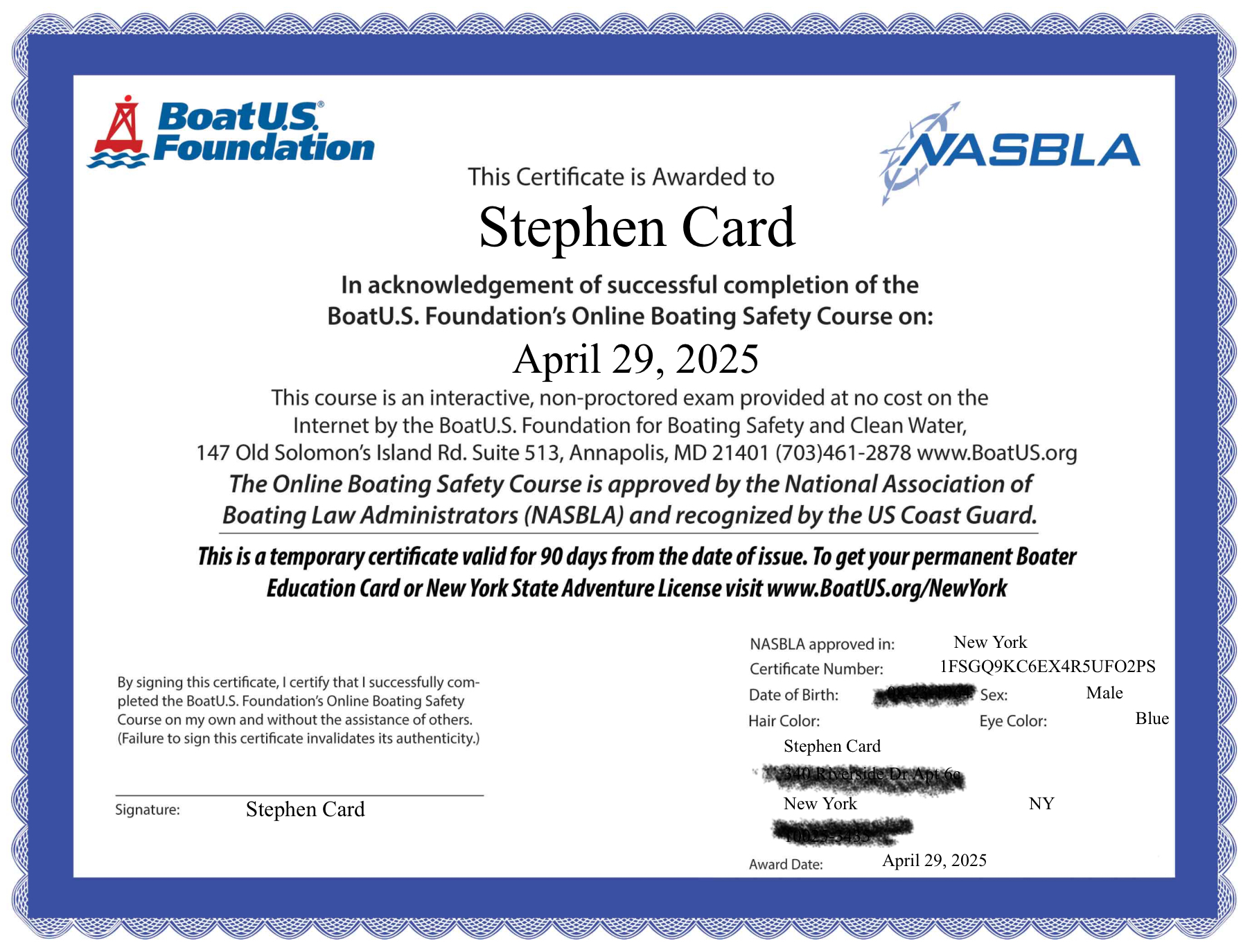
First kid on my block: perhaps not, but this one is mine. Example of a Safe Boating Certificate.
Safe boating certificates are not “licenses” in the sense that most people think. In the US, licenses on the water are for professionals carrying passengers for hire. Safe boating certificates (hereinafter “sbc’s”) are for everyone else. And, like professional licenses, they don’t require proving that you know how to handle a boat and can drive it safely. They cover a lot of other stuff, much of it very important, but the only way to learn how to actually operate a motorboat or sailboat is to get lessons and practice.
IN THAT PIC: who knows how that boat wound up there. But we know what it is: a J/24, one of the most widely used boats for beginner sailing instruction in the US. And, one of the worst. Good riddance.
I never had an sbc. I figured that it’s time to see what “civilians” have to know in order to get certified. So, I signed up for BOAT US’ free online safe boating course that’s Federal but with individual state additions (namely NY for me). I did the course, took the quizzes along the way, and then sat for the final exam. I got two questions wrong in one of the quizzes (meaning I passed that one with the minimum score), and got 100 on the final. So, in addition to my license, I have my sbc.
What were my takeaways?
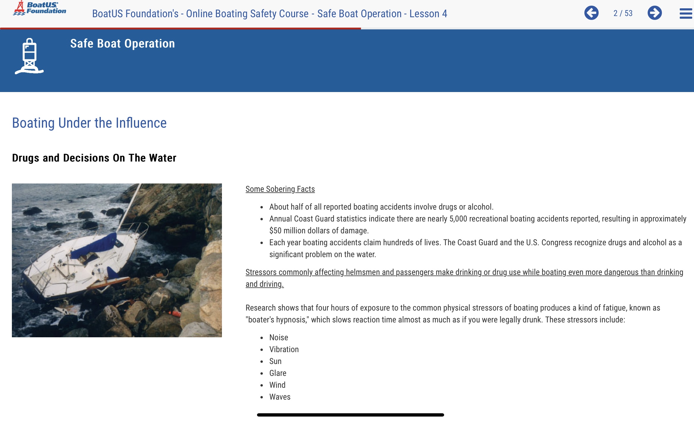
There are errors in the material, which reminds me to remind you: just because you read something in a book, or see it on an exam, doesn’t mean it’s guaranteed to be correct.
Leaving aside the fact that no one has to prove they can competently operate a boat, the course and exam covers a lot of important stuff everyone should know.
SBC’s are good things. The intent is noble and the government isn’t skimming.
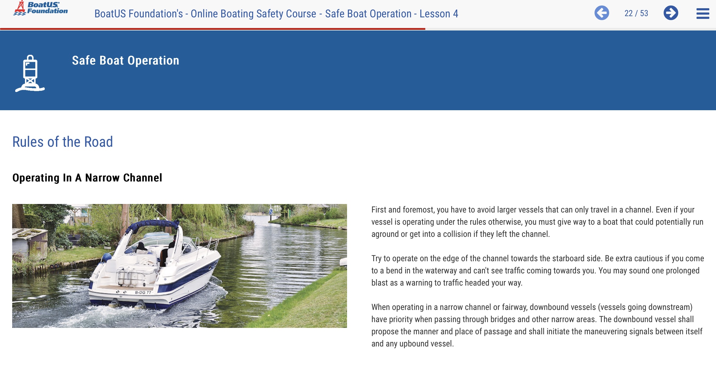
IN THAT PIC: an error. The upstream/downstream rule they state is not universal. it’s for the Great Lakes, “Western Rivers” (as strictly defined), and certain other waterways as designated by the Secretary. Those are almost exclusively certain river areas. Examples of rivers not covered by this rule: East and Hudson Rivers!
Some content is ridiculously obvious and easy. Other stuff isn’t as obvious. I did the whole thing pretty quickly, but I’m a professional and also a good test taker. How long does it take? I didn’t time it. Having said that, each page you must view is up on screen for a minimum of 21 seconds and a max of however long you’d like it to be there. You can’t skip ahead even if you’re done reading. Maybe this is to cut down on people skipping stuff they think they know but really don’t. Who knows.
IN THAT PIC: an error. They contradict themselves on whether an engine must be simply on (idle) or in gear to turn a sailboat into a motorboat. Elsehwere in the course material, they explicitly state that if the engine is simply on, the sailboat becomes a motorboat. That’s only when it’s in gear. The idea is that if only sails are propelling the boat, it’s subject to the wind alone. If an engine is actually propelling the boat, regardless of how slightly, or how much sail is in play, the boat is power driven. ASA had this wrong in their textbooks forever; recently fixed it. I got an interpretation from the US Coast Guard as well. Turns out I’m right…
For New York, the only free online course and exam is through BOAT US. It’s a boating and boating safety advocacy and membership organization. I have them for towing insurance. The course is free. You might or might not need to pay a small fee for ID cards or an anchor symbol on your drivers license depending on your situation and preferences, but it’s chicken feed.
Here’s a link for the course (and, of course, them):
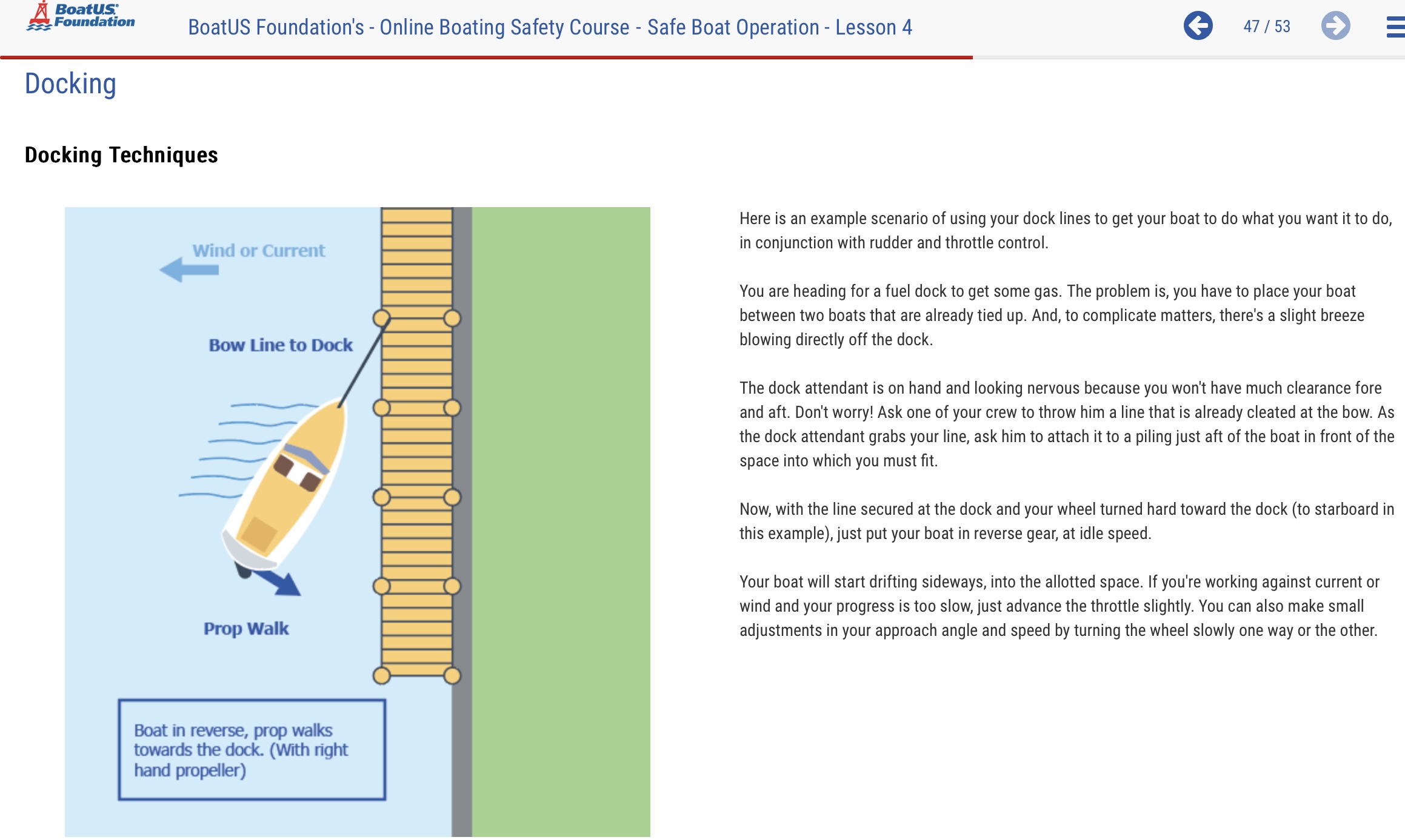
IN THAT PIC: the final insult. Save yourself the agony of trying to read that shit. Just look at the diagram. They label the arrow as “prop walk.” Right idea; wrong “right.” The vast majority of propellers turn clockwise in forward gear and are called “right hand props.” What do they do in reverse? Just that. Reverse directions. They turn LEFT! This diagram leads to the boat swinging further away from the dock, with the bow liable to hit it eventually. Ass backwards.
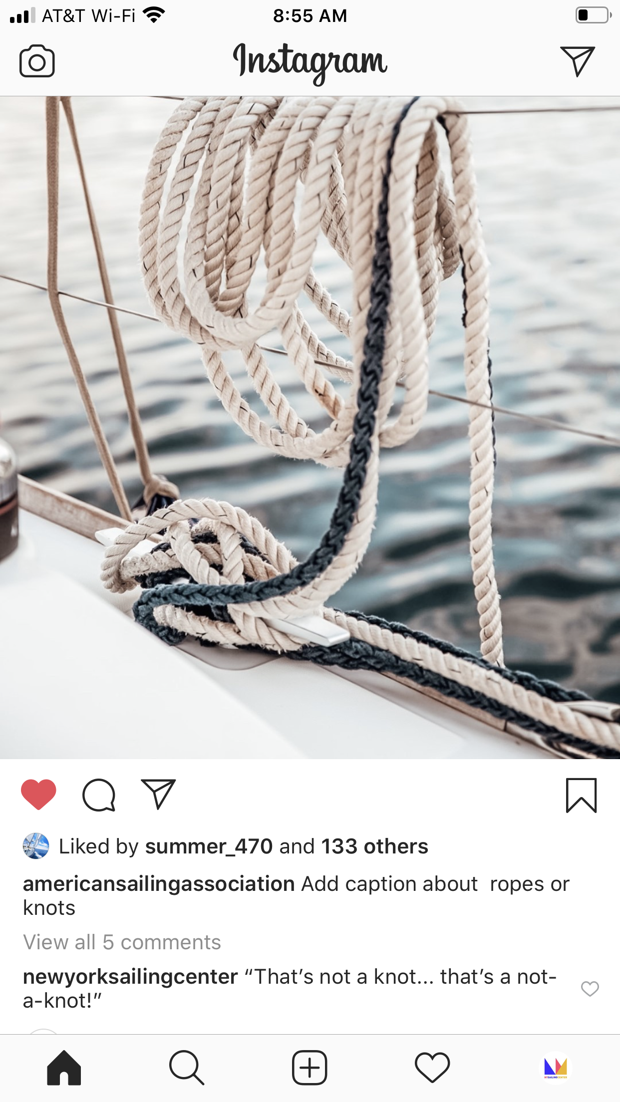
It’s probably a not-a-knot, and when you learn how to sail with us, you learn how not to tie them! Or, just take our upcoming Knot-Tying Clinic.
In that pic: screen capture of an ASA post on Insta. See our comment at the bottom!
Knots are curious creatures. Sometimes they actually look like creatures; hermit crabs come to mind with some “stopper” knots. Often, they’re elegant. A few good knots can go a long way; some people know a f-ton of knots but aren’t so savvy on application.
We had one guy join us for our Start Bareboating course (ASA 104, Bareboat Cruising) around 10 years ago. He was a very nice guy; decent sailor; professional technical photographer. And, he loved knots. Knew multiples more than anyone I know did (including me). Why?
“I’m an insomniac. When I can’t sleep, I get out my knot book and learn a few more.”
That was all well and good, but he got a little green under the hood out on the Sound one day and I think we had to come in early. I know he didn’t show up the next day. Sad.
Anywho…
KNOT TYING CLINIC: click that link to visit that page on our site and see if you wanna join us on Sunday March 2 for a few hours.
I learned most of my limited repertoire of boating/sailing knots a very long time ago. So, I don’t remember how I learned them. I also learned some fishing knots way back when. I do remember revisiting fishing knots in my 20’s when I got back in that activity after a bit of an absence. At some point, I bought a book on fishing knots. Way more than anyone would need, of course, but still… options. One stood out, which I believe I also found in an article. The Uni Knot! One and done. It really works for so many applications it’s the only knot I use for fishing.
But, for sailing, one can’t rely exclusively on any single knot. To get ASA 101 Keelboat certification one is supposed to learn 6 knots. Their descriptions are covered on the written test. Schools are supposed to observe that students can tie them. I’m far less interested in how many knots a sailor can tie than I am whether they can rig the boat, get underway safely, avoid other boats, and sail back to and stop at the mooring without an engine. The rest of the knots can come later. But, they are important – especially if poorly tied and something gets away.
IN THAT CLIP: Dock Knot Patrol! Click pic to play the clip.
On our Sailing Vacay destination trips, in the Caribbean and Mediterranean, our cruising charter yachts come equipped with dinghies for getting around once anchored or moored. We had one get away from us.
Twice. (Ugh)
1st time: someone apparently took it upon themself to re-tie the dinghy after I’d secured it very well with a proper cleat hitch. We were on a 40-footer towing a 9’ dink. This was our second day out, and we were en route to the island of Paxos off the Ionian coast of Greece. We were more than half way along with a lot of fairly open water astern and not much ahead. You know, islands… I looked back for whatever reason; possibly to check my fishing line. I was likely trolling off the back of the boat to see if we were lucky enough to catch fresh for din din.
No dink!
Called down for the binos. Someone kindly brought them up and i looked back and couldn’t see a dink. But, eventually I spotted it drifting. We lost some time backtracking and returning, and this was valuable time to get situated at an unfamiliar anchorage before dusk to not only enjoy the evening but to get anchored or moored safely before dark. Didn’t figure out who did it, but someone did. (I was confident it was one of two people; those same two people left our trip the next day to the relief of all others. Happens. Rarely, but it happens. This was the final straw on accepting people from Meetup to come on our trips; that ship sailed. Actually, that ship sank.)
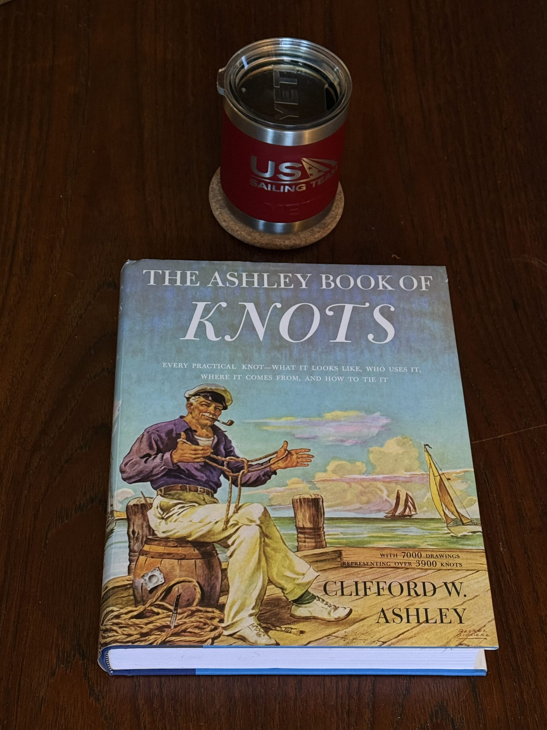
IN THAT PIC: A comprehensive book on all things knots. “Every practical knot…” Link to this book below.
Fast forward a few years; back in the BVI, our winter stomping grounds. It was windy and gusty and we were sailing with a quartering sea from Jost Van Dyke to Norman Island, by way of Thatch Cut. Thatch are two islands off the west end of Tortola. One passes between the extreme west end of Tortola, which is a mini-peninsula with a bluff – very scenic. That cuts across the mouth of Sopers Hole, a very protected bay on Tortola, and past the Thatches. Once beyond Tortola, you’re in the channel between it and St. John, and onward to other islands (in our case, Norman).
We had a family aboard; self-described affable Type A’s including two or three lawyers. Couple; their adult daughter; sister/aunt. They were indeed affable; but the husband was also sometimes arrogant and defensive boarding on belligerent. We had not sailed with them before. (Starting to see a pattern?)
For the second time on the trip, this time during our windy leg from Jost to Norman, the husband started getting into it with me out of the blue. This time it was to protest how a task that was also an educational segment went wrong. The task was to figure out the reefing system on the boat for future use (assigned days before). Then, the application: that morning, before we left the anchorage. They struggled to figure it out but eventually did with little or no guidance from me.
But, hubby was angry about it. He didn’t like two things: one, how I went about teaching it; two, which he didn’t admit, how he struggled with it. He could be self-critical but was quicker to blame others for his own failures. This wasn’t a test; it was a learning experience, and therefore a success! But he didn’t see it that way.
I tried to keep it smooth and let him know that there were a number of ways I could have assigned that task or taught the procedure. I chose one. If he and/or others didn’t like the choice/method, that’s fine – I wouldn’t use that again and would do something that fit in better with their learning preferences. But, he wouldn’t leave it alone. He got angrier and louder.
He weren’t no hermit…
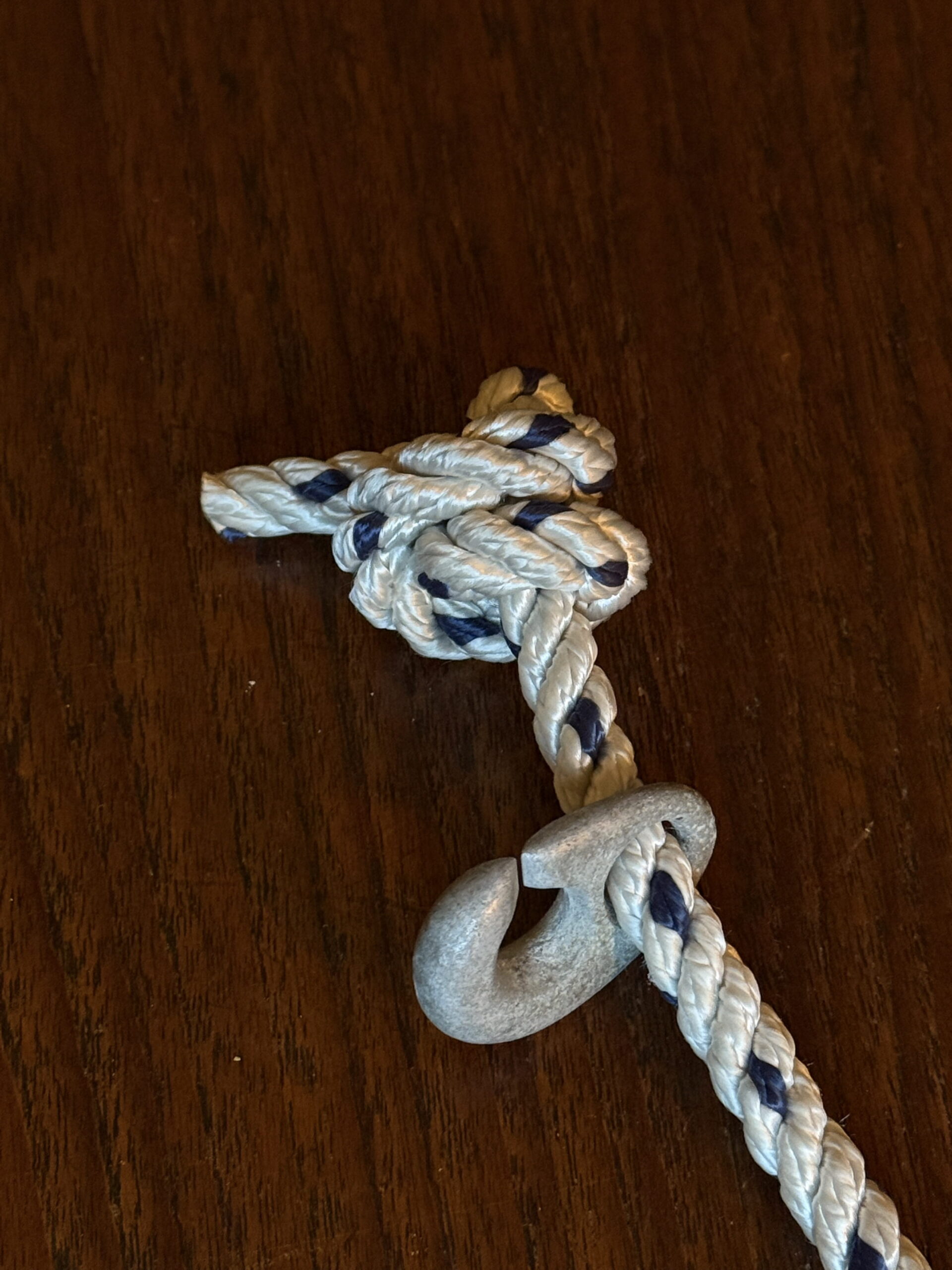
IN THAT PIC: a stevedore knot, my preferred “stopper.” In this case, it would serve to stop that hermit-crab claw-like thing from sliding off the end of the rope. Anyone know what this is? If you reply to this post with the correct answer, you’ll get $50 off any course (not the $25 knot clinic; sorry).
I kept my voice down after at one point starting to raise mine to be heard over his. I explained that he had to calm down and keep his voice down – happy to discuss and debate, but not going to be yelling. When he still wouldn’t calm down, despite some of the family telling him to shut up, I said something like this:
”Look, here’s what’s going to happen. If you keep yelling, I’m going to just get this boat through the trip and eventually back to the charter base. I’m not going to teach anything. You’re not going to get the certification you are here for. I’m just going to shut up and get the boat from A to B to C. And that’s going to be the end of it.”
”Ray, SHUT UP!”
-entire fam in unison
That time, he did. We got through to Sopers Hole and I suggested we stop for docking practice and maybe some ice cream or something. Sounded great to all. Ray eventually was joking around instead of fighting with me. He dialed it back including when we got ashore, when I half expected him to start up again.
I was walking along the dock with my friend John who was on the trip with his wife Lydia. We were on route to the store and John said, “where’s the dinghy?”
I looked around and saw none. Silence.
Gone. Last time I saw it was when it was surfing behind us on the swells that were developing en route to Tortola. I was checking that it wasn’t going to ride up on the transom of the yacht, and that it wasn’t yanking hard on the painter (tow line). As it looked fine, I didn’t adjust it.
But, that was then, and this was now. I called the charter company to advise and ask if they had any ability to look, and I started hailing on the VHF to see if any vessels in that area had seen it or might keep an eye out for it.
Gone. They brought us another dinghy in a short period of time, and we were on our way. Of course, I forfeited the security deposit for the lost dinghy. That was some expensive ice cream! Probably would have seen the dinghy get loose if it weren’t for Ray. I see everything; it is known. This time I didn’t. That was the first nail in the coffin for people joining us on our destination trips if we haven’t sailed with them before in a course setting. Another trip two years ago was the final nail that closed the coffin for good; the only strange we allow on the boat is when friends or family join people we’ve already sailed with, and then only if we do the due diligence to make sure they’re a good fit and really understand what they’re getting involved with and what the “real estate” is like on a small charter yacht (versus an ocean liner).
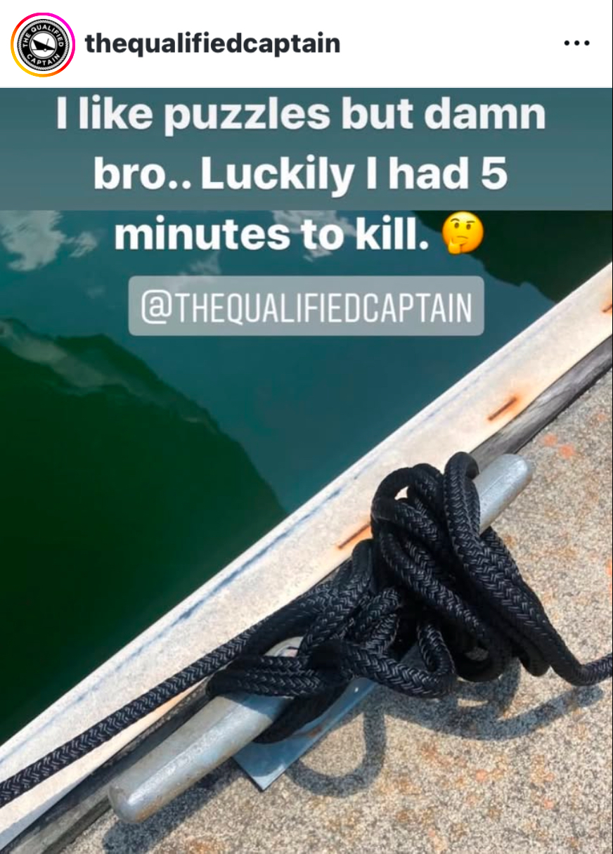
IN THAT PIC: some kind of fuckery involving rope and a cleat. Needs a proper cleat hitch. The Qualified Captain, one of our favorite Insta accounts, often posts insane examples of how people tie shit up. Worth a follow.
The knot that failed both times? Cleat hitch. Main reason? Probably the material. Dinghies are usually tied off with a type of plastic line that floats called polypropylene. It’s not just a bitch to tie right; it’s a war-time whore. It must be overly wrapped in many ways with locking hitches in between, and then I usually tie the end to something else. I check. Often.
The cleat hitch is one of the least understood knots out there in my (potentially dubious) opinion. There are standard caveats about how to tie it that I can prove wrong to you in the knot clinic. They miss one important point about how to start the cleat hitch that sets it up for success or failure (meaning either it will slip, which is unlikely despite the experiences described above, or it will be hard to untie when critically necessary).
”Marlinspike seamanship!” It’s a fascinating if misogynistic-sounding world. Maybe some of you will come tie one on with us at the clinic. If not, read up, practice, and apply on the water and at the dock and have fun with it.
KNOT TYING CLINIC: click that link to visit that page on our site and see if you wanna join.
Just want that book? Multiples of scores of more knots than the clinic for just under twice the price. But, diagrams don’t explain how to handle the rope and close knots properly, which is a large drawback. For under $100, you should probably do both! Here’s the book link on Amazon…
A former “sea lawyer” goes back to school to revisit the rules for how to sail a boat on a race course.
A very long time ago, I got my hands on the USYRU Appeals Book. It was a short/wide 3-ring binder. In it was the “case law” for the rules of sailboat racing.
I don’t remember how I got it. But, I remember where I opened and started reading it: in a Burger King somewhere in Midtown-East. That makes me wonder if I picked it up at the New York Yacht Club in the 40’s, where the YRALIS had a small “front desk” thing going on.
Anywho, I remember getting grub and going to the downstairs seating area. I ate, and went through the right-of-way section. I started highlighting those appeals that mattered: the ones that dealt with the less obvious “what ifs” of sailboat racing. For all the good it might do…
In that pic: copy of the rule book, two editions ago. It came in the mail as part of my US Sailing membership although I wasn’t racing at the time.
Did I become a “sea lawyer?” No. Not in the generally understood sense of the term. That would mean I was always getting into it with other racers, yelling, threatening, protesting, etc, etc. That wasn’t me. I just wanted to understand the rules and be able to race within them. Sure, that meant having the occasional tactical advantage, and sometimes enforcing it by speaking up on the race course, but always better to avoid tiff and just sail the race.
The idea was to steer clear of trouble, not look for it.
The basics of the racing rules are, basically, like those that apply to everyone else. One is a common sense rule: don’t hit shit from behind. That leaves two other basic rules:
A boat with the wind coming over its starboard (right) side has right of way over the opposite (wind coming over port side). When “steam” (power) driven vessels emerged, the equivalent was that when crossing, the one on the right had right of way. Then, cars came along and, well… same.
When two boats both have the wind coming over the same side, the leeward (downwind) boat has right of way.
But, racing is more complicated. We deliberately cram ourselves into tight quarters and turns, often at speed, and have to deal with the mess when we converge. So, the details are tricky.
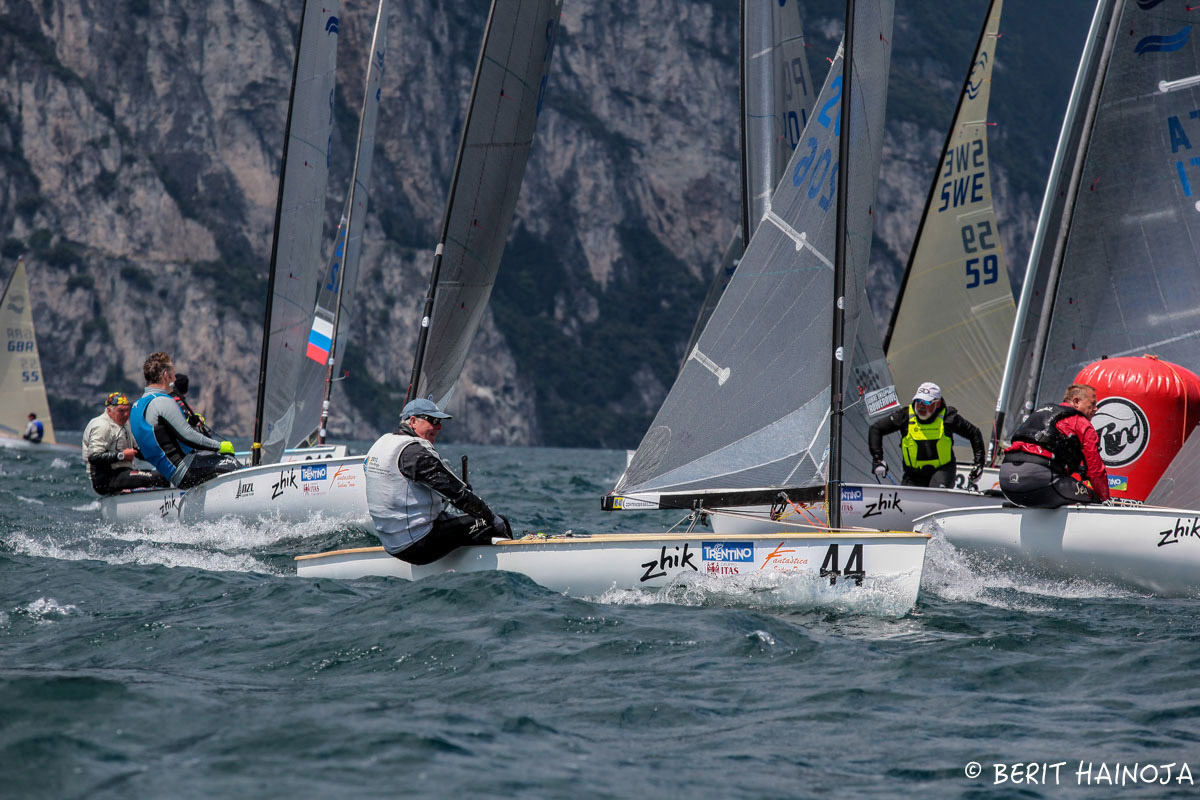
In that pic: tight mark rounding at the Finn Masters Worlds, Torbole, Italia (sailing on Lago di Garda), 2016. The Finn was the Olympic singlehanded dinghy for many Olympiads. Had a great run. Despite it being dropped, with the Laser remaining for lighter sailors, the Finn is resilient and sees large numbers of boats at regattas – for “masters” as well as the younger set. It’s a heavyweight brute, and arguably the hardest boat to sail in the world. Berit Hainoja, photo.
The appeals help sort out some of these situations for racers. It starts with a protest, when one boat calls out another over an alleged foul on the race course. If the protested boat doesn’t agree and do penalty turns, there’s a protest hearing after the day’s racing. If the loser of the appeal isn’t satisfied, they can appeal it. The race committee for the event organizes an appeals committee..
If THAT doesn’t go their way, and they want to keep it real, they can further appeal it. Ultimately, for America, US Sailing (formerly United States Yacht Racing Union, and before that, North American Yacht Racing Union) is the Supreme Court of sailboat racing. World Sailing is the global Supreme Court.
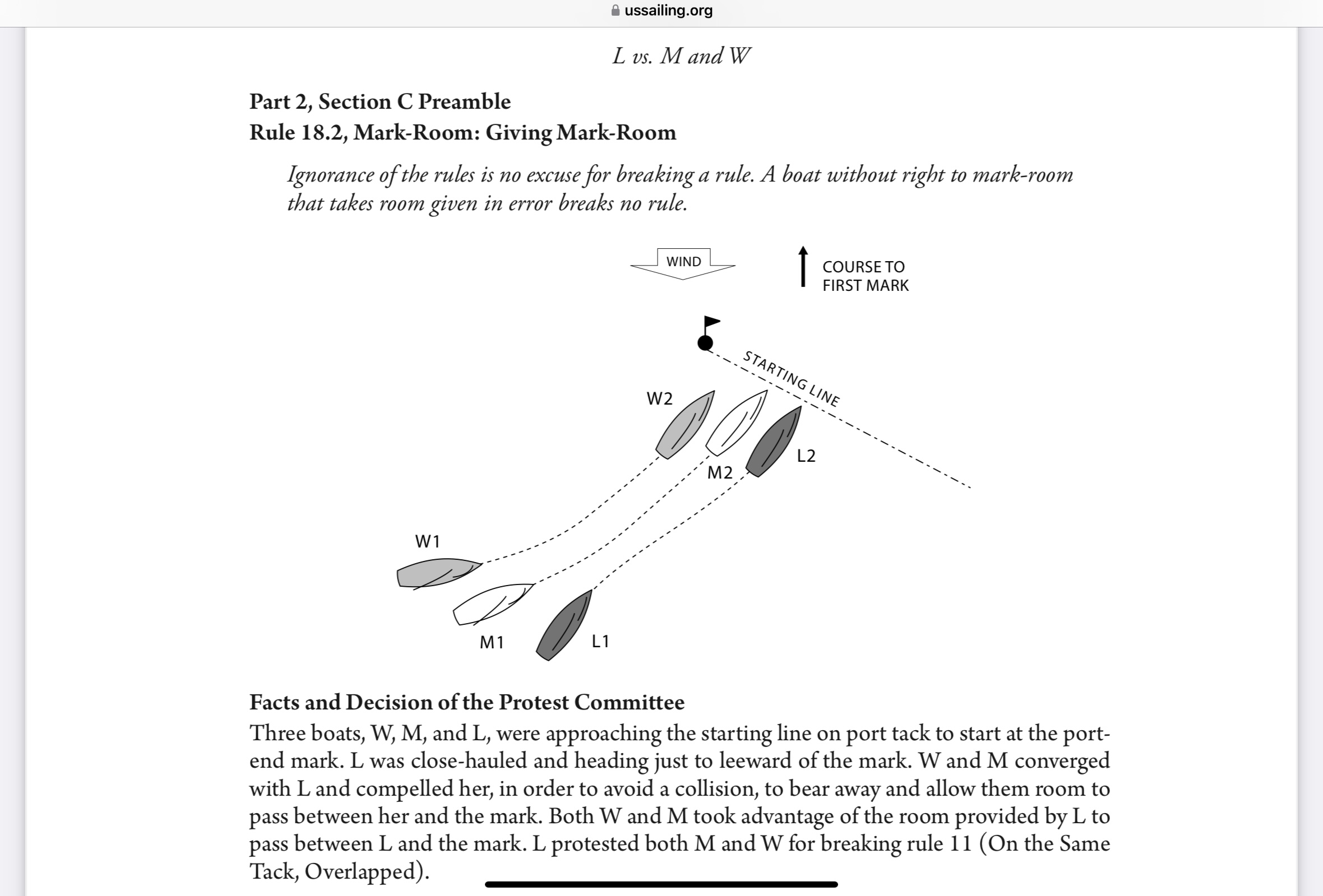
One appeal in particular always stood out for me. It dealt with mark roundings. Most sailboat racing involves crossing a specified starting line, turning around specified marks, and crossing a finish line (often the same as the start). When boats meet at those marks, the rules get tricky.
Without worrying about all those rounding rules, we’ll just talk about one principle: room at the mark, or “mark room.” Sometimes, one boat has to give room to another to round the mark, or go first. Everyone who races is at least vaguely aware of how that works.
When a good chunk of the fleet arrives at a mark roughly at the same time, it’s chaotic. Boats that are denied room at the mark have to keep clear. There might be nowhere to go! Sometimes, however, a boat that’s ahead and doesn’t have to give room makes a bad rounding or turn. That can leave room that wasn’t intended. What’s a boat to do?
If you’re coming in from behind, you can take advantage of “room given in error” (formerly, room “freely” given). So, if you get to the right place at the wrong time, but another boat struggles and swings wide, it’s fine to swoop into the gap and round the mark inside of the other boat and wind up ahead.
In my racing experience, going back to the 1980’s, this concept goes beyond being misunderstood. Most people never heard of it. It was the case then; it’s still the case now.
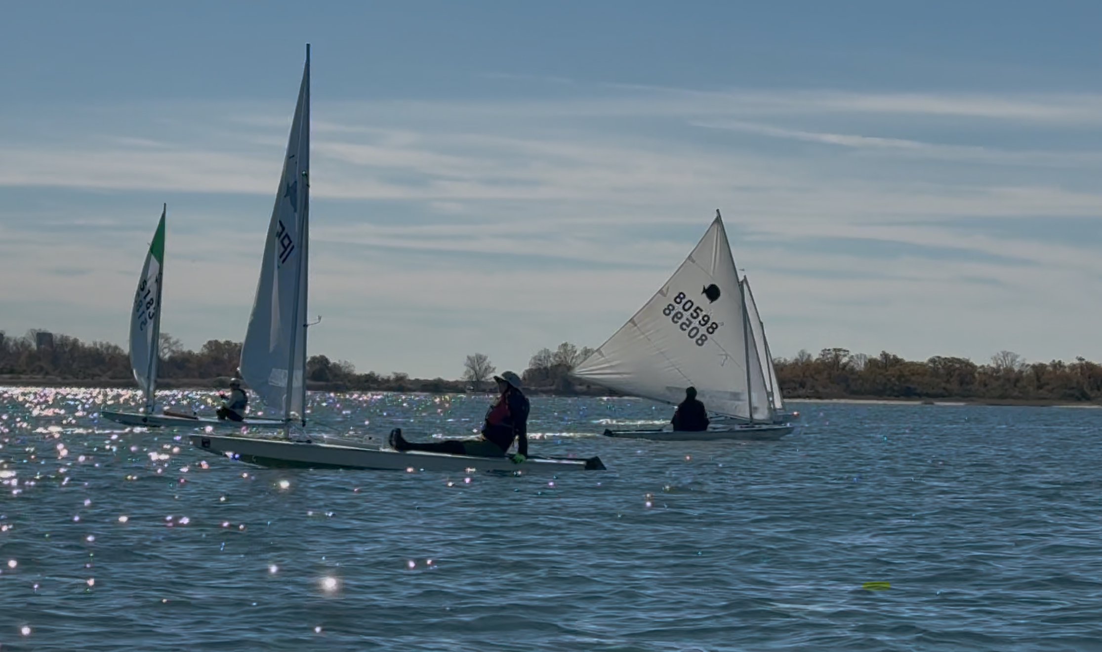
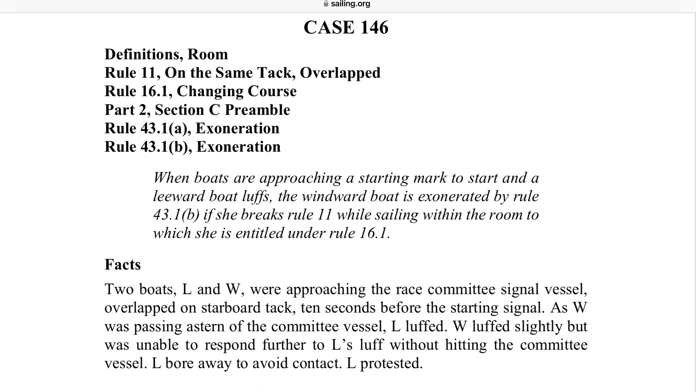
In that pic: BUSC, 2024 – the inaugural Brooklyn Urban Sunfish Championship, hosted by Sebago Canoe Club in Canarsie. I had to miss that one due to teaching commitments. Here, all but two of the boats shown are sailing downwind. Two have rounded a mark that must be out of the pic, and are heading back upwind. The Race Committee boat is anchored mid photo. When it’s not a required turning mark, boats passing it can treat it as an obstruction and potentially get room from competitors to do so. Not so when it’s a starting or finish mark, which it is for every race. Photog unkown.
Back when I was frostbiting in Dyer Dhow dinghies, this came up once. Bud MacIntyre (might be misspelling his name) was a nice guy in the fleet. He was ahead of me as we approached a jibe mark, which is when sailing diagonally downwind, a boat has to execute a “jibe” turn to get around the mark and on course towards the next one further downwind. The course change was typically 60-90 degrees. Jibing means crossing through the wind ass-backwards, when the winds is from behind the boat, and the sails cross over.
I was behind and slightly to the mark side of Bud. I didn’t qualify for “room at the mark.” But, Bud was a big boy. Barely fit in that little boat. He got tangled up and swung wide of the mark, slowly and painfully. He knew I was there and said “don’t go in.” Several times, I think. I don’t remember if I said anything, much less what it was.
(I do know what I’d say now: “Try and stop me!”)
Anywho, Bud swung way wide and gave me more than wee room. I took it and went inside of him at the mark. There was no contact, and he couldn’t shut me out much less round the mark well. He couldn’t have hit me if he tried. (If he could, and did, I’d have to do penalty turns or risk being protested and disqualified.) Of course, he protested. There was a hearing. He said I didn’t have room at the mark but went in anyway. I said he swung way wide and left a ton of room, and couldn’t defend the hole by hitting me if he’d tried, and that I was entitled by the appeal (case law) to take advantage of room freely given.
Despite the facts not being in question, and the appeal ruling being clear, they disqualified me – even though there wasn’t any contact. For that low-level of Sunday afternoon frostbite racing, that was silly. But, it’s what’s done, and why it’s best to avoid protests and hearings if at all possible. The people who decide it are on the spot, and usually not up to the task -which is a thankless one, really, when everyone is out playing together and then some have to referee a squabble. No good comes of it.
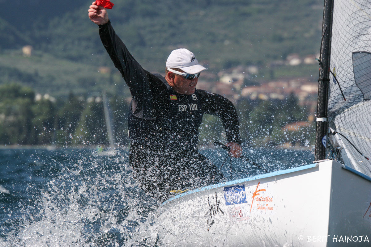
In that pic: that clump of red isn’t a bloody hanky – it’s a bleedin’ protest flag! This sailor is protesting another boat (or more). The flag must be hoisted or otherwise brandished as soon as practically possible. Upon finish, or as soon as possible thereafter, this sailor would have fully informed the race committee of the protest (which boat/boats he’s protesting). Finn Masters Worlds again (Berit Hainoja, photo).
Fast forward many decades. A client and friend of the school, who took some cruising classes with us and joined the Club, was racing a boat in the Virgin Islands. There’s a series where one can charter a boat and participate. He was protested and disqualified in a race, and asked me what I thought.
The details were different, but the concept was the same: room was given and he took advantage of it. When his competitor lost ground to him based on losing the boat-to-boat duel, said competitor got pissy and protested. Loser.
Unfortunately, he became a winner (at least compared to my buddy) because he won the protest. My buddy got a DSQ. He asked me to look it all over and give my thoughts. I did; and that required revisiting the racing rules.
The rules have changed a lot since I was regularly active in racing. They were simplified; oversimplified, if you ask me. (BTW: check out the YouTube channel “Oversimplified” for quick, cartoon-art videos that whittle down historical events to bite sized chunks. Super entertaining.)
It’s much easier if something is added; WAY harder to deal with simplification or subtraction. So, there was that: get acclimated to the new rules. Truth: I’d been racing again, starting in ‘23, and had NOT learned the rule changes. So, I figured that until I did, I’d avoid trouble. If in doubt, turn away from the other boat. I really should have re-learned the rules properly before I got on the race course, but it was super friendly club racing and I could get away with it.
So, I re-learned the rules more or less. Then, I re-visited my buddy’s situation. My original conclusion had been that he was in the right: he’d taken advantage of room given in error/freely. I also found a new rule that went even more in our direction: when a right of way boat alters course, they must initially allow room for the other boat to keep clear. This is more limiting on the right-of-way boat, and should also have helped his case, which was…
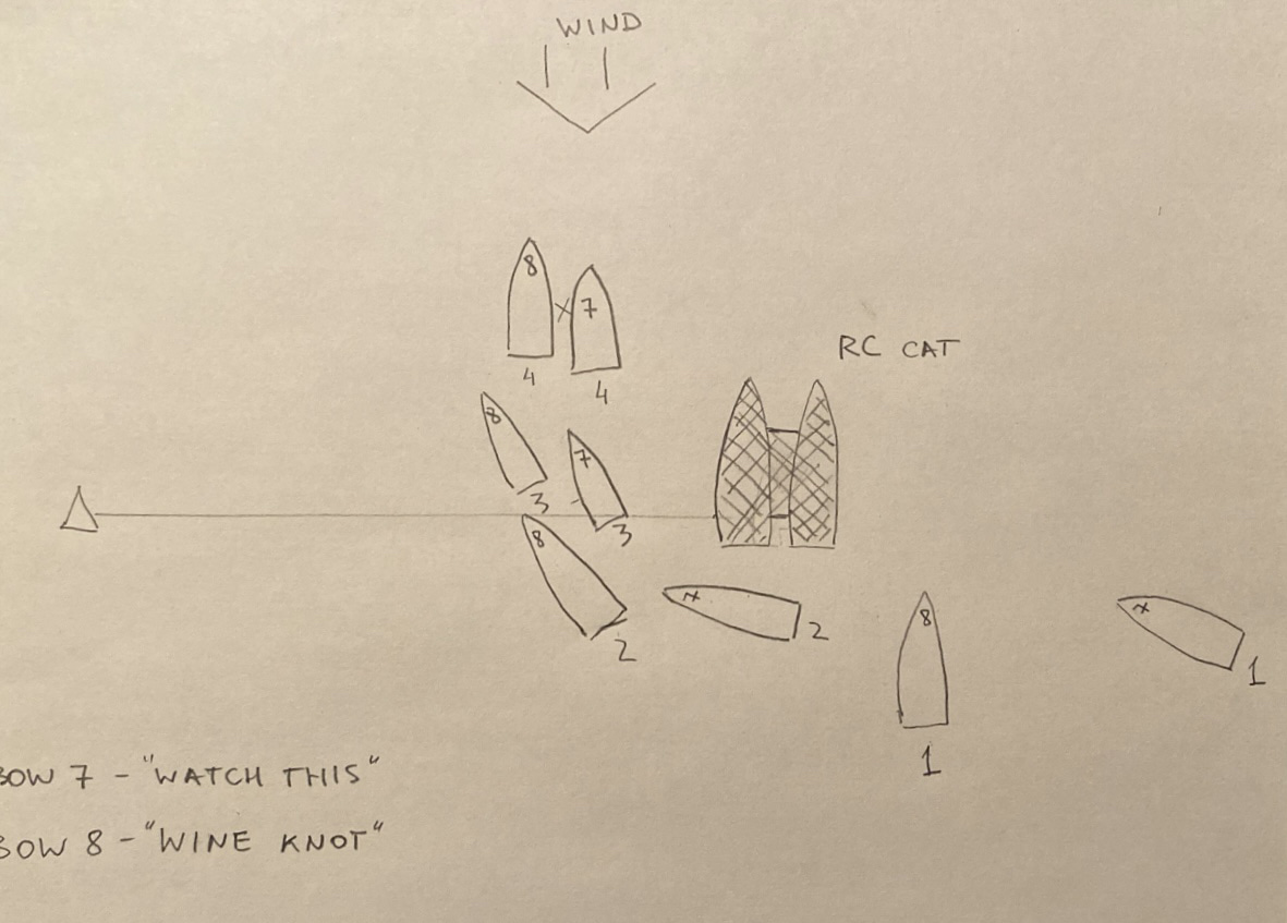
In that pic: diagram that Alex drew for the appeal he lodged after being disqualified from a race. He’s #7, far right in diagram.
He was sailing toward the starting line, specifically the anchored committee boat. Ahead of him was the competitor in question. (This was a fleet race; no other boats were close or relevant to this sequence so they’re not shown.) Let’s call them boat A (asshole) and boat B (buddy). Boat A hovered head to wind (pointing directly at the wind) motionless or nearly so. He was blocking the route Boat B would take, to pass directly downwind/behind the committee boat and then head up toward the wind to cross the line and start.
(nb: in the diagram above, “A” is #8 and “B” is #7.)
Something would have to give: Boat A would have to turn away from the wind at some point and actually sail if he were to cross the line and proceed toward the first mark. But, if he didn’t do so before Boat B arrived, B would have to dip below/behind A and hope to make up the lost ground with better speed. (When approaching a starting mark, the windward boat almost never has rights to room at the mark.)
Boat A, predictably, headed away from the wind to accelerate and cross the starting line. That left a lot of room for Boat B to sail in between him and the RC boat. He did. They both crossed the starting line (between RC boat and a mark way to the left, forming the starting line). Some seconds went by. Then, Boat A decided to alter course by heading up toward both the wind and Boat B. Boat B headed up too, as A was entitled to do that – but up to a point:
Can’t go beyond “head to wind,” or you’re “tacking,” and lose all rights to a boat “on a tack;” or, at least that’s what it used to be…
Under new rules, must initially allow the give-way boat room to keep clear. A did; B had time to keep clear at first, and did so, but stopped short of crossing head to wind. Had B done that, he would also be forced into the committee boat or its anchor. Therefore, A wasn’t entitled to force B past that point.
Room freely given was almost not even relevant, but would force a competent race committee to ignore that complaint from boat A, which is what it protested about: A claimed B was “barging,” or trying to force its way in between boat A and the starting mark (which it’s not allowed to do). Barging isn’t a rule and isn’t mentioned in the rules, but it’s the common name for the situation. Rule that out, and one can then focus on the rules at hand (limits on altering course).
Boat A went beyond “head to wind,” and Boat B didn’t. A hit B lightly; no real damage. But, contact means both boats must retire (quit), or one must do penalty turns, or either/both must protest. If there’s contact, at least one must be disqualified after the hearing. (No contact? No requirement for a boat to be tossed from the race, although that’s the way it usually goes.)
My buddy in Boat B was DSQ’d as I wrote. Based on my opinion, he decided to appeal. But, he wasn’t able to get a written copy of the Race Committee’s decision and the appeal committee decided against him largely on that basis. (Reasonable, although unreasonable and odd that the RC didn’t supply the decision. Maybe they didn’t want to deal and/or be seen as correcting their own mistake, as RC and Appeals Committee might have overlapped.)
After I’d given him my initial opinion, I also asked for that of key members at Sebago Canoe Club where I race dinghies. Some of them race a lot, and travel to regattas both in the US and abroad. One guy (the most traveled) got back to me. He thought that Boat B was “barging” and didn’t have rights – which is exactly what everyone always thinks, and what the Race Committee thought as well.
I read the rules. I found the appeals. One source of help for that was Dave Perry. Look him up; he was a top racer back in his day and has been considered the pre-eminent rules expert for a long time. He’s the guy for US Sailing as far as rules are concerned. My Da and I saw him give a talk on racing back in the late ‘80’s somewhere in Connecticut, probably hosted by North U (North Sails’ educational arm). Nice guy. Well, I emailed US Sailing about the appeals; trying to find them in general and this one in particular. Dave and another fellow both got back to me.
Dave and I share a few things in common: we’re male members of the species, we’ve both lived in Connecticut, and we both raced Lasers and Solings. We’re both good at the rules (me in the past, and playing catch-up now; Dave always). The main difference is in the success level. According to North U:
While at Yale (1973-77) he was captain of the National Championship Team in 1975, and was voted All-American in 1975 and 1977. Other racing accomplishments include: 1st, 1978 Tasar North Americans; 5th, 1979 Laser Worlds; 1st, 1982, 2006, 2008, 2011 and 2015 U.S. Match Racing Championship (POW); 1st, 1983 and 1984 Congressional Cup; and 1st, 1994, 1999 and 2003 Ideal 18 North American Championship.
Dave also campaigned a Soling at the top tier, vying for but falling short of an Olympic berth.
Me? Largely learned to sail on Solings; raced them at the lowest, weakest level that existed; crewed for someone at a Soling East Coast championships once (zero tactical responsibility on my part and zero fucks given by the skipper for my opinion on anything); raced Lasers with some success at the District level (NYC/Long Island). Got back into Lasers two years ago; everyone considers me “fast.” Haven’t sailed a proper race in one yet since resuming (did so with Sunfish and Vanguard 15’s and, again, “fast,” and occasional moments of brilliance balanced by blunders and mediocrity in a low level fleet).
Dave spent some time getting acquainted with and helping me via email; I very much appreciated that. He put me onto the appeal I needed as well. It’s not the one I remember, but maybe I don’t remember it well. They do delete some and add others, so it’s possible the old one is simply gone and replaced by a “better” one. The concept is exactly the same, and it is in fact settled “case law.”
The net/net: here are the two appeals that apply to this particular race start.
First: Case 146 from World Sailing’s Case Book (Appeals). This one establishes that once a leeward boat (downwind, or to downwind side) lets a windward boat (opposite) in between itself and a starting mark, it can’t whine about it later. It also can’t force the windward boat into that mark. Normally, leeward has rights over windward, and can alter course toward it and make windward move. This is one of the exceptions those rights. The Case goes on to explain that “barging” isn’t a rule or discussed in the rules, and is only an issue when a windward boat forces its way in between a leeward boat and a mark. No force? No foul…
And now, the US Sailing Appeal on room given in error… Appeal #5, all the way from 1950!
Appeal #5 is where it’s at. One of the older appeals; still as unknown today as it was back in my day. It’s the concept of room freely given (now room given in error). One takes a risk trying to take advantage of it, but if an “attacking” boat assesses the course well, and the boat being attacked – and not required to give room – is unable to do anything about it, for any reason, it’s fine to take that room. Common sense, IMHO. Yet, all anyone can think of is “barging.”
B-Buddy (real name Alex) decided that it was a very interesting learning experience and let it lay. He really didn’t have much choice. On the race course, one can usually make this choice: get into it with competitors, or just avoid rule confrontations. Sail faster and smarter, and enjoy playing by trying to win a sailboat race. Stay out of the courtroom. Leave that to the “sea lawyers.“
”Some of my best friends are lawyers.” In fact, my two best friends ever are lawyers. I’ve lost touch with one sadly (he moved to Asia). The other is right here and we still argue about whether his wife and he saw a large barracuda, or a small shark, on one of our Virgin Island trips. He knows all the lawyer/shark jokes.
Here’s one, told by the one I lost touch with. short version (want the long version? Post a comment in reply to this, and I’ll post the whole joke for ya!).
Why do sharks never attack any lawyers they find from shipwrecks?
If you race a boat often enough, that number never fades away even if you forget how to sail a boat well.
Pro athletes are often synonymous with their jersey numbers. Most big fans of major league players probably know their faves’ numbers. Those numbers are often retired with the players themselves.
In that pic: a typical tight start in a Laser race. Every sailor there knows their number cold. These guys are sailing the standard, full-size rig: 76 square feet of sail. The author used to sail this size rig when he was around 120 pounds soaking wet. Got away with it as it was district level racing in a light-wind region. A better body weight would be 160-170 pounds; heavier isn’t usually a problem. There’s also the Radial rig, with a smaller bottom mast section and somewhat smaller sail, with a radial cut rather than parallel panels. Screen-grab from a race video on YouTube posted by RYA (Royal Yachting Association) during interview with a British team sailor. Didn’t see video credit.
Not the same for sailing; even though there’s a little bit of team racing out there, and a few true rock-star sailors, it’s the boat – not the sailor – that is identified on the course. For most racing, it’s the sail number. It can be random, or it can be the number of the boat that came out of the mold (hull #1 would say just “1” on the sail, or maybe “001”). It’s used to identify boats for scoring or penalty purposes.
I’ll never forget my sail numbers. I raced two boats actively enough for enough time that I have them. Sadly, I can’t find photos of my father or in the boats detailed below, but they might be hiding in one last storage area. Anywho…
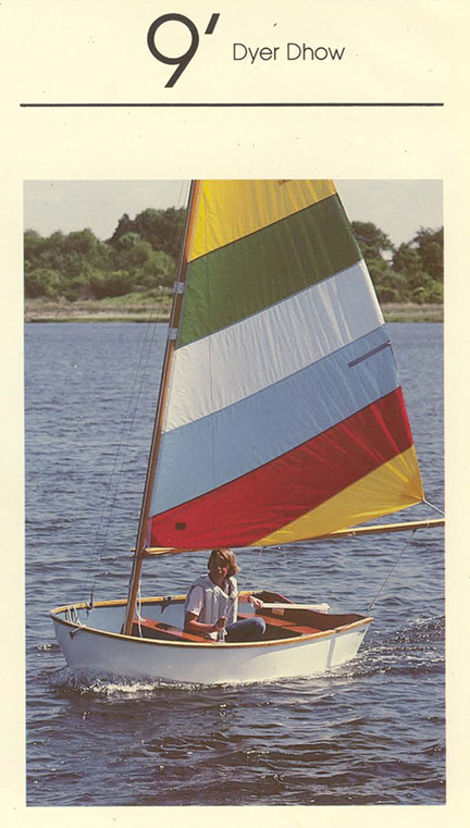
#228: my Dyer Dhow
In that pic: no, not me in my own boat. Photo from back in the day from Dyer’s site. But, Imagine a tween or teen in her/his first boat. Just boat, sail, and excited young sailor. That’s the idea. Back when I frostbit, the sailors spanned all ages from under 17 to well over 70.
My first dinghy (and the first time I ever sailed one) was my Dyer. Funny story about how I got it:
Sometimes Dad had strange ideas about what made for a good birthday gift. That might have been due to forgetting my birthday – never knew for sure. One year, he said that he was giving me one of the sailing school boats. (He owned and operated a major sailing school and that was my introduction to the industry.) Great! I was too young to realize what it did and did not mean.
Years later, I got interested in racing, and then read an article in Yacht Racing & Cruising (now just Sailing World). It was in their how-to series, “From the Experts.” Here, champions in their respective boat classes dished on how to deliver. They shared their secrets on how to get the best performance out of the boat. I forget the author’s name. This got me interested in frostbiting, or racing boats in the winter months here in the northeast.
I asked my folks if they’d get me a Dyer so I could do this. No.
I somehow remembered about my sailboat gift: hadn’t thought of it for years. I leveraged it. My boat, but..? How many classes did your school teach on it? How much rental income was there from it? I did some gymnastic arithmetic that was at least roughly based on reality. I can up with a bill: you gave me this boat, then used it for profit. Here’s what you owe me.
He knew he’d been had. Mom didn’t intervene, which meant she agreed with me. Next week, he bought me a new Dyer Dhow. I remember going to Sobstad Sailmakers in Mamaroneck (a solid regional sailmaker at the time, perhaps national, with good racing pedigree). They had the deal to make all the sails for Mamaroneck Frostbiting Association’s Dyer Dhow fleet. Truly one-design; all sails were identical. You could opt for an aluminum mast instead of the standard wood one. You could “Harkenize” your boat: use all Harken turning blocks instead of whatever shit Dyer installed. That, and your choice of rope material for the mainsheet and outhaul, maybe halyard, and hiking stick. None of that made any significant difference. You had to sail the boat better than your competitors.
In that pic: tight times – mini match race during a fleet race, Mamaroneck Frostbite. I had a bow dodger (spray canvas) on my boat as did, and do, most sailors. Never opted for the metal mast; I like how the wood bends more. Must have been windy/gusty that day – they’re using the smaller “storm sail.” The race committee makes the call for the day; it’s not optional.
Anyway, I was #228, and I named the boat Dyer Straits. (I was a Dire-hard Mark Knopfler fan.) I remembered the number due to the sheer number of times I looked at it and heard it through a bull horn on the race courses. (“228, you’re over early.” “228, we have your finish.” (DFL, or dead fucking last…) “228, nice race!” (I did win some).
Dad was not about to be undone. He drove me to the frostbiting. Eventually he borrowed my boat from time to time. He might have sailed a race or two by swapping out with me at the committee boat on some days. But, of course, he eventually got his own.
#501: Apocalypse Dhow!
He probably wore Levis’ 501 jeans as well. Big on denim and a Willie Nelson looking bandana.
A year or three later, I wound up trying a Laser in the Virgin Islands. They had them for rent at Bitter End Yacht Club in Virgin Gorda. I’d never sailed one. But, I knew how to. Why? Another “From the Experts” article: Laser, by Olympic Finn contender and one of the top Laser sailors at the time, Carl Buchan (whose Dad, Billl, was a champion in the Star keelboat class). I knew how to throw the boat around with my body by torquing at the hips with torso as lever. I knew how to hike out, and get the boat up on a plane quickly by handling the sheet properly to pump the sail. I knew were the daggerboard should be. I capsized once… but flipped the boat back up easily as I’d read about it.
I sailed the boat back to the beach up on a plane, skimmed way up past the shoreline, pulling up the dagger board just before I grounded. Hopped off and gave it back to dad.
Dad secretly bought a new one for me soon afterward. But, mom didn’t think I deserved it, and told him to not give it to me. He couldn’t hide the boat, nor could he satisfactorily explain why I couldn’t use it. (I didn’t know at first about mom’s interference.) So, eventually, he let me try it. Then, more often. Somehow he sort of stopped using it so I just kept doing it, and boom – it was my boat.
#101670, no name.
Yup: at the time, they’d make over 100,000 Lasers. That was in the early 1980’s; now that the boat has been active in the Olympics for a long time, I shudder to think what the hull count has gotten up to. But, I’ll always remember 101670.
My boat was stolen 5 or 6 years later. That was that. I filed a police report, and still almost remember the name of the female officer who took the complaint as I had an instant crush on her (Jimenez or Rodriguez; probably former as I new a Rodriguez or two from HS & college so might have them crossed up). But the sail number remains!
I started sailing and racing Lasers again two years ago at Sebago Canoe Club in Canarsie (sailing dinghies abound in addition to paddle craft). I added Sunfish and a Vanguard 15 (which is like a big Laser with a jib.) Maybe I’ll take a club sail with minimal or no numbers on it and resurrect mine. I’ll be easy to ID when called over early or rounding a mark the wrong way.
Old habits die hard…
In that pic: I’ve posted it before, and will prolly post again. Me helming a Vanguard 15 with a client/friend crewing. It was Paolo’s first time ever in a sailing dinghy. He went from scared shitless to shit-eatin grinnin! Behind is Jon, also a client/friend, in a Sunfish. Sebago Cup (distance race in Jamaica Bay), September ‘23. Chris Bickford, photo.