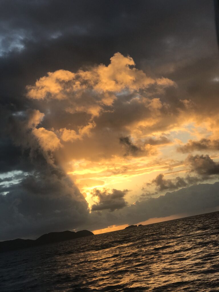
Not on a boat – by plane to ride a snowboard. But storm chasing to ski/ride is more like planning a boat delivery than it isn’t, so once you learn how to sail a yacht, you can apply this to delivering one!
Mid-January: I’m frustrated and feeling like I’m losing out on the winter. I haven’t hit a storm yet. I’ve missed many; couldn’t leave early enough for the annual Thanksgiving pilgrimage to Vermont, so missed that one. Couldn’t stay later than Sunday, so missed the next. And so on, and so on. One conflict after another and I had missed many shots both locally and out west. Got some days in but in average conditions at best including crowds.
What’s the hurry/rush? Well, snowboarding in powder is my favorite activity. (Yes; even more than sailing, and I LOVE sailing.) I started relatively late in life, so the novelty hasn’t worn off. Plus, as I advance in confidence and skill, and learn how to explore more areas and when, I get more rewards.
So, what do I mean by “storm chase” exactly? I mean that I don’t pre-plan snowboard trips in advance. I keep an eye on trends in different regions, and keep checking long and mid range forecasts. When those consistently call for a lot of snow in an area, I pay very careful attention to the trends when less than a week out. If, a few days before the storm, it still looks good, I see if the travel and lodging logistics would work. If everything alines last minute, I go!
Boat delivery: similar. What’s the weather window for the journey? What’s the expected amount of time? What is the margin of error and likelihood of running into overtime? What are the consequences? What does getting to the boat, and home from it, look like? How is that affected by weather as predicted and as it might change? These are many of the variables that factor into why I stopped doing any deliveries, whether on my own or helping other captains, awhile ago. (For deliveries, the boat itself is often the issue.) Last time I broke from that policy I was, of course, reminded why I had put it into place in the first place, but that’s another story.
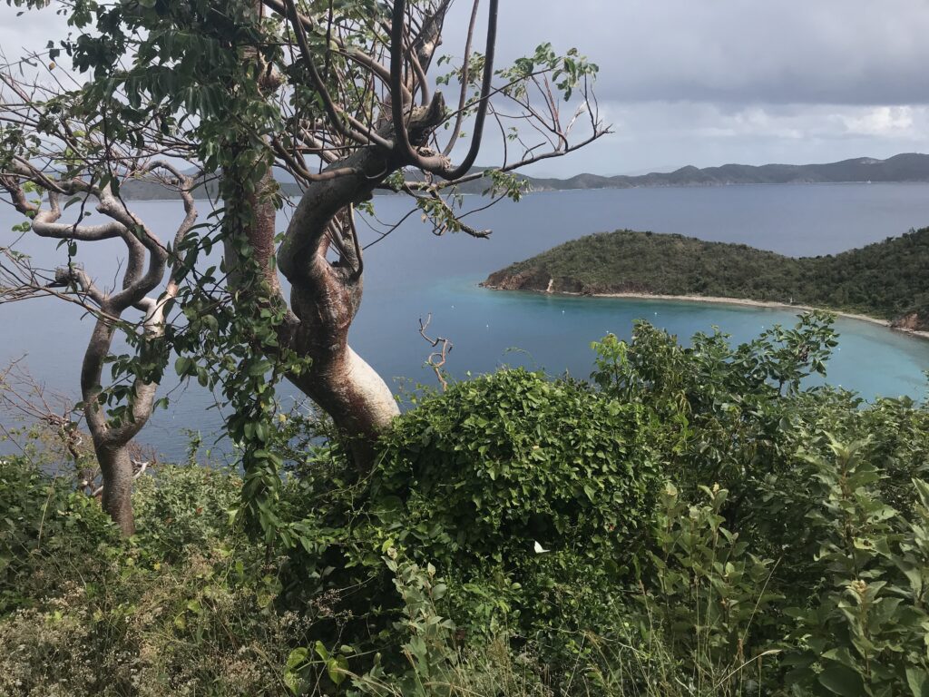
This storm chase: the Cascade Mountains in Washington.
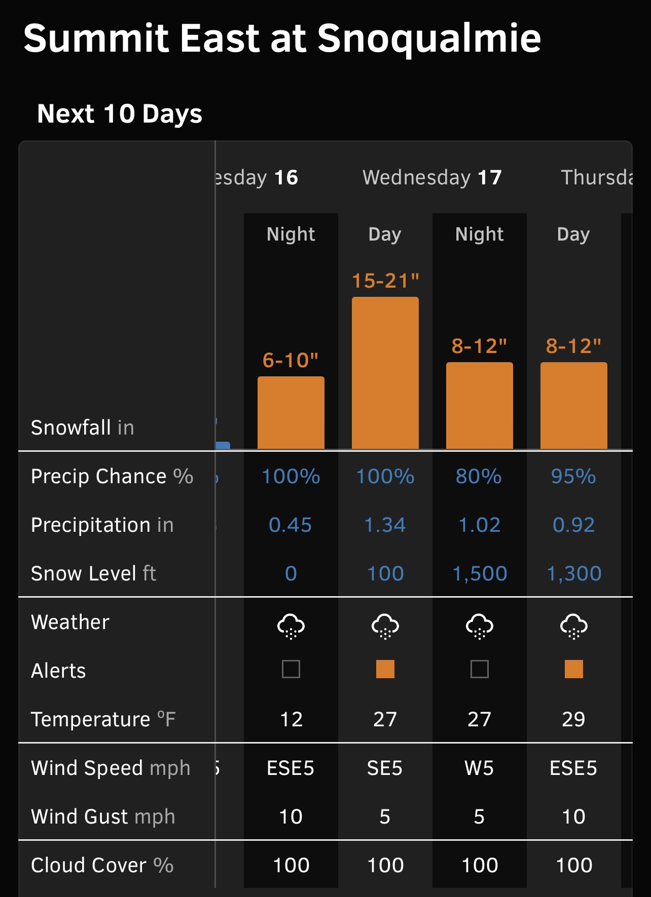
- Target mountain/resort: The Summit at Snoqualmie + Alpental
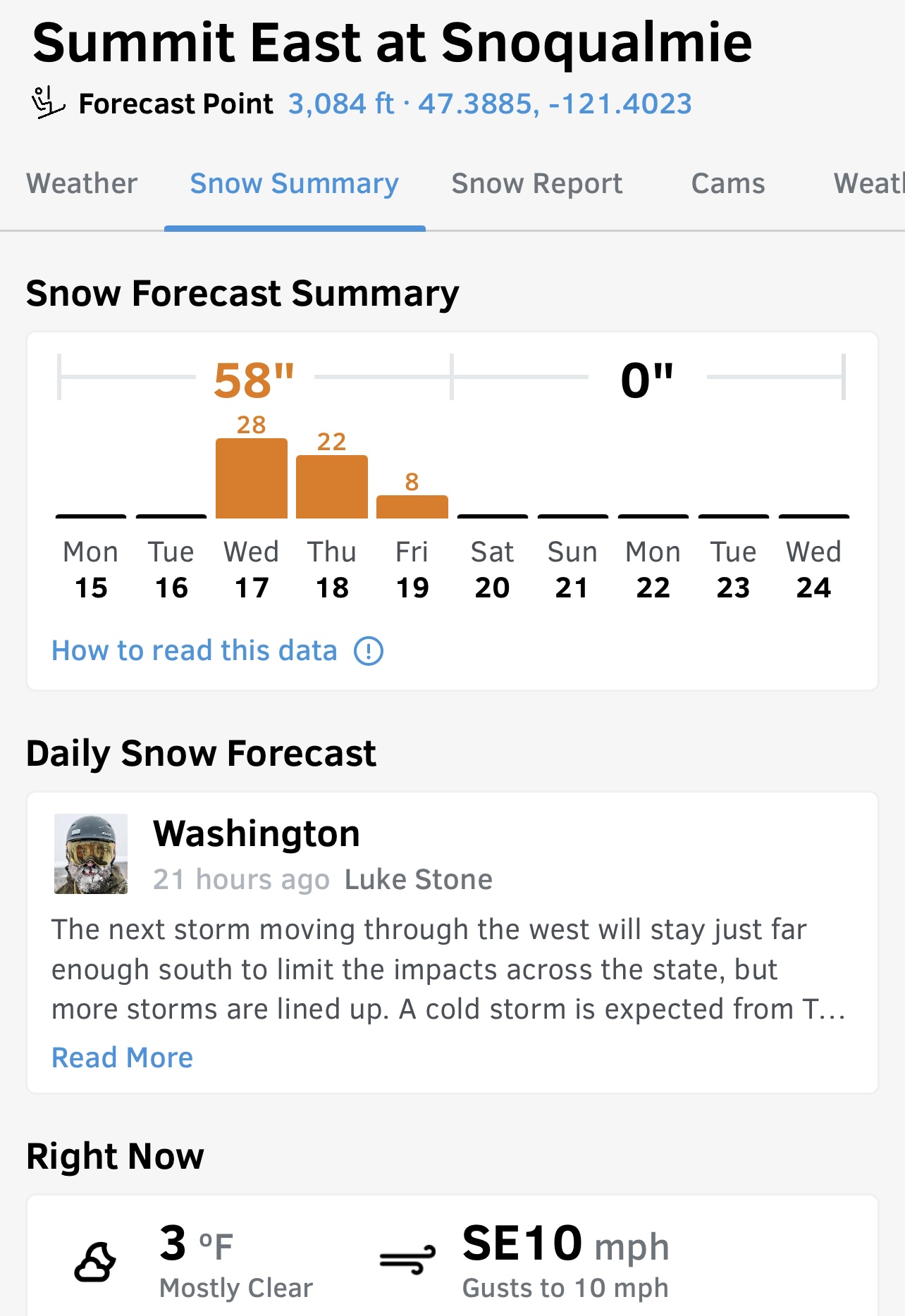
- Time of storm: Tuesday night through Thursday night (non-stop snow)
- Intensity: 50-55 inches total, with most of it the first night into the next day
- Airport: SeaTac
- Ground transfer: rental vehicle
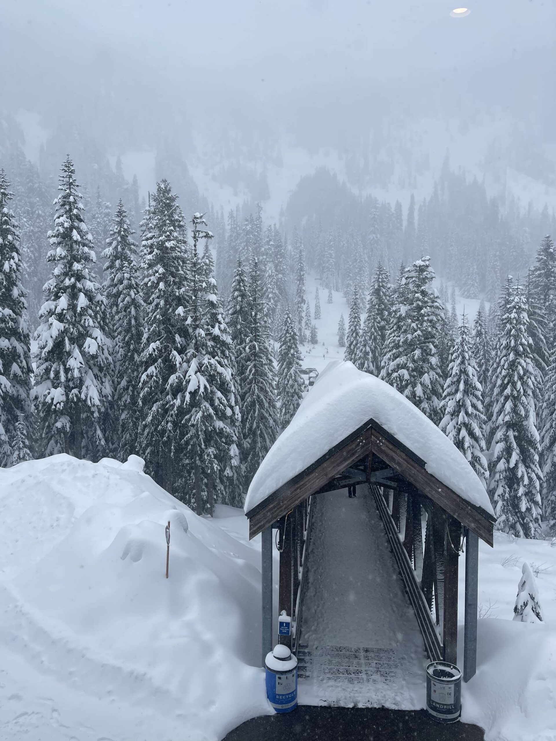
- Lodging: The Summit Inn, across the street from part of the mountain resort
- Access to mountain if roads unpassable: walk across the road!
- Access to food if roads unpassable: downstairs, next door, across road
- Weather windows to arrive before storm and depart after: Green light Go
And so, I booked. Lodging was expensive for what it was, but almost couldn’t beat the convenience – especially as there was a restaurant on site that served breakfast through dinner. The resort itself has no lodging, so no ski in/ski out. But I could drive anywhere from a few hundred yards to a few miles to the different bases, and I could walk to one with my snowboard. I did all of these.
I knew that it was critical to get to the hotel before the winter storm got underway. I got down to the wire on that score. The morning of my departure saw a few inches of snow in the City, so I left earlier for the airport and upgraded my Carmel ride from minivan to full-blown SUV. That paid off. But then…
Airport: we left almost on time… only to stop for de-icing. That took awhile, and then they announced they had to go back for more fuel. (?) We’d also have to de-ice all over again. Don’t remember if we got that far along, but no one could forget that they deplaned us and delayed departure for another 3.5 hours. Some happy crap about timing-out and needing to change out some flight crew. Of course, they were supposedly flying in from somewhere else so I took that with a grain of salt.
That was strike two. One more time strike and I would have to bail out. Consequence? Costs of one night’s lodging, plus round trip taxis to JFK (over $100 each way). Not cheap. Plus, the sleep and time lost. It was supposed to be a 7am departure and was now going to be 1pm. If they delayed again, I was going to let them know to take my Sportube off the plane and I’d take it home. (Sportubes are two-part cases for ski and snowboard gear and they’re the best thing I’ve seen on the carousels so far.)
But, they boarded on time and left the gate on time. Yes, they de-iced again despite the snow having turned to rain a long time ago. But, better safe than the other thing. And, with no more hitches, we were off.
This put me at SeaTac in the late afternoon, dealing with rush hour for rental cars and driving. But, I still had enough reserve time to get to the mountain before the winter storm was supposed to start. Despite super gusty winds on the Snoqualmie Pass, and light precip, I was able to safely drive the second half of that ground leg. I’d made the wise decision to forego a proper stocking up on fridge supplies while still in Seattle and settle for some quick bare basics and takeout dinner. (I almost just drove to the lodging, but called to verify I was en route and to ask how late dinner was offered. Restaurant was closed! Gear-shift…)
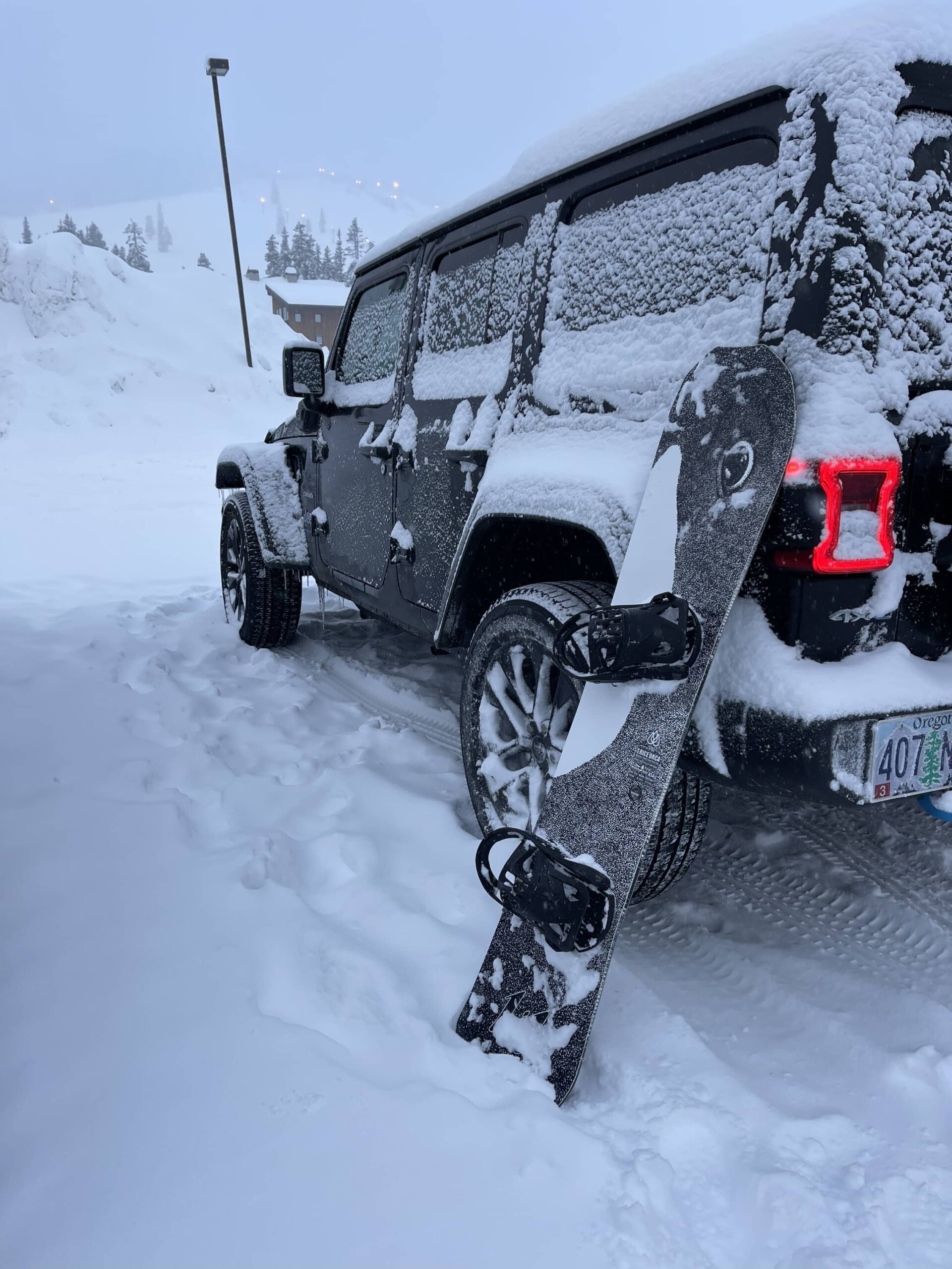
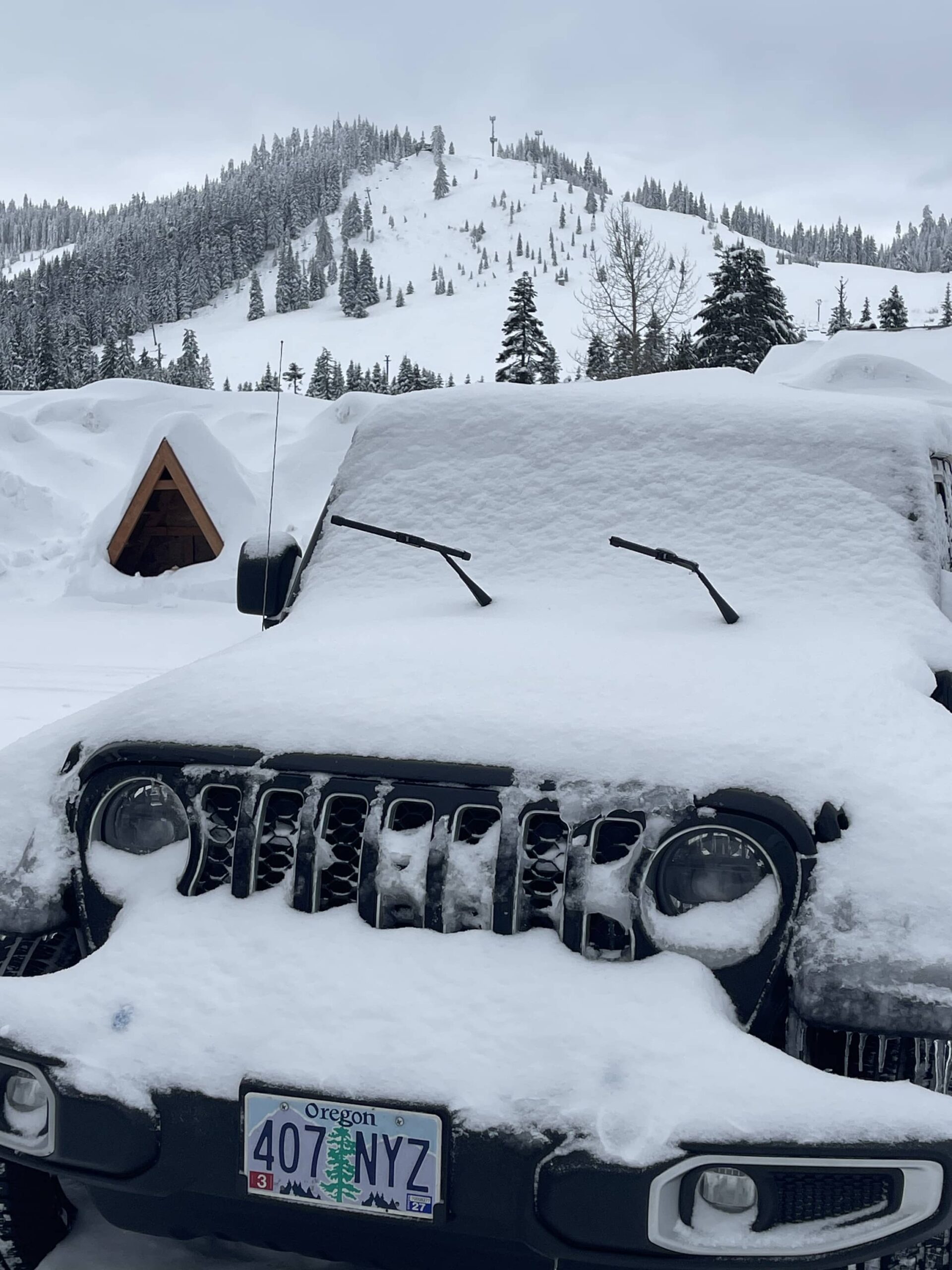
The airport arrival, shuttle to car rental, and actual driving out of Seattle went quicker and better than anticipated. Sorting out the vehicle was slower but fine. I needed winter tires, all-wheel drive, or preferably both or, again, I wasn’t going. I got the all-wheel drive in the form of Jeep Wrangler Sahara.
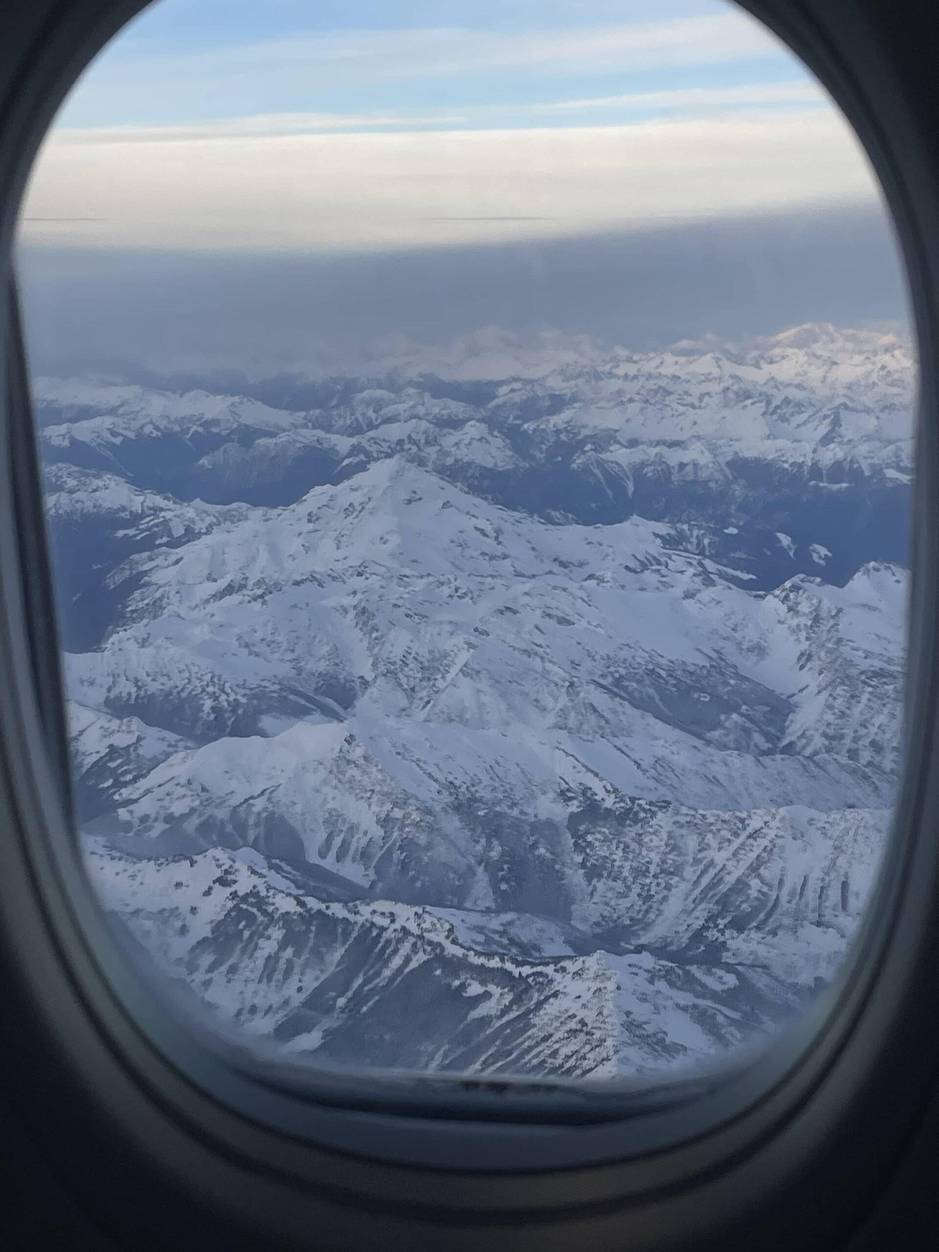
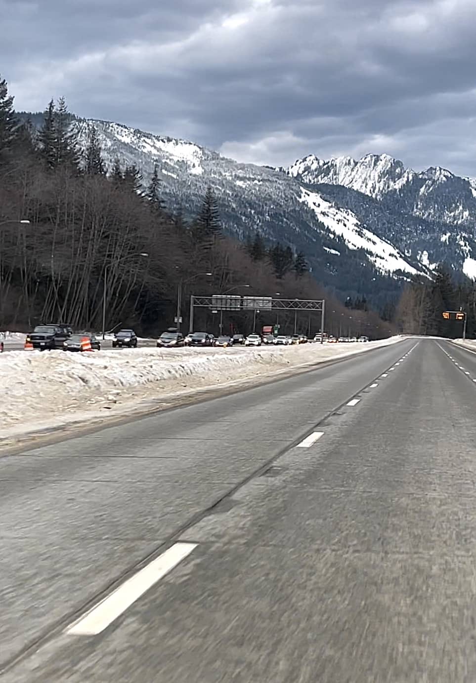
That vehicle steered squirrely, but braked very well. It also drove well on snow, and there was a LOT of it up there. The roads were snow covered before the storm and it just got deeper and messier over that night and the next day. In fact, and as anticipated, I-90 closed in both directions once the storm got intense enough. That mean no one was going nowhere far, no time soon. That suited me: semi-private snowboarding at the mountains – if they were open!
Same risk – if they didn’t get enough of the work force to the hill, some or none of it would be up and running. I got lucky: everything opened basically on schedule with small delays with only Alpental not open on day one.
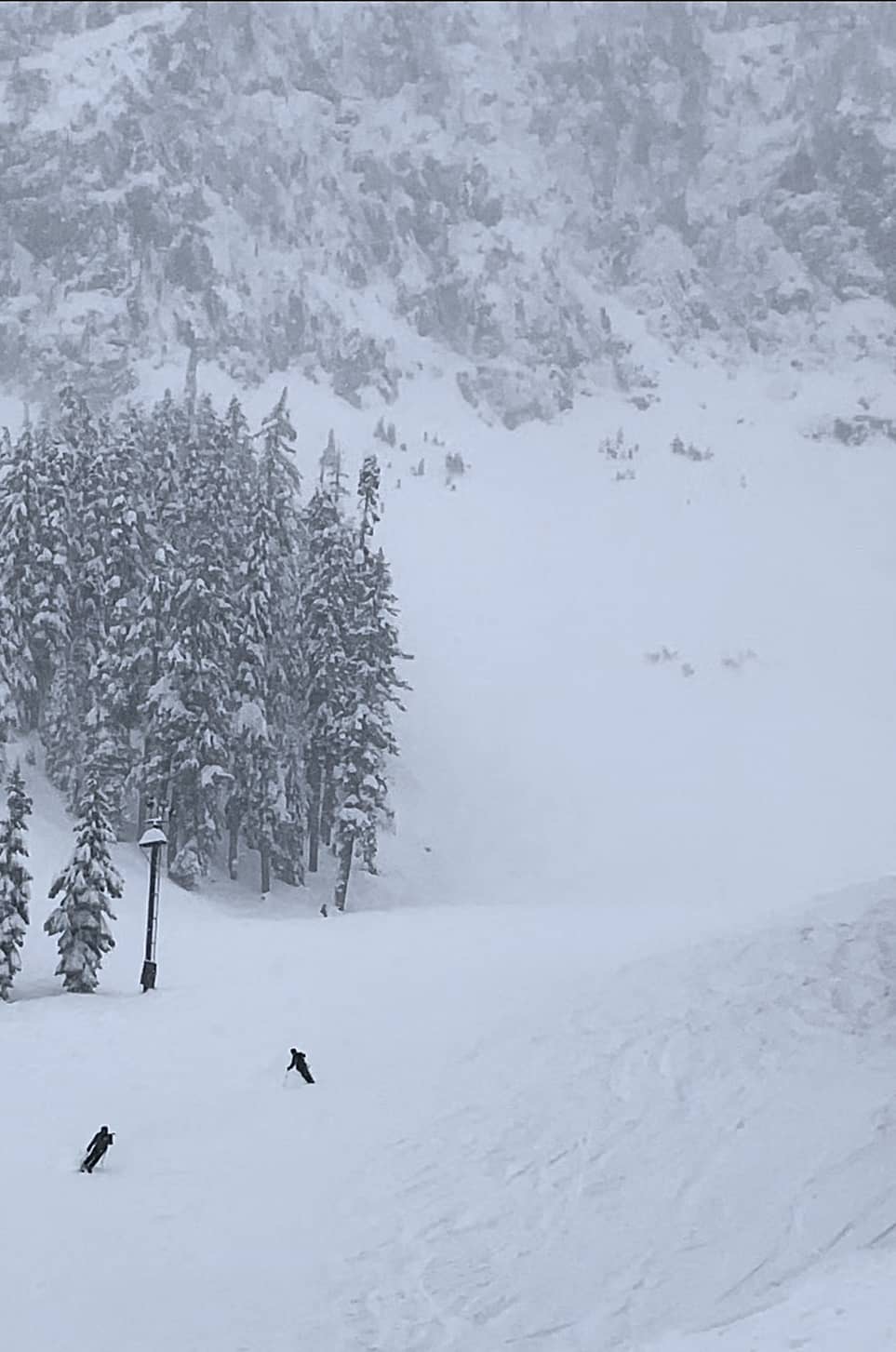
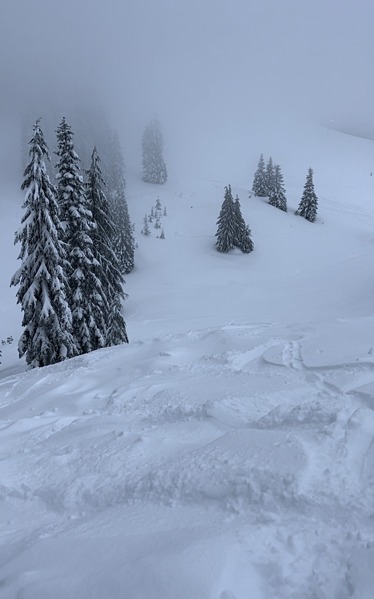
What was I hoping to do? Surf powder! And, I got the goods. I didn’t get 50-55″ by any means, but got enough: between 15 and 20 over the 3 full days I had to ride, on top of other high quality recent fresh I’d missed. It stacked up in places to be over 2 feet deep. For the 3 days, I rarely hit ice or hard pack. I almost always had soft to deep snow under my board.
The Summit at Snoqualmie is a mostly locals resort. People day trip or do several days from Seattle and other areas in striking distance. All the locals I met at the bar or on the lift spoke to me about Crystal Mountain, Mount Baker and Steven’s Pass. They all said I had to do those. But, there they were at Snoqualmie with me!
The first one to discuss this with me was the second person who…
- I met on the way to, or once at, a ski resort I’d storm chased, and:
- Rode a fish-themed board;
- Was Asian;
- Wanted to buddy up for tree riding!
Enter Dzon, a Seattle guy doing a half-day at Alpental on Thursday. He rode a Burton Barracuda, which I recognized in the lift line as I’d owned one briefly in the past. We got to talking, and next thing I know, he’s showing me around the best routes and stashes in the best order based on when they’d get tracked out. We exchanged numbers for future storm chasing endeavors after doing half a dozen runs over the course of the morning and early pm.
(Last winter, I’d met Jack on the ski bus from Salt Lake City en route to Brighton + Solitude. That was my first dedicated storm chase. Jack and I had coinkydinkily lodged at the same motel in SLC and were planning on hitting some combo of Brighton, Solitude and Snowbird over the next few days. Jack was riding a Rossignol Sushi. I never had one, but my first board was a Rossi Taipan with skulls, flowers, anchors, steering wheels, and a foundering tall ship with a large sea serpent breaking through the hull. Most complicated graphics ever. Turn the board at different angles, and the color changes as well as the graphics. Wicked. Jack and I will eventually hit SLC again at the same time as we keep in touch.)
The Summit at Snoqualmie has 4 different areas (some say 5). 3 / 4 are lined up and interconnected along State Route 906. One can usually ski back and forth amongst them rather than drive or take the resort shuttle. (The shuttle doesn’t run during the week, which was a potential logistical snag in my storm chase planning I hadn’t realized until after booking.) The 4th is a little further down the road and not connected.
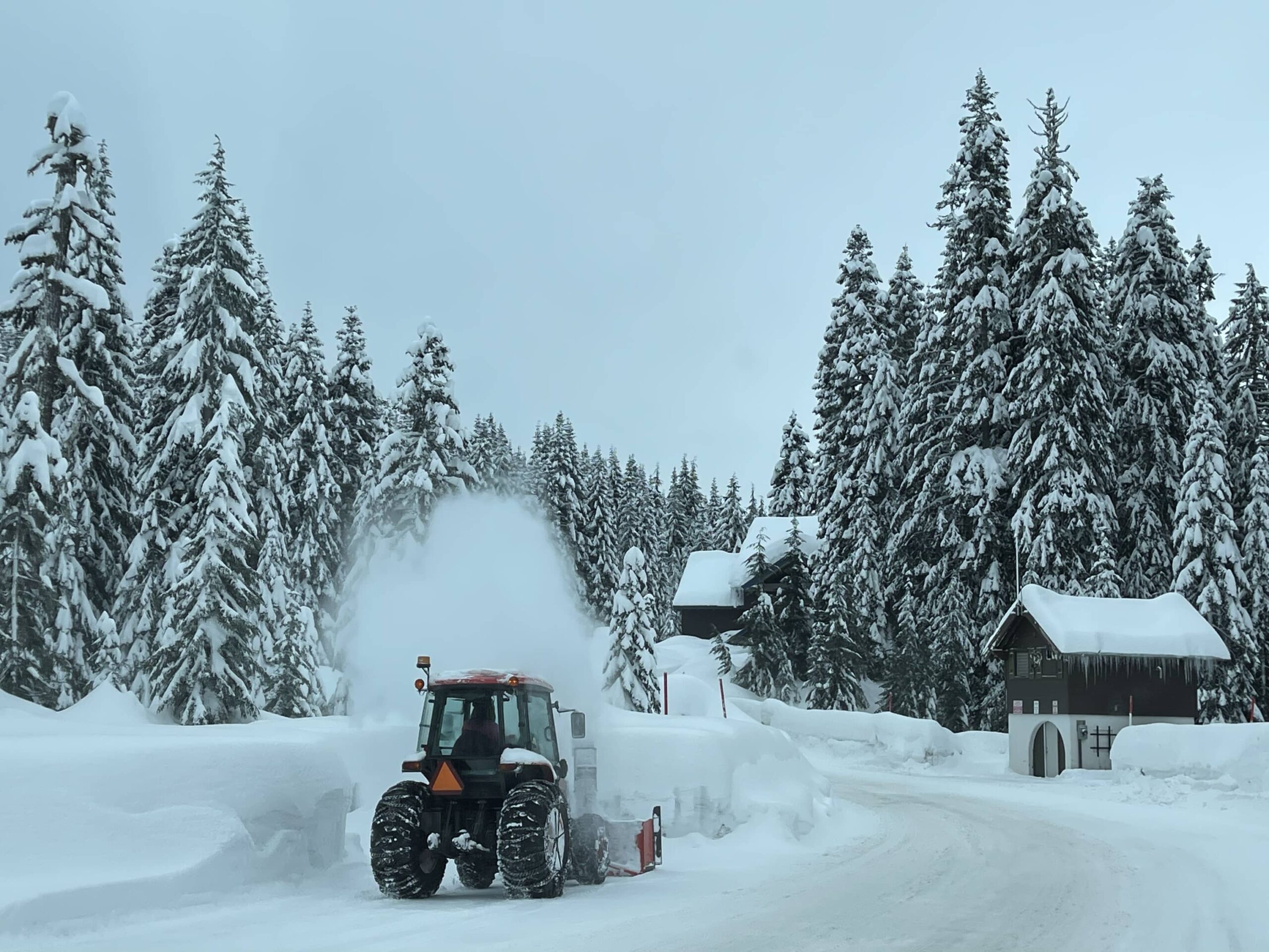
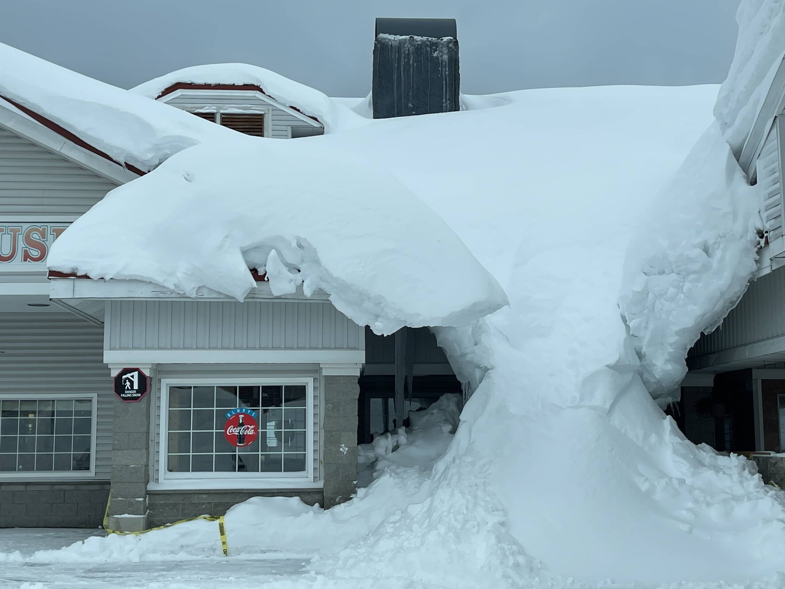
The areas are Summit East, Summit Central, Summit West, and Alpental. The first three are small hills that some would find too tiny for their taste. Alpental is larger, although not intrinsically large. Want stats? Ain’t got no stats. Didn’t really care. I knew the locations were large enough for me, and the main thing was timing good snow during the week. I don’t do weekends except in Vermont, and very carefully planned at that. Point is, they get snow at The Summit: somewhere in the neighborhood of 400″ of average annual. It dumps frequently. Sometimes the snow is wet and heavy. Sometimes, it’s light and dry. This time it started quite light (on top of a previous dump of light powder) and got a little heavier as the cycle did its thing.
So, how does one get around DURING the storm? Drive as little as possible, and only walk where it’s safe. Both were doable. On the first day, I wanted to hit Alpental, but it was closed either due to avalanche mitigation (yeah.) or lack of staff. So, I drove the short distance down the road to Summit Central. That was, of course, after dealing with the fact that my room’s fridge was more like a freezer and had frozen my milk for coffee and cereal solid. Slight delay getting to the hill; missed the initial queue so more tracks were made on the snow before my arrival.
Small problem; large amounts of powder remaining. Did a few runs there and at the Silver Fir area (has its own lift and runs). Silver Fir is the “5th” hill at The Summit. Central had a little of everything terrain wise – just as advertised. I stuck to runs where there should have been the most powder and/or ability to just plow pow. Being alone I stayed out of the trees other than cutting between a few right at the edge of trails were I could be seen even if upside down in a tree well with only the bottom of my board visible.
wha?
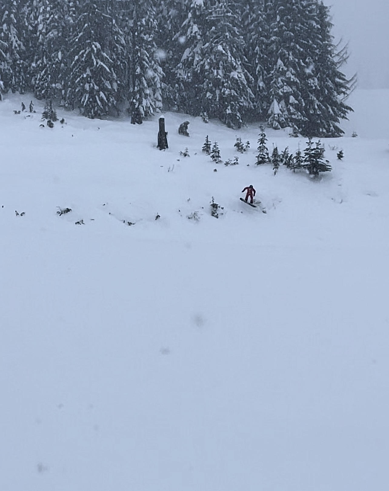
Tree wells! Serious trouble in some areas out west, and the Pacific Northwest is infamous for them. A tree well is the ring around a tree’s trunk that appears to be filled with snow, but only very loosely as the surrounding branches are widest at the bottom and don’t let as much snow get in (while trapping what’s there against the wind removing it). If you wind up sliding or falling into one, you can sink way down. If head first, you can suffocate. It happens every year. Deep snow immersion is a thing, and riding through trees, especially in the backcountry, has elevated risk. Even for experts. Only way to eliminate the risk is to stay on groomed trails. But, one can mitigate the risk.
After some runs in each spot and an early lunch break at Silver Fir (great little lodge), I decided to take an extended break before hitting Summit West at 2pm when they opened for afternoon and night skiing. That paid off with 3rd chair and untracked pow on a gentle blue with enough pitch to straight line the shallow pow (didn’t get as much here, and they had groomed after the previous dump). But, didn’t touch bottom! After a few of those runs I explored the two black diamond areas off to the side, each of which had trees as well as pow. This was cheating; shouldn’t really be doing trees without a partner. But, others were going through at the same time and the distances between open areas was short. Too tempting.
Day two was when I kicked things off at Alpental and met Dzon. Alpental is small but otherwise the real deal. Most of if is single black diamond terrain, with equal-ish amounts of blues and double diamonds making up the rest. Might be a green or two at the base. There are very few lifts, like at Revelstoke, but a fraction of the terrain as well. The first lift is a high speed and the second, often on hold or closed due to the terrain, is a slow double. So, lines at the Edelweiss chair are usually long. Didn’t get to go up there this time so no doubles for me on this trip. Maybe next time; definitely sometime.
The main run down the middle is a tough blue that, when there’s enough powder, would be a blast. I stayed along the sides and in the trees as much as possible with Dzon, and chose my tree spots more carefully when he wasn’t there. I put up with tiring traverses to skiers’ left to get into the single blacks and trees in between. For a snowboarder, it’s much harder to hold a traverse on one edge with no poles. (Backcountry riders often carry poles, and borrowing poles from a guide on a heli trip got me out of a tough tree run that was more like x country than downhill, so it’s worth considering.)
For the afternoon, rinse and repeat: Summit West. Did the same runs; there was some extra powder on top but not as much as the day before and it was somewhat heavier. Couldn’t get to the far left (Wildside) as the chair was delayed and then the main one was acting up. I got cold and tired on a long haul up with more time stopped waiting than moving. Disappointing but it happens.
Day 3: more Alpental in the morning, but only a few runs. I was running out of steam. The long traverses were getting to me. (Must get in better shape for this.) They didn’t get a lot of extra snow overnight, but enough for a topping off. That helped.
PM: got over to the Wildside finally! And it was worth it. The whole of Summit West is small, and Wildside is just one side. But, it’s higher and steeper with some variety to the terrain. Locals had all said it’s good, and they were right. I found my jam right away by not coming straight down under the lift but instead circling around back, where I found good trees to the left with a steep drop but plenty of room, and a visible end to it. Looked too flat at the bottom to continue riding out to the main slope, so I bailed early and traversed across the wide open bowl (for lack of a better word). This has irregular, wind-blown snow that was minimally tracked, so it was fun to play around in it on the way back to the lift. The beginning of this area, as hit on the way down, allowed cutting back across to the base lodge seamlessly.
I hung it up around 4:30 that afternoon despite night skiing being open until 9:30, conditions permitting.
Next logistic: getting home! All I had to do was leave early and hopefully not hit bad road conditions. When I planned this chase, I expected rain on Friday and possibly into my departure morning on Saturday. That would have been fine, but I didn’t even get that. The Interstate was open and unrestricted. Small patches of compacted snow/ice here and there but the few vehicles traveling westbound were flying. Not so much heading east from Seattle: Seattle was on its way to The Summit! It was very obvious. I was going the right way at the right time.
Dropping off the rental and airport logistics were a breeze. I enjoyed a solid if not spectacular fish and chips plus salad at 10:30 leisurely with a view out of the Olympic Mountains. Killed some time with a coffee and flew home. Only snag thereafter was waiting almost 1.5 hours for my snowboard case. I’ve had to wait about an hour or longer three times now at JFK. Will make the complaints, fight or not over the meager comp offer if any, and seriously try to avoid JFK on the return flight. The issue is that I book last minute which hampers my options. Waiting another hour to 1.5 after a great trip is annoying but a small price to pay.
Would I do this particular chase again? Yes, as long as the coast is clear to get to Snoqualmie before the roads might close. I was considering the vbastly larger Crystal Mountain for this trip but it looked to be getting considerably less snow than Snoqualmie this time around. I didn’t check what they actually got. But, Crystal was close to 100% open recently when I checked, and with over 5,000 acres, there would be untracked pow all day for days if one hunted for it. Snoqualmie has closer to 2,000, but it does fight well above its weight class – especially with Alpental in the mix!
“Dining”
Never did eat at the restaurant on site: the Summit Pancake House. On the first morning, I was going to try the pancakes but bailed when they couldn’t tell me whether they had real maple syrup or just the ultra-processed shit. Not paying good money for crap. That soured me on trying them for dinner – if and when they were open for it. So, I ate my muesli that I’d packed and made my own pour-over coffee.
Lunch: on the hill day one at Silver Fir. They had nice looking lodge food, and their terriyaki chicken with broccoli was excellent. Day 2: ? I think I just tossed down some cereal. Can’t remember day 3.
Dinner: 3x at Commonwealth across the street from the Summit Inn. Looked good, came recommended by locals, and it didn’t disappoint. Bar scene was nice and tables were mostly longish community seating with half of it high tops near the bar area. Food was solid; good beers. Didn’t dive deeper than that. On the first night they said they were indeed open before I strolled over, but added “as long as the power stays on.” So, I hustled out the door.
Back-up/emergency plan: Chevron station next door to the Summit Inn almost never closes, and has snack food plus some frozen pizza and burrito stuff. Something constituting hot food to tie one over. Next time, I’d shop better in Seattle on the way out as there’s a Town and Country (Basically a Whole Foods) that’s an easy, quick detour with mini-mall parking. This is where I did my quick stop completely by accident: once I heard the lodging’s restaurant was closed, I pulled over to find something and got lucky. Have to take the luck out of it next time.
Boat delivery, storm chase – more similar than not in the planning stages. I’d rather mess up the planning on a storm chase than on a delivery however. Being stuck at the lodge or the airport is safer than being caught in an actual storm on a boat.