Did you learn how to sail on an Olympic class sailboat? Probably not, but untold thousands did!
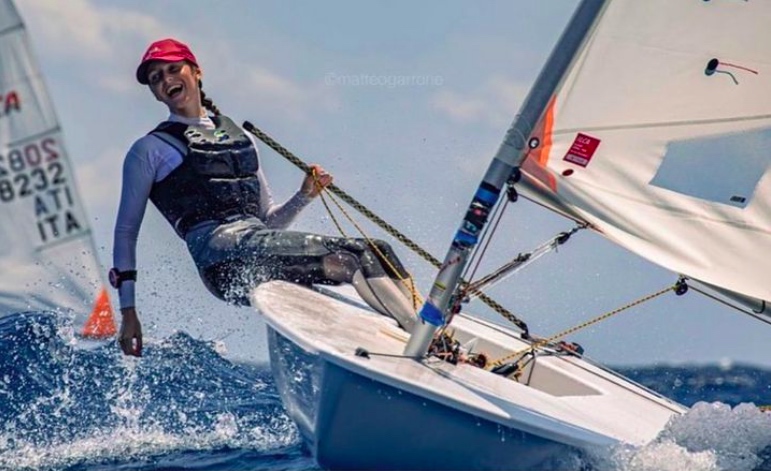
A Flying Dutchman. You can see the driver. Where’s the tactician, ballast, spinnaker magician, etc? Feet firmly planted on the rail of course with the rest out on the trapeze! This 20-foot, 2-man class is a beast. No wonder Paul Elvstrōm loved it. This one was screen-captured from a clip on Instagram, via @giornaledellavela on their feed.
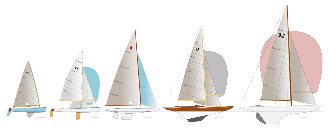
While searching for some sailing stats (Ted Turner’s best result in the Flying Dutchman class), I came across some kewl graphics on Wikipidia of the boats raced in certain Olympiads. I’m sure there are others, but I stopped at three.
Who in the group has sailed an Olympic class boat (or board)? It’s something. Not all excellent boats make it to the Olympics… but all Olympic boats are arguably excellent. And, some of them are versatile. The Soling? One of the most heavily used designs for adult sailing instruction in the US in the past (and still in use today). My dad’s sailing school (New York Sailing School, now out of business), taught untold numbers of adults how to sail on them. Laser? Found all over the world for beach resort rentals, junior training, and all levels of racing.
The sailboat classes of the 1964 Olympiad: Finn, Flying Dutchman, Star Dragon, and 5.5 Meter. None remain today, and there are no keelboats now either.
The first graphic shows the 1964 lineup. Why ’64? Year I was born, and also the Olympiad I thought Turner either sailed in or campaigned for through the trials. (Still can’t verify if he was in the trials or on the Team; found conflicting info on whether he ever won the Worlds in that class.) Turner was one of the most prolific and accomplished sailors ever to race. Inshore? Flying Dutchman and 5.5 Meter chops (world level if not actual world champ, and he might have won a 5.5 Meter Worlds. Americas Cup? Won that. Offshore? How about he won the Fastnet in 1979, when 15 people died and many boats had to be rescued or at least didn’t finish?
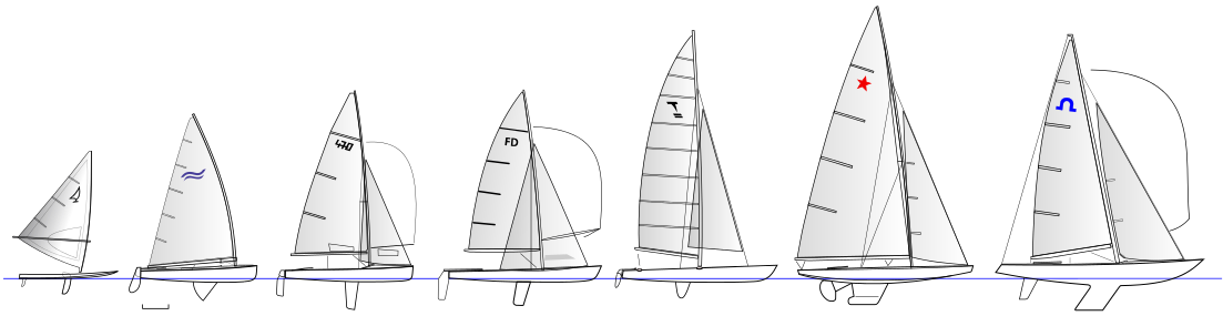
The classes of the 1984 Olympiad: Windglider (not Windsurfer), made by Dufour; Finn; 470; FD; Tornado Catamaran; Star; Soling.
Next one: 1984. Why? There was a graphic for it, and it was the year Paul Elvström just missed bronze in the Tornado Catamaran. Why would one care? Because he was 53 at the time, and his teenaged daughter was crew! Elvström, lest I let anyone forget, won multiple Olympic gold medals in the Finn and was European or World Champion (or close) in a number of other classes. Elvström, a Dutchman, was competitive in the FD. 1984 was also the first Olympiad with female sailors. Only two, but at least it finally started.
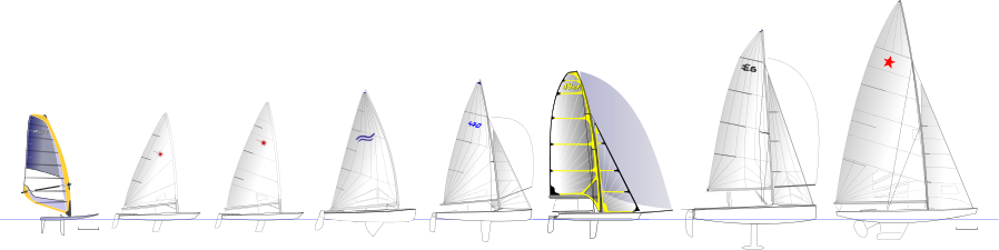
The 2012 Olympic classes: RS:x, Laser Radial, Laser, Finn, 470, 49er, Elliot 6m, and Star.
Finally… 2012. The venerable Star Class saw its last outing. At the Olympics, anyway. It’s still a super relevant and competitive class, as evidenced by the Star Sailors League invitational regatta featuring champions from many classes and always a tight tourney. Past Champions at the World and Olympic level include Lowell North, Dennis Conner, Robert Scheidt, and many other notable names. The 2012 Games were the last to have keelboat classes race.
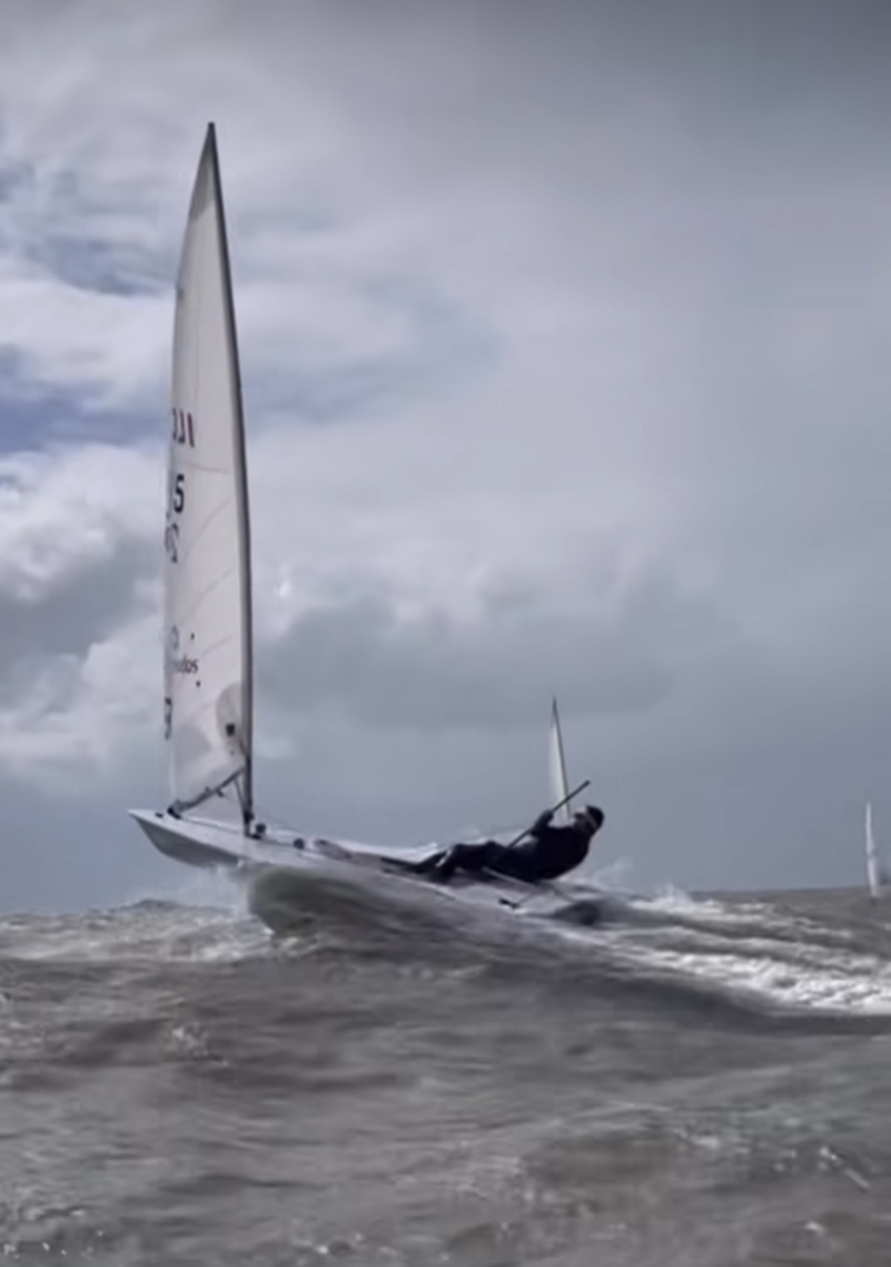
Which Olympic classes have I sailed? I have a lot of time in Lasers and Solings, and an outing or three in Stars, with racing from the most local of club levels to regional regattas such as the East Coasts. I haven’t sailed any of them in awhile. I miss the Laser the most. It’s the simplest to get back into, so who knows. (For racing purposes, due to boring legal stuff, it’s referred to as the ILCA Dinghy, and the familiar laser logo is gone.) Most people ought to spend at least a little time in a Laser. To paraphrase that line from Risky Business, “there is no substitute.”
“Laser: there is no substitute.” Kids can bop around in them; couples can canoodle. Having said that, they’re mostly raced by one person at all levels of competition. This guy? @stefopeschiera of Peru, a top contender at the world level, in full send mode. This is also a still grab from a clip on his Instagram.
Our Director, and most prolific instructor, scored 3.92 out of 4 so far in 2022! THIS is how we teach people how to sail in Brooklyn and City Island.
Year to date, 2022: Captain Stephen Glenn Card, our Director, “Dockmaster” and author of our Blog Rants, has a near-perfect record thus far. Unless there’s a seriously negative ballot-box drop in the next few week, which basically can’t happen, that’s that with that.
Captain Card explaining the gift of lift – or, how sails work most of the time. Quick shoreside preview before going out and doing it for real.
And, we’re not talking about an average of 1 or 2 reviews. 20 were submitted, which is a meaningful amount statistically (and particularly in our industry.)
How does this work? ASA sends a confidential email survey to all students who have course certifications processed. Some students respond, and answer key question about how their course went. Their responses are strictly confidential: schools and instructors never know who said what about the where now. Instructors can only see how many reviews were done, and when, plus a breakdown of scoring for each question (not each student).
Dinghy Captain (every trip has one) Steve clowning for the camera while simultaneously towing a stranded dinghy from another cruising yacht (the little outboard that couldn’t). Off Marina Cay and Scrub Island, BVI, literally days before the pandemic lockdown in ’20.
And, ASA issues Instructor of the Year awards based on these. Assuming an instructor gets a minimum number of responses (ASA doesn’t’ disclose what that is), they’re in the running based on their cumulative score for the calendar year.
Will 3.91 be enough to win one for our Dockmaster? Doubt it; he’s always scored quite highly and hasn’t won one yet. So, the margins at the upper end are tight. But, that’s splitting hairs. It’s like when the final race in a regatta comes down to a few top sailors, and they all finish within a few places of each other in the final race in a large fleet. Someone gets the win, even if there’s really no difference in their overall performance. But, Steve hasn’t won. (Yet?)
Bareboat 104 course; Long Island Sound. 20-25 knots (building to 30 by the time we approached home port) and a long haul back to City Island from Oyster Bay. Beat back, or beat it.
What does this mean to students looking for a school to learn how to sail, or take their sailing up to the next level? As the owner, and most prolific instructor of late, top scores translate into a top-tier program. Our Director sets the pedagogy of the school, plans the places and the props, and keeps adapting the program based on results and feedback. And, the weather! As that’s been changing, schools must adapt or decline.
“My dad started a sailing school back in 1968. He sold it in the late 80’s. Eleven years later, I started a new school. I modeled it after his program. Yes, I changed and tweaked, but cautiously and creeping, not with reckless abandon.
The new and subsequent owners of the school dad sold? They took something that wasn’t broken and tried to fix it. It took awhile, but the more they messed with it, the worse it got. They ran it into the ground. Ultimately, they just abandoned the boats. Sad.”
Captain Stephen Glenn Card
… who shall remain in first person mode for the remainder of the Rant. I guess at that point, it wasn’t fun for them anymore. True, it was a business. But if this type of business isn’t fun, you’re not doing it right. To quote one of the most highly respected snowboard instructors at Okemo Mountain resort when I was part-timing there…
“You’re going to be safe, and you’re going to have fun. And, maybe you’ll learn something!”
spoken at the start of a beginner group lesson
I’m afraid I don’t remember his name – only his face. I’m bad that way. Not so hard with groups of only 3 people max for our learn-to-sail courses (and 4 for cruising). But, when teaching up to 8 students in a group snowboard lesson, with faces often covered, and no name tags, names get lost. Yes; I taught snowboarding part time for 3 winters. It was mostly to prove I could teach better than I’d been taught (only 2 years before). It was also for instructional cross-training, getting good as fast as possible, and a free pass to a quality mountain. I didn’t do it for the money; it’s safe to say I lost money on this deal.
In my first lesson, I felt vindicated on the teaching part. From day one, supervisors were watching me intently, clearly wondering what I was doing and why. But, they just watched. My students didn’t fall (certainly not a lot, and some never fell). And, the feedback I was getting from veteran instructors who inherited my students for their next level, and later my supervisors, was super positive.
This one from our inaugural Kid/Parent cruise in the Virgin Islands (BVI), with two moms and 4 kids between. Wildly successful!
Did I figure out a new model for how to teach snowboarding? No. I picked it up from a video series! Anyone who’s even curious about maybe learning to snowboard should watch this. It’s entertaining. Highly qualified instructors, one of whom was a pro rider for Burton for a spell. Brother and sister. Their system made sense from my own experience trying to learn, and from their presentation. It wasn’t a complete departure from the conventional progression, but they made key changes in the early stages that appeared to make far more sense. So, I did it that way. It’s not what the mountains seem to be doing, and that’s why they have students falling all the time trying to learn (as opposed to occasionally). Have an open mind, and when stuff doesn’t make sense, consider rejecting it.
It took me another few years to accept something another veteran instructor said one day, but due to his experience and the respect he commanded, I kept thinking back on it. Turns out… he was right. And, he was voted Instructor of the Year by his peers! But, whether I ever earn that in sailing circles doesn’t really matter. Delivering an excellent lesson, every time, is the goal. The proof is in the people when they can sail off the mooring, do all the skills, and sail back – without brakes, without a reverse gear – and stop their boat.
And, we do it for them every time.
Live 105 on Zoom, November 15, 2021. Pets and drinks are welcome. We have fun! But, we also get shit done. It’s quite efficient especially as no one needs to travel. We were the first school to switch to Zoom for coastal nav courses when the pandemic hit. None of our local competitors did this; we have yet to confirm any school that actually has. In-person 105 courses are likely to resume this winter in addition to Zoom
A skipper/owner went overboard and died – because he wasn’t tethered to the boat and wasn’t wearing a life jacket or PFD.
That’s essentially the story in a nutshell, but the commissioned report is still way worth reading for more detail and education .
Offshore sailing, and especially distance racing, augments the normally slight risks of sailing for a few key reasons:
When conditions worsen the waves are larger
Safe port is nowhere nearby
Everyone gets tired
Help is usually nowhere near
Call me a sissy, but I just don’t do long distance ocean sailing. I grew up watching the news about the Fastnet Race tragedy of 1979, and that was the end before the beginning could ever happen. Every now and again, I’d read about another tragedy at sea. Eventually, the Sydney Hobart happened as well. Commercial vessels lost; cruising sailor basically run over by large ships. A coastal delivery (not even a race) where the life raft was taking water and the sharks were at them – and that was the US Eastern Seaboard!
Of course, these cases are very few and far between -but that has basically been enough for me to not go. Yet. Maybe I will. But, you better believe it won’t be before copious quantities of research and prep, especially vetting the vessel and people I’d be going with.
Here’s the report from US Sailing on this past season’s tragedy in the Newport-Bermuda Race. The lessons aren’t just for long distance races, so read up!..
Yes, we’re still sailing… but they’re blowing snow on the mountains while those who’ve learned how to sail this season wonder when to switch gears!
The Mary’s of Miramar, as we affectionately call them, taking their final lesson with us down at Miramar Yacht Club in Sheepshead Bay – our new branch. They’re aboard an Ensign, and the boat in the background is also an Ensign. October 6, 2022!
Soon we’ll be switching gears – Live 105 Coastal Navigation courses (both in person and on Zoom), and our Virgin Islands (BVI) trips for sailing vacay courses. And, snowsports!
Skiing at Mt. Zion, Michigan, October ’22! This is a still grab from a clip reposted on Snowbrain’s Instagram. Click it to play!
Each fall and spring, people who sail and also ski or ride sometimes have a choice to make: slide through water, or slide on snow. That time is just about here in the northeast. Killington began making snow awhile ago, and while not open yet, it’s probably just around the corner. They often start with a few trails in late October, and host a world cup women’s ski comp each Thanksgiving weekend.
And, there was a dump in the midwest already! Michigan got it, and they’re already doing it. Much more is coming out west shortly – as in a few days.
Precipitation modeling chart/map, as posted by Snowbrains on their Instagram. Winter is coming. Fast!
How long does sailing go on in the Northeast? As long as you like, really. Ever hear of ‘frostbiting?’ It’s racing during the winter, usually on small boats and dinghies. I started doing it in high school and stopped during college. I decided it was insane. It’s much better now with better outerwear options, and also because self-rescuing boats are more commonly used than before. I used to race Dyer Dhows, which are still popular in parts of the Northeast including Western Long Island Sound.
The Dyer is basically a bathtub with a sail and fills up with water if you flip it. Positive foam flotation prevents sinking, but a swamped sailor needs rescuing by one of the fleet’s chase boats before considering getting back out. A Laser, on the other hand, can be flipped right back up and back into action with minimal fuss. If one is fast, and stays on the windward rail, they might not even get wet. But, it’s a boat that throws up spray so in any wind, one gets wet just from that. Dry suits are in order here.
“Laser: there is no substitute.” – Captain Stephen Glenn Card, former Laser racer and lifelong enthusiast. No, that’s not him sailing. It’s a recent regatta snap posted on ILCA Sailing’s Instagram. (International Laser Class Association)
How about bigger boats? Keelboats don’t easily capsize, and they’re drier. Many people extend their seasons well into the fall. At Miramar Yacht Club, which hosts a branch for our school in Sheepshead Bay, Brooklyn, some members keep their boats in all winter and sail from time to time. The Club is open all year, despite launches being hauled out for the winter. The Bay is super calm, so it’s reasonably safe to just row out to one’s boat if weather permits with a life jacket on and others around knowing what you’re up to.
Around 12 years ago, I was living in Greenwich CT. I was in a super kewl and fun/funky apartment complex right on the water, at the end of a peninsula and street, next door to Indian Harbor Yacht Club. Fancy club, and expensive, but a sailors club. The main thing they needed to know before one joined is that you actually were into sailing and active at it. They didn’t care if you had a lowly J/24, as long as you sailed it. They had a frostbiting program in the winter, on Dyer Dhows. And, it was open to non-members. I was very close to just joining that program, as it was happening almost in front of my living room window.
A Dyer Hair Day? I do note the helmet on the sailor to the left… And while two of the Dyer Dhows here have no names, punny plays on Dyer and winter weather are the norm. Photo from Mamaroneck Frostbite Association’s site.
And then, I took a snowboarding lesson. I was a newbie; never did it before. I hadn’t skied since I was a wee boy either, and skiing and snowboarding are very different skills with almost no overlap, so no muscle memory, etc, to dial up. “That’s that with that,” I said. I’d never frostbite again. I wouldn’t have time. Snowboarding is my winter jam. But transitional fall sailing? One of my favorite ways to play!
Pro tips for fall sailing:
Dressfor fall, but be prepared for summer – or vice versa. You can still easily get sunburned, especially with clearer atmospheric conditions when it’s from the northwest. Bring both a warm hat and a sun hat. And, sunscreen for exposed spots.
Don’t dehydrate. Wind and sun do that, even when it’s cooler. Bring water.
Bring a hot beverage in a thermos or some soup in case you get chilly and need a warm-up.
Do you ski or ride? You can bring those clothes, minus helmet/boots, and you’re in good shape!
If you’re skippering the boat, beware the setting sun. It sneaks up on us early now; we’re conditioned to sail into a sunset that is much later in the summer. Don’t get caught with dimming light and dropping temps when you have a ways to go – especially if the wind picked up from the afternoon sun and hasn’t died down yet.
My biz card for the side hustle awhile ago: teaching snowboarding part time while also running a sailing school and its winter nav classes and Caribbean sailing vacations. Whew! Busy boy. I don’t teach for a mountain any longer, but occasionally offer a private lesson. (Certification lapsed for non-renewal just for full disclosure. Easy to renew if needed: one continuing ed clinic and pay a season’s back dues!)
As well as being a certified sailing instructor with ASA since 1983, when they started, I was a Level I snowboarding instructor with AASI/PSIA for few seasons much more recently. I got certified almost exactly 2 years from when I first got on a snowboard. Not because I was prodigy, but because I had a teaching background and had stubbornly applied myself on a board to get as competent as possible as early as I could. I didn’t even have a goal of teaching – it didn’t enter my mind until I was getting ready for my second full season of snowboarding, and I saw some instructor recruitment info on mountain resort web sites. “You don’t have to be the best skier or rider on the mountain to teach. You have to be good with people, enthusiastic, etc, etc.”
An idea was born. I pursued it. I was hired to teach at Okemo in Ludlow, Vermont, to my great surprise (more on that story in another issue of the Blog Rant.) And, I brought back a lot of instructional cross training and teaching methodology to the Sailing Center. More on that later, too.
Our Director & Dockmaster, Captain Card, taking a break from navigating Memorial Chutes or Here Be Dragons (some navigating, eh?). They’re adjacent, anyway, and just like on the water, there are not road signs in gate-accessed sidecountry in the mountains. Solitude Mountain Resort, Utah, February ’22.
I occasionally have free time to give snowboarding lessons, and I always enjoy it. If you’re interested, or know someone who is, shoot me a message by reply to this or from the contact page on our site (in the main menu of every page and post).
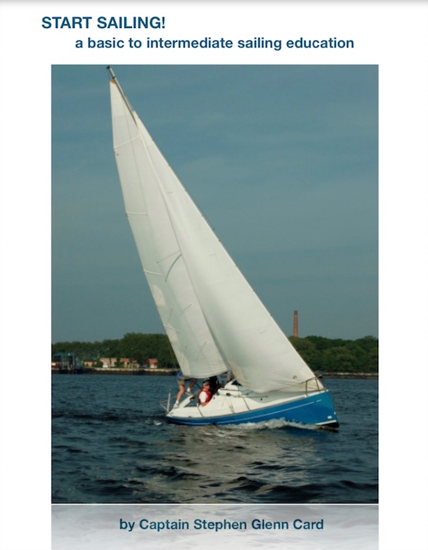
We teach newbies how to sail on two types in two locations. These sailboats are very different, yet both deliver top notch learn to sail lessons.
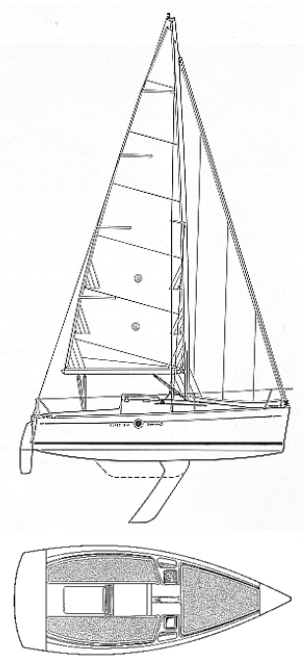
One of our Beneteau First 21 sloops as seen on the cover of our new learn to sail textbook.
Which boat to play on today? Depends where you sail with us.
There are several types of boats we use at our City Island home branch, where we’ve been sailing on and off forever and uninterrupted since 1996. For learn-to-sail courses, it’s the Beneteau First 21.0 sloop. It’s a very modern design – light weight and responsive, maneuverable, ergonomic, and with twin rudders. Designed and built by the world’s oldest and largest maker of sailboats, it’s the only sailboat design ever endorsed by a national sailing school organization.
ASA did a collab with Beneteau and their modified version became the ASA First Trainer (and subsequently the ASA First 22). Same body (hull), keel, rudders, sailplan, etc. Only real difference was to make a smaller cabin and longer cockpit to better reflect sailing classes. (Wouldn’t really benefit us much, as we’re one of the few schools to limit learn-to-sail classes to 3 students per boat.)
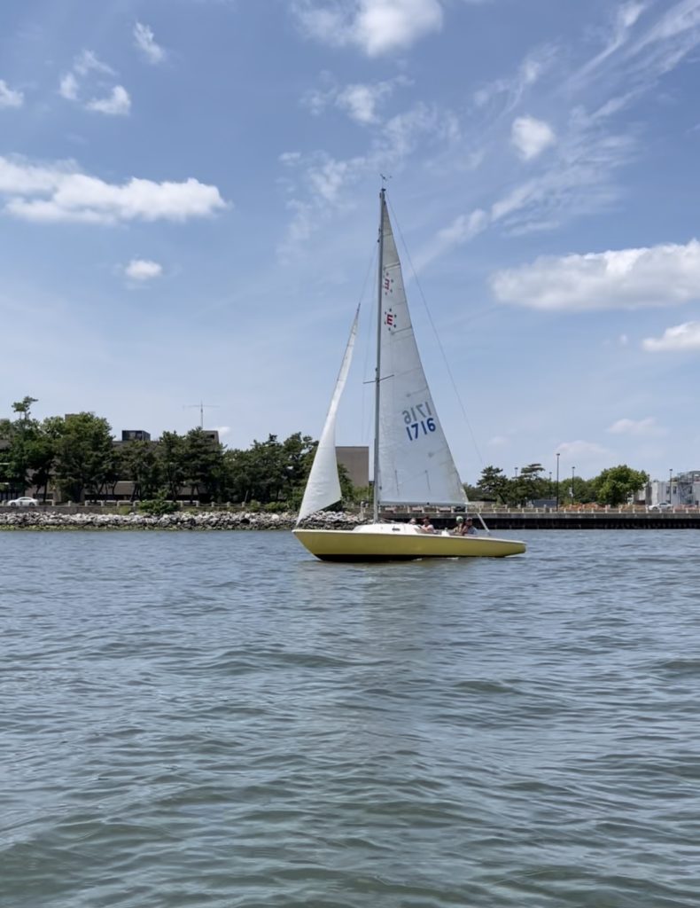
Sail an Ensign; see an Ensign. Or, many; they’re out and about all the time! From our Sheepshead Bay location this summer.
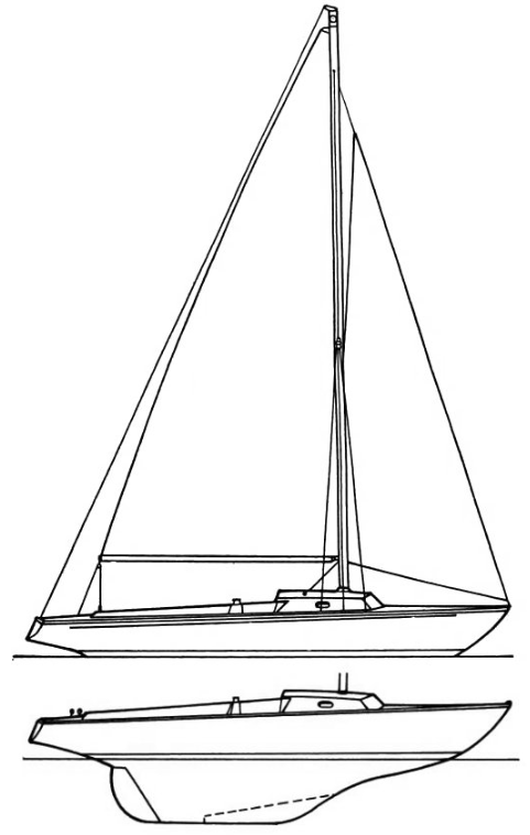
Fast forward to 2022, when we re-wound to a boat designed 60 years earlier: the Pearson Ensign, from venerable naval architect Carl Alberg. it’s what they sail at the Miramar Yacht Club. That’s in Sheepshead Bay, Brooklyn, and that’s where our second branch is. There are almost 20 Ensigns at this Club, but also many other daysailers and cruising designs. The Club has been around since the 1930’s and was incorporated in the ’40’s. And now, we’re at both “Bookends of the Boroughs.”
The Ensign is very different from the Beneteau. Traditional full keel, rather than a fin or long swing keel (the latter of which the Beneteau sports). Single rudder than hangs off the back of the keel, rather than a modern spade rudder. No real cabin; just a small ‘cuddy’ with room for two diagonal berths and sail storage. Low to the water; a little wet when it gets wild on the waterway with wind and chop. Very long, deep bench seats in wood (the Beneteau has excellent ones as well but fiberglass). Very large mainsail; two sizes of jib/genoa. (Beneteau has a fairly even distribution between main and 110 genoa, to which we add a storm ‘jiblet’ courtesy of the classic Rhodes 19 class, as well… we had two from the past and they worked. The Ensign has seen a resurgence in popularity whereas most of its contemporaries and next-gens have faded into obscurity. It’s also in the American Sailboat Hall of Fame, along with the Tartan Ten. And, Miramar YC has its own Tartan Ten as well as Ensign!
Saturday, September 24: aboard an Ensign off Breezy Point near Sheepshead Bay. Day 3, Start Sailing course (ASA 101).
We were the 1st school to use the Beneteau 21 for learn to sail. A few other schools have been using the Ensign in recent years, and who knows how many did over the decades. They both work extremely well for the purpose, despite the large differences in their designs.
We do strictly sail in our Start Sailing course (ASA 101, learn to sail / Basic Keelboat). No motors – except on the launch that drives you the short distance to your moored sailboat. Then, we keep it real. No brakes; no reverse. You get to use forward (trim in the sails and angle the boat properly). You also get to go into neutral (make the sails flap like flags, or luff, but easing the sails and angling the boat enough into the wind). That’s it! Do those things with the right timing, and you glide to a near or complete stop at the mooring ball.
Simple. Also, simply difficult. It takes only a shot or two to start to understand it, but it takes a lot of practice to get consistently good at it. Expect to have many of your stops wind up short, or to happen well after you want them to. Don’t worry – you’re surrounded by something soft: water! And, yes – boats. But we teach you how to start moving again on demand.
Blueprint of the Beneteau First 21.0 sloop including the largely irrelevant cabin configuration. Note the long, high-aspect keel.
One concern we had before trying out Sheepshead Bay was the proximity of the moorings to each other (on the tight side), and the narrow nature of the small Bay. We also wondered if the current in Rockaway Inlet, just outside of the enclosed Bay, would be too much at times. Not so, said the Commodore, David, who sails both an Ensign and a Cheoy Lee 35. The Ensigns overwhelmingly sail off & on, and also out & in. This entire season, I saw an Ensign under power only once or twice: one time the main was up and drawing and I wasn’t sure if the electric motor was also in play.
The Pearson Ensign. Note the full keel and attached rudder.
Head to head comparison…
Beneteau pros: super responsive; light on the helm; mainsail easy to handle; lifelines going around the boat give a good sense of security going forward.
Ensign: super stable; has great momentum; very predictable response; huge cockpit helpful for groups; wide foredeck offsets lack of lifelines.
They’re both excellent for sailing off and back onto moorings, and for teaching people how to sail a boat. Which one will we use today? The one that’s where you want to sail!
Those aren’t our words, but we could well have spoken them ourselves – and they also apply to the East River and NY Harbor. And it’s why we would never have you learn how to sail there.
There was a fatal accident on the Hudson recently, near the Intrepid aircraft carrier and museum. An adult woman and a child died when a motorboat overturned. NY Waterways (ferries) were on scene quickly rescuing other passengers.
On any very busy waterway, there will be an occasional accident, and more rarely, a tragedy such as this. But, some places are just less suitable for recreational boating, and all the more so for beginners. The Hudson River, where a number of sailing school/clubs operate, is one of those.
So are the East River and New York Harbor where the rivers join it.
The quote in the title? Words spoken by Inspector Anthony Russo of the New York City Harbor Unit after the accident. Three other people were critically injured in the accident.
One accident by itself doesn’t make an area inherently dangerous. It’s the potential for other accidents, or how much effort goes into preventing them, that matters. In these areas, one contends with…
strong currents
narrow waterways
erratic windshifts
high speed commuter ferries
cruise shiops
huge medium-speed ferries
any number of other large commercial vessels
Plus, the water is basically so dirty that you can often smell it as you get within half a block or so. Ugh.
So, why learn to sail there? Because you can?
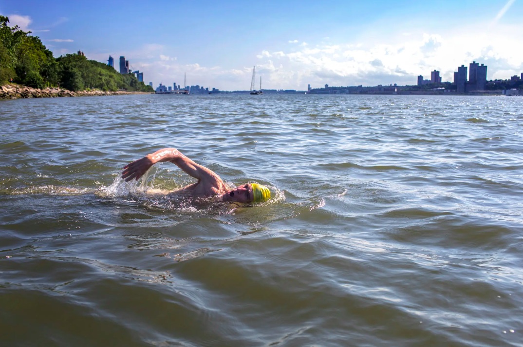
There’s a guy who, as of 2018, regularly swam in the Hudson about two blocks from where I live. He was featured in the NY Times; link below (photo here). Note the off-color water. He swims there to promote that one can, and to increase awareness and access. But..? Because one can? Should one?
Intrepid swimmer on the Hudson. Chang W. Lee, NY Times, photo.
There are so many other places people can safely and enjoyably swim – and sail. Some of them are in NYC. Some off them are further away, but accessible by public transit and car.
The Hudson, East River, and NY Harbor offer no benefits to sailing – or learning how to sail – other than potential proximity to ones work or home. But why have a short commute to a crap-ass location? And, we’re talking literally – there’s sewage being pumped into these waters! Sure, much or maybe most of it is treated. But, there are frequent overflows of untreated sewage. Still smells. Not sanitary.
On the other hand, our Brooklyn and Bronx locations at Sheepshead Bay and City Island have swimmable waters with public beaches – and lifeguards – nearby. And, fish. And, birds. And the waters are hospitable to sailing and learning how to do it. Our locations have five yacht clubs with mostly (overwhelmingly) sailboats in their fleets. Hudson? East River? NY Harbor? None. Nor do they have college sailing teams. Ours do.
If you have to hold your nose to go to the waters, or are afraid to get them in your eyes, or if you read too often about accidents on them in the news, or if public officials say they’re basically dangerous… Why? Just, why? Ride the subway or your car a little longer (if at all), and enjoy the sights, smells, and success of sailing where NYC ends and sanity begins!
Our first class there taught them how to sail a boat in Brooklyn – or anywhere else.
Our first Brooklyn schedule is basically in the books. We did days 1 & 2 (out of 3) at our new location in Sheepshead Bay hosted by the Miramar Yacht Club.
So..? How did it go?..
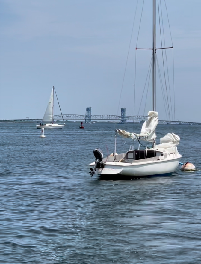
In that pic: the lucky first three students at our new Brooklyn location in Sheepshead Bay. That’s the Marine Park Bridge in the left background connecting Flatbush Avenue to the Rockaways, and Breezy Point behind the sailors.
Exceeded our expectations. Not by much, as they were rather high based on due diligence, it not being our first rodeo, etc. Probably just the weather: as that’s so unpredictable these days, we were pleasantly surprised at the pleasant weather. This area gets a more reliable afternoon sea breeze than anywhere else around here – definitely a check going in the ‘PRO’ column. It was dead in Western LI Sound on Saturday afternoon, so our 103 course in progress there reverted to maneuvering under power. No need for motors at the Gateway to the Atlantic, however. There was even a Pearson 30 sailing out under main alone. Impressive.
In that pic: a Pearson 30 in the background, which sailed out of the Bay under main alone. In the foreground is the Amanda Rose, the Ensign sloop we were aboard for the course.
The ‘CON?’ The super-close deli/food mart is a bit slow for banging out the lunch orders. So we learned we’ll have to call those in, cross the street, and pick them up. Coffee? Decent (by our Dockmaster’s rather high standards). Quesadillas? Great. Overall, lunch experience def not a deal breaker. We have yet to explore what else there is to try around here. (BYO always possible.)
The Bay is super protected, so there are never large motorboat wakes rocking the boats when boarding, rigging, departing, or returning to the mooring. We came and went numerous times each day, often just for practice. We had a few small wakes over the course of the weekend; nothing that interfered with anything.
Getting out from the Bay to Rockaway Inlet, the large, wide body of water around the corner? It was anywhere from very manageable to easy at all times. I expected to have trouble sometimes with beginning students. It was more or less as it is everywhere: see if there’s a direction you prefer or maybe need, to start in. (Often there is none.) Check whether there’s a gust of breeze approaching. Hoist sails. Check for boat traffic. Time the wind, and let go the rope!
Next: short sail around the corner, along the east end of Coney Island, to get to open water. That is tight sometimes, but everyone is doing it. If the wind is coming from where you’re going, you must zig-zag to get there. (There’s your first sailing lesson!) Not a problem if the waterway is wide open. This channel is a bit tight, so one must focus on the sailing and also look for other boat traffic. Most of that is sailboats, so they all get it. Most of the rest? The fishing fleet, which come and go twice a day typically, so they’re used to it and going slow and steady. It works out.
VIDEO CLIP: CLICK TO PLAY.An Ensign sloop sailing out of Sheepshead Bay, off Kingsborough Community College.
More than half the time, the wind allows sailors coming around the corner from Sheepshead Bay to aim straight where they want to go and just, well… go. And, it if it’s a zig-zag getting out (the direction that more often requires it), coming back after sailing is the easy part. Straight! The prevailing sea breeze from the south allows for easy returns, and also for easy approaches to the mooring when done.
How about the sailing once outside? Superb! It’s very roomy in the Inlet, which feels more like a bay. We don’t have to leave Rockaway Inlet to do any training for learn-to-sail/101, and even to just cruise and enjoy a bit, it’s hard to leave this playpen. There are several options awaiting, however, for variety and for longer-distance sails in our cruising courses and for Sailing Club members who want to get off the leash and roam.
The boat we’re teaching on down there? Awesome! The Pearson Ensign, designed in 1962 and still going strong today. In fact, it’s resurgent. The Miramar YC has around 20 of them in the fleet, as well as any number of other sailboat designs members keep there. We’re using a Club-owned boat and have other member-owned boats on standby that they’ve volunteered.
VIDEO CLIP: CLICK TO PLAY. Watching a nice ketch with wood masts returning to Sheepshead Bay as we continue to practice and play aboard our Ensign.
The Ensign has been a popular day sailor and racing class since its inception. The Class Association has licensed new builders in the last decade or so, which is rare for a design of this vintage. Carl Alberg, the venerable naval architect who thought it up, got it right. The boat sails very well across the wind spectrum, is super roomy and comfortable, and very stable due to its full keel. It’s an excellent choice for this area, which includes Breezy Point. The name is appropriate. Each time we’ve sailed here, there were always other Ensigns sailing in and out of the Bay. Always sailing; never motoring, although some of the boats do have engines.
No dolphin or whale sightings this weekend. We did see gamefish busting up bait on the surface with terns diving on the bait from above. Only a matter of time before we see full-on feeding frenzies (blitzes) and some dolphins. Whales are less common to see, so that might require a day trip on the Tartan 10 for our Start Cruising course when the timing is right.
So far, so good! It’s a hospitable environment, both at the Miramar Yacht Club who are gracious and enthusiastic hosts (who actually go sailing too), and on the water. It feels like we’re out in the Hamptons are on the Cape. Yet, there it is, behind us and the trees along the beaches: the NYC skyline, reminding us how short a distance we are from home despite feeling a thousand miles away.
In that pic: a C&C sailboat off Plumb Beach, just outside Sheepshead Bay, competing with the skyline for our attention. It won. Plumb Beach is part of Gateway National Recreation Area, and we saw kiteboarders doing there thing there!
Come join us in Brooklyn! We can teach you to sail in a few days. Then, you can join Miramar Yacht Club and sail the same type of boat you just learned on as well as meeting members of the Club with other boats – and who knows how many might invite you sailing on their boats?
Now you can learn how to sail a boat with us out of Sheepshead Bay, Brooklyn as well as City Island – the best locations in NYC and the Tri-State Region!
IN THAT PIC: an Ensign sloop, full and by as they say, off Sheepshead Bay, Brooklyn, approaching Breezy Point, Queens!
We’ve had a lot going on this spring & early summer. We moved the school down the street on City Island. I wrote a textbook (separate post coming on that). And, we explored opening a satellite branch in Brooklyn. And did it!
Now, we’re at the Gateway to the Sound and the Gateway to the Atlantic! The northern and southern extremes of NYC both offer ideal sailing – and learning – conditions. Your hardest decision might just be which Borough to book.
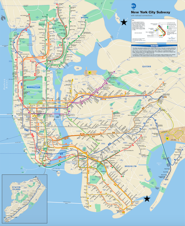
IN THAT PIC: the NYC Subway Map, with black stars at our two locations – the Bookends of the Boroughs, and the Gateways to the Goods! City Island is at the top, just off of NYC’s largest Park (Pelham Bay). Sheepshead Bay is at the bottom, close to Gateway National Recreation Area, in green – like, you know… parks.
Our new host is the Miramar Yacht Club. It’s a wonderful cooperative that’s been around since 1905. It’s in Sheepshead Bay, a super protected port that allows sailing straight off the mooring before exploring Rockaway Inlet, Gravesend Bay, the Verrazano Narrows, and even the Atlantic. Have a little time? Head into very large Raritan Bay, with Sandy Hook creating a natural barrier to ocean swells when they occur.
While nearby Jamaica Bay and parts of Rockaway Inlet can have decent currents, most of this area has the mild currents that make for great sailing in general, and learning in particular. Miramar has a sizable fleet of Ensign sloops, and they race on Wednesday nights. A large majority of them never use engines to get out and about, and also back. That was a huge checkmark in the right column for me.
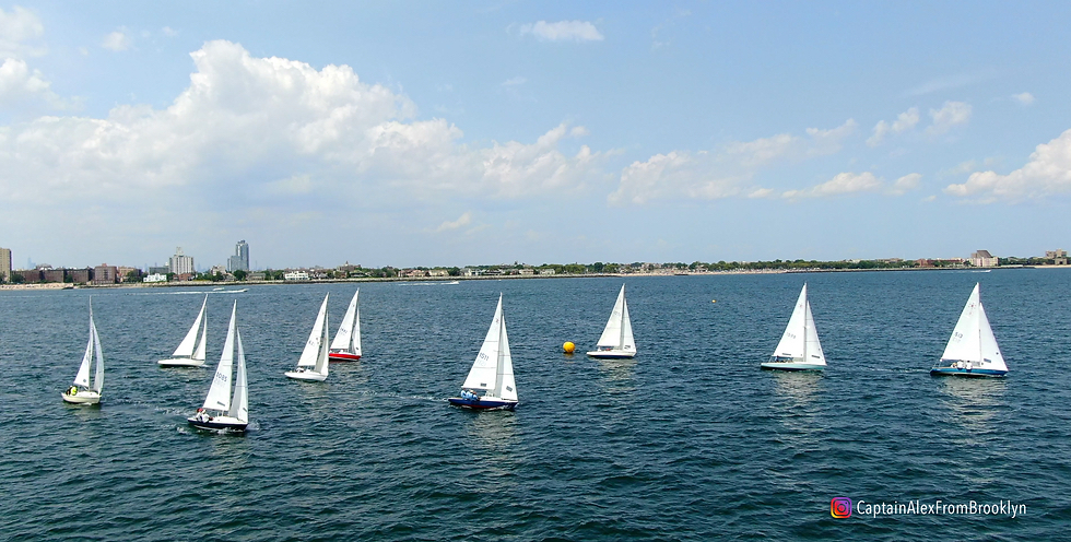
And, Ensigns are what we’ll be sailing on initially (and possibly also their Tartan Ten). Here’s a fleet!..
IN THAT PIC: Ensigns racing out of Sheepshead Bay, Brooklyn, from the Miramar Yacht Club.
If Montauk is “The End,” as the bumper stickers say, Breezy Point is “The Beginning.” Clear waters are flushed between Jamaica Bay and the Atlantic Ocean, with an abundance of fish and birds. How about marine mammals? Dolphins are regular, common visitors.
You can expect to see dolphins.
David Shin, Commodores, Miramar Yacht Club
Whales? They occur too, says David, albeit not as commonly. While all this could be a bad sign from a global warming perspective, at least we can enjoy it while we pursue sailing – something with a low carbon footprint that’s not exactly a guilty pleasure.
How does one get there?
Driving, public transit, or even bicycle. There’s good street parking in the area (sorry, no on-site parking due to limited space for members). Subway? Take the B during the week and the Q on weekends. Bus transfer, or grab a drink from Starbucks and walk. Have a bike? Bring it aboard and shoot over. Or, we can pick you up from the subway.
Speaking of pick-ups, here’s one of the Club’s launches at dusk (I shot this pre-season before it splashed)…
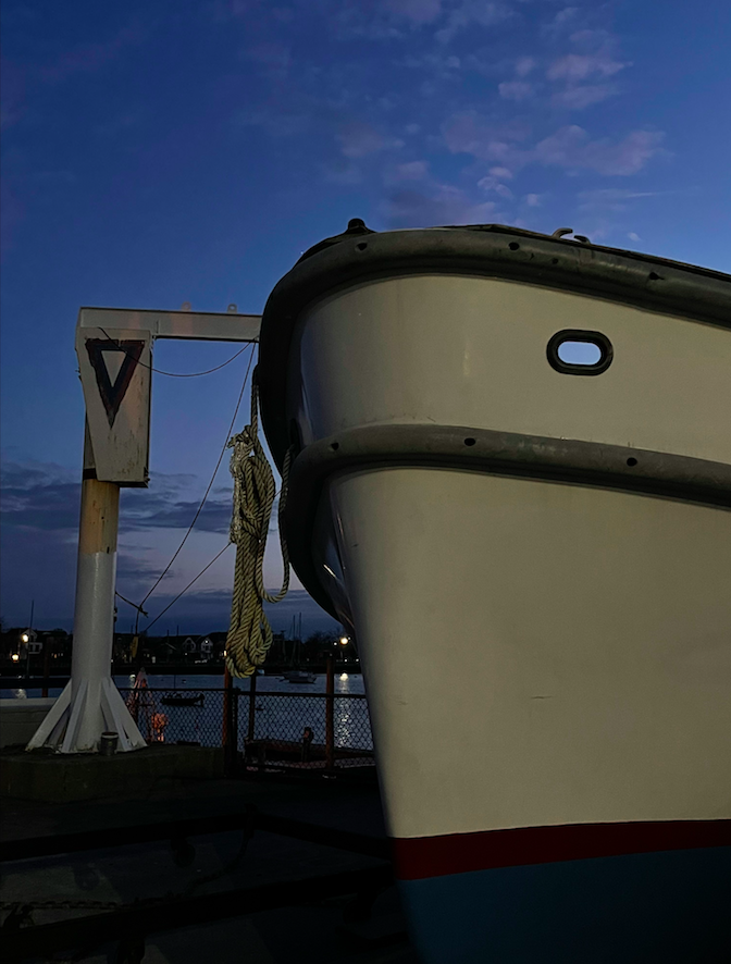
IN THAT PIC: dusk at the Miramar Yacht Club in April. The boat? One of their two diesel launches. The tower on the left? Their hoist to dry-sail boats and to haul for winter. The waterway is Sheepshead Bay, with Coney Island behind.
Expect to see an announcement from us about an Open House soon. In the meantime, if you want to explore this exciting new option for learning to sail, just contact us and we’ll discuss scheduling or just a tour!
To see more about our host there, the Miramar YC, follow this link…
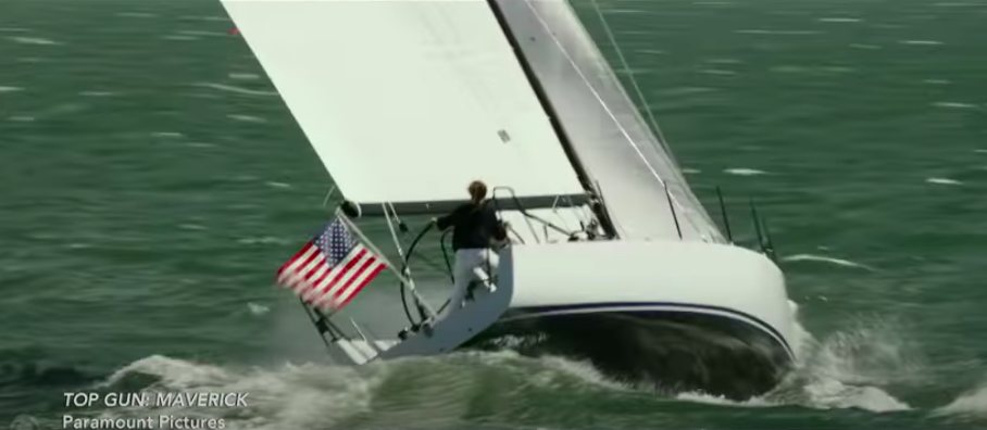
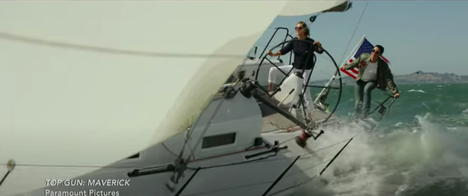
That’s Jennifer Connelley’s take on trying to learn how to sail a boat in New York Harbor in preparation for “Top Gun: Maverick.”
IN THAT PIC: still grab from the sailing scene in the flick. Jennifer Connelly, driver (at the helm).
We taught David Letterman how to sail back when Late Night was actually Late Morning. A looooong time ago. (This was during Dad’s school; I worked sweeping up for child’s pay.) Of course, when Ted Turner was on Late Night not that long ago, David didn’t work in any Q&A about sailing despite Ted being one of the best. I was disappointed. I half expected him to say, “You know, I took a sailing course. It was on City Island. New York Sailing School, I think it was.” Didn’t happen.
Fast forward to earlier this week, and actress Jennifer Connelly appeared on A Late Show With Stephen Colbert. (We link to that below.) I didn’t realize there was a sailing scene in the flick, but Connelly did and decided to prepare for it. She took sailing lessons in several locations in preparation, as she had no background with it.
IN THAT PIC: JC driving and Tom Cruise bringing up the rear. Apparently, he wasn’t satisfied with the pace of things off San Diego so they did some sailing out of San Francisco- a renowned heavy wind region. This was there.
Being from NYC (Brooklyn), she did a course in NYC and did what too many people do: she did it in NY Harbor, as accessed by the East and Hudson Rivers. Train wreck conditions, but maybe they saved 15′ on their commute!
“I was taking lessons in the Harbor, which was interesting…”
“That’s busy!” (Colbert)
“It’s kinda like learning to drive on the Autobahn, you know? I don’t recommend it as a first way to sail.”
Jennifer Connelly
We link to the full clip below. As mentioned above, she took lessons in a variety of areas, so this wasn’t an isolated perspective.
Sailing in NY Harbor and the Rivers is difficult with challenges that are not the good kind…
Currents strong enough to stop a boat in its GPS track;
Lots of random commercial traffic including high-speed ferries, barges, and cruise ships;
Narrow waterways and, where they open up, with large obstructions;
Confused winds with shears from geography and high-rise buildings.
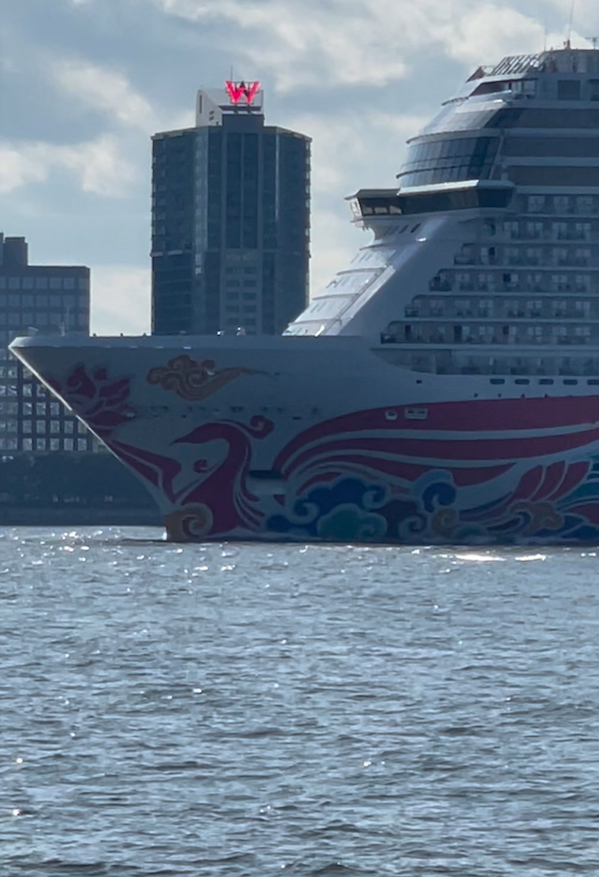
IN THAT PIC: a rather large Norwegian Cruise Lines ship about to block out the W hotel in Jersey City as seen from the shore of lower Manhattan.
This isn’t a recipe for success. Expert sailors can have a lot of trouble there. Why try to learn how in such an environment? The perception is that it’s close and convenient. It might be quicker; depends where you live, and your actual commute time. (Two schools that sail in NY Harbor are located in New Jersey, including one with Manhattan in its name. There is one in Brooklyn.) More importantly is the education and skillset you get. If you can’t skipper the boat after the course, you didn’t sail in a good location and/or get enough training.
IN THAT PIC: the same Norwegian cruise ship about to totally dwarf the rather large classic sailing vessel. It’s a schooner rig, normally only found on larger vessels.
We don’t go there, literally or figuratively. There’s a reason Columbia and Fordham Universities have had their sailing teams practice out of City Island for so long. (Columbia moved recently, but only about a mile or two as the bird flies). There’s a reason why there are 3 ASA sailing schools on City Island, and also three yacht clubs that are almost all sailboats (used to be four before Hurricane Sandy closed one down).
It’s the beginning of Long Island Sound, and the beginning of a proper sailing foundation. And, one never outgrows it!
Here’s the link to the Colbert segment with Jennifer Connelly:
More accurately, I largely re-wrote his textbook on how to sail a boat from the 1970’s but kept the best parts, which inspired the project in the first place.
In a previous Blog Rant, I wrote about how both my Dad and I wrote books for our respective sailing schools. I’d been meaning to resurrect his for awhile, and that post put me over the edge. I gone went and did it!
IN THAT PIC: the cover of NY Sailing Center’s new learn-to-sail/101 textbook.
That’s one of our Beneteau First 21.0 sloops flying along upwind, with Teacher John as he’s known on the transom where he’s known to love perching or propelling himself. Yup; that’s a class in progress.
Dad’s textbook, The Masters Course, was brilliant: pithy, funny, effective. Well illustrated. Nothing is perfect; his wasn’t. In fact, a few of the diagrams on piloting and navigation left a lot to be desired. But, these weren’t important to this level of training. I left them out of the new book.
As well as wanting Dad’s book to be resurrected, I also just wanted a better learn to sail book than ASA was putting out. I disagree with some of the content in their book, completely disagree with the order and emphasis of the material, and can’t deal with a defective diagram in it that’s a very important and which is very fucked up. It’s so bad, that after our first day of instruction, we challenge students to figure out “what’s wrong with this picture.” Some do on the spot after pondering briefly, most take a little longer. A few don’t figure it out. But, to a person, once they see it or are told it, they get it. And, they can’t believe it was allowed to go to print that way.
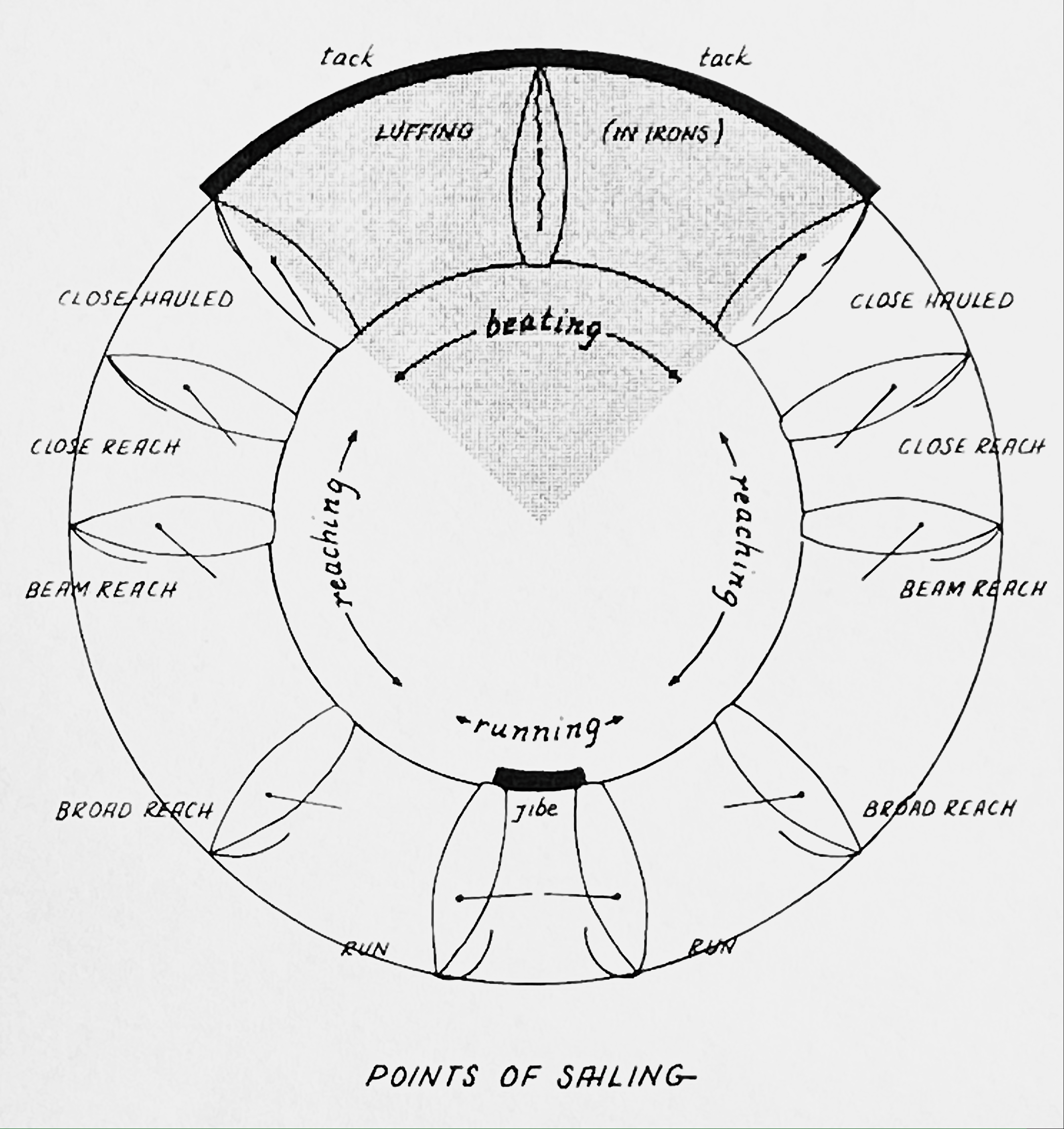
IN THAT PIC: the best Points of Sail diagram I’ve ever seen. From Dad’s book, and now in mine.
(Not long ago, I found an error in The Annapolis Book of Seamanship by John Rousmaniere. Now, this is perhaps the best single all-around sailing reference available. I highly recommend it to all beginners and intermediates; most advanced (and some pro) sailors can learn at least a little if not a lot from it. I corresponded with John about it; I don’t think he realized the error was there. “After all these decades, you’re the first person to spot this,” he wrote. I see EVERYTHING. It is known.)
Truth be told, Dad’s book had what I consider to be an error in one of the illustrations. But, I left that one out and used many of the good ones! Almost everyone will eventually err in an explanation or illustration. However, when it’s caught, it ought to be corrected.
IN THAT PIC: modern diagram of heaving to. Jennie Wilde, illustrator. Text: Steve Card.
My book? It started out as Dad’s book redux, but became more mine than his. I did keep parts of his prose intact. I augmented other parts. I deleted some others. And, of course, I wrote several sections from scratch.
Our new book is going out digitally to people as a PDF. That way, it can be easily corrected, but also searched, viewed on any mobile device, and updated easily. Also, instead of putting painful step-by-step photos of knot illustrations, for example, we can have one good reference photo plus a link to quality step-by-step videos! And the book can easily evolve as photos are added, better ones are found, an idea comes to mind for a better explanation or ordering of content, etc. Of course, if anyone prefers, it can be printed.
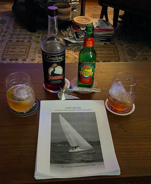
What better way to celebrate writing a book on sailing than with sailor drinks? Dark ‘n Stormy: Reed’s ginger beer, Gosling’s Black Seal rum, oversized ice balls and cubes, and a mini-anchor bottle opener. It’s made by Lewmar, and a replica of their Delta Fast-Set anchor. That anchor is on the bow of most charter boats around the world. Why? It holds best in most seabeds. We’re all about the “why’s” of things.
Yes, I wrote about anchoring in the book. I left the illustrations to others; I explained what one is really trying to do when anchoring, and how to get the job done on the water.