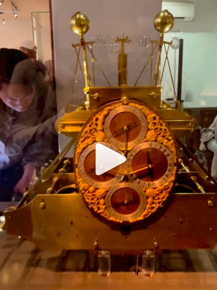
Actual clockwork – the works that solved the problem of how to sail across an ocean safely by keeping proper time for navigation. And, these clocks from the 1700’s are still ticking!
IN THAT CLIP: Harrison’s four timepieces that revolutionized navigation and long distance sea travel.
I visited the Royal Observatory in Greenwich, England this month. Been on my list since I first read “Longitude” by Dava Sobel, about the English crafstman and inventor John Harrison. I’ve written about it before, but now I’ve seen it.
“You have to see it to understand. Now I’ve seen it.”
The Dragon Queen, Game of Thrones
(I also saw the dragon motifs in Wales, and got some great drag swag, but that’s another story from the same trip.)
Harrison’s clocks revolutionized sea travel and have withstood the test of time. It took him most of his adult lifetime, partially because he was a self-sabotaging perfectionist, but he solved the problem of his time: how to determine longitude at sea. His timepieces were the first chronometers, or very accurate time pieces that would work for extended sea voyages without adjustment or maintenance. And, he won the incentive prize offered by Parliament: 20,000 pounds. That translates into roughly $7 million when adjusted to today’s value.
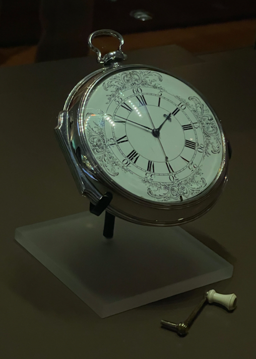
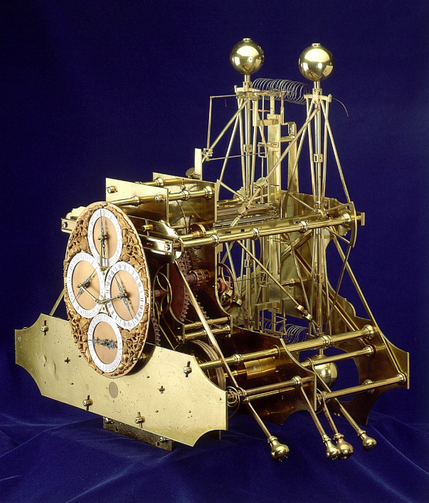
IN THAT PIC: His first chronometer clock, H1. Kept good time near-coastal in Europe.
Why was this a problem to begin with?
To determine longitudinal position at sea (east/west), one needed to know the time at the home port of departure (now Greenwich, England, or GMT for all) and compare it to the local apparent noon (sun at its zenith).
To do that, one needed an accurate time piece.
They existed on land, but none of the day could keep time at sea due to the motion of the ocean, as well as changes in humidity and barometric pressure.
Until the problem was solved, vessels were constantly at risk of delayed or premature arrivals, getting lost, or worse, running aground. That last eventuality was the straw that broke the stiff upper lip of the land: a small armada was lost off the coat of England due to poor position reckoning.
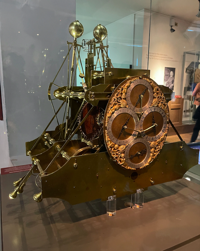
IN THAT PIC: H2. Tried to sole some problems; he found another. NEXT!..
The detailed history is best left to Dava Sobel, but suffice it to say it that this wasn’t an easy affair. Here’s a super-short summary.
In 1714, Parliament created the Board of Longitude and offered the prize.
In the 1720’s, Harrison created his first clock. It was huge, unwieldy, and elegant a/f – so much so that a fancy-lad clockmaker in England makes stunning replicas.
It worked well enough on a proper sea trial, and it was duly recognized by the Board, but there was room for improvement. A small sum was paid with the promise that another improved clock would be built.
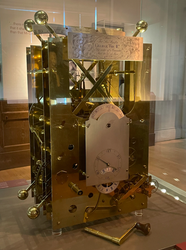
IN THAT PIC: H3 Not good enough. The can of worms, they squirms…
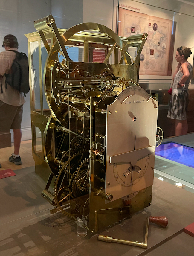
It took three more iterations, decades of time, and some political jockeying to get it done…. but the fourth time was the charm. From a large machine, to a large pocket watch, Harrison created a consistently reliable chronometer and safe navigation was possible. Sadly, despite this accomplishment and also winning the king’s ransom of a prize, he died a bitter and broken man.
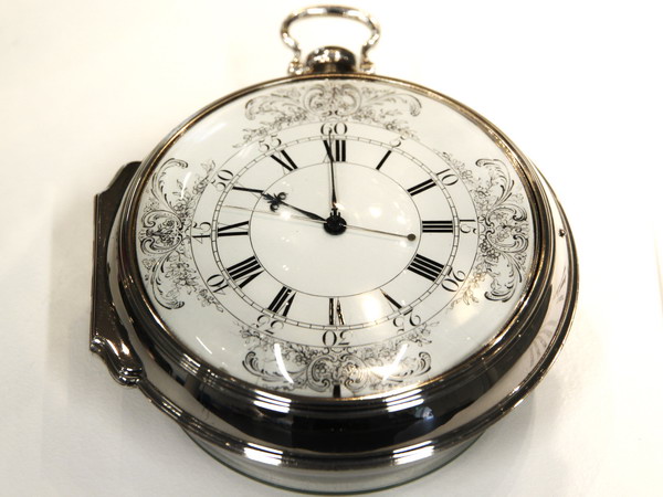
IN THAT PIC: H4. DONE. Kept accurate time from England to the Caribbean.
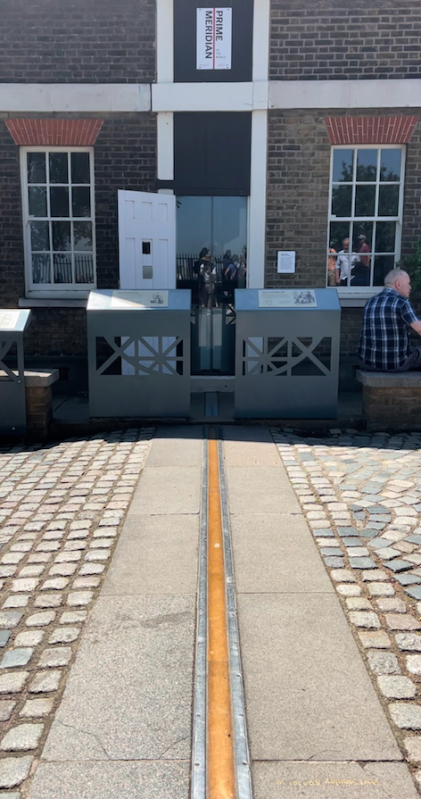
But, I was a happy fan at the Royal Observatory. I highly recommend anyone traveling to London take a side trip to Greenwich, which also has the Maritime Museum and the Cutty Sark. Easy on tube + rail. Harrison’s clocks might be the best part about the Observatory but there’s plenty more, including the touristy thing: standing on the Prime Meridian!
Again: read Longitude by Dava Sobel. Get the illustrated version. Fascinating and revealing. There’s also a Nova episode about it, and despite being a little campy with reenactments, it’s great. Sobel is interviewed in it.
We teach the basics of latitude and longitude work in our Coastal Navigation course, Start Sailing (ASA 105), including how to use lat/lon coordinates from a GPS to plot position on a paper chart. Old school blended with new.
What would Newton do? (In a modern day pandemic.) Well, he actually did it, if one considers London’s Great Plague of 1665-66 modern enough. He did several things in fact.
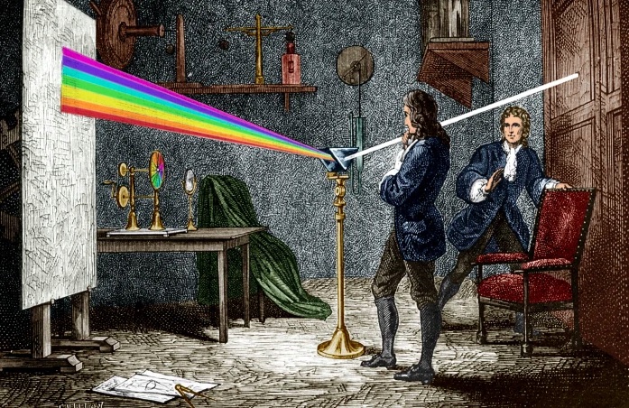
Isaac Newton, eventually Sir Isaac, basically quarantined himself during this catastrophe, having recently completed undergraduate studies at the ripe old age of 23. He, like all privileged Londoners at the time, fled the city. At his family’s countryside retreat, he was a busy boy! What did he do that was relevant to navigation?
Newton, with some social distance from an apparently alarmed observer, as he experiments with prisms to understand the composition of light. Image shamelessly copped from stock.)
Well, truth be told, that’s a stretch – but we do need to stretch our imaginations to keep ourselves occupied during our social distancing and quarantining. We’ll try to get there. First, here is what Newton did with his time:
He studied gravity. Yep; that apple crap. This led to his eventual creation of the laws of motion and his career-defining work, Principia.
He started working on optics, proving that “white” light consisted of the complete color spectrum using a pair of prisms;
He picked up where Descartes and de Fermat left off with universal equations of fluctuating quantities, solving that dilemma with a series of papers and formalizing what we now call Calculus!
That was Newton. And that was then. And now, we have to find things to do and learn while keeping social distance and isolating. One option: Start Navigating SM: ASA Coastal Navigation (105). But we have to do it with social distance. So, we have to do it from home via Zoom, FaceTime, etc. That’s the Staples part (where we get some of our 105 supplies); that’s easy.
But what about the math? Newton did some complex math during his tenure away from town. How much math is involved with Coastal Navigation? That depends on who you learn it from. It can be fairly complicated – or, you can do it our way:
Plot the path without the math!
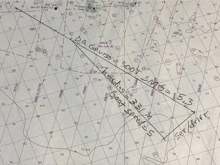
Path; no math. No arithmetic or math used to plot this set & drift ‘triangle.’ The geometry is built in. This is our preferred method. Cuz, you know… trig sucks on a boat! 1210 Tr chart (training; not updated), Block Island to Martha’s Vineyard. This is the solution to a practice plot submitted to us to refresh a memory on this technique.
We use as little math as possible when doing – and teaching – navigation. We teach the little bit of algebra needed for deduced, or ‘dead,’ reckoning, and we make it easy with a visual aid that’s intuitive to use. We refresh peeps on their long-hand division when they forget how. Can’t rely on a calculator on the water. But for the serious stuff? Set and drift of current while underway with no current tables to consult?
That’s where we plot the path without the math. Not even basic arithmetic. Just draw lines based on the concept, representing what the boat and the current do, and measure the final answer: course to steer! We even give you some toys to play with in the process…
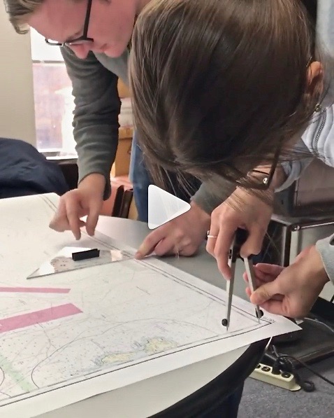
People plotting in one of our Start NavigatingSM courses this past winter. Pre-Corona. He’s working with a triangular protractor, or plotting tool. She’s manipulating the world’s finest one-handed dividers. Yes; she’s using two hands. Sometimes that’s helpful to set one point quickly and accurately. Then one rocks ’em with one hand! All being done on a real chart, not a training chart frozen in time to the 1980’s with incorrect coloring and needless extra clutter.
Here’s how it works – think of it as a sample of the 105 Nav course. Yes, it’s an advanced topic; no, there will be no quiz to you as the reader afterward, and I’m sure you can follow along!..
Step 1: Draw a line from “point A” to “point B.” That’s the path you want to sail. It’s like drawing your own road on a map; your only job after that is to stay on it. In the chart pic above, it’s the top line labeled “DR Course” (not A to B, but think of it that way).
Step 2: Now, draw a line from point A showing the path the current will flow. How do you know? Let’s just assume you knew how to look it up and find its speed and direction. (Yes, we teach you all that in the course.) Draw it in that direction, for the distance it moves in one hour. Tool used? Any straight edge such as a ruler, or the nautical plotting tool we send you in advance! Distance? Use the dividers, or nautical drafting compass, to mark this. (No math – we promise!) In the chart pic, it’s the bottom right line labeled “Set/Drift.” So, for example, if the current is 2 knots, set the dividers to 2 nautical miles – the distance it flows in one hour.
That shows were your boat will be if you just let it drift helplessly from point A for one hour. We don’t want that, do we? Of course not! So, we have to figure out how much to offset our course to fight the current and stay on our intended track. How?
Step 3: Figure out the boat’s speed in knots (nautical mph). Then, we set the dividers to that speed. How? Same as with the current in step 2 above. It’s all based on one hour: an hour of the current’s motion, and an hour of sailing (or motoring) while in that current.
Step 4: Now, set one point of the compass/divider on the spot where the current line ends. Swing the other end over to the DR, or nautical road map line, you drew from A to B. Set the point down; draw in that line. In the pic, that’s the third leg of the triangle formed, labeled “heading” and “boat speed.”
Step 5:Boom. That line is also the angle to steer by the boat’s compass to fight the current! Measure that with your plotting tool. Steer that when you sail, and you’re on track to point B.
Is it slightly more complicated than that in real life? No… but you do need to work up to it by starting with more basic info and practice, and then the steps above are very straightforward… just like your boat’s trajectory over ground in real life/real time to arrive at your point B!
And, yes – we can teach this to you live and interactively. We’ll do that for now; eventually, we’ll be cleared for takeoff on taking off the masks, cutting the social distance, and resuming life as normal as it gets post-pandemic. In the meantime, if Newton played with prisms, here is a prism for you to ponder navigationally…
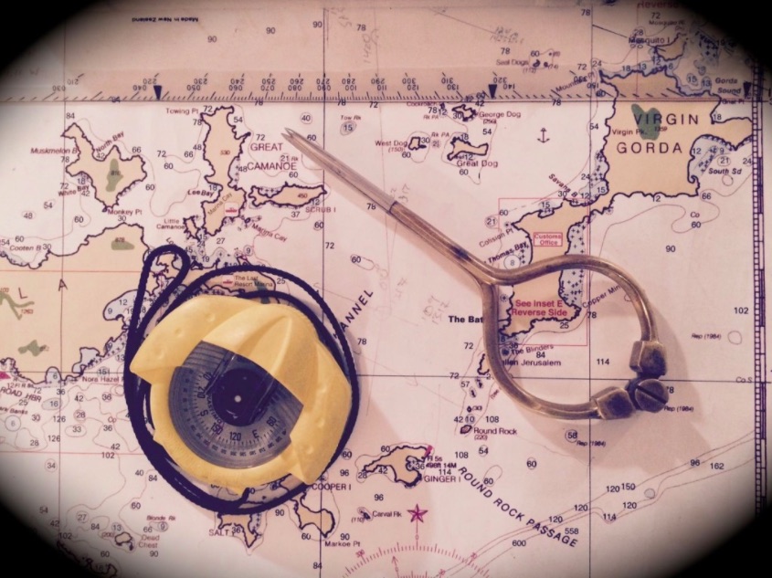
Remember the porrtait of Newton playing with prisms? No? It’s literally at the top of… Nevermind. Here’s a hand-held compass that’s one of the most popular models in use. It uses a prism! The funny metal thing on the right is a fancy-lad pair of dividers. Elegant but not as practical as the ones shown above. We teach you how to use a hand-held compass like this in the course.
Sort of; kind of. A boat can be a small piece of real estate, but people certainly don’t have to be in each other’s laps. And, you can drive to us and avoid public transit. Which, we’re hearing, is often pretty empty. That alleviates the concern that it’s supposed to be a big petri-dish whirling cesspool of infectious spread. If we’re few and far between, we’re further from infectious.
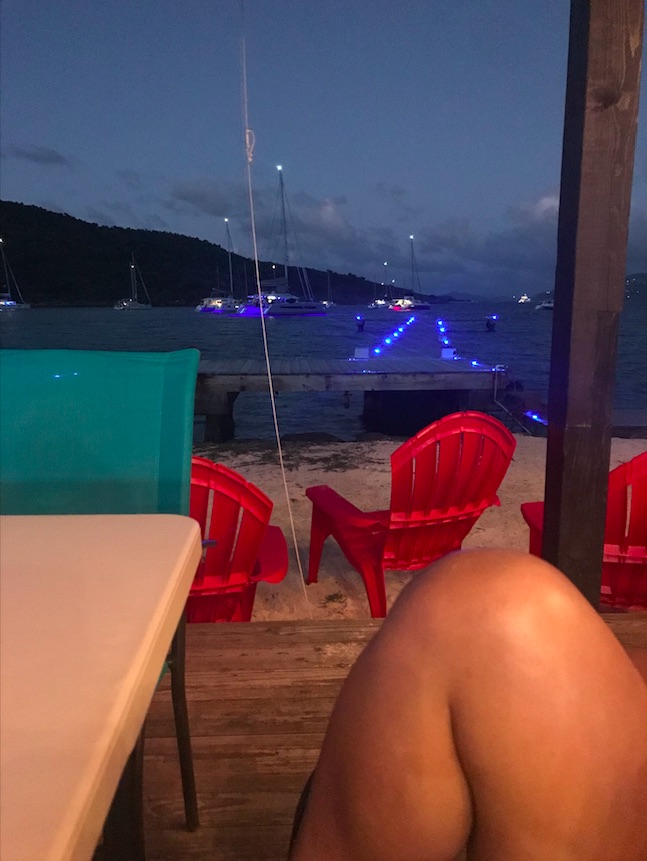
Social distance: one knee and done! We had this beach side restaurant to ourselves that night (rare occurrence, as it’s popular and excellent). The ‘runway’ is a fixed pier for larger vessels and also dinghies. Our yacht is out there somewehre! Jost Van Dyke, BVI, from our March 2020 trip.
At least out on a boat with us, or on your own if you already know how to sail, you’re doing a relatively safe, healthy, outdoor activity in the scheme of all this. Brooklyn bier gardens and rave parties: they be gone. My GF and I pretty much closed down a kewl bar we discovered on Sunday night… Bier Wax. No one’s going in no time soon now. But you should check it out when things are stable. NY Sailing Center post-virus celebration? Yup.
The exterior of Bier Wax in Brooklyn. New York brews from Brooklyn to Upstate, all surrounded by shelves of vinyl that they play. First link on their front page? “Featured DJ’s”. Turntable spinning and taps spilling. Miguel Rivas, photo, with link on their site on the gallery page.
So, what to do with the spare time? Sailing does start soon. We hope it will start on Friday, with temps at or above 70! But the updated forecast spoke of rain, wind, and maybe some thunder. We’ll have to see.
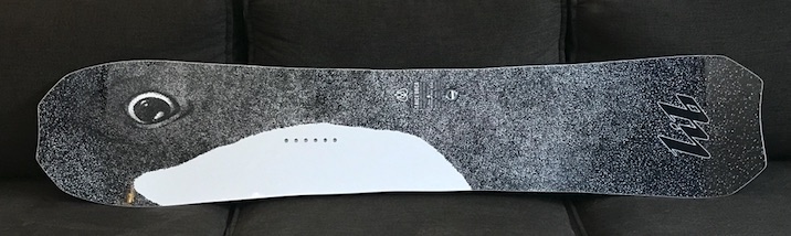
The author is a fiend for snowboarding. All the mountains closed for coronavirus. So? He sold one his boards on eBay that had proven a little too large for him. It took three auctions, including one where the buyer basically blew off the purchase. But, on the third, people being home seemed to increase viewing, bidding, and in the end, the sale price. So, there’s that!
From the eye of the Orca! Lib Tech T.Rice Orca snowboard. Super popular board that can do almost “it all.” It’s an alternative freeride board that’s excellent in powder, but it also has magnetraction edges (wavy) for solid grip on hard pack and icy snow. Short/wide/surfy style board.
Right from home, people can learn navigation. We prefer to teach that as a classroom course with practice plots in between sessions as homework. But, we have one class in progress that might switch from classroom to video conference, and we will be doing that going forward on a super flexible schedule. Let us know if you want to discuss getting in on that stay-in option!
Plot the distance… recent Start NavigatingSM course (ASA 105, Coastal Nav). Two men. Current course? Two women. We always have low class density; helps with social distancing now in the age of coronavirus. And now, we’re going remote!
Most of us are at least a little concerned about the COVID-19 coronavirus thing. Some are very stressed and panicked. We’ll get through it as a communities and countries. Some thoughts to share on prevention efforts:
Put straight isopropyl alcohol into a simple spray bottle. Boom. You have a very efficient surface and object sanitizer. The broad mist spray gets a little of it all over. In my (not so often) humble opinion, that’s all that’s needed. No need to wipe down and rub around. My GF and I came up with that; no doubt others did as well.
Re-think all brick and mortar and in-person transactions, especially paying with cash in person. I love a coffee n bagel break in my hood, but had decided to cut this out of my routine. Today, I was sorely tempted in the late afternoon. I walked over, and there was only one other customer. The staff were using gloves. I paid with singles and said to keep the change. I disinfected. I felt safe.
Be prepared to walk away from any environment when you see careless behavior or lack of adherence to suggested safe practices. See someone touching their face in the store when they’re ahead of you, or the hired help doing that (especially without gloves)? Walk away. Leave. And disinfect.
Don’t just wash your hands “for 20 seconds” and use sanitizer. Consider how thoroughly your’re actually doing it, and the order in which you’ve touched things. We wash our hands to get rid of stuff on them. So, once we’ve touched a faucet or container of liquid soap, it’s contaminated! Wash those as well. Then, wash your hands with more soap. THEN turn off the faucet. Apply that “last touch” mentality to every relevant scenario.
Exercise, eat well, and take some supplements. It can’t possibly hurt. It will boost your immune system and may well be the deciding factor as to whether you get this virus, and if so, how severely. For example, I’m taking vitamin C, zinc, and echinacea. I’ve been advised that the echinacea ought to be one week on and one off so I’m putting that into play. I’ve also ordered some bio-active silver hydrosol by Sovereign Silver based on a recco from a trusted health care professional. The list could go on as far as reccos; do what you’re comfortable with. No point in stressing over it and defeating the purpose.
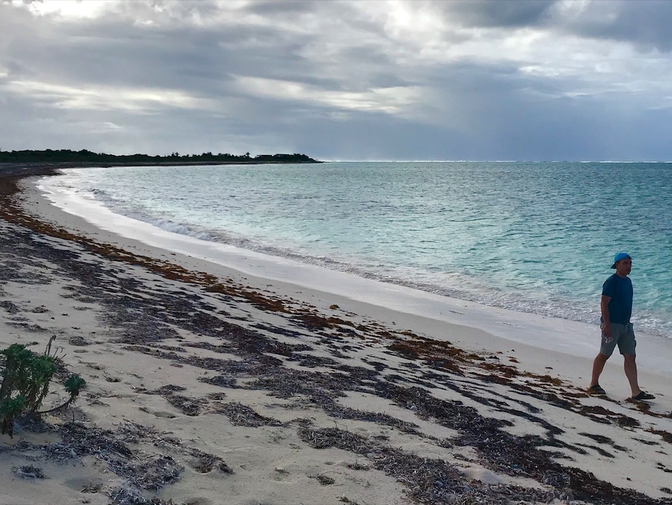
Keep your social distance – stroll alone on a deserted beach. Two other people you don’t see: me, the fotog, and Kalindi. We had a very bowl of a beach to our selves for the price of a fun bike ride. From our March 2020 BVI trip. This is on the north shore of Anegada in the late afternoon.
So… about that sailing. We got back from our March BVI trip (Virgin Islands) on the 7th as we previously wrote about. Advanced courses start in late April, and learn-to-sail in early May. Sailing Club sessions could start as early as… Friday? We shall see. But it’s coming soon!
If you join the Club, and you haven’t yet learned how to sail, we’ll find ways to get you out with us or other Club members. If you can sail, then you know how it goes.
The author, our Director and HBIC (Head Bozo in Charge) often drives out from the Upper West Side, and sometimes from Park Slope, Brooklyn. If that sounds better than public transit, he might be able to give you a ride. Of course, you’ll be asymptomatic and will have taken your temperature regularly for a few days leading up to that (and again that morning). Fever is by far the most common symptom, in the upper 80’s percentile wise. That’s why the White House had started taking temps of reporters and turning away those with spiked numbers. The second most common, in the 60’s, is a dry cough. Duane Reade was due to get more thermometers in. Find or order where you can.
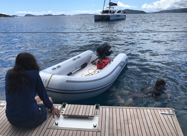
Social distancing: boats spread out (except for the harmless dinghy). People spread out. Plenty of room to breathe and roam. Quick lunch/snorkel/swim stop, first day of our March 2020 Virgin Islands (BVI) trip.
We’re all put out by this as well as freaked out. I’m a silver-lining kind of guy. I deal with the harsh reality of some things. I accept what I can’t influence or change. And, I look on the bright side. What can I do with the time I have, in the place that I am, that’s productive and maybe even makes me happy? What can I appreciate that’s different about my surroundings or microcosm of existence? There’s usually something.
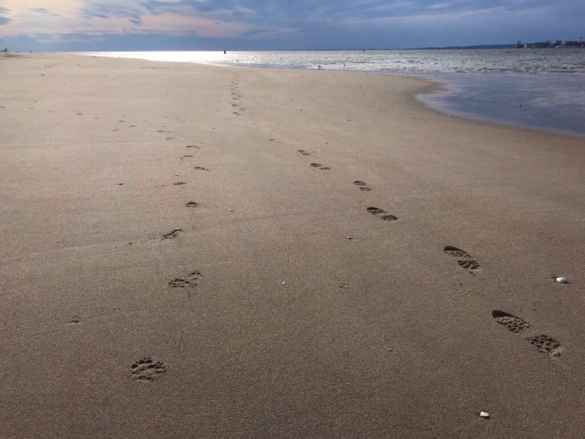
Welcome to the Irish Riviera! Dog took a walk with its human apparently. Back side of Breezy Point, Queens – the exact opposite of Montauk: The End. This is the Beginning. Great place to walk off the beaten path. The ocean side beaches had a fair amount of peeps that day, but social distancing was superb. This beach ends in a long jetty. If you go there, only walk on the dry parts. Once you see any sign of slime, DO NOT GO FURTHER. Unless you’re wearing cleats you’ll go down. Author used to rock hop out to the end wearing cleats and sporting his fly rod to catch striped bass and false albacore. It’s not for the casual caster.
If you’re not finding enough of that… come out sailing! We’ll be open soon. And we’ll keep our distance.
Yes, this is a serious Blog Rant! Yes – we’ll have some fun with it too. Why not? Isn’t that what this is all about?!
No… the title doesn’t mean “go watch porn.” You be you, of course, but it’s in the sense of anything that we obsess about on the internet these days and watch a lot of YouTube, Vimeo, Insta, etc about it. In this case, it’s just wrist watches. I’ve developed a minor obsession with them of late.
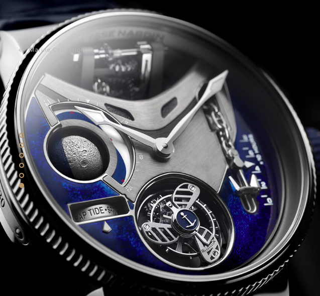
That’s not a watch… THIS is a watch! This is a total statement, too, to the tune of, say… $300,000? Flying tourbillon in the shape of a propeller; anchor that might or might not do something; best moonphase complication ever; something about tides too! From Ulysee Nardin, a preeminent Swiss manufacture who’ve been around since 1846, and in the same facility at Le Locle for almost all that time.
Not sure how it started. Must have seen an Insta ad that grabbed me by the second hand. I do recall that soon after college, during my first job (office, not ‘Below Deck’), I started to like watches. I figured that if I ever made it rich, I’d have a serious watch collection. I was really intrigued by the Movado Museum watch (which, of course, is still going strong with umpteen variations on the original theme).
Never did start that watch collection. Never too late, of course. Have to start somewhere; tried out a few but starting to realize how complicated it is. You know.. complications. Moonphase; chronometer; day/date; GMT; heartbeat/skeleton… etc, etc. So many complications. (In case you didn’t know, that’s the horological term for a feature or function.)
So, what’s the big deal with watches and telling time at sea? Where’s the porn I promised? (It’s coming, it’s coming…)
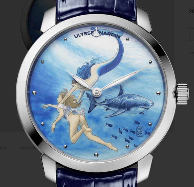
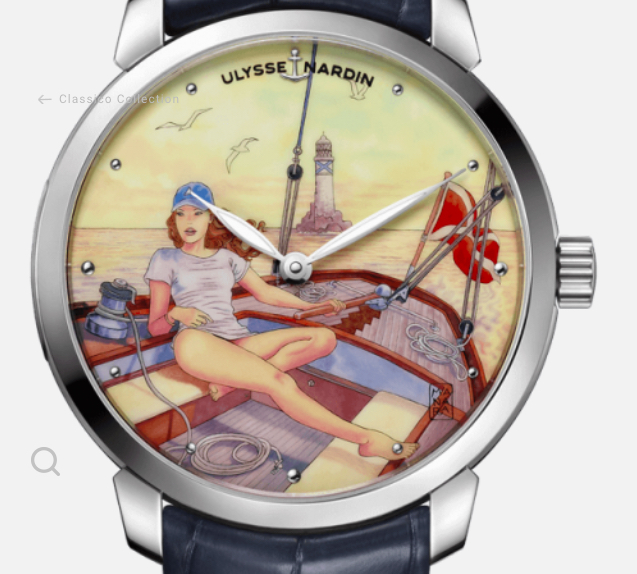
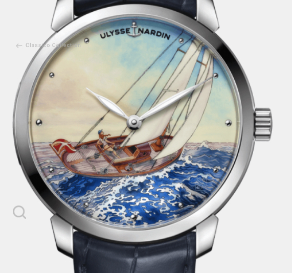
Tme for… some mermaid on nympho action? From the Classico series, also by Ulysse Nardin, as painted by the artist Milo Manara. They like their erotica and great white sharks, but they also like traditional and elegant watches as well as funky new design concepts. MSRP: $26,900. More to come…. you’ve been warned!
The big deal is… LONGITUDE.
Latitude and Longitude have two meanings related to this topic and the Sailing Center:
Latitude/Longitude was a fragrance from Nautica. They hired us to re-create realistic lat/lon coordinates from a film shoot of a TV spot. They filmed near Cabo San Lucas. Based on the time of day they sailed, the angles of the sun, etc, etc, we came up with some coordinates they could add as a screen graphic that were in the area. We didn’t represent them as the coordinates of the vessel as depicted in the shot. (They sort of did.) We told them that anyone trying to find fault wouldn’t be able to. Still have the charts lying around somewhere – Defense Mapping Agency renditions at both harbor and general scales.
Much more importantly, latitude and longitude form the man-made position grid that is used for navigation worldwide. It’s what GPS was built on.
What’s the relationship of watches and horology to longitude? Both latitude and longitude are position references, but they each have another property that’s mutually exclusive. For latitude, it’s distance. The parallels are equidistant. For longitude, yes- you guessed it… TIME.
Centuries ago, the concepts were well developed and understood. Ashore, it was easy enough to measure both and determine a reasonably accurate position. But at sea, while measuring latitude was annoyingly doable, it was just impossible with longitude. Why? There wasn’t a device that could keep accurate time over the course of, well…. time. Time on the ocean. The longer a voyage, and the rougher it was, the worse that got. When temperature and atmospheric pressure changed, so did the functioning of timepieces. The existing methods were difficult or impossible to use over the course of an extended sea voyage, or during certain moon phases. Add bad weather, and, well… you were aground or lost.
“She wast lost, but then was found…”
We warned you! But you kept reading… more from the mind of Milo. Shark had enough apparently. Yes – this is actually a real watch available for sale in limited quantities. All these screen snatches are straight from the Ulysse Nardin site. But there are a number of other depictions in the series that are more universally suitable for public unveiling; more examples to come.
One particularly disastrous sea voyage pissed off the British Crown to the point of offering a prize for solving the problem. In 1707, a naval fleet foundered on bad shoals off the Scilly Isles, losing four ships and almost two thousand men. A simple sailor tried to warn of the impending danger, as he’d kept his own careful deduced reckoning and was certain they were about to run afoul of the treacherous area. He was summarily executed for his trouble, as he would well have known was a risk at the time. Imagine what went through Admiral Sir Clowdesley Shovell’s mind (1; whew! 2. Origin of “shoveling shit?”). The guy he just hanged was right. Too late… Karma is tough. The Admiral was one of only two seamen to make it to shore. He was murdered for his emerald bling; the woman who did it confessed on her deathbed in a last minute act of contrition long afterward. Can’t make this shit up!
So, who solved this less than delicate debacle? Many people took stabs at it over many decades. Some tried to use celestial methods to determine longitude while at sea; others tried to make timepieces that remained accurate on ocean voyages. That’s what ultimately worked. Simple concept; hard to make. The chronometer was conceived long before it was built, and the name was first coined in 1714 by someone who hadn’t made an effective one. But it was eventually made, and further refined by himself and others who followed in his footsteps. And it was made by…
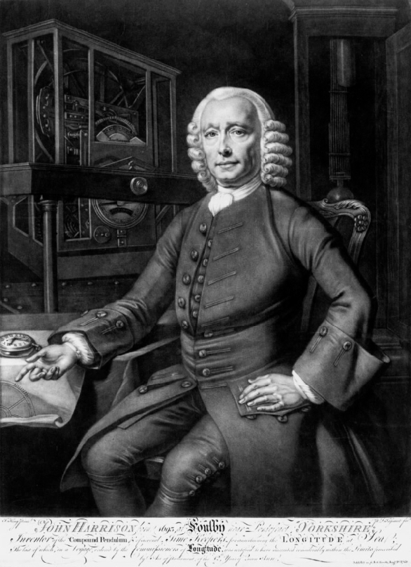
One John Harrison, an English carpenter and clock maker. And it took much of his life.
John Harrison, in a portrait depicting his chronometer on a map to the left.
Ever heard of him? Probably not. Heard of Galileo? Sure you have! He was just one of many minds who tried to solve the issue of determining longitude at sea by lunar methods, or tracking the moon’s movements in relation to stars and the sun.
Harrison? He made a watch that could accurately tell time on extended sea voyages. That was much simpler and more reliable. But, it took a few large, less wieldy prototypes before his very portable time piece evolved. Plus, he fought battles for decades against the prevailing politic and conventional wisdoms of his day, and – truth be told – himself. Decade. DecADES. It took awhile.
H1: Harrison’s first marine chronometer, made between 1730 and 1735. This illustrates that he was a clockmaker, not a watchmaker – but that didn’t stop him from being the first to create an actual watch that did the trick. And, the 75-pound machine above worked! It kept time at sea in rough weather on relatively short but rough voyages. It never did the tran-Atlantic trial run that was required to claim the prize offered by the Board of Longitude. H1 and Harrison’s other creations are on exhibit for the public to see at the Royal Museums of Greenwich.
The end result? A carpenter and clock maker who no one had heard of laid the foundation for safe navigation at sea and better timepieces. He never even founded a watchmaking concern. (John Arnold, who was a rising horologist, did. But his legacy truly began after he read what was published about Harrison’s work, and took it to the next level in simplicity and efficient production.) Here is Harrison’s masterpiece…
H4; Harrison’s smallest and best piece, which he duplicated as did others. This pocket-sized watch crossed the Atlantic, keeping amazingly accurate time – besting the standards set by the Board of Longitude to claim the cash prize, which they never fully awarded him. King George III rectified the cash flow but not the insult.
Today, Arnold & Son claims that the first timepiece to be called a “chronometer” was one of theirs. This is false. Arnold wasn’t born until 18 years after Englishman Jeremy Thacker first created a clock that he called a chronometer, in writing, and diagrams of it survive to this day. In fact, Thacker’s invention was made specifically as a marine chronometer designed to solve the longitude problem and claim the prize purse of 20,000 pounds. Did it?
No. It wasn’t good enough. It had an inherent flaw: it couldn’t deal with significant temperature changes.
Regardless, Arnold done good, chiefly by proving that chronometers could be mass produced and therefore accessible. Arnold improved and simplified Harrison’s chronometer. It must be noted that Harrison’s piece was more than good enough, and exceeded the standards set by the Board of Longitude: to determine longitude within half a degree. How does that translate into time? Plus or minus 3 seconds or less per day on average, yielding 2 minutes over a six-week ocean voyage from England to the Caribbean. Thacker’s clock came close-ish: up to 6 seconds per day, although usually less. But that wasn’t while at sea with temps changing over time, and with the motion of the ocean to boot. Still, it seems impressive now for 1714!
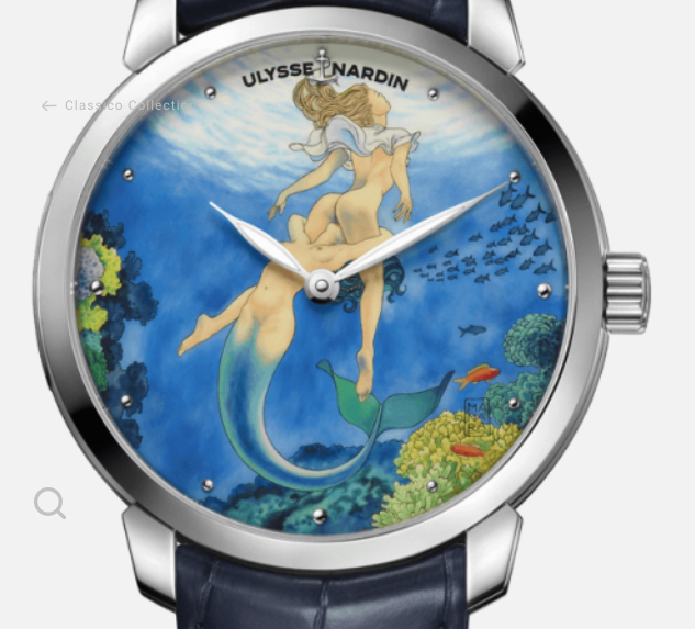
Redemption! Almost as many sailing depictions as soft porns. Have to zoom in a bit to see the woman in the second shot, but she’s there flying solo.
And, what of Harrison’s contraptions? His H1 clock did vey well from England to Lisbon, but never went all the way across the Atlantic. He had himself to blame for that; he could have tried to claim the Longitude prize by demanding a sea trial and taking his chances on the results. Instead, he verbally beat up on his clock to the Board, and asked for stipends to continue work on a better version. They gladly went along based on the promise the first clock held out. That was in 1735, five years after he began work on it.
And his watch? Several decades and two clock contraptions later, the H4 watch was completed went on two trans-Atlantics from England to the Caribbean. The first was in 1761/62; the second in 1764. How did it do?
Trial one: over 147 overall days out and back, it lost just under 2′ total time.
Trial two: over 156 overall days, the average error was 39 seconds. This was good enough to deduce the position of the island of Barbados within 10 nautical miles, which was 3x better than the requirement of the Board of Longitude! They noted that they were…
“Unanimously of opinion that this said time keeper has kept its time with sufficient correctness.”
Muckety Mucks of the Board of Longitude
Yet, Harrison wasn’t officially awarded the prize from the Board. Ever. He did eventually get the rest of the money, but it was only by a magnanimous act of Parliament, facilitated by the intervention of King George III himself. The King became interested after Harrison’s son, William, who went on the actual sea trials, petitioned him for an audience. George used his own personal observatory to officially monitor the accuracy of Harrison’s timepiece (along with Harrison and another individual) . He then advised Harrison on how to approach Parliament.
No one was EVER awarded the top prize from the Board of Longitude. Harrison came closest with a considerable sum of money over time, and the admission from the Board noted above. Eventually, the advent of affordable and accurate chronometers made the Board moot and it was disbanded. But it was Harrison who pioneered the path of timekeeping and navigation precision.
And, what do we have now in the way of a chronometer? What’s the modern-day standard of accuracy?
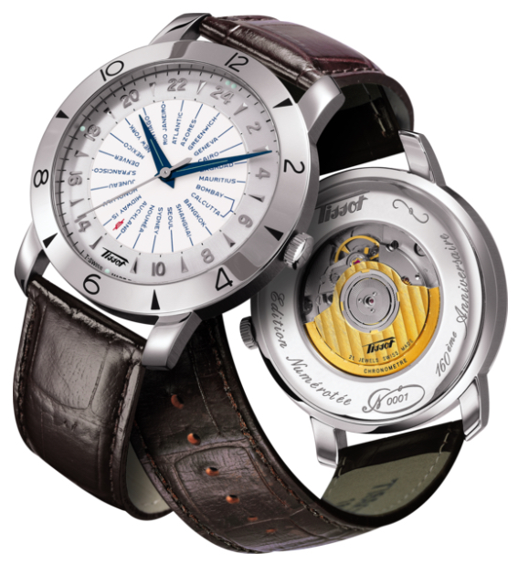
Tissot’s Heritage Navigator, a re-issue of their centennial piece from 1953. It’s a world-time mechanical watch, and it’s an officially certified Chronometer. This is just one example of a modern day chronometer. They range from inexpensive, very accurate quartz models to Breitling and Rolex standard issue fancy-lad wrist lashings.
Watches are synonymous with Switzerland. And the Swiss non-profit/industry association COSC governs the standards. The Controle Officiel Suisse Des Chronometres (Whew!) is the only entity that certifies Swiss watches to have met the accuracy and consistency standards that earn the title “Chronometer.” A small percentage of all watches bear that mark, whether because they aren’t good enough or they simply haven’t been submitted for certification. Each timepiece that passes has its actual movement engraved with a number and gets an official certificate. That applies to both watches and clocks.
How good do they have to be? It’s complicated… but it appears to currently be to -4/+6 seconds on average per day for mechanical watches. Apparently, Japanese standards are slightly more rigorous (Grand Seiko being a brand that meets them). Quartz watches are significantly more accurate with a standard of less than 1 second of error per day.
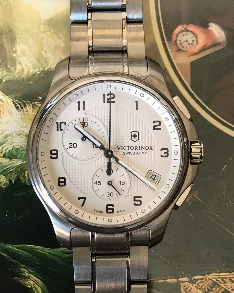
Victorinox’ Officer Chronograph – not a chronometer – atop a copy of Longitude with Harrison’s hand clutching his H4 from a contemporary portrait. This quartz watch retails for $795 unless on sale, but can sometimes be had for under $300 – as was the case with the one right here. Chronographs have stopwatch functions.
So, compared to today’s machine world, Harrison’s chronometer from 250 years ago was not only better than its time, but just better. His H1 through H4 pieces are still on display for the public to appreciate in Greenwich, England… also known as zero degrees Longitude.
Ed. note: Most of the Harrison and related references in this post were sourced from the book pictured above: Longitude: the True Story of a Lone Genius Who Solved the Greatest Scientific Problem of His Time. Author: Dava Sobel. We highly recommend this book, and especially the Illustrated version The Illustrated Longitude, with substantial illustration and captioning by co-author William J. H. Andrewes. Want the video version? There’s a Nova episode which is available on DVD!
Now, one app does it all. iNavX just announced that it’s available for Android. And, it can run Navionics.
One stop shopping. Comes at a price: $30. That’s an expensive app. But it used to be $50, and worth it, even before it integrated with other chart app software. So, you get what you pay for – and sometimes you get rewarded and pay less for it!
Who cares? What’s so special about iNavX?
First, a word or 50 about charting apps. They’re a great resource when you have cell service on the water – which, for most of us, is most of the time. They show where you are in real time just like a dedicated GPS chartplotter but for pennies on the dollar. Even without cell service, you can look at the charts for planning purposes. However, just as with anything else electronic, they can fail, go overboard, or just run out of power. And, you can’t plot a course or position on them with a pencil.
Having said that, most of us want to be using them to supplement our paper charts. It’s just as foolish to swear off them as to over-rely on them.
And now, why iNavX…
iNavX is the quintessential (if not only) chart app that uses digital imagery of real charts. It’s a static display. What you see on the chart is what you get on the screen. You can zoom in and out, but it’s like cropping a photo. The same stuff is there.
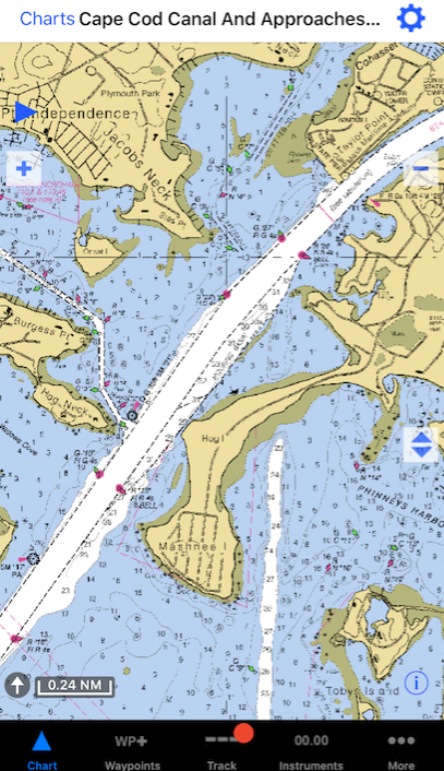
Example of iNavX:
Screen capture of an approach to the Cape Cod Canal from iNavX chart app. This is what the equivalent paper chart would look like, as this is scanned directly from the same file.
Pros:
like we said – what you see is what you get: consistency.
More practice reading the same style chart makes it all faster and easier.
Cons:
not available for all areas.
Must ‘switch’ charts in the app when your position crosses the boundary.
The popular Navionics app uses ‘vector’ scan tech. The app uses its own colors and presentation to display essentially the same data that a chart would, but it is responsive and dynamic. As one zooms in or out, the scale changes. If the user selects a different size area, the amount of detail changes in inverse proportion. Translation: what you see is what the app chooses to show you. Ask for more area, and you get less detail. Stuff disappears.
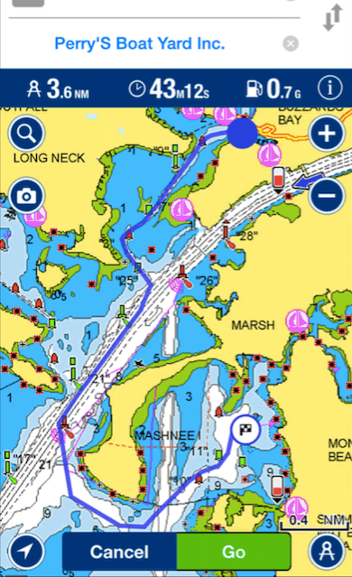
Example of Navionics:
Navionics display of basically same area and scale as the previous iNavX image. This is vector scanning. Captured from the Navionics web site. Resolution slightly degraded from how it would likely appear in-app, but you get the picture. Different type of display. Nb: the near complete lack of depth soundings – prime example of data disappearing.
Pros:
broad coverage: more regions available worldwide.
seamlessly switches ‘charts’ without interruption or input from user.
Cons:
changing graphics causes visual confusion
inconsistency with paper chart presentation can do the same
both above slow things down
And, like we said – the chief culprit? Stuff disappears. If one zooms out pretty far for ‘small’ scale (large area in smaller detail), reefs and shoals can disappear, and the app doesn’t tell you that it just erased something – including the shoal you were, and still are, aimed at.
A few years ago, a boat in the Volvo Ocean Race ran aground off a tiny island essentially in the middle of nowhere in the Indian Ocean. The area is called the Cargados Carajos Shoals, about 270 miles off Maritius. Everyone on all the boats knew they were going to pass close by one of the islands. One ran aground while sailing at close to 20 knots at night. It’s somewhere between possible and probable that vector scan charting software that was overzoomed contributed to this mistake. Fortunately, no one was hurt. But, the coral was damaged, and the boat was essentially wrecked.
Our recommendation? Get iNavX and be done with it. If you want to play around with vector charts as well, then get the $29 add-on for Navionics and run that within iNavX so you have options at your disposal. In the interest of full disclosure, Navionics alone, outside of iNavX, is $10. It’s called Boating and has a similar logo.
A client of ours is originally from Canada, and two buddies and he did 103 and 104 with us one season before doing their first bareboat charter in the BVI.
Adam’s uncle got involved with a latent lighthouse in Ontario, Canada. He’s on the local preservation committee, and had been trying to get it lit back up. Apparently, it was a somewhat uphill battle as there were concerns about the light shining on shoreside homes at night and being intrusive. The major’s office was involved and favored the light being back on, so that helped.
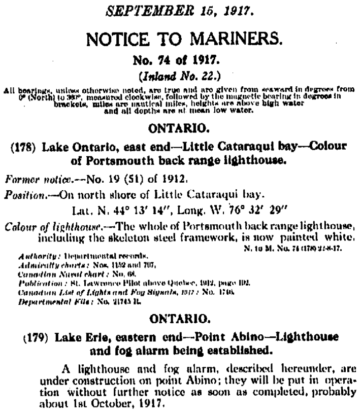
Here’s an excerpt from the original Notice to Mariners in 1917 that announced the construction of this light!..
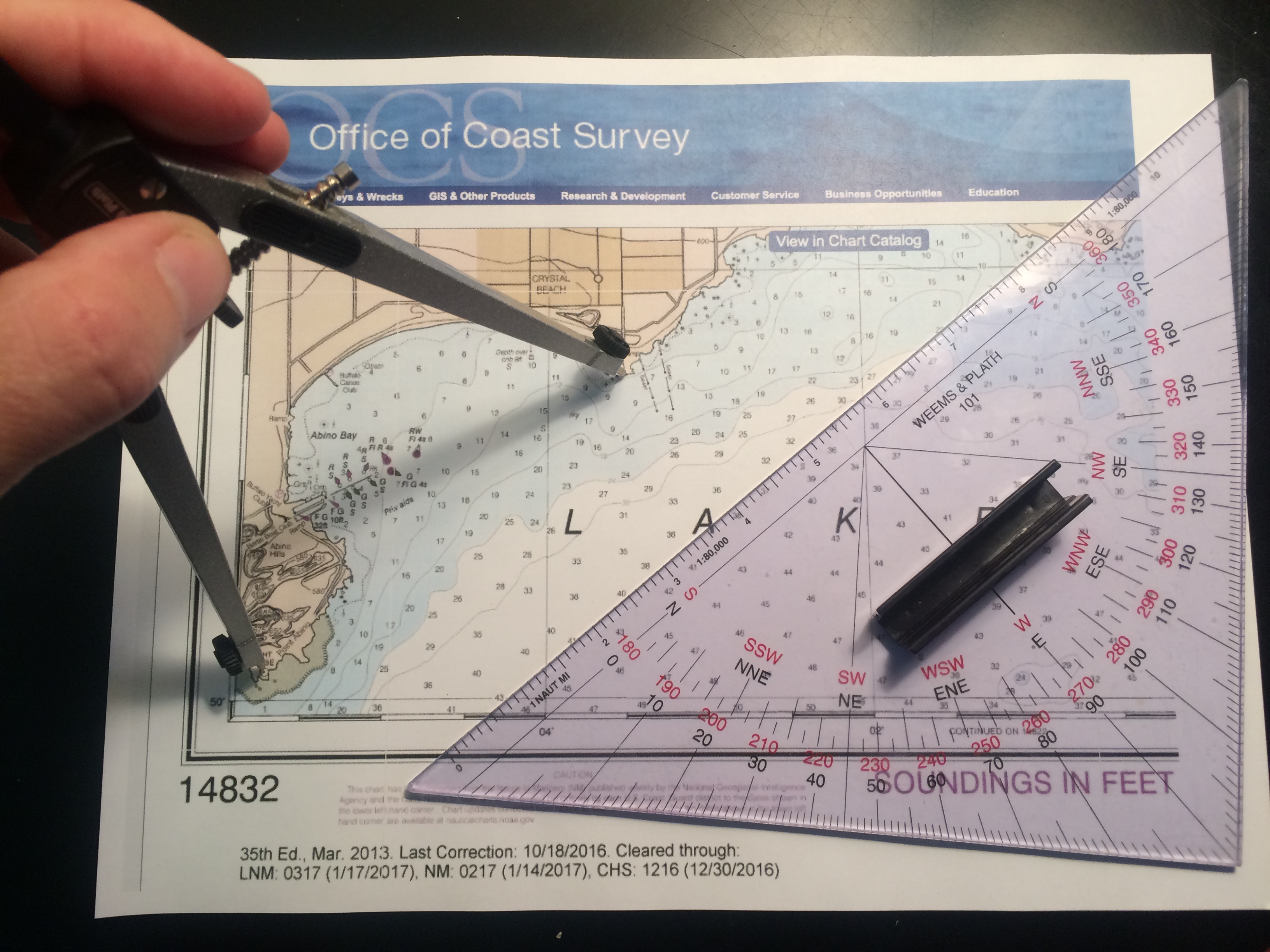
For its return, the compromise was to aim the light across the bay at another peninsula rather than sweep across the shore or just aim 360 all around. Our mission: confirm the exact bearing, and show/explain why we came up with the magic number.
(Truth be told, Adam was more than capable of doing this himself, having successfully taken and passed 103, 104 and 105 with us and then applied it in the BVI. But this had to come from us as the outside experts.)
Anywho, Adam enlisted us to be the alleged experts to plot the angle of the light and show how we’d done it.
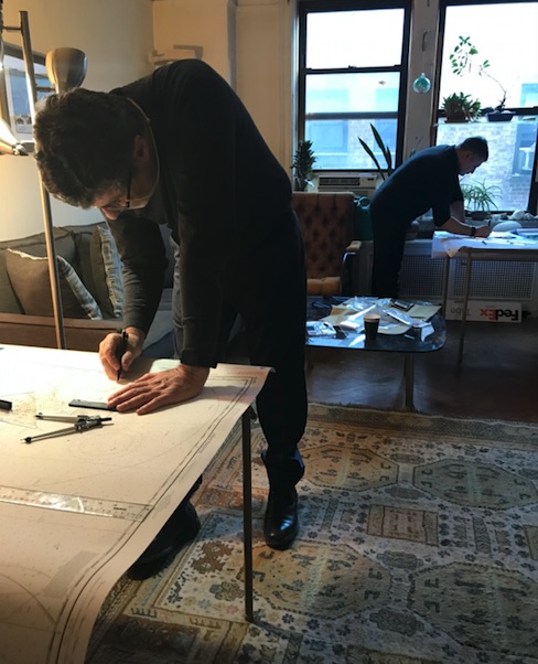
Dividers (nautical drafting compass) set exactly on the two points; protractor triangle was laid carefully against them to be on the correct bearing. Then, triangle was carefully moved to a meridian of longitude to read the bearing in true degrees. This was converted to magnetic so bearings could be taken from either point in real time to confirm.
1. Get the right chart. Adam took care of this: NOAA #14832, Upper Niagara River, ending in Lake Erie.
2. ID the light in question: “Light House,” on Point Abino. No characteristics shown as it’s idle.
3. ID the exact spot the new light is supposed to be aimed at: SW corner of the peninsula across the bay at the other end of Crystal Beach.
4. Measure the bearing painstakingly several times with at least two methods and get a consistent answer: 61 degrees magnetic.
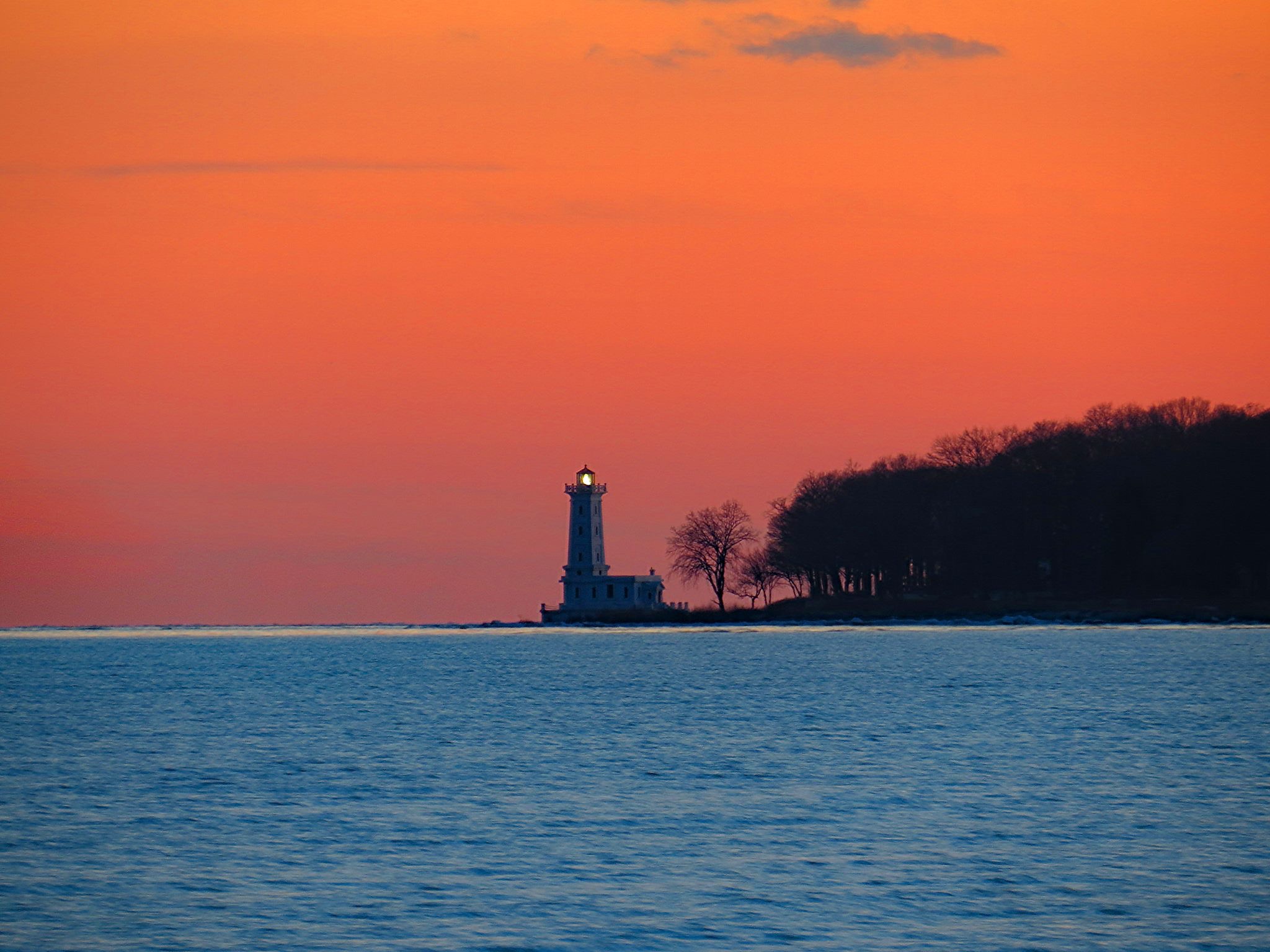
There you have it. And thar she glows…
The light house at Point Abino, Ontario, with its beacon aimed back across the bay.