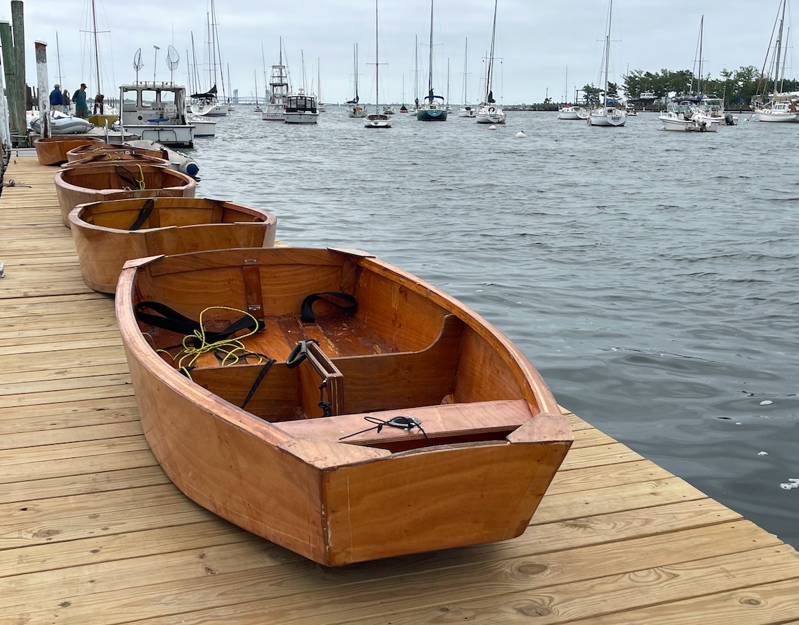
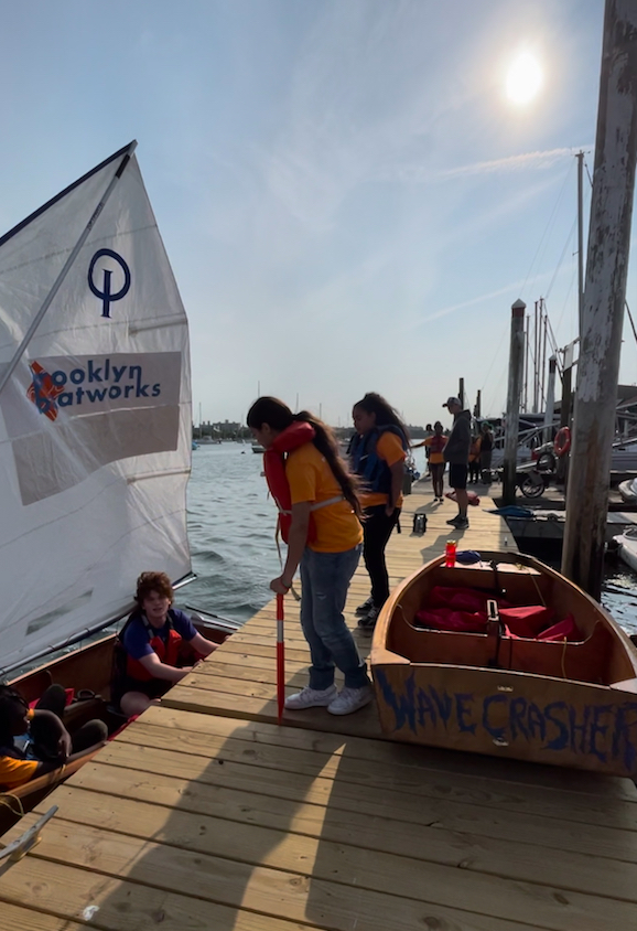
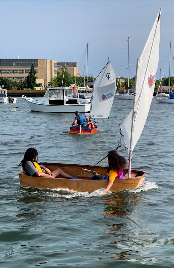
Kids learn how to build, then how to sail, small sailing boats. STEM working for them!
I started sailing dinghies (little boats that can flip over) when it was almost ‘too late.’ From a development standpoint, kids should learn on dinghies. If they learn on keelboats (larger boats that basically don’t flip over), fine – but they must get on dinghies while they’re still young and developing themselves. By late teens or so, that ship has sailed. They’ll never develop their skills as well as they would have had they been on dinghies earlier.
These kids have a shot. True, they’re largely from less or disadvantaged backgrounds. Sailing has a deserved reputation as being lily-white. This student body isn’t. But, as with many other activities and institutions, things are changing. There are more opportunities. Sailing might be one of the slowest to come around, which is partially intrinsic due to the cost of boats and access to them, but it is coming around.
And, around came Brooklyn Boatworks:
BUILD A BOAT.
BUILD A DREAM.
Harnessing the unique craft of wooden boat building and maritime-centered exploration, we inspire young people to uncover the confidence, skills, and courage to chart pathways to success in and outside the classroom.
call-out on home page of Brooklyn Boatworks
Basically, they offer community programs and after-school activities that take a different tack toward preparing kids for both academic and life success. What better way to approach STEM (Science, Technology, Engineering & Math) than to do something in real life that shows why a kid would want to do well with those subjects in school?
It reminds me of the public service TV ads from awhile back (a long way back) where they’d show someone doing an activity they liked, then, ask how that’s going to help them in life? They then explain why. “Joe likes shooting pool. How is that going to help him in the real world?” Well, I’ll tell you why. Angles. Physics. Geometry. Patiently learning physical techniques and manual dexterity that can apply to any number of potential future tasks – including surgical sutures. (Ed note: I made up the explanatory part, and re-created the quoted part which gives the gist of it but with different words.)
Building a small wooden boat as a team lets kids work on…
team work
long-range planning
managing material resources
safe use of tools and glues/epoxies
setting and achieving goals
application of academic subjects to the real world
etc
etc
The mission has been around for a couple of years. Now, Brooklyn Boatworks has moved their most recent completed fleet of Optis (Optimist Prams) to the Sailing Center’s host facility, Miramar Yacht Club. Miramar’s mission is simply to promote sailing and get as many people from as many walks of life as possible into it. That dovetails well with Brooklyn Boatworks.
We saw it all in action last week. The school had a class of two (young) adult students out for their 3rd day of lessons. On the way out, the boats were lined up on the dock in preparation for rigging and sailing. On our way back, it was all happening.
I wanted to hop in on one! But, of course, that wasn’t the point. They had everything under control as far as volunteer instructors, coordinators, and safety staff. The wind had been too strong, but then it moderated and conditions became ideal for this – wind aligned with dock, enough to sail but not enough to bail, no threat of squalls, etc. Perfect.
The Sailing Center is an unofficial, informal advisor to the program. We can’t wait to see what comes next!
Harry “Buddy” Melges, one of the greatest sailing racers ever, has passed at 93 after passing down a legacy that has reached down even to those learning how to sail.
I got into sailboat racing when Buddy Melges was a household name in racing circles. From Zenda, Wisconsin, Melges (pronounced with a hard “g”) was super successful in a variety of boat types and also influential – and consequential – in sailboat design.
I’ll leave the more general obituary to others (several are linked to at the end of the post, along with a photo biopic from a local paper). Here, I’ll talk about him from a racing perspective.
He was a scow sailor. What does that mean? Scows are type of very flat, wide, lake boat. Scow racing is very competitive in many lake areas of the US. Melges came up, so to speak, on scows, and was one of the most successful scow racers in history. He was particularly successful in the E scow, winning the nationals 5 times. I’ve never sailed one, but reading about Melges back in the day made me curious to try.
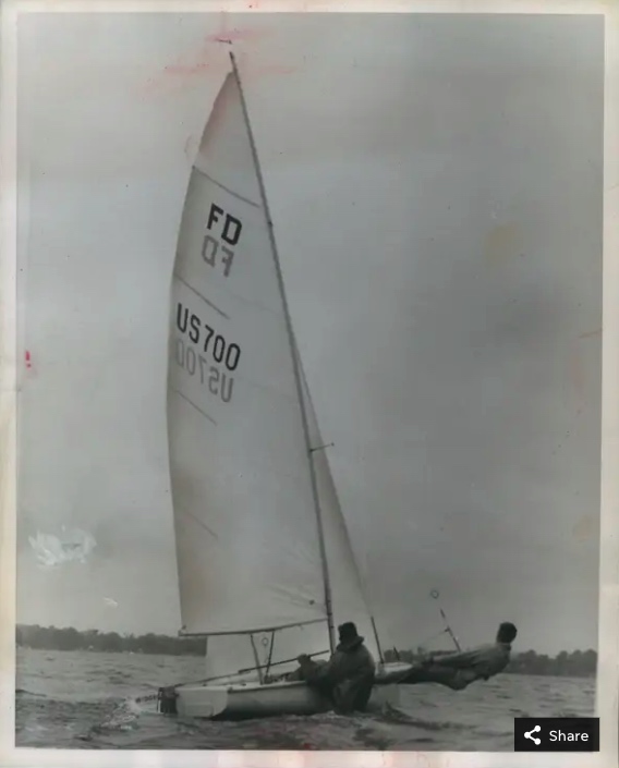
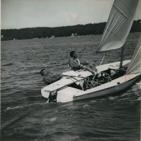
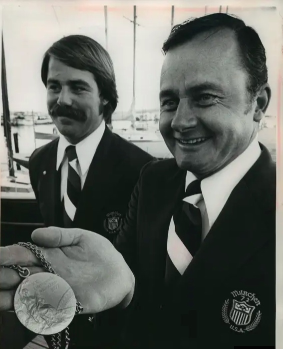
He also raced both dinghies and keelboats. He medaled in two Olympiads: the Flying Dutchman in 1964, and the Soling in 1972. The FD was the “heavyweight” 2-man sloop rigged dinghy with main, genoa and spinnaker, and it was a beast to sail. Paul Elvström and Ted Turner were two competitive FD sailors, to give some perspective on the talent in that class. (Neither won an Olympic medal in one.)
The Soling? The 3-man Olympic keelboat, also sloop rigged, with main, jib and spinnaker. I have a lot of time on Solings, although much of it was learning to sail and race when younger and, later, teaching both sailing and racing. I did sail in an East Coast Championship once as crew. Who did Melges beat in the 1972 Olympiad, amongst others? Paul Elvström, arguably the greatest racing sailor in history. (The Great Dane didn’t do very well in ’72, coming in 13th.)
But wait – there’s more! Melges also championed in the Star class, another sloop rigged Olympic keelboat (2 person; main and jib; no spinnaker). He won the World’s twice in that class. Who else is a sailing household name with fame in the Star? Dennis Connor of America’s Cup lore.
And, then, there’s the America’s Cup. Melges won that in 1992! Co-skippering, to be clear, with Bill Koch and David Dellenbaugh, but an integral part of the team. And, to win the right to defend the Cup, they had to defeat Dennis Connor, the name most synonymous with the America’s Cup. Melges was in his 60’s at the time, when the average age of an AmCup skipper was more like 38. Decades later, he said this:
“It’s nice to win the America’s Cup, but I’ll take an Olympic medal.”
Harry “Buddy” Melges, c0mparing winning Olympic Bronze and Gold to winning the America’s Cup. He did all three, and was more impressed with his Olympic successes.
Taking a few steps back in time from the America’s Cup, I realize I overlooked some of his successes. He won the Skeeter Ice Boat World Championships 7 times, and the 5.5 Metre keelboat class World’s 3 times. Almost more impressively is the fact that these two records, plus the E-Scow record, were all done from the ’50’s through the ’80s. Yup. Consistency over a long span of his life.
That record makes Melges one of the most well-rounded and diversely successful sailboat racers in history. At the moment, only Elvström comes to mind as a comparably, or arguably even more, successful overall sailboat racer. (Melges has the ice-boating, giving him a singlehanded class, and the America’s Cup. Elvstrom has the Finn dinghy, the world’s toughest boat to sail, with 4 Olympic golds, and he just missed the bronze in the Tornado catamaran when he was in his 50’s and his teenage daughter was crewing for him. As with Melges, Elvström was a 5.5 Metre champion. Elvström was top tier in the 505 dingy and Dragon keelboat as well. Melges built boats; Elvström built sails. Both businesses continue to thrive.)
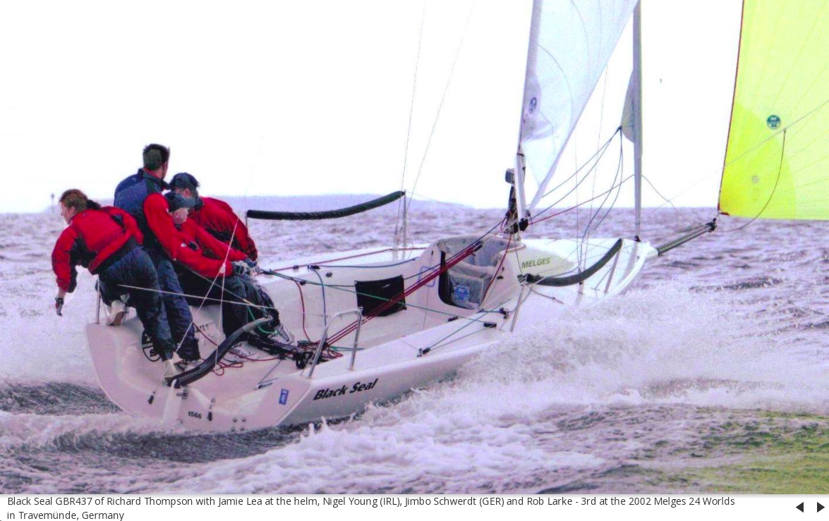
Melges had always been into making and tweaking boats. Ultimately, he followed in his father’s footsteps with Melges Boat Works, transitioning and expanding it. After the ’92 Americas Cup, he partnered with renowned naval architects Reichel/Pugh and the Melges 24 was born, with a 32 to follow. The 24 was a true sport boat, super-light and fast AF with an asymmetrical spinnaker to make for more tactical and controlled speeding downwind. It became a very competitive class around the world, supplanting the J/24 (which was succeeded by both the J/80 and J/70).
Melges was nicknamed the Wizard of Zenda, and he co-authored, with Charles Mason, a well-received book on racing called Sailing Smart: Winning Techniques, Tactics and Strategies. If memory serves from the debates from back in the day, Melges believed in something called the “lee bow effect.” Other experts didn’t. I happen to believe that most people misunderstand current, which is what’s involved here, and I always believed Dave Perry’s explanation of why there is no such effect (which he credits Peter Isler explaining patiently to him for over a year until he “got it.”).
The lee bow effect argues that, if the current is basically head-on to a boat sailing upwind, meaning it’s also sailing directly into the current, that the boat could pinch slightly (head up toward the wind) to get the current onto its leeward, or downwind, side. That, in turn would push the boat further to windward, more than offsetting the loss by going a little too close to the wind.
Never made sense to me. Set a fleet of boats adrift with no wind, but in current. Have them at various angles. They all drift the same way. Start moving them through the water with motors. They all travel exactly straight through the water. What’s different? There’s a ‘wind’ created by the boats moving through Earth’s atmosphere, regardless of current. The current simply changes that angle. But, rotating the boat in the water doesn’t make the boat ‘feel’ the current and react differently, so there’s no advantage to changing the angle of the boat to the path of the current. Boats neither ‘feel’ it nor are ‘deflected’ by it.
Having said all that, my racing success is limited to the local and regional level and nothing to speak of compared to that of Melges (nor to Dave Perry, Laser and Soling champion amongst other accomplishments, or Peter Isler, tactician to America’s Cup winner Gary Jobson).
Maybe Melges wrote about it in his book. I just ordered a used hard-cover copy to find out.
Rest in peace, Buddy. The sailing world misses you already.
Our latest Virgin Islands trip saw people brushing up on how to sail a yacht and how to kick it on a kewl cruise.
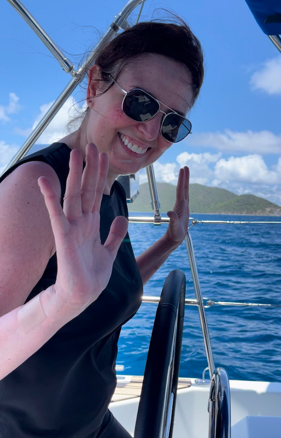
Our (typically) annual trip in the British Virgin Islands was spectacular. Winds were surprisingly consistent, especially for this time of the year. The group got along like Kool and the Gang. There was less traffic than in the high season, and therefore parking, playing and getting dinner reservations were all easier.
For newcomers to our ramblings and Rants, these trips are instructional sailing vacations. People get a tour and vacay, but also can train at all the aspects of bareboat charter cruising. Those with the prerequisite background can earn one level of ASA cruising certification (either 103 or 104). On rare occasions, a student might pursue their 105 (coastal navigation).
This trip was full and waitlisted for any cancellations. Our last BVI trip was literally the week before the pandemic lockdown in early 2020, so we skipped two years in paradise. We did manage an Italy trip last fall which had been postponed for the same reasons. On this BVI trip, we had one couple who’d taken their beginner course with us last summer, one single guy, and three single women (one of whom had gone to Italy with us as well as sailed in our club and taken a course or two).
So, what was new in BVI? What was the same? We skipped the “new” stuff. For example, we know peeps who played there a month earlier. They reported that Cooper Island, Bitter End & Saba Rock, and the restaurant above The Baths had all over done it. A few places had rebuilt bigger and badder than ever after the back to back hurricanes that preceded the pandemic. Others never rebuilt. Others were simply the same. It therefore felt like it always had, in a good way, and often felt as if we had it to ourselves.
I’d anticipated some dead zones where motoring was required to get anywhere. March had been like that a few times. Not so this early May! Winds were consistently about 12-15, and sometimes into upper teens. One day was honking as we got started, and we very conservatively double reefed the main. When it diminished somewhat, we shook out one reef but that was all I could get a basically lazy crew to do. Their party; their time. It was our last full day so they were kinda chill.
And, of course, it’s all supposed to be “island time.” There are some exceptions, of course. Want a guaranteed mooring? Have to be on the special app for that at 7am. Maybe not in the shoulder season, but certainly in the winter and early spring. Want a dinner reservation at Pirates Bight restaurant on Norman Island? Better make one early, especially if you want to choose your table time. How about dinner at all on Anegada? They do things different there. Call in your boat’s name and exact dishes (plus any choice of sides) by 4. Better yet, do it by 3. How many lobster? How many Mahi? Etc, etc.
We were on a nearly new Jeanneau 40 (Sunsail 40, as that’s who we chartered from). Nearly new here means 4 months. We paid extra for the privilege, and always do if they’re available. The sails were therefore perfect, and almost everything else showed new. There were some strange small failures that weren’t fixed before we set out on charter, such as the strut to hold up one of the top-load cabinets, and one door handle kept coming off for the aft head. But we dealt easily enough. The engine and electronics were all perfectly functional, and the boat performed.
It did poorly under the double reef; the boat needed to heel over and power up. The sail plan must have been inherently small, requiring reefing higher up on the wind dial. The crew had their chance to shake out the single reef when even that was too little but were enjoying it nonetheless. We got to our destination with plenty of time to do other activities despite that.
Turtles were doing well, and we saw them daily. Rays were a little down in the count. Snorkeling got us into all kinds of parrot fish, and numerous other species. One decent sized shark was spotted: almost the size of the 10-foot dinghy (so perhaps 7-8 feet, although it was an experienced snorkeler who’d seen sharks in the past, so maybe 9). That client asked for a pick up from the dinghy, as we were snorkeling off the boat close to shore, and he backed himself up almost onto it to keep an eye on the thing. He did say that the shark seemed to spook when they got close to each other and take off, but due to its size he wanted to play it safe. We drove over to the other snorkeler and advised. He wanted to see if he could see the shark! So, we let him be. Shark attacks in the Virgin Islands: how many documented attacks? One, in the 1970’s, on a diver in over 200 feet of water far from shore. Statistically insignificant, as I often say.
Food: better! I’m often less than impressed with the local food, sorry to say. Having said that, there are several places worth dining at. We ate out for dinner half the time, and every meal was excellent, with the possible exception of the first night before we took off on our adventure. I ordered duck that was under cooked, and when it came back, it was still undercooked and everyone else had finished their meals. I rejected it and ordered a salad, which came back way too complicated after I’d asked for greens with dressing. I’d go back despite that, as we’ve been there before and it was top tier.
Sadly, my personal favorite, and always a favorite of clients, is still not back up and running after the hurricanes. That’s Fat Virgin’s Cafe, not surprisingly of Virgin Gorda. Unpretentious; cheap; excellent. Slow, which might be to get more drink orders or, more likely, because they take their time to cook things right. Dinghy up to the dock; the picnic tables are two feet away. Limited seating; never full; hard to tell if reservations are ever needed or taken seriously. If a pro captain brings a group, he or she eats free. But, don’t be bringing no high-maintenance people late in the evening. Yup; we sort of did that once.
It can be fun to cook on board, and everything just tastes better on a boat. We did stove top and barbecue grilling for some of our dinners. Simple stuff, and it came out great. No complaints here. One woman’s pasta dish caused me to totally overeat with healthy seconds heaped on. Plus, ice cream she’d gotten at the last port and somehow managed to fit into the tiny freezer! That was a feat of modern engineering.
Next trip? September. Where? Europe: either Croatia or Italy, both of which we’ve visited before. Excited to go back to either, so I’ll basically let clients choose assuming comparably good boat availability with doable pricing at both locations.
Hope to see some readers on that trip! Get in touch if that might be you. You never know; you might dial up the delightful experience you want for yourself.
Until it isn’t… or is that Brighton, Utah? The weather has been wild all over, but we’re starting to teach people how to sail in Brooklyn and ignoring the powder out yonder.
We started on April 4, did a few lessons, resume this week with a private on Wednesday, and take a break for our Virgin Islands Sailing Vacay (BVI). After that, our first full Start Sailing course of the season kicks off on May 6.
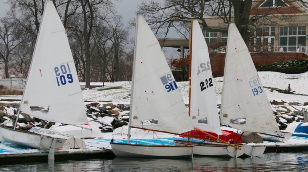
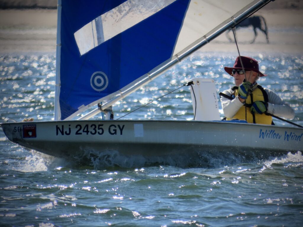
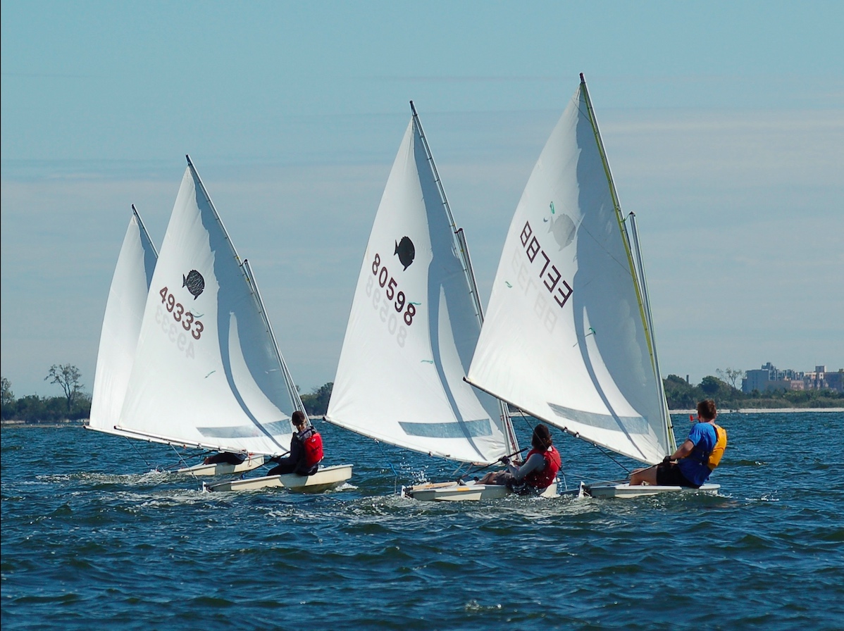
The little guys above are Sunnies! That’s a nickname for Sunfish, one of the world’s most well-know sailboat classes. There are a ridiculous number of them worldwide accumulating since they were born in… 1947!!! I most certainly did NOT know they went back that far. By the time the Sunfish turned 50, there were over 300,000 of them. They’re a competitive racing class with well attended world championships. I’ve sailed them once or twice, along with the similar Sailfish.
That shot was posted to promote the Sebago Canoe Club‘s spring regatta, which involves Sunnies and Lasers (which I’ve raced extensively). Sebago is in Jamaica Bay, a short ride away from our Sheepshead Bay location at Miramar Yacht Club. Like Miramar, Sebago is a cooperative and all members give service to the club to help run it and keep costs down.
So, the Sunnies will be out in force. How about us?
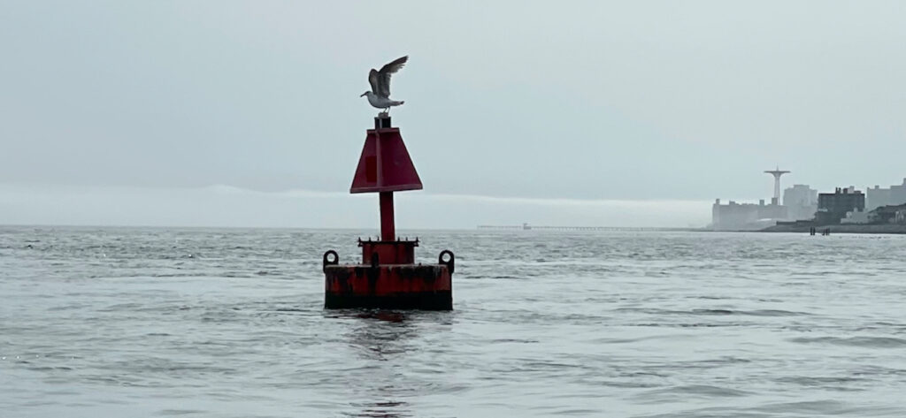
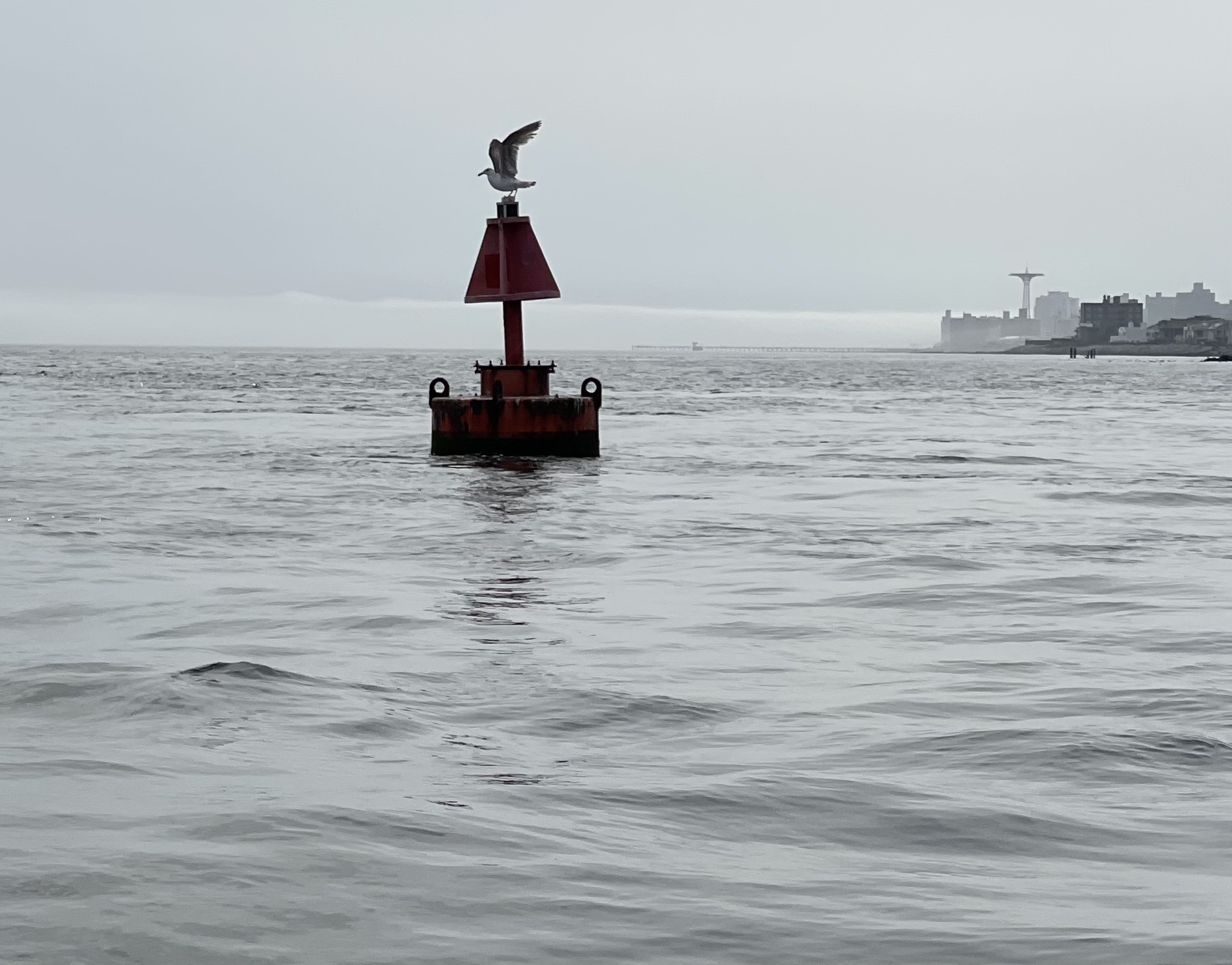
We’ve been sailing off Brighton Beach. That’s next to Manhattan Beach. But… it’s not in Manhattan. We don’t do Manhattan for sailing. Brighton is on Coney Island, facing south toward the Atlantic, and almost there. Directly across Rockaway Inlet is Breezy Point. If Montauk is “The End,” as the bumper stickers say, Breezy is the beginning. It’s the very start of continental Long Island, and where New York Bay meets the Atlantic.
Brighton was a bit cloudy and more than a bit foggy the last time we were out. It happens. There was enough wind to sail after being almost becalmed briefly. That’s super rare here. Remember… Breezy. The area has its own micro climate, with fair weather far more often than foul. Last season, we did five full learn to sail schedules there, spread out over the whole summer and early fall. We also did numerous private lessons. How many times did we cancel due to thunderstorms? Zero. Not so with our old digs at City Island. “It’s (almost) always sunny at Breezy and Brighton.”
How about Brighton, Utah? Still snowing!!! They just got some more, and have little more on the way. As of this writing, they’re still 100% open. Every. Single. Trail. And, all the glades. 65 big runs, at the little big mountain in Big Cottonwood Canyon.
Who cares? Anyone interested in both sailing and snowsports; anyone concerned about climate change. The Wild Winter that Was out West broke many records. We might not be glad that it did. Add in the drought we had on the East Coast this winter, and the spring tornados that have wrought havoc on the southeast, and who knows what to expect going forward.
Down around Breezy and Sheepshead Bay, for at least the foreseeable future, we can count on afternoon sea breezes most days, with virtually no risk of thunderstorms. It is known. We’ll take it, and take our chances with what happens when the next winter comes.
Our season for teaching people how to sail a boat, or get better at it, is underway.
Actually, it began on April 4, one of our earlier outings! We started off conservatively with a private lesson for an experienced student who has a new boat arriving soon. He’s been a regular private lesson client for awhile, and has come down to our new location in Sheepshead Bay a few times now despite plans to keep his boat on the Sound.
Due to the vagaries of spring weather, as exacerbated by global warming and climate change, we stopped our long standing tradition of kicking off learn to sail courses in mid April. Now, it’s early May, with an occasional advanced course starting earlier as well as private lessons.
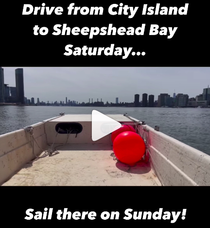
Next up after that lesson: I brought our Carolina Skiff down from City Island. I ran it down the East River, which is not necessarily for the faint of heart, and then NY Harbor (even less so) before getting through the Verrazzano Narrows and on to Rockaway Inlet and Sheepshead Bay. I knew I needed to not only time the current properly, but also the weather. Our skiff is very open, so spray can be an issue. It’s also more flat bottomed than deep-vee’d, so it has serious limits to how much of a pounding it can take in chop. That said, it’s super stable and can handle rolling/yawing extremely well.
I settled on a Sunday with a forecast for very light north winds, switching to light from the southwest late in the day. If all went well, I’d have a gentle wind at my back on the way down and no worse than a gentle one from on one side toward the end of the trip. The slack current at Hell Gate was predicted for exactly noon, and I love the ‘high noon’ thing. I assumed a 10-knot average speed, and based on the distance, figured it would take 2.5 hours non stop. Of course, I’d stop for various reasons a number of times, including potentially for a fuel top-off, so guesstimated 4 hours dock to dock.
It was a milk run. Sunny most of the way to take the edge off the chill; flat calm due to light winds. There were occasional wakes, but I barely reacted to most of them and none were dramatic. I almost skipped the fuel stop, but heeded the advice of one our instructors who’s and ASA Instructor Evaluator, and super knowledgeable and experienced in that area. “You’re right there – how long a detour is it? 30 minutes? Just do it.” He was speaking from both experience and common sense. Most very experienced boaters have, at some point, had a fuel fiasco.
It was around 30 minutes. I also did numerous very short stops for grabbing a bite to eat, adding clothes, doing something on the phone, or taking pics. Total time dock to dock? 3:08. So, my 2.5 was damn close to exactly right. Score one up for the great navigator! Turns out… I didn’t need the extra fuel, but better to have to add stabilizer to that than wonder if a tow boat service could do a fuel drop half way between Hell Gate and Schitts Creek.
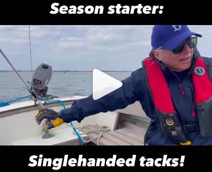
Next? A quick sail with two instructor candidates. Chilly and wet – but fun! See a sample in the clip above.
We did another private lesson for a City Islander soon afterward. She booked weeks in advance and didn’t realize we had moved to Sheepshead Bay! But, she decided to make the trek anyway. Her sister and she had taken lessons together previously, and wanted a better progression at a pace that suited them. They tried, we supplied, and they had nearly perfect conditions that helped that happen. They’ll be back.
We also got out two students who had different backgrounds, but were both in need of a similar lesson. I grouped them and also brought along a new instructor we’re ‘onboarding’ for his second orientation session. We got becalmed just as we entered the Inlet, but then the wind picked up enough to fight the current. Soon, we didn’t need to consider the current.
Full courses begin on May 6, and our first Sailing Vacay Course of the year ends the day before down in the Virgin Islands (BVI). In the meantime, we’ll continue with privates as the weather allows. Spring weather up here is too volatile to plan on multi-day beginner courses for people with busy schedules. Some schools do it anyway and graduate people who haven’t learned to sail. We’ve paid attention to the weather trends and decided to start a little later, so students who Start SailingSM with us can get it done the first time.
Using your phone to take pics and clips while learning how to sail, or sliding down a mountain? Don’t do it without a leash.
Instagram is a boon and a bane. And, it’s incessant. It’s like the Terminator. It doesn’t stop; it doesn’t reason; it doesn’t care. It just does. Insta? It’s newer digital tech, but it uses an old school ad trick. It makes sure you see the ad enough times to have a chance that you’ll take the bait.
I took it. Despite being leery of Insta ads, this one looked good and I needed something like it. I needed a leash for my iPhone for snowboarding, and potentially for on-water this sailing season. The closest thing I had in the past was a bulky foam protective wrap that went around the phone’s case, and would both cushion and float it. It came with both neck and wrist lanyards. I took the phone on chairlifts; I took it snorkeling (waterproof case). That was the Lifeproof case and Lifejacket accessory. But, their quality control eroded and I lost a phone to water intrusion, so was done with that.
Anywho, fast forward to early/mid winter. I was seeing ads like the one above for the Hangtime Koala. It’s a one-piece silicone leash and holster. It straps around the corners of various phone models and interferes little to not at all with functions. It attaches to ones clothing with a choice of carabiner or spring clip. I removed the clip and tried the carabiner, which isn’t perfect (I popped it off a few times but didn’t lose my phone). Upgrade the carabiner, add an extension to the short leash, and I should be good to go.
It works! Like everything, nothing’s perfect, but it’s a solid product. I’ve taken clips on the hill, and also while doing runs. I fell; I tumbled. The phone stayed with me (possibly because I had a death grip on it; can’t remember if I dropped it during any of my falls).
The last time I used it was around 2 weeks ago at Stratton Mountain in Vermont. It was a true powder day; I’d driven up the previous afternoon to avoid driving as the snow fell that evening and through the next day. That was a good move – few people got to the mountain the next day due to the storm, so the overnight snow held up well and we were all treated to free refills all day. And, it kept snowing into the evening and next morning! Stratton reported a total of 41.” No one got to ride or ski 41″ of course as people started getting at it the first morning, but it was already 2+ feet by then and building. That’s almost as good as it gets for a Northeast powder day. (I had a better one once, with 2.5-3 feet overnight, and also at Stratton. Killington does get more snow, and better quality on average, but Stratton seems to get the bigger dumps albeit rarely.)
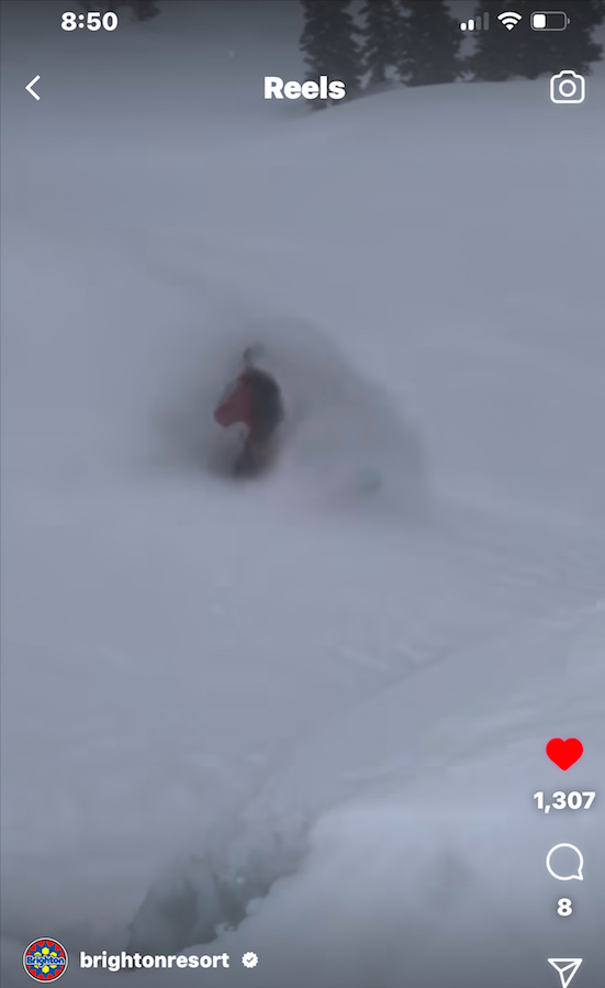
I posted that run in the previous Rant, but here’s one newly posted from a Utah trip two weeks beforehand using the Koala. Click pic to play…
During a break in the mid mountain lodge, a guy approached me and asked what I was using to hold onto the phone. It was still attached to the Koala. I told and showed him. He said he owned the patent for it, and that the guy from Hangtime was knowingly violating it. His company? Smart Catch. Similar product; less expensive; patents shown on the web site. (And, yes – there are other similar products out there including one aimed at those who go fishing.)
His wife apparently came up with the idea while on a chairlift, and the idea became a reality. This fellow (very nice; didn’t get his name) actually said that the Hangtime product was very good – but also that it was a patent infringement. I felt bad, but what did I know. Hangtime’s Koala has “patent pending” printed on it. I reached out through their Insta ads but didn’t hear back. The Smart Catch products are sold directly on their site, and also on Amazon.
Anyway, I was an unsuspecting purchaser in good faith, and the guy who might have the intellectual property rights signed off on the quality of his competitor. I’m keeping it unless I find something significantly better, and who knows? I might very well try the Smart Catch for the lower price and out of pro curiosity.
For a few years in a row, we had at least one client each season lose a phone overboard. I cringe every time someone is about to step from dock to boat, or boat to boat, holding an unsecured phone in their hand. I warn them against it if I can do so without risking them dropping it right at the edge as they try to pocket it. I’ll be updating our “What to bring and wear” list that we send to everyone before their course, which we do seasonally. I’ll be adding a phone leash to this (and that we’ll laugh like Cartman if they lose their phone stepping off the boat with it formerly in hand).
Climate change is affecting weather everywhere, but when we learn how to sail or cruise, new apps give old (and new) dogs kewl tricks
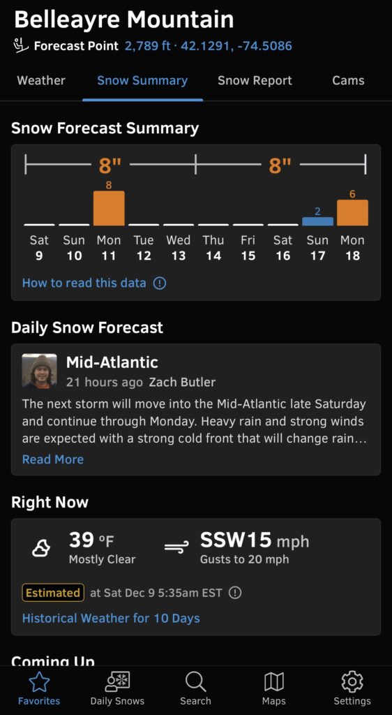
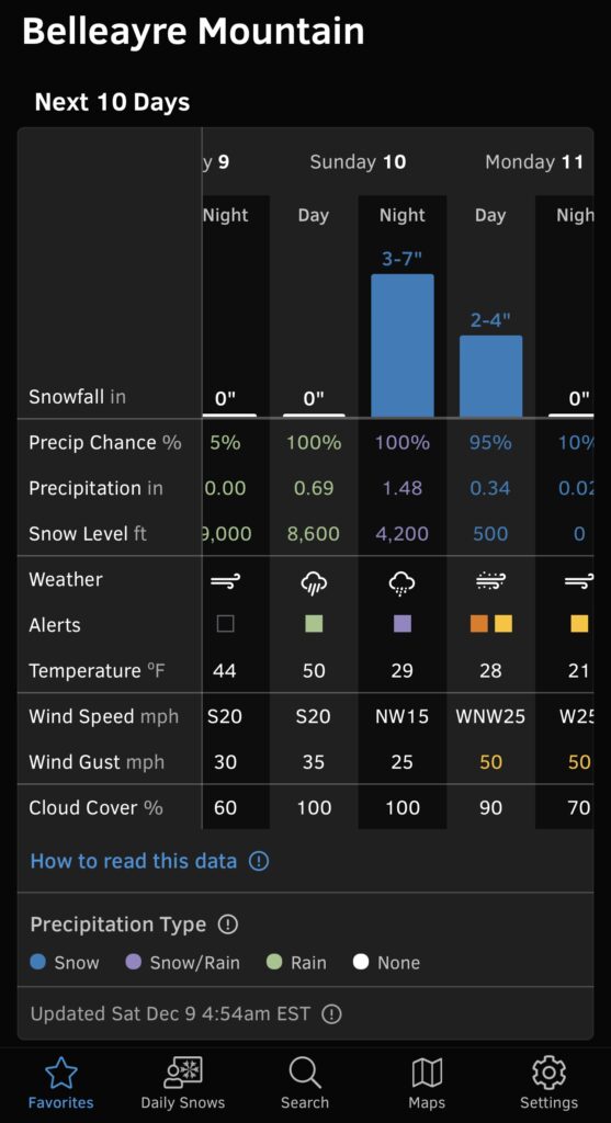
It’s all about the weather… whether we’re skiing, riding, or sailing. And while the weather is more volatile, the apps to check it are more robust.
I was getting a bit of a rep for forecasting on City Island. I’m no meteorologist. My experience, history and insight (if any) range from “red sky at night; sailor’s delight” stuff from back in the day to “which app is that?” Patterns have changed, and technology has taken strides. Anyway, I’m on the water a lot so there’s that.
With everyones smart phones come apps. However, what’s included stock is sketchy. We all have some kind of basic weather app. But, how does it work? What’s it good for? Do we trust it for snowsports in the winter, sailing in the summer, or neither?
The answer is probably a little of both, and not neither. But, those basic apps need to be used judiciously, and paired with something more robust and specific to the sport at hand.
First, a story…
As you probably know, I’m a snowboarder. I got tired of not getting fresh pow, even when traveling out west to do so. I used to think that out west, they didn’t get ice, and a ‘bad’ day there was like a packed powder/hardpack day on the Ice Coast (northeast). Not soooo… EVERYONE gets ice! Everywhere. It’s just a matter of how often. I learned the hard way: we booked a trip to Solitude (& Brighton) in Utah and not only got skunked (no fresh while there), but ICE. Crappy conditions. It hadn’t snowed in over a month!!!! I call it the Great Drought of ’22, and it affected much of the west in between great starts and finishes to the season.
Short-term forecasting doesn’t help when you have to plan a trip months in advance. I’d done the right thing; I picked a place that’s hard to get a drought, and which gets a ton of snow each season (annual average of around 500,” as opposed to 175-250 in Southern Vermont). Plus, a ‘minus:’ subtract rain (and add that the snow is light and dry). While it didn’t work out on that trip, at least it didn’t rain. Plus, the trip was still very enjoyable. Just no fresh snow. Historically speaking, it was a not a gamble but a good idea.
Next trip? We still had to plan in advance, and decided that variety plus consistency were good ideas. ‘Variety’ was a totally different area with unusual terrain, scenery, etc: Revelstoke, B.C. Also, it’s known for good annual snowfall averages of good quality, and consistent smaller amounts of fresh snow (“free refills”). It delivered – sort of. Compared to their previous season, they were about 2 metres below when we arrived, and there hadn’t been much recent snow. Bottom of the mountain was icy. Top was zero ice and some soft powder to be found, but no bonanza. Fine; it was still a good trip and half way through, we got some fresh that fixed the lower mountain. Lesson: a little fresh goes a long way at Revelstoke!
By then, I was looking around for better apps for the mountains. I had a new strategy in mind, and needed new last minute tactics. Strategy? “The Formula.” Basically, identify two, maybe 3 mountains or areas where the following conditions had a chance to all align at the same time…
Lots of fresh snow in the forecast (on top of good recent snowfall and no drought);
Good flight itineraries with low risk of weather delays;
Cheap, practical lodging
Safe, reliable and affordable transit to the mountain.
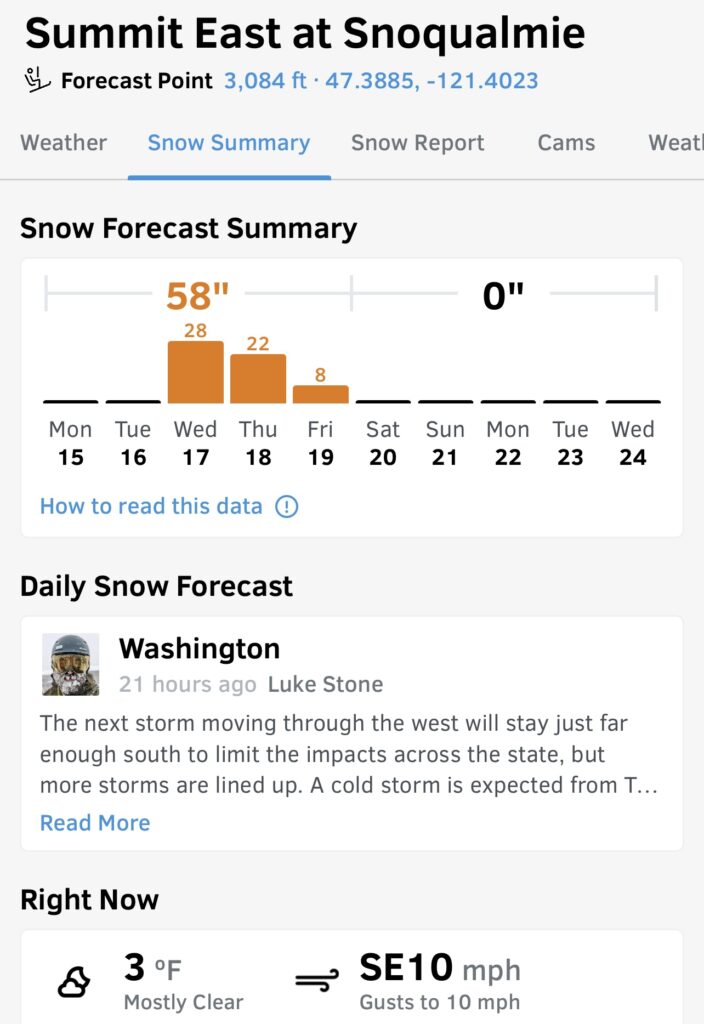
Lodging and transit could be figured well in advance. Snowfall was mid and short term dependent on weather. Same for flights. But, how to forecast the upcoming snow reliably? I had to do better than try to extrapolate from weather dot com (which I do use for some boating), and NOAA forecasts, neither of which are comprehensive enough at the local mountain scale.
I searched around and found two candidate apps to use and cross reference. If they were reasonably in agreement, and the trend looked good, I could pull the trigger.
They were; I did.
It worked. Third time’s the charm! I got 3 powder days in the Wasatch Mountains of Utah (Brighton and Snowbird). Conditions were anywhere from excellent to epic (heli-quality), with the exception of later in the day on one of the faces of Snowbird where it had been heavily trafficked and skied off with horrible visibility due to fog. Almost a problem! But, I took another route out through chopped up pow, another lift to top, and the tram back down to the base.
The apps?
Open Snow, primarily. It’s a paid app with a 2-week trial period. For $29/year, you get detailed conditions report, regional forecast narratives, and super detailed forecasts for snow, wind, temps, etc at just about any ski hill you’d care to go to. Turns out the guy I met on the UTA ski bus, who had the same “Formula” as I, had been using Open Snow for some time.
Cross reference? On The Snow. Not as robust, but serves the double-check purpose. I also follow Powder Chasers, although there’s no app involved but the option of a paid concierge service (that could be well worth it in the context of the cost of an actual trip).
“What if I don’t ride or ski? What about on-water weather?”
First, let’s talk about some forecasting basics -what you’re looking for in evaluating weather for boating. Once you know that you can narrow down the app choices.
Marine forecast. It’s at least somewhat different from the standard weather forecast most people use on a day-to-day basis (including me). Marine forecasts focus on wind direction & strength, sea state (waves), and risk of precipitation – particularly thunderstorms. That’s what you really need. If you do nothing else, consult the NOAA / NWS Marine Forecast for the general area you’ll be boating, and also keep checking a radar app if there’s any risk of thunderstorms.
Radar. The greatest risk for most people boating inshore and along the coast is thunderstorms. In the northeast, for example, most people do most of their boating in the warmer months, which incurs risk of thunderstorms (especially mid afternoon and later). So, using some app to track potential approaching storms is critical. In the old days, we relied on the morning’s published forecast and our trained eye on the sky. Eventually, Marine VHF radio helped, but when it did, it was almost too last-minute. Radar can see what you can’t, and when real-time stuff changes, so does the radar imagery. It’s not perfect- it can’t always keep pace with small pop-up squalls at water’s edge, but large, seriously bad-ass systems don’t get missed.
History and trend. Don’t just open your iPhone, look at the included weather app, and see what the current temperature is. Look at what happened for at least a few hours prior, and what will happen into that evening/midnight. This applies to temperature, wind direction & strength, and if the area is exposed, the wave heights. Also, look at the forecast and the actual radar imagery for risk of precip and especially thunderstorms. If the forecast for later doesnt’ make sense in the context of the recent history/trend up to ‘now,’ the forecast could be stale or just plain wrong.
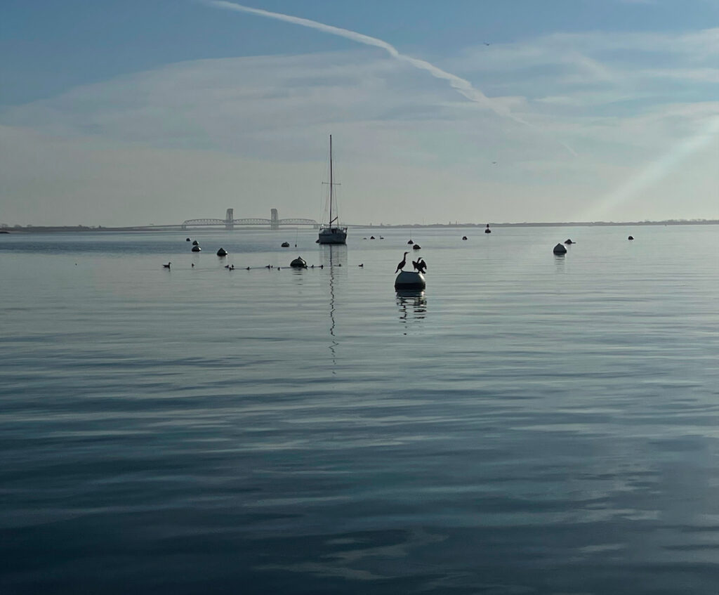
Of course, there are many apps and sites to choose from. Personally, I have mostly used weather dot com, searching for stations that most closely reflect the area I plan on boating. Example: I cross reference Brooklyn and Long Beach when evaluating conditions for classes out of Sheepshead Bay. (See top photo in post for an example.) The reality is somewhere in between, but favoring Long Beach which is close and also most similarly situated: an Atlantic Ocean inlet. Weather dot com gives hourly breakdowns and, for the very short term, 15′ breakdowns. To get the full suite of features and skip adds, it costs around $30/year. Annoyingly, it logs one out too frequently so choose an easy, short password.
I also cross reference that with the NOAA NWS Marine forecast for the area. No app here – just find the right web site starting point, bookmark it, and return often. Important: to get the history/trend, one must go to the NDBC page (National Data Buoy Center). This is a list of stations on and off the water that give frequently updated live data feeds for wind direction, strength gusts, wave heights, etc, etc. This, plus the forecast for the area (linkable from the NDBC pages) gives a good overall picture. The history of the live feed remains up, revealing the trend up until the user checks it.
What else is popular?
Windy. This was recommended during our Croatia trip at the skippers meeting to go over weather for the week, itineraries, etc, etc. The First Mate of record for our trip, Dave, and I both downloaded it immediately. Personally, I find it counterintuitive and annoying, and seldom use it. Having said that, many if not most people disagree with me and it’s certainly a robust app. Plus, it’s supposed to be good for snowsports!
And… there are two. Yup; two Windy apps. A good friend and client of the school, who’s a United pilot by profession, uses Windy.com as opposed to Windy.app. the dot com is an app for mobile as well. (I have on rare occasions used the other one, so now I’ll play around with the one the Pilot uses.)
How about a Radar app? For the Northeast, I use not an app, but a bookmarked site few people know about. My dentist, who’s a sailor, turned me onto it. It’s called CT Precip, and more commonly just called PLUFF. (pluff dot com) A University, in conjunction with Accuweather, arranged a feed of images for the northeast and much of the continent, plus other evaluative feeds that I don’t understand and probably don’t need. The first two screens take care of all my local and regional needs. When I travel out of the range, and need radar, I figure that out in the moment.
Old school?
VHF Marine Radio. Apps aside, one should understand how to get weather updates that are broadcast on VHF radio, including ‘push’ severe weather alerts where available. If your smart phone dies or falls overboard, VHF could save the day proverbially – or literally.
On the water, the stories aren’t the same. We either get the green light to go, or we don’t. It’s not the same as a serious powder day at a mountain. But, it lets us go out when the sky looks doom n gloom, but nothing shows on the radar or in the forecast. And, more importantly, it lets us know when conditions favor the development of thunderstorms, or they’re strongly predicted – and lets us see them beyond the horizon when the weather looks just fine. For now…
And, now that you have more of an idea what to look for, start comparing history/trend with both forecasts and what actually happened for the local area you do most of your boating in. That will teach you how to forecast based on trends, and not totally rely on the apps. It will also show how reliable your choice of forecasting app is. And, it will make you a safer and more confident boater.
UPDATE: storm chasing with the app worked again… this time for Southern Vermont. This was a week ago. For the second time, I hit Stratton when it was likely to get the most snow in the region during a big storm. It did, and so did I. Car was socked in so deep I couldn’t see anything but the side view mirror. But, I was at the mountain snowboarding when most people couldn’t get there. It dumped overnight, and kept nuking as the day – and night – went. Free refills. And, it was Open Snow that made it a go, letting me see that I could safely drive up on Monday and get there before driving was not a good idea. 2-3 feet. Enough left over the next two days to keep hitting pow on side hits and in the trees, plus two incredible runs at Magic Mountain on Wednesday when they opened just because of the storm. Maybe they looked at Open Snow…
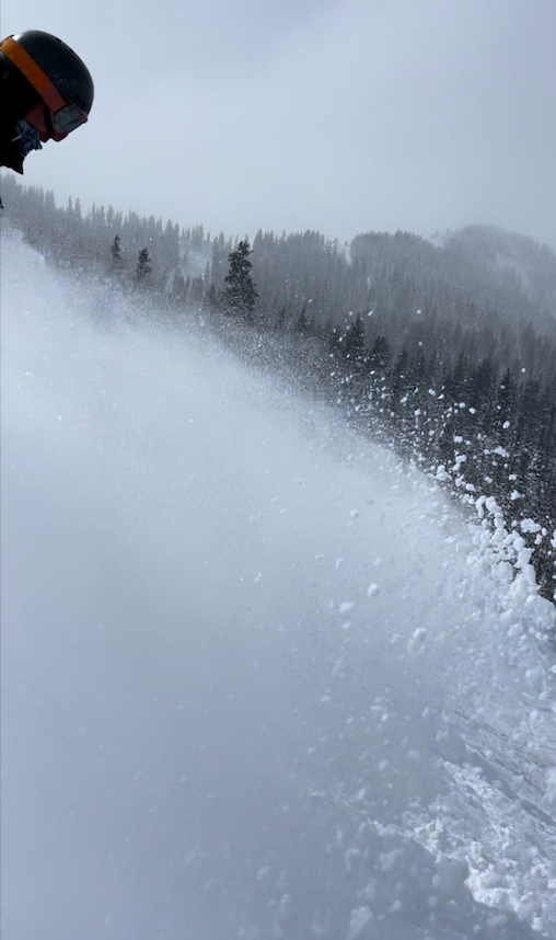
If you made it this far, here are links two a couple of Insta clips I posted. Come take part of a run with me down Brighton and Stratton Mountains from those recent trips! In the Brighton clip, I’m shooting Jack drop before I follow. It’s me, myself and I at Stratton.
Brighton: dropping into the double diamond bowl off the top of Great Western…
NDBC (for data buoys/stations and marine forecast): use the map to gradually zero in on a region and find stations relevant to you… https://www.ndbc.noaa.gov/
When learning how to navigate or sail a boat, currents and tides sometimes have something to say. Which causes the other – current, or tide?
We ask this in each schedule of Start NavigatingSM, our ASA 105 Coastal Navigation course. I have a strong opinion on this. Apparently, it agreed with NOAA and NOS. They had a “Did you know?..” posted on one page, and it said what I thought already: one causes the other, despite the conventional wisdom being otherwise.
Of course, when this topic arose again recently, due to ASA sending an e-blast concurring with the conventional wisdom, I was ready to sink my chops into it. Here’s what they said…
Tides are the vertical movement of water caused by the gravitational fields of the sun and the moon acting on bodies of water. Tidal Currents are the result of water moving between high and low tides.
Zeke Quezada, “TIPS FROM THE TEXT ‘TIDES & CURRENTS,'” on ASA’s site and in their January 27 e-blast.
So… celestial gravity raises earth’s waters, forming currents that fill in the gap? Nahhh…. Hard no, IMHO. Where was that NOAA page? I went looking for it.
Two weeks later: still looking. They seem to have deleted that page, and / or edited it and others. And, they have mixed statements about how this all interrelates. That got me thinking again about the topic, and further researching it. Most explanations I came across seemed somewhere between lame and oversimplified. But, most of them shared a common assumption of facts that were supported by an astrophysicist who I’ll cite below. He sought to debunk the common explanations of those facts. As did I.
I wrote him but haven’t heard back yet. I also reached out to a good friend who’s a PHD candidate in climate science at Columbia. She supported my explanation, and also noted that it’s a tricky topic to teach and that her students usually have trouble with it.
Let’s try to decipher this. What are currents and tides generally? What’s the difference between them? That part is simple.
CURRENT is any horizontal motion of earth’s waters across the face of it (back and forth; in and out).
TIDE is any vertical motion of earth’s waters (up and down).
What causes this to happen? Let’s limit this to interrelated current and tide, and leave out anything about wind driven currents or those caused the the rotation of earth (both of which are separate phenomena from tide and tidal current). Back to cause and effect:
The gravity of the moon mostly, with a little less than half of the forces caused by the sun.
Yup. “It is known.”
But, that’s both the beginning and the end of what people pretty much agree on. So let’s flesh out what the author here – me – thinks. Methinks. (Yes, grammatically incorrect x 2. So sue.)
What causes the “motion of the ocean?”
The gravitational pull of the moon, mostly, with less than half the total force being from the more powerful but far more distant sun. Their combined gravity pulls the earth’s waters around, causing cycles every day. We have two high tides and two low tides each day as the waters bunch up in response to celestial gravity. Because the tides are based on the moon much more than the sun, it takes a little over one “day” for the completion of all the cycles – around 50 minutes or so. (The moon rises later each night, in case you hadn’t noticed. That’s due to the moon’s orbit around earth.)
As the water chases the gravity, it flows horizontally across the earth’s surface, which is what we call current. As water leaves one area, it drops vertically, and as it bunches up in another, it rises. Therefore, current flow causes the rise and fall we call tide.
The Motion of the Ocean, excerpt from “Navigation for Numbskulls,” or How to get from A to B Without Hitting C. Captain Stephen Glenn Card (I authored the text in 2002, updating occasionally, and it’s the companion textbook we use for the ASA 105 Coastal Navigation course, Start Navigating. )
When people say that tide causes current, it implies that the moon stretches or lifts earth’s waters vertically, and pulls in water from other areas in the form of current. Neither the moon nor the sun has the gravitational force to actually lift earth’s waters.
Analogy, for those who like them: imagine the force required to push a boat through the water at a dock with one hand on a calm, still day. It’s pretty easy. Then, imagine lifting that boat out of the water and up into the air. That requires a multi-ton hoist. The concept is the same for cosmic gravity moving earth’s waters. It’s easy to pull them across earth, and impossible to lift them up and away from it.
But, don’t take my word for it… here are two videos and a pulled paragraph that sort of resonate with what I’m saying…
And, here’s a quote pulled from NOAA’s site (National Oceanic and Atmospheric Administration)…
TIDES
If you live near the coast or have ever visited the beach, you are probably aware of tides. But did you know that tides are really big waves that move through the ocean in response to the forces exerted by the Moon and the Sun? Tides start in the ocean and move towards the coast, where they appear as the regular rise and fall of the sea surface. How much the water level changes over the day varies depending on where you are and what day it is.
NOAA, in their abstract / synopsis of tides and currents. https://oceanservice.noaa.gov/navigation/tidesandcurrents/
Here’s another… also NOAA: Physical Oceanographer Greg Dusek, a senior scientist at NOAA’s Tides and Currents Office…
…And that affects water levels too, because you’re pushing either water away from shore so you have a little bit of a decrease in water level, or you’re pushing water towards shore and you have an increase in water level.
…When the Gulf Stream slows down, you can see increases of water level along the Southeast coast by several inches to maybe a foot. In some cases, it happens pretty regularly. So in North and South Carolina, you get a regular increase in water level in the fall because the Gulf Stream tends to be a little bit slower during those time periods.
Greg Dusek, NOAA Ocean Podcast Episode 15, “Tides and Currents: the Motion of the Ocean” (not to be confused with this author’s identical section title from his book, as I came up with the phrase on my own. So there.) Dusek’s topic here was mostly ocean currents like the Gulf Stream as caused and influenced by earth’s rotational force.
I repeat: “tides start in the ocean and move towards the coast” (translation: current)
…where they appear as the regular rise and fall of the sea surface.” (translation: tide.)
So, on a simply descriptive basis, with or without the terms current &/or tide, NOAA’s explanations agree with mine. And, everyone agrees that current is horizontal and tide vertical.
Add all this up…
Tyson: earth revolves through the tidal bulge caused by the moon (horizontal motions of earths surface and/or waters)
Perez-Giz: the moon does not lift or stretch the earth’s waters.
NOAA: ocean waters travel toward the coasts, where they rise and fall.
Card’s Conclusion: current causes tide.
Hopefully, this clears it up more than clouding it. What do you think? Weigh in!
Whether learning how to sail a boat, advancing your ski skills, or flying a kite from a board, it’s seldom too late to learn a new trick.
Bucket list: heli skiiing. In my case, snowboarding. It was on the mental list of things I really wanted to do but wasn’t sure about the cost or logistics.
Turns out…
It can be done for just a day, and less expensively than I’d imagined. So, when our trip to Revelstoke, B.C. was fast approaching, and snowfall had been somewhat subpar for awhile, I figured the best way to guarantee pow was to fly to it. And, if there were enough on the resort, maybe I could try my first cliff drop.
So, I booked a private lesson for Sunday, and a heli day two days later so I could rest up in case I needed it. Yup – I needed it. Both: lesson and rest.
I’m pretty experienced, and get out more than most people I know. I was a certified instructor, too. (Lapses if you don’t keep paying dues and doing the occasional continuing education course. Re-ups as soon as some back dues and course are done.) When you’re an instructor, you get paid to TAKE lessons. Not much, but it’s better than paying a LOT to take them. Plus, in a group clinic with other instructors, you are with peers and, in my case, superiors. It pushes one to pick it up and ride with it.
I didn’t take the lesson to work on general skills or techniques. I wanted to have a shot at doing a cliff drop. I had no idea where to go on the mountain to do it, nor where it was reasonable and safe based on conditions. I booked a Level III snowboard instructor who was also Level IV alpine ski. Plus, he knew the mountain intimately. This was my guy! Mike M.
First thing we did was work on the popping off small natural terrain hits and drops in the trees. Fun; hard; scary in some spots. Mike knew where to find exactly the kinds of terrain that would imitate cliff drops, enabling me to work on the physical skills and let him assess my progress. He also took me through the small terrain park a few times to hit certain ramps without doing the features, as they’re very structured for the purpose.
My progress? Didn’t do no cliffs. So, apparently not so good. But, I did get time in and repetition on similar terrain. One piece had a basically vertical drop, but a perfect runout. I got my head around it due to Mike’s explanations, and also the fact that I’m happy in a half pipe. I did that one just fine, which gave me hope.
Almost more importantly, when we were heading back down through the lower mountain and had some icy groomers to contend with, Mike picked up on something that wasn’t quite right with my edge angles and balance that was costing me heel edge hold. One suggestion and the problem was solved. No, I wasn’t carving heelside on ice on demand, but as close as one could expect. The general idea and specific fix both carry over into riding in general, so that’s a lifelong benefit from a 2 hour cliff lesson with no cliffs!
And, later in the week, I stumbled upon some small cliff drops and did them. One time was perfect. Exactly what Mike had worked on with me. Another time? Lame, but I didn’t get hurt. I found this stuff in the middle of the mountain, in the last place I would have guessed. I know where to go back to warm up for a proper ridge drop into a bowl. When I’m ready…
And, so on to heli! I booked with Selkirk Tangiers Heli. In Revelstoke, there are almost more storefront heli ops than there are coffee shops – and they like coffee. Three of the major players are here plus others: CMH, Eagle Pass, and Selkirk Tangiers. I went with Selkirk as they’re owned by Revelstoke Mountain Resort, have been around for 40 years, and have the largest tenure (exclusive territory) in the area. Solid operation; I’ll be back.
No cliffs for us here – just open alpine and trees. But, those trees were a train wreck half way through and most, if not all, of the 9 person group had trouble with that section. It was so bad I gave up riding out of it and started hiking after radioing the lead guide that I was safe and hoofing it. After a few too many times sinking one leg hip deep, I resorted to laying half on/off the board and doing some combination of kick boarding, surfing paddling, and army crawling which led the tail guide to get me back up using her ski poles. That worked, and gave me enough rest to finish riding out on my own at the end. Whew!
More to the point of the post, my tree-buddies for this section. Once we were about to hit the trees, we stopped and the guides explained how we were to ride and ski them: in pairs or threes. We were to call out regularly so if we DIDN’T hear our buddies, we knew to stop and figure out what was going on. I buddied up with two guys who came together who I’d befriended already. They were also snowboarders (as were all but three in our group despite having two ski guides).
And, here’s the fun part. They are both kiteboarders. No, I’m not, but I’m a boardsailor (windsurfer). And, that’s not even the best part.
They each own their own kiteboarding/surfing school in Aruba! They’re competitors – but friends, who go off on snowboarding trips together each winter. How kewl is that!? Plus, they sail. Armando has a lot of time on Hobie cats and we were comparing notes (I have a tiny bit of time on those and a funny story or two.)
Armando and Lysander. Both rocking Jones Mind Expander snowboards they rented from the heli outfit (included in package price). I rode my own Sims Solo, a sick powder board that’s also surprisingly good on groomers and can handle tight trees.
We got those two runs in. I was late to lunch but didn’t matter. As we wrapped up, the pilot radiod Makunda to advise that due to poor visibility, the only run we could do next was the same damn one. He announced this to us, saying we could try to stay more to the right and avoid the worst of the bottom half. I said, “If that’s all we can do, I’m bailing out.”
Armando: “I’m bailing too.”
Lysander: “If he’s out, so am I.”
So, I’d started a mini revolt. The whole group had trouble, and not just the snowboarders. At least one skier wound up on his back, head downhill, and had to be helped up and out of his landing by the tail guide. Evian was basically a goddess that day, cleaning up the mess as we all tumbled our way through the variable pitch, irregularly spaced, can’t see around the corner and don’t want to race-track the lead guide’s path like the Baker Banked Slalom terrain. I fell a little too often and got a little too tired. Conditioning is very important for this. While I didn’t expect tight trees and cross-country sections, we got them. I had planned on being in shape, and I’d been trying. But a knee injury had been talking loudly to me, and I’d backed off the intensive stuff and started PT for awhile leading up to the trip. It helped the knee, but cost me the conditioning.
We sat it out. They flew us to another staging area and we eventually spoke with the head guide for the day so he knew where we were at, got feedback, assessed damage control, and made a plan.
The rest of the group opted to do that run again. A good snowboarder in that group reported back: “it was cross country skiing all over again.” Translation: sucked.
Again, if I were a better rider, and in better shape, I would have managed it. Even at my current level, if I were in much better shape I could have done it better the second time as I knew what to expect. I wouldn’t have relished it. But, the first section of that tree run was actually spectacular, and what one signs on for with heli: great powder, good tree spacing, steep enough to move, and beautiful.
After that 3rd run, visibility hadn’t improved despite a brief tease of extra sun. (It was a powder day, so mixed blessing of extra snow and reduced vis.) They called it and brought us all back early.
And, to their credit, and probably due to my bailing and complaining rightly or wrongly that they shouldn’t have taken us on that run in the first place (and certainly not again), they refunded everyone’s money for not just the missed 4th run, but also the 3rd that most of us took. That was excellent management of the situation. I bought some merch. The Arubans? Tried to apply the refund to a 2-day heli trip later in the week! And, they got the trip. Great time; 4 runs each day and tiring.
So, back to sailing… or kiteboarding! I’ve been interested in this for awhile. We keep seeing it on our Virgin Islands trips. On one trip, a younger client and I came damn close to booking our first lessons at Bitter End Yacht Club on Virgin Gorda. We had the time. It was just too damned expensive; not a fair deal in our opinions. Then, the back to back hurricanes that fall which ended it. They destroyed much of the Virgin Island, and obliterated the areas around Bitter End. A lot of it’s been built back, but a fair amount didn’t survive or rebuild. Hundreds of charter yachts were destroyed, and the repercussions of that were many, including consistently and vastly higher trip charter fees going forward.
Anywho, there’s plenty of kiteboarding around the Caribbean basin, and in the Virgin Islands (including our favorite Island, Anegada).
And, there’s regular kiteboarding right next to the Sailing Center in Brooklyn! Plumb Beach, part of the Gateway National Recreation Area, is almost adjacent to Sheepshead Bay and a few minutes sail away. There’s wind here, so there’s boardsailing and kiteboarding. We see it all the time. I won’t try it here for the fist time, however. I’ve got a standing invitation to Aruba, and I’ll learn from my tree buddies. As soon as I can squeeze it in without interrupting powder chasing!
Want more info about learning to sail, cruise or navigate with us? Start here…
Want more about kiteboarding and surfing in Aruba? Check these guys out… Armando’s school and Lysander’s school in that order:
We moved the sailing school, and skied a new hill, so we updated one map and checked out another!
It’s official: New York Sailing Center has moved to Sheepshead Bay, Brooklyn. We are no longer on City Island. We’ve given out some snippets about that, but thought we’d wait to make the full announcement until Google believed it too and updated our listing and map pin.
I tried to update that while on vacation last week in Revelstoke, British Columbia. I’ve wanted to snowboard there for awhile. Many people haven’t heard of it; many more have heard of Whistler-Blackcomb, which is also in B.C. and is larger. And, more crowded. Less Ikonic. (No; not misspelled – at least not in the sense of multi-mountain access passes that many of you know and use.)
While up there, I got the expected text: a photo of the postcard that Google sent to the new location. It had a code I needed to enter when logged in. Forgot the password, of course, so instead of risking loss of our Google account messing around, I just waited until I got back to a device Google associated us with. And, in minutes, Google believed what I’d been saying for awhile: we moved to Sheepshead Bay, Brooklyn! And, it updated the map.
Why the move?
We tried out a satellite branch there last season on a limited basis. Still NYC; still sailing off moorings; still not worried about commercial traffic and strong currents. They wanted a school presence; we wanted to experiment.
Weather has become worse for sailing in much of the Tri-State region over the last few years, and City Island was no exception. More volatility in wind speeds (too little or too much, and more often the former). More consistent risk and occurrence of thunderstorms.
City Island is a great place to visit, but painful on the B 2 B side of things. We had some hope that our new hosts at Sheepshead Bay would be a welcome change of pace.
One season sold us, and that was that with that. Sailing in Sheepshead Bay, and Rockaway Inlet, with the Atlantic Ocean just beyond Breezy Point, was a game changer. Zero low-wind cancellations. One late afternoon cut slightly short when a building sea breeze became a little too much for day 2 students who’d already been put through their paces. One early evening when everyone started heading back to port when it looked like a thunderstorm was approaching. It missed – and hit the north shores of Queens/Long Island and the Sound. Other than that, no weather delays. Incredible record in this time of climate change.
Add to that a great host facility with all the parts, easy access by car or public transit, and a welcoming and super inclusive sailing environment. And, add dolphins. Yup; it’s hard to sail there a few times and NOT see some. Whales? Not uncommon further out or around the corner. All this makes us almost not want to wait for the new season to begin.
But first, another map, and another experiment! Off to Revelstoke, B.C, for a mostly ski/ride trip with a side hit to friends in Seattle on the way back.
Revelstoke has a history of timber and rail. They do go hand in hand. What many people don’t realize, even if they’re aware of Revelstoke Mountain Resort, is that skiing has a long history there… about a century of it. You can look it all up on your own. The current resort only started up in 2007, after a troubled history of trying to keep a ski hill open in that area. The new investors got permits to operate a resort on a large tract of Mount McKenzie. (There’s a Mount Revelstoke, and park named after it, nearby.)
Revelstoke Mountain Resort (hereinafter just Revy) occupies a little over 3,100 acres, which is large if not gigantic. But it has the longest vertical descent of any ski resort in North America, and also the longest trail: 5,600 in round figures, and 9.5 miles in actual ones. The 9.5 one winds back and forth a lot to be that long. But some of the straight top to bottom runs are quite long as well, especially compared to other mountains with less vertical.
it also has a lot of snow, and ridiculously stunning views and scenery (considered a rival to Telluride – or is it the other way around?). Endless rows of conifers create spectacular glades to ski or ride, and also delineate most trails Three bowls with various degrees of difficulty to access and/or ski make for excellent terrain variety. And, from the highest lift-served areas, anyone can get down. Beginners and true experts, and in between, have choices. But, not crowds. Probably due to the hassle of getting there, it just doesn’t get crowded.
I did a heli day. Had to; rare opportunity as BC in general has so much heli territory, and Revelstoke might be the capital of BC heli skiing. We almost got tired of turning corners in town and seeing yet another heli operation represented. My day was not the best example, as poor visibility severely restricted terrain options and later shut down heli ops early. But, I got blower smoke powder for a run and a half before getting into trees that started off great and became too difficult for most of my group (yes, including me) as we progressed. Taking a helicopter to two different areas to drop in and snowboard was good enough for me.
Also, in the spirit of trying new things, I figured I’d set my sight on dropping cliffs. I booked a private lesson with a highly certified and recommended instructor there (Level 3 Snowboard; Level 4 Alpine). Mike M is an excellent instructor. He knew from observation that I wasn’t ready to drop any serious cliffs (I suspected as much myself, rather than expecting to drop one.) We worked on the skill sets that I’d need on various natural terrain features, and a few in the park. I did do one steep drop that wasn’t too long and ran out nicely, despite often failing at getting off the ground for small hits. My body doesn’t do well at the motions needed, especially when locked onto a board.
But, a good instructor can also just work on fixing bad habits or techniques observed in the student. I know; I was a Level I Snowboard Instructor for a few years, pursuing my Level II before I ran out of time to commit to teaching. I did it part time for a variety of reasons, one of which was some instructional cross training for the sailing school, and which paid large dividends in how we operate courses. Mike saw something and got me to fix it, and it was another game changer. (I was having trouble with heelside edge-hold on steep, icy trails. He fixed my problem; I’d made strides on my own in the past, but he really fixed it. That alone was worth it, yet I got so much more out of the lesson. And yes – an older dog with an open, motivated mind CAN learn new tricks!
And, I found some small cliff drops where I least expected to later in the trip – mid mountain, on a blue, under their shortest chair ride. First drop perfect! Second, not so much… but down safe. Part of the fun is looking at the trail map, poking around, and exploring a large mountain from both the chairlifts and on the snow.. You’ll find stuff you didn’t know you were looking for.
Maps new to us to look at; old maps updated for others. Still learning the areas out of Sheepshead Bay by using the new charts. Will still need the trail map at Revy to know how to get to the next glades on the next trip (yes, I’ll go back). Sailing from Sheepshead Bay, and riding & skiing at Revelstoke? Two scenarios that we can honestly recommend you bust out maps for.
Want more on NY Sailing Center and our new location? Follow our menu links from the side or bottom of this post and every other page.
Want to learn and see more about Revelstoke? Here you go!..