We hope you’re all enjoying the holiday season despite the encumbrances bestowed/inflicted upon us. We do what we can.
Jingle… booms?
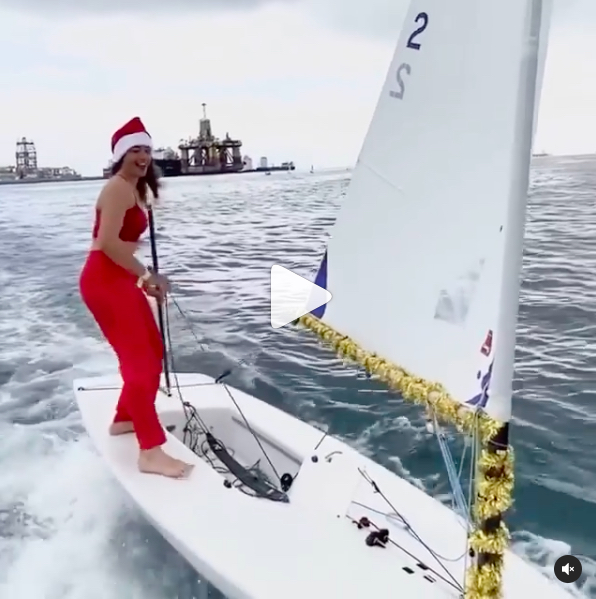
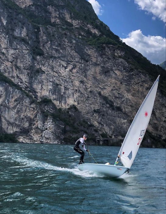
@mariebarrue decked out and rocking the deck of her Laser. This is a screen-grab from a clip we re-posted on our Insta). We’ve said it before, and will keep saying it: there’s nothing like a Laser, one of our top favorite designs of all time.
“There’s nothing you can’t do on a Laser!”
Captain Stephen Glenn Card
What makes them so special? Versatility, impeccable sailing characteristics, highly transferable skills, and just sheer fun. Everyone who can ought to spend some time on one. And, it’s not as difficult as some pics and clips portray it. Just like skiing and riding, one doesn’t need to do icy double-diamonds to have fun on the surface.
A Festivus for the rest of us!..
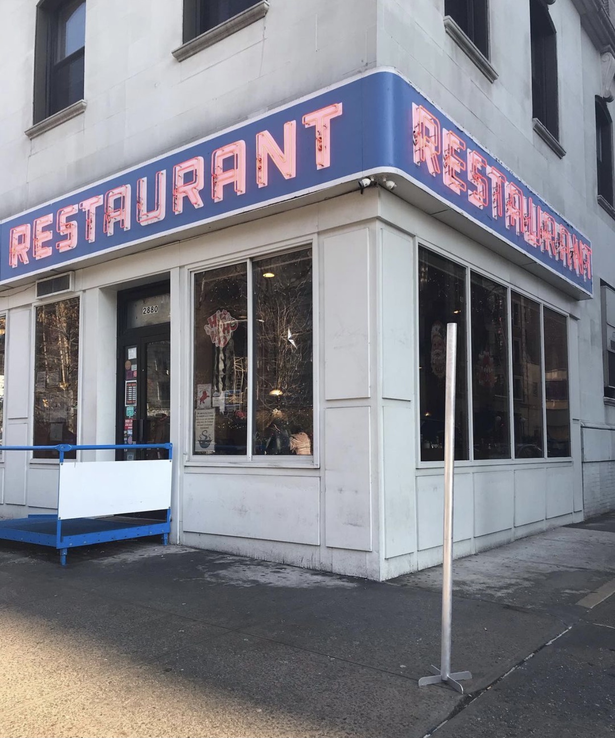
Who hasn’t seen this facade? Okay; but who’s seen it with an actual freakin’ Festivus pole?! Your correspondent did, last winter… and cleared people away for this shot.
Still don’t get it? It’s Tom’s Restaurant near Columbia U, the facade made famous by the Seinfeld series. Festivus is an alternative holiday created by character Frank Costanza (George’s father). It includes the pole, of course, plus airing of grievances, followed by feats of strength. Example: the man who schlepped this pole down from Washington Heights to pose it properly.
Kilroy sighting!
“Have your boots and your rifle? Good – you can walk into combat!”
Clint Eastwood’s Marine drill sergeant cum battle commander in “Heartbreak Ridge”
The Burton Kilroy snowboard. Note the face doodle at the letter ‘N.’ This iconic image dates back to WWII, where it spread wherever the US Armed Forces went. A similar graphic adorns the transom of our Pearson 10M, Kilroy Was Here. There are two basic variations on the them. We chose the one that was chosen for the World War II Memorial in Washington, D.C. There’s a narrative of the doodle’s history, to the extent it’s fully known, and visitors are invited to find the Kilroy tags at the monument.
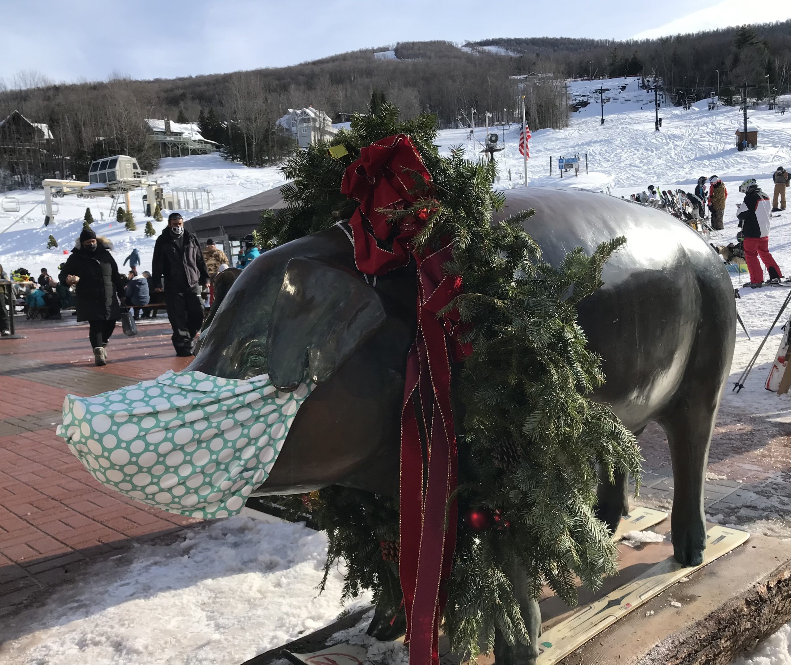
Christmas ain’t complete without a wreath…
The socially-distant, mask-compliant pig outside the lodge at Windham Mountain Resort, the ‘other’ mountain in the Catskills! (Well, there’s also Belleayre, but who’s counting…) Hunter is better known; Windham isn’t exactly a secret however. They seem to go toe-to-toe. Windham had more acreage until Hunter leapfrogged it with a 5-trail and 1-lift area expansion. That lift is a high speed 6-pack, so one can seriously lap that area. However, it gets little to no direct sun so stays icy/scratchy longer. (Personally, I like to see where I ski. Or board, which is what I actually do, but more often than not I board with skiers.)
One foot or two; always woo-HOOOO!
Vrinda Hamal (@vrinhamal) one-footing almost on the beach at Los Roques, Venezuela. Note the beach umbrellas! She’s on a kiteboard, and she’s quite extraordinary on one.
Kiteboarding is on our backburner list of things to try. We almost pulled the trigger on one of our Virgin Islands trips (BVI) not long ago, but the next season saw it all wiped out with the hurricanes. It’s coming back; one outfit on Anegada was doing it this past winter but we discovered it too late to try it out. Another time, perhaps…
Whatever you’re doing during this holiday season, stay safe – and have fun. Cheers!
Women just steer better, but 3rd time’s the charm for Joe Biden.
…where are we going with this? Well, the obvious announcement as called by all news outlets on Saturday is, well – obvious. Assuming no legal challenges affect anything (and so far, they appear to be non-starters), Biden will be the next President and Harris the next VP – and first woman in the role.
This post came about initially as I searched for a ‘skipper’ reference. “Hey, Skip!” “You got it, Skip.” Whatever. But nothing like that came up. Instead, when searching on Biden & ‘Skipper,’ I found this:
Magdalena Skipper, the Editor at Nature, did that post. Guess what? She’s the first woman to head up the journal! Took the helm in 2018. So, there’s that.
All this reminded me of a time-proven fact: women learn to steer better. They just do. I’ve been teaching sailing since 1981, and observed it before then. Women take naturally to learning to steer a boat than men do. Not every woman, but the overwhelming majority. Why ? Probably because…
They listen.
They don’t try to force things when they should be finessed.
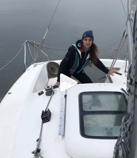
Here’s a clip from our Instagram of a woman solo-tacking. She’d never tried it before…
Look through our Insta for more pics and clips of women steering and sailing in general.
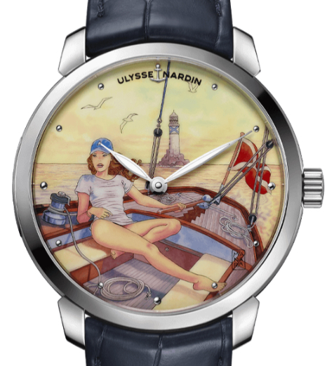
One of the world’s premier watch manufactures, Ulysse Nardin, has an artist’s series that are largely on the provocative side (shown in a previous Blog Rant of ours about timepieces and the history of determining longitude at sea). Here’s one apropos to the topic at hand…
To any women who wonder whether they can learn to sail, and might be feeling any apprehension about it – DON’T! You got this. And when you come to us, we got you. You’ll be a skipper in a few days, and we’ll prove it to you by letting you out to solo on your own.
We’re not out of COVID country yet, so protect and then play.
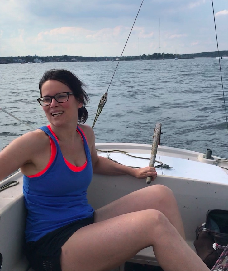
IN THAT PIC: Melody, Sunday, October 18, during a Start Cruising course (ASA 103). She did 101 with us this season as well!
It’s been a strange season, but as usual, we improvise, adapt and overcome. In March, we didn’t know if we’d have a sailing season at the Sailing Center! By June, we knew it would be closer to biz as usual on the water, in addition to our innovative and popular “Live 105” courses on Zoom for Coastal Nav (which no one else seems to be running). We figured we just had to play it safe.
We did. We limited class sizes beyond (below?) our normal capacities, further reduced classroom time for learn to sail courses, and mandated masks. Sometimes, people could take them off, but only when it made sense. Most people arrived at the Sailing Center pre-conditioned to wearing their masks all the time. (One or two prospective students were not invited to sign up after expressing a distaste or unwillingness to wear masks.)
Video clip for ya ! Mike and Kelly “deal with the heel” on a windy day…
We got through the season, which is winding down. It ends by early November for us. But, the country, and much of the world, is NOT through the pandemic. Politics aside, numbers don’t lie. People lying in ICU beds in hospitals are not faking it. Many countries are in their second or third waves or spikes, and winter is coming which will almost certainly make the pandemic worse. (And don’t forget the flu!!!) A COVID-19 vaccine is not immediately around the corner, nor is worldwide distribution of it when it arrives. So… wear that mask!
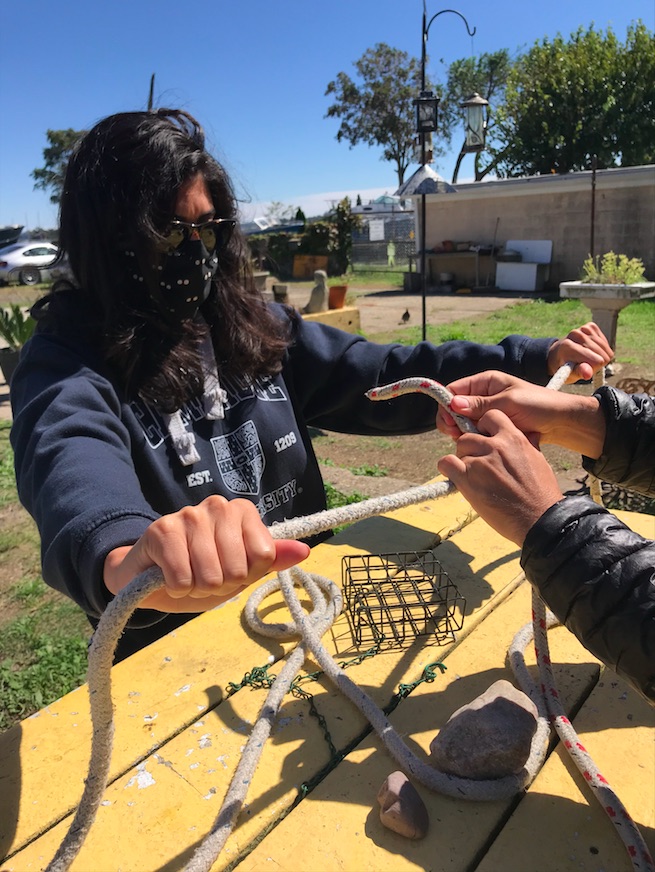
IN THAT PIC: Laura, behind all that mask and hair, joining two lines with a rolling hitch in tandem with Chris’ hands. Start Sailing, ASA 101, in September.
So…. it’s not over ’til it’s over. That sadly applies to the pandemic, but I’ll gladly take that this sailing season isn’t quite over and despite that, and eager anticipation of sliding down snow, we’re already looking forward to the next one!
Well, they never really left – but our classic full-keel Swedish design and Friday afternoons are resurgent. If you know how to sail, come have some fun in our Sailing Club with either/or, or both.
We hadn’t launched our International (‘Swedish’) Folkboat last season for various and boring reasons. But it’s back! Demand dictated it.
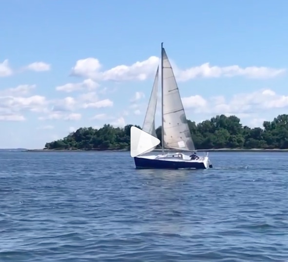
2020’s shakedown sail of our International “Swedish” Folkboat – Silent Reach. Late launch this season; this sail was on August 1. Better late than never, and plenty of summer and fall left to get in Scandinavian style sessions!
Friday afternoons are also demand based. We had some regulars for Friday afternoon and evening sails. These Sailing Club members could only break free then, or just needed to as a way to end their work weeks on a high note and begin the weekend early. Life changed and so did demand. We tended to get out of Dodge early on Fridays to beat traffic and have a break before busy weekends.
Last Friday? All the boats went out at once! Busy afternoon. Delightful conditions, too. That can’t be predicted, but on average, there’s more wind in the afternoon and temperatures cool down in the evening. Beat the traffic to go TO sailing, not leave it. Always made sense. We have more weekday pass members in our Sailing Club this season and that’s part of what’s driving Friday sessions.
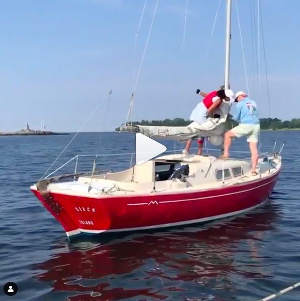
In that pic: Two of our Beneteau First 21 sloops playing follow the leade,r with our Pearson 10M ahead (on right). The Folkboat was rigging up to join!
The Folkboat? It dates back to WWII! Not ours, of course – it’s a fiberglass one built by the premier manufacturer Marieholm in Sweden in the 1970’s. But the design was from a contest in Sweden. Three different designs were chosen as ‘winners;’ one man was tasked with taking the best of those designs and amalgmating them into one fnal boat – the Nordic Folkboat, which became the International Folkboat we now know.
It’s popular wherever there’s wind. Over 5,000 have been built, and that number probably only reflects major production from established builders and doesn’t even count kit or home-built boats that were off the radar.
Flick of our Folkboat rigging up for a sail as we sail by with a class, and another Club boat preps to sail. Click the pic above to roll video!
Silent Reach basically fell in our lap and we couldn’t pass up the chance to have one of these in the fleet. Despite their rep – eats up heavy weather; countless trans-Atlantics; a few well documented circumnavigations – these boats are fine in Long Island Sound! They do well in light breeze, and point surprisingly well. Go figure. Better yet; go sailling!
Here’s an article from Practical Sailor, a sailing review rag that predated all this internet stuff and still goes strong… scroll down past blank image to link:
The new Clinic from NY Sailing Center; it fills in the gaps left by the sailing school you went to instead of ours to learn how to sail a boat. Oops…
Years ago, we basically stopped offering rentals to the outside public, and restricted it to our own graduates. Anyone can join our Sailing Club, but before they can skipper one of the boats, they must prove they can handle it. We include one short private lesson for new members to help get them skippering.
Here’s an example: someone who joined our Club, who had 101 training and had other experience. What he didn’t do? Includes but not limited to…
Sailing a boat without an engine;
Sailing off or back onto a mooring;
Singlehanding.
So, in the clip below, you’ll see him doing the singlehanding part. roughly, but safely. We coached him through this after teaching him how to get off a mooring without a motor. When he was ready to come in, we coached him on that. Roll video:
One of our new Sailing Club members practices singlehanding, after a Beta version of our upcoming ‘102’ clinic!
So, why did we stop renting to gen-pop? They were all failing the rental checkout. Most schools had transitioned to courses that were only two days long, and it just isn’t enough. That’s a time-tested fact.
The other day, I chimed in on the ASA Private Instructors’ Forum on Facebook. (ASA is the American Sailing Association, the industry association we belong to for accreditation and certification. All legitimate schools in the US belong to ASA or US Sailing; most are ASA. ) There was a post relevant to this topic. The original poster mentioned that a school he had worked at did their learn-to-sail course in only 2 days, and he felt that 3 days was necessary. An ASA staff member commented, indicating that 3 to 4 days or sessions are typical for a proper learn to sail course. (Half day sessions can be quite productive.) I added this:
The trend toward 2-day courses has devalued the certification. I stopped renting to the general public years ago out of frustration with rental checkouts and wasted time due to this. Students who attended 3-day programs, where each day was spent mostly sailing, usually passed our checkout. NO student who did a 2-day course EVER passed our checkout. We wanted them to succeed and become rental customers. None of them passed muster. 2 days just isn’t enough, especially when the “unofficial” official industry standard is 4 per boat (we do 3 and some other schools do as well). We gave up; we don’t rent to the outside public. They can join our club program, get a free private lesson, sail with others, and be re-assessed.
Captain Stephen Glenn Card, Director and HBIC,* NY Sailing Center.
(*HBIC – Head Bozo in Charge.)
Two other members of the forum ‘liked’ my comment. No one disliked or commented on mine.
At least 2 schools in our region claim to have a 3-day course that is actually only 2 days of instruction. One does a few hours of classroom the night before the weekend of the course (after work; tired; bored after a few minutes). But, they only give 2 days of on-water instruction and sailing. Another does 2 days of mostly on-water, then lets students practice on a 3rd day. But, there’s no instruction going on after their 2-day 101.
So, where’s 102? Doesn’t exist. Not yet; not formally. But we’re going to offer a new clinic: “102: for when their 101 wasn’t enough for you.” This will be a clinic to have fun filling in the gaps left by other schools. It will be at least a day’s worth of time, probably broken up into two shorter sessions on two visits to the Sailing Center. Tuition? Not sure yet. We’ll debut it later this summer.
If you want to do it right the first time, here’s what we provide in 101:
3 full days of instruction, each mostly to entirely on the water.
2 half days of supervised and coached practice. An instructor is around the whole time, and is alongside during sail hoisting and ‘take-off’ before coaching as needed via radio and chase boat for the remainder of the practice. But, the instructor isn’t aboard. Students are sailing without one. This is the logical progression.
More time if needed for either instruction or practice. For example, if weather delays eat away too much time from a scheduled course, we simply schedule a free make-up session. If students aren’t feeling confident after the first practice, they can get more instruction for free before doing more practice. (This has NEVER happened.) If they want more supervised practice before renting or joining our Club, that’s fine – they get it. (This happens rarely; less than once per season.)
We also get people who join us for their next course, 103, after not taking 101 with us. They’re rarely ready for 103, and it becomes remedial. They weren’t done with 101!
You can pay a lot less at other schools to take their ASA 101 course. Of course, you get what you pay for. And then you pay more later. Or, you can just get it right the first time with us. Your move!
For more about our Start SailingSM 101 course, navigate your way here…
Our Director reminisces about Olympic sailing class boats he’s raced, and how it helps teach you how to sail and learn to sail better.
Laser dinghy, stand-up style! On Lake Garda, Italy: from Gregorio Moreschi’s Instagram.
I’ve been at this for awhile. I started sailing as a small boy aboard whatever my parents were on, and sometimes boats that just my Dad and I were aboard. We were both relative latecomers to one thing: sailing dinghies. He started WAYYY late, and I started somewhat late (at 15). Some of my fondest memories are of the two of us on separate Dyer Dhows in the Mamaroneck Frostbiting Association winter series. I sailed ‘Dyer Straits;’ he joined the next season on ‘Apocalypse Dhow.’ We had mixed race records, with a modest rate of success (i.e, staying in A Division and taking home some plaques and platter) But we hands-down had the best punny names for our Dyers.
But, I digress. Apparently, yesterday was Olympics Day! I figured it out on my Insta feed. I’ve followed Olympic sailing to some degree for decades. While I never competed at the national or world level, I did compete to one degree or another in three different Olympic classes:
Laser
Soling
Star
Sadly, I can’t find a single photo of me in any of those boats. There’s a great shot of me sitting on the rail of my capsized Laser in between races off City Island one day. In between races, one could sail by the committee boat and ask for a can of Coke. I flipped my boat so I could just relax with my feet on the daggerboard sipping my soda while others wasted energy sailing around for no reason. I won the regatta that day. I lost the photo. But, temporarily; it’s somewhere in family photo records.
Late 1970’s; a Soling converted for sailing instruction. This was when our family owned and operated New York Sailing School. We installed custom bench seats on two of the boats to make instruction and day sailing a little easier. Harsh boat otherwise, but oh, boy – did it sail! Almost all schools eventually switched to more student-friendly designs that were more effective for instruction. Almost. (We ditched them in the early 80’s for this purpose and never looked back.)
The Soling came first, as it was the teaching boat used at our family’s first sailing school (NYSS, or New York Sailing School). Dad sold that school in the winter of 86/87, and I started mine in the fall of 1997 with classes underway in the spring of ’98.
The Soling is a truly elegant, pedigree little yacht. 27 feet of purity and grace and zero creature comforts. It’s a racing machine, straight up. Yet, it’s fun to day sail and a surprisingly good teaching boat. However, the lack of seating, lifelines, etc and the wet nature of the boat really interfered with instruction and learning. So, when Dad found a better alternative, he took that tack away from the fleet of other schools.
I mostly raced Solings at the school. We had a Tuesday night series in the summer. No, not really very competitive – but still, super instructive as it was repetitive short-course racing with tight starting lines and put a premium on tactics and boat handling. And, we used spinnakers. My favorite was a solid black chute with a stark white steer skull in the middle.
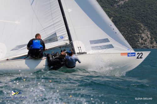
Relatively recent action on a Soling: only the skipper stays on or in the boat on a windy day! Not just a venerable Olympic class, the Soling was heavily used by adult sailing school programs across the country if not the world.
The highest level I raced a Soling? The East Coast Championships one fall out of Stamford Connecticut. I was crewing, not skippering. Perennial class champ Hans Fogh of Canada was the skipper to beat that time. We didn’t. Windy couple of days; I spent much of it hiked out over the side in the manner shown in the photo above.
The Soling was an Olympic class for quite awhile. Two veteran American racers who did well in Solings were Dave Perry and John Kostecki; Perry also excelled in the Laser. One of the best sailboat racers in history, Robert Scheidt of Brasil, won 5 Olympic medals combined in the Laser and the Star: 2 gold, 2 silver, and a bronze. Only man to win Olympic medals in both dinghy and keelboat classes. Hmmmmm….
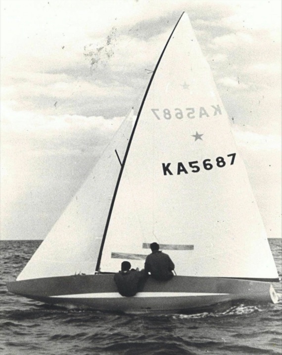
1972 Olympic Gold Medalists: Australian style! Star Class.
Then came the Star. The Stuyvesant Yacht Club on City Island, which was around from the late 1800’s, had a nice fleet of these sloops stored on trailers which they dry sailed by lowering and hoisting on a dedicated lift. I was invited to crew on a couple of occasions for Sunday afternoon racing. We had light winds, so it wasn’t too exciting – but it was fun and tactical. No spinnaker, so easier to shift gears on shifting winds in an instant and focus the whole time and tactics and strategy.
Star white room; typical recent scene for this low-riding, wet and athletic class that has seriously withstood the test of time.
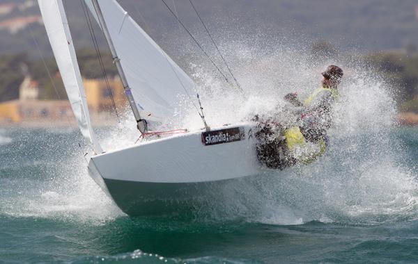
The Star was in the Olympics for some time. It was the 2-person keelboat. One crew hikes over the side when needed; both sailors need to be decently sized to hold that boat down. It’s work. While no longer in the Olympics, the boat is still super competitive and used in series including the Bacardi Cup in Miami and the Star Sailors League Invitational regatta. Dennis Conner of America’s Cup fame was a world champion in the Star before he got involved in the Cup.
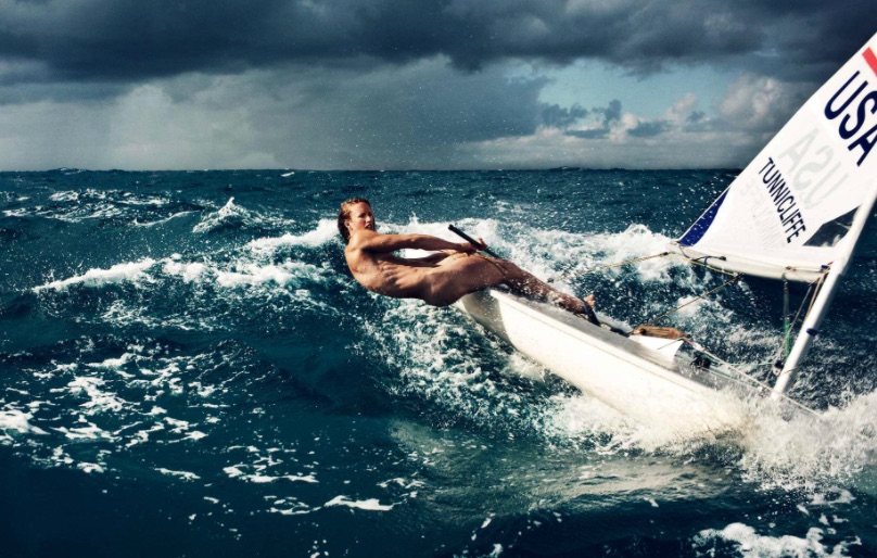
Next: the Laser, which came later to the Olympics but was already one of the world’s most widely sailed boats and is now the most. It’s a singlehanded performance dinghy with one sail (cat boat or uni rig), with three choices of sail size.
Olympic medalist Anna Tunnicliffe, from Steven Lippman’s shoot in ESPN’s In the Buff series. Note the cuts; this is an athletic boat to sail competitively.
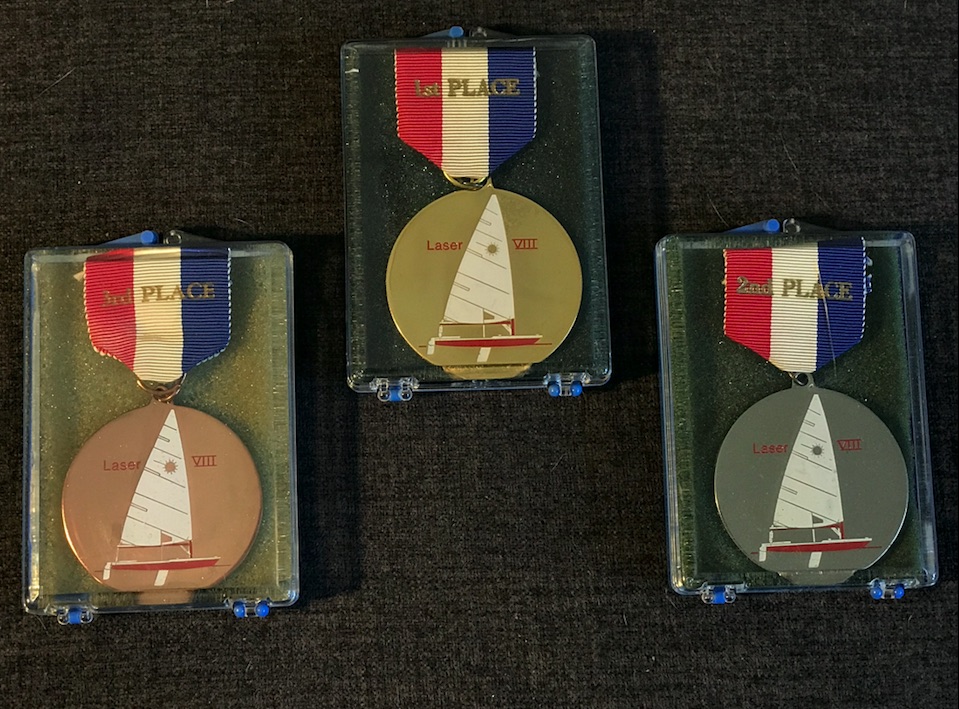
I started sailing these in the early 1980’s and raced them for a few years in the NYC/Long Island district of the Laser Class Association. I also qualified for the Empire State Games once and drove my Laser atop my Pontiac Ventura Hatchback up to Syracuse. I was only about 118 pounds soaking wet, and raced a full rig – but as we’re in a light wind region here, I got away with it. The one time I actually won a regatta saw 15-20 with some higher gusts, but some of the better racers in that district didn’t attend. But, I sailed hard and beat larger sailors. First race: chose not to jibe on the screaming reach to the jibe mark. I did a ‘chicken jibe:’ I lowered the board, spun around in a tack, and continued. The guy I was basically fighting the whole day for 1st place? He kept it real and jibed. He flipped. I won the regatta by a hair and his capsize spelled the difference.
Medals in the Laser Class, District 8 (NYC/Long Island). From back in the day when our Director actively raced the world’s most popular sailboat. It’s still in the Olympics despite recent challenges by upstart imitator classes.
So, sailing on some Olympic classes paid off. First, it made me a better sailor. Second, it made me better understand how boats relate to teaching beginners and intermediates. Our family started teaching on the Olympic Soling in 1968. Since then, we’ve used three more designs for teaching beginners, in this order:
J/24, in late 70’s (immediately abandoned and returned to Solings)
Sonar in 1980 or thereabouts, continuing until NYSS sold;
Beneteau First 21 with my new school in 1998
I could have gone out and bought a fleet of Solings, Sonars, or especially J/24’s to make a cheap fleet. You get what you pay for. Spare parts for our Beneteau First 21 sloops typically exceed the purchase price of a cheap used J/24 and often that of a Sonar. I leave that for the multitudes of other schools that don’t know or don’t care.
Our Beneteau First 21 sloops have an enviable distinction: they’re the only sailboat design ever endorsed by a national sailing school organization such as ASA or US Sailing. The First 21 is the same boat as the Beneteau 22 and the ASA First 22. What’s the only difference between them? The ASA First 22 had a longer cockpit and smaller cabin. It’s the same exact hull, keel, twin rudders, mast, etc. The only real difference is the cockpit to cabin ratio. The Beneteau models have plenty of room already, so no problem there. Guess we got it right in 1998!
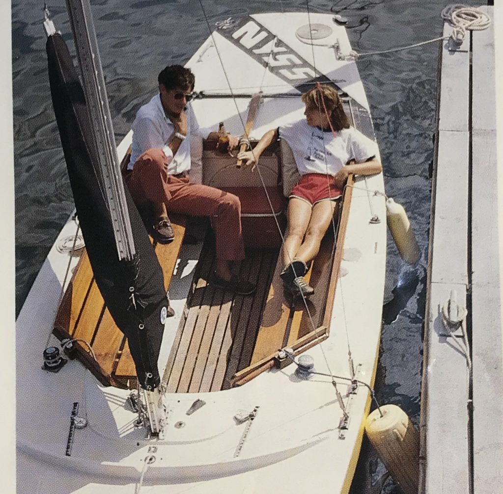
Here’s a couple sailing one back to our moorings on a windy day. This couple has a fair amount of experience: both raced J/24’s in NY Harbor; both sailed J/105’s. He did a Transatlantic! Also grew up cruising Maine. She did two levels of ASA courses in NY Harbor as well as an offshore delivery from Florida to New York.
Guess which Club they belong to now, and what their current favorite boat is? It’s ours – what many European sailors call the Baby Ben…
“At NY Sailing Center, we know a thing or two because we’ve sailed scores of boats, not just a few… including 3 Olympic classes.”
Captain Stephen Glenn Card, Director and HBIC (Head Bozo in Charge).
It’s that time of year; weather is warming up, and thunderstorm activity is heating up as sailing club, school and rental activity opens up. We revisit this topic every year as a public service. One reason: people still don’t seem to ‘get it.’
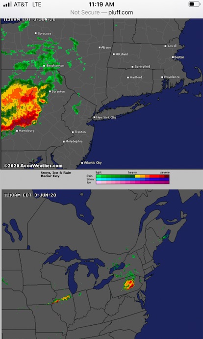
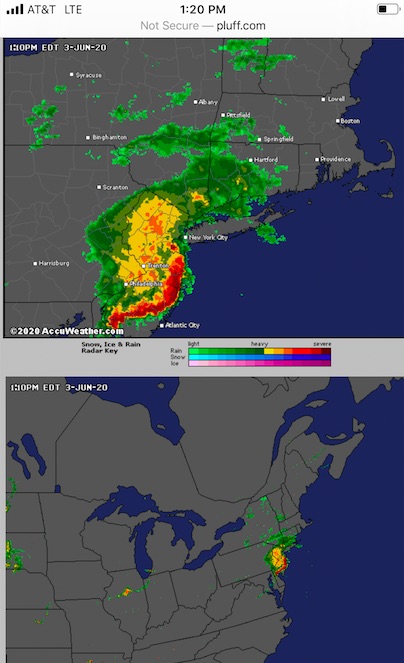
In that pic: screen capture of radar images on Wednesday, June 3, in the late AM. We had a private lesson booked that day with an experienced sailor. The forecast was for thunderstorms – not a chance, or a likelihood, but just… thunderstorms. And, they warned of potentially damaging winds and hail. Not a garden variety summer forecast, which is “chance of showers and thunderstorms” or similar language.
Oh, no… it’s ON!!!!
Below, I’ll share how the day of June 3 unfolded forecast wise, and also stories about two needless tragedies in the past that happened when people didn’t pay attention to the forecast.
The first step of the day is to check the forecast. That should be done several times as the day progresses to look for updates. The next step is to check the radar. Easier than you might think; just look at the pic above. Pretty clear that something is brewing. And, even if the forecast winds up being off, the radar doesn’t lie. It doesn’t take a meteorological degree to read a radar app. It just takes a little time and experience.
On two occasions since I’ve been operating New York Sailing Center, which I founded in the fall of 1997, there were particularly violent thunderstorm systems that passed through the region and resulted in a fatality at some other school/club. NOT AT MY SCHOOL/CLUB. At others.
The first was in 1998, before we all had smart phones and radar apps at our disposal. It was old school; check the forecast, check the sky, and listen to the VHF radio weather band for updates. The forecast was doom n gloom: thunderstorms, some of which could be severe, and which had a large outer perimeter of strong wind (meaning no way to see it coming). And, the storms had already started upstate and killed a few people.
Make no mistake; winter is coming…
Sky getting gray as we return to the mooring on Wednesday, June 3. Radar? Showed rain passing to north and east, and squalls approaching in the distance from the west and south. Might miss; might not. So, we cut the lesson short and played it safe.
So, I kept everything on a super tight leash that day in 1998. We had one class with a veteran instructor. We talked about it and decided to confine the boat to the anchorage. No further than the outskirts of the anchorage. The anchorage is small. More maneuvering, then! Marina customers were warned of the storms if they showed up. A few did and just turned around and went home. One woman chose to sit on her boat at the mooring for awhile and then go home.
Eventually, after frequently checking the sky to the north and west, I didn’t like the look and feel. I started radioing the instructor to come in, and saw he was already approaching the mooring. They took one shot, and fell short… and then it hit. BAM. Nothing to be seen in advance. Just wind laying the boat over and flogging the sails. They didn’t have a chance to sail back to the mooring; no way. The boat was basically blown down onto the next pier, and the instructor wisely off-loaded the students and left the boat. I went out with a few experienced people and two solid motor boats, and towed the sailboat off and moored it. It took two boats just to pull it off and suspend it into the winds, which were at least 60 knots and possibly as much as 70. When it subsided a bit, we moored the boat.
It was over quickly. It always is. But it takes little time to cause mayhem. We got away with a torn sail and a fright. Down in New York Harbor, they weren’t so lucky. One large club/school had allowed at least one member to go out with his family. The boat took a complete knockdown, and the man was in the water and separated from his family. He wasn’t wearing a PFD. His body was found a few days later in Gravesend Bay, Brooklyn.
Fast forward to August, 2010. Morning forecast: about the same as the 1998 incident. Thunderstorms. Severe. Moving fast. Clear band of strong winds. This time, however, we had smart phones and radar.
I kept the one class we had that day pretty close for our morning sail. I intended to do a short n sweet lesson, get off the water way early, and watch it all blow through during lunch and some extra classroom. While on the water, I got a call from a recent graduate hoping to come out for one of his practice sails that afternoon. Sorry; no. Bad forecast. He pushed; I explained the severity of the forecast. He tried some more.
“No fucking way! I’m not going to let you come out here just to die in some violent thunderstorm! You’ll come out another time – live to sail another day!” The first sentence is an exact quote; the second is approximate. The message is clear.
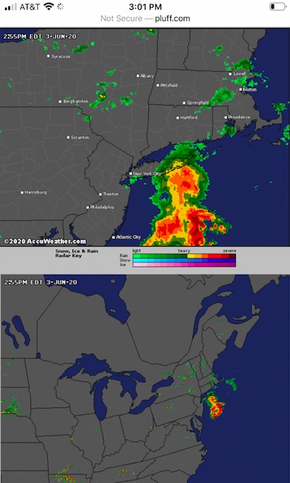
What happened then? We sailed back to be safe. Sky still looked fine. Checked the update radar while waiting for our launch ride. Whoah…. it was the largest Darth Vadar Death-Star-looking doom ‘n gloom ball of red, orange and yellow I’d ever seen – before or since – on a radar screen. It was moving south and clearly going to hit all of Western New Jersey, Westchester, NYC, and Nassau, Long Island. All of it; all at once.
Updated Radar imagery from Wednesday, June 3. Note the wall of band of red/orange just south of our area. That’s violent weather. The yellow with orange/red above? Not to be taken lightly either. Only takes a splash of red to dash your head on the rocks.
So, I shut down the operation until further notice. Told my launch operator to go somewhere inside for lunch on the avenue and stay there until I told him to return. I took my class to do the same, with some classroom props.
It did hit. We were basically done with lunch and b.s.-ing about other stuff. Suddenly, it was very dark. Stuff was flying around like that scene from the Wizard of Oz. Darker; windier. Eerily, we couldn’t really hear it as the place was well sound insulated and we were in the back looking down the hall at the front door. And, almost as soon as it started, it was over.
We paid up and walked back to the marina. None of us had ever seen so much random debris blown around by a squall. The waterfront was worse; the waterway itself was a shit show of stuff blown offshore by the storm. There was zero wind. Sun was back out. Surreal.
And then, I got a text from one of my instructors. He let me know that another school (again, not ours) had a class out during the storm. They lost one person. Literally. The body was found a day or two later. This was disturbingly close to home, in lower Westchester, within sight of my school on a clear day. it was day one of a learn to sail course (compared to day 3 for mine that day). They went out in the afternoon (as opposed to my coming in at around mid-day). No one aboard was wearing a life jacket, or PFD. (We spend extra money on comfortable automatic inflatables with manual overrides, and make people wear them.) The boat had no lifelines, which are wires or ropes that are elevated above the deck going around the boat. (Not all boat designs have them, but it’s riskier when they don’t – especially for beginners.) Everyone on that boat wound up in the water; all but one made it back to the boat.
All but one.
I knew several sailors who got caught out in that same storm. They all fared well, but got quite a fright. I heard of others who got caught as well (also survived). The common denominator? And, what was reported in the news regarding the fatality in Westchester?
“It happened so fast.” “You couldn’t see it coming.”
But, you could. On the bloody radar! And, you KNEW it was coming. Why wait to see it? Does that sound simplistic? Well, it really is that simple.
In that pic: all gone – out to sea, but I pity the fool who got caught out in that. It intensified as it neared shore and got over the water. Wednesday, June 3.
Remember the DUCK boat incident a few years ago? We did a blog rant about that. Same shit; different details. Only that time, many people died. I’ll link back to that blog post below.
The lesson: people don’t seem to learn the lesson. Here’s how I suggest you manage the risk of getting caught in a squall or thunderstorm on the water during the summer, which is when most of them happen, and also when most of you would likely do most of your boating.
start the day with the forecast online, cross referencing at least two sources.
If there’s some risk of thunderstorms, consider skipping boating that day.
If you go anyway, check the update forecast upon arrival at the marina.
Start checking the radar at that time as well. If it looks dicey, don’t go!
If it looks like it’s far off, or just not developed, stay close and check frequently – at least every 20′.
As soon as it’s looking worse, assume the worst. Head back. If you have an engine, turn it back on (yes, you should have checked it before). Stow sails.
Moor or dock the boat. Double check the radar and forecast.
If still no good go home! If the risk went away, it’s your call.
I’m not a meteorologist. I’m not a weather forecaster. I’m not a climate scientist (although I know one who’s a PhD candidate at Columbia). But, I am an expert and well-seasoned mariner. And, I have to make decisions all season that affect other people: whether they get to play or not that day. it comes down to whether they’re safe or at risk of death. And so, I check the weather and radar pretty obsessively.
“What do we say to the God of Death?”
“Not today.”
Arya was bad-ass enough to slay the Night King. But even she knew the universal truth:
“Don’t f*%! with Mother Nature!”
RESOURCES:
The Radar web site (not an app per se) that I like to use for the northeast…
Most of us have had cabin fever during the COVID pandemic; some of us have weathered it better than others. And, the weather is better – and warmer – on average. So, more boats are out. Some of ours are too!
We’ve been sailing since April, albeit very sparingly for obvious reasons. Things are opening up gradually with select low-risk on water activities. We’ve managed some private classes and lessons for individuals or family who’ve quarantined together, and some of our Sailing Club members have gotten out.
In this pic: our Pearson 10M, Kilroy, with the ‘Gold Coast’ of Long Island in the background – and closer than you think (just as City Island is)!
Memorial Day Weekend is a benchmark of the beginning of the summer season. We usually ramp up for it. This weekend was quite slow, due both to weather and pandemic precautions. But, we got some folks out.
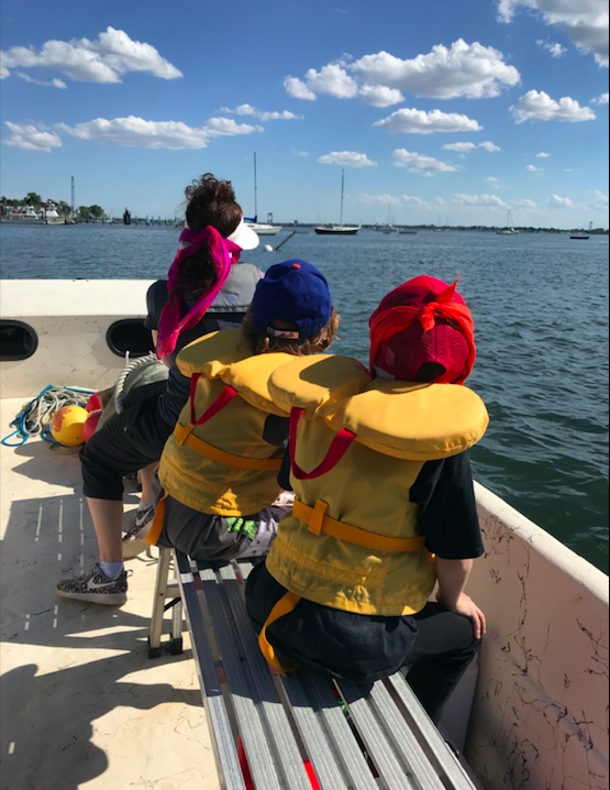
In that pic:teens enjoying a sail with the folks on the Sound recently. Memorial Day, in fact! Note the greenery surrounding the Sound. Plenty of bird sanctuary.
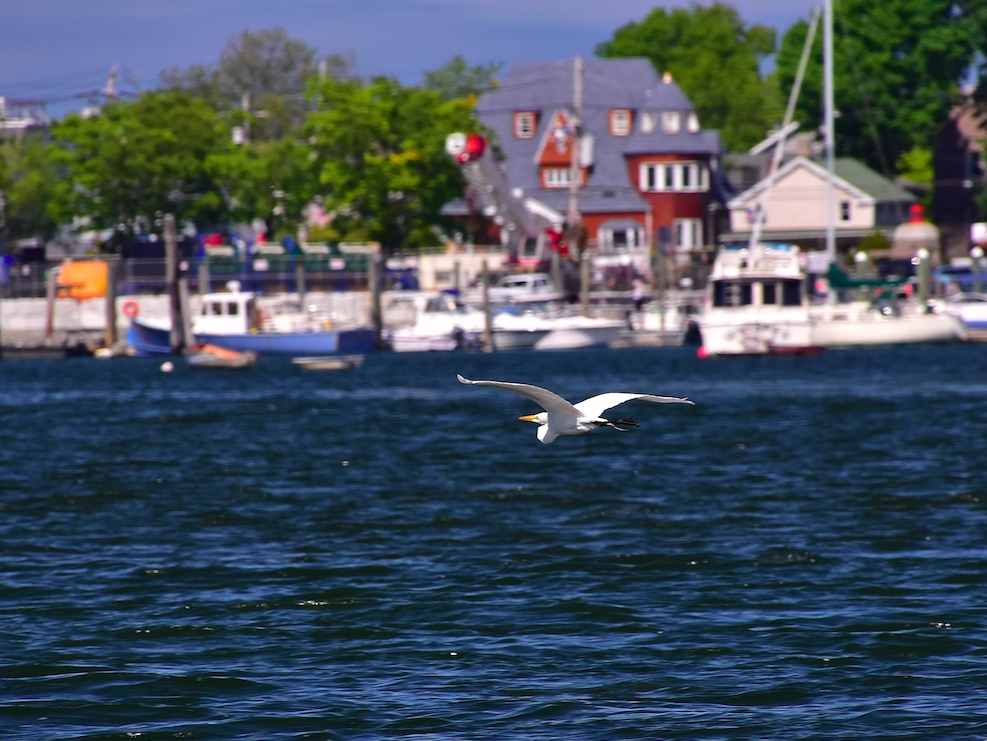
And, we got to simply observe. And we were reminded of one of the things that make City Island special as a sailing location and destination: wildlife. Fish and birds abound.
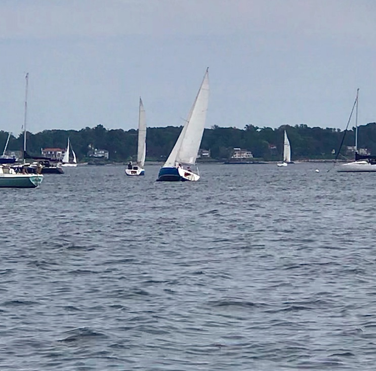
The sailing in Long Island Sound is arguably the best in the New York Tri-State region: gentle currents, abundant room, little commercial traffic, clean water one can swim in, scenery everywhere, tree lined shores, etc. It’s excellent for beginner and expert alike, with yacht clubs and sailing associations lining both coasts, and any number of one-design racing classes well represented. Junior programs; race weeks. Pick-up and JAM sails (Jib & Main). Coastal and the occasional National Championship. Cruising destination par excellence. Breeding ground of Olympians. And, perhaps the best place for people to just learn how to sail.
Plus, we have the plumage…
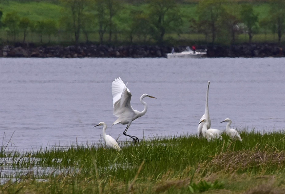
In that pic: a family, flock, or whatever one calls a gathering of snowy egrets. Eastchester Bay, on the west side of City Island, Memorial Day. S. Card, photo.
No, it’s not important to see birds to learn how to sail or enjoy quality Club sailing. But it is important to see them as a sign of a healthy ecosystem that’s clean and fun to play in. Plus, all other things being equal (and they’re not), why wouldn’t you want to see them? They’re one of the attractions of the Sound in general as well as City Island.
In that pic: Geese and goslings. Rodman’s Neck, off City Island, Memorial Day. Shot taken by our DP, Captain Card, while taking a quick fishing break. He did hook one weakfish and lost it. Signs of life…
Here are birds we see routinely or occasionally here…
Amazon parrots (no shit!)
Black capped night herons
Canada geese
Cormorants
Ducks
Egrets
Great herons
Gulls
Hawks
Osprey
Swans
Terns
In that pic: family returning from a sail aboard one of our boats on Saturday, May 30. Parents: grads of our program and now cruisers. Kids: taking a shine to the daysailing and cruising, and who knows… maybe future wave shredders on the race course!
Osprey attempt to nest each spring on the frame over our pier. The gulls always outsmart them and dash those dreams on the ramp and rocks. Amazon parrots are fairly well distributed around the region, surprisingly; City Island had a large population that appeared to have disappeared, but we’ve been seeing them again the last two seasons. They hang out right in our marina and are a hoot (ouch) to watch and listen to.
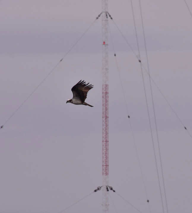
In that pic: a lone osprey captured doing a fly-by against the tall radio tower next to City Island – the single best beacon, or navigation aid, in Western Long Island Sound.
All the others? Seen along the shore, off our docks, from our boats, etc, etc.
So, if you want to mix some bird watching with your boating, or you just appreciate a calmer, healthier environment in which to enjoy top tier sailing….
Birds of a feather know what’s better.
In that pic: an egret or heron (who knows? who cares…). Picturesque, yet pedestrian… this kind of scenery is an everyday thing on the waters around City Island and Long Island Sound. Come capture your own scenes!
Scientists struggle to model the movement of the magnetic north pole. In our live, online ASA 105 coastal navigation course, a real instructor teaches you about this, and why you can basically ignore it.
We’re having a lot of fun with our “Live 105” classes on Zoom! Real instructor, real time, real students – in the same, small manageable class sizes we have for in-person courses. One of our current students sent a link to a BBC article related to the content of a 105 course, which is of course all about…
COASTAL NAVIGATION.
The link Cristina sent? A BBC piece about the movement, or wandering, of the magnetic north pole. We link to the piece at the end of this Rant. For now…
In that pic: the thin aqua line traces the approximate motion of the magnetic north pole from 1840 to 2019. It’s accelerated recently, creating a scientific buzz. (Pic is a still frame from a video in the BBC piece we link to below.)
THE IDEA: the magnetism of earth is both consistent and inconsistent. Compasses point to the same place on earth with minor wiggles. This is close to the geographic north pole, or the rotational axis of earth. If Atlas stopped shrugging, and spun earth on the tip of his finger like a Harlem Globetrotter, it would be on the South Pole, with the North Pole exactly at the other end – or “top.” But, “top” is arbitrary, ain’t it? Space has no direction. We’re floating in space. And, what’s more…
It might flip! Yup. Magnetic North and South have reversed from time to time. Maybe every few hundred thousand years. The question is whether this could happen within our lifetimes. And, partially due to accelerated movement of the Mag North Pole, scientists suspect it might.
1, 2, 3… SWITCH! Oops…
THE ARTICLE’S PATH: Scientists studying this have noted the acceleration of the drift of the Mag North Pole recently, and have updated the global model used for that as it relates to GPS, which is critical to precise navigation. That’s not always super critical itself; as we teach in Start Navigating ( ASA 105), it’s almost more important to check progress in real time than plan the path perfectly to begin with. Basically, they think they’ve identified two molten “hot spots” in the earth’s outer core that are having a tug of war over the magnetic north pole. Kewl! Or, very hot…
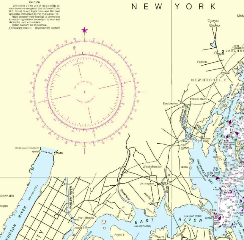
That gets into some chart nitty-gritty: the compass rose. It’s a tool to measure direction, and it looks pretty kewl too. Check it…
In that pic: a section of the 12363 chart of Western Long Island Sound, with City Island (“City I”) on the right, which is home to the Sailing Center. It’s about half the length of Manhattan away from it; northern MannyHanny is on the bottom left of the chart. It has a nice, large compass rose, or rings that measure direction. The outer ring is for true, or geographic, north – with a star at the top for Polaris, the actual North Star. The inner ring is for magnetic north, which is where compasses point more or less. In navigation classes, we teach how to use these to plot out a course to steer a boat.
THE CONVENTIONAL WISDOM: look at the annual increase/decrease in the variation as listed in rose (the pic below blows it up for you). It’s usually a few “minutes” a year. Each minute = ..? It’s a measly 1/60th of 1 degree of the compass. Yup; slicing hairs with razor blades. Anywho… if your chart is out of date, the idea is to multiply the number of years of ‘stale’ by the number of minutes of change, and add or subtract accordingly. And, get the +/- right!
ABOVE: blown-up crop of the compass rose from the same chart above. Variation: 13 degrees West as of 2016. Annual decrease: 2 minutes (2 out of 60, with each compass degree having 60!). Splitting hairs…
NYSC knows better… our Director and HBIC (Head Bozo in Charge), Captain Card, had a suspicion about something years ago. He compared every training chart the government produced, which are all frozen in time going back a far as the early 1980’s, to the updated, real-life versions of those charts. The conclusion? It’s silly to try to project any annual increase or decrease into the future. We expand on that and reveal the goods in class, and in our own in-house text book that we supply to students (and sell on the side). Despite what other books say, just skip this step. Much smarter move: get a current chart, for all the more obvious reasons.
Maybe we’ll be lucky (?) enough to see the poles flip in our lifetimes! Will planes drop from the sky, and cars run off the roads? Well, if they can’t figure that their GPS and compasses are basically pointing backward, we can’t help them.
Your takeaway? Use updated charts to plot courses to your destinations, and casually follow along with the progress of Mag North Pole’s wanderings across cold areas most of us will never visit.
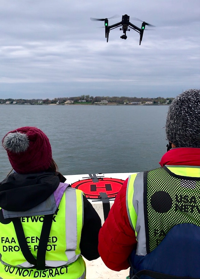
When media needs a captained boat rental for tv, film, ad & photo shoots, we often get the call.
In that pic: USA Network journalists/drone pilots in action from our Carolina Skiff on Long Island Sound. The foredeck is like a drone heliport, and the open profile of the stable skiff facilitate shooting in any direction from on board. Here’s a sample of what they captured before their drone landed:
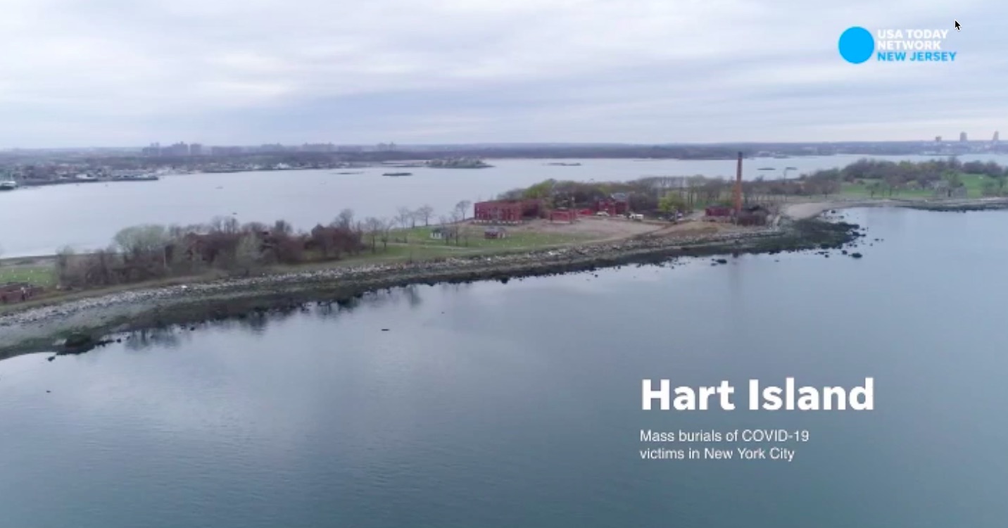
Still frame from video aired by USA Network on northjersey.com – an aerial piece about burials at NYC’s cemetery (potters field) on Hart Island, adjacent to City Island.
This isn’t anything new for New York Sailing Center. We’ve been featured on cable, network TV, and in print since soon after we opened in the fall of 1997 with on-water classes starting in April of 1998. And, we’ve helped produce the full spectrum of the same things for other purposes.
Our Director and HBIC (Head Bozo in Charge), Captain Stephen Glenn Card, is a solid photographer if slightly shakier on the video front. However, he’s an all-around rock star on setting things up – and then keeping clear – so pros get their shots: by still lens, video, and anything attached to a drone. Somehow it just comes naturally to him.
In that pic: a glassy calm photo session from City Island Harbor, looking out over Long Island Sound. That’s the ‘Gold Coast’ of Nassau County, Long Island in the background. This was a lengthy piece in New York Magazine last summer. We took NY Mag out for stills from our Carolina Skiff and aerials via drone, ranging from the Brother Islands in the East River out to some small islands off Westchester in the Sound. Foreground of pic: the Chimney Sweeps, large rock islets off City Island.
When the shoot calls for talent on a boat with a particular look and lighting, we can supply the boats and time the lighting. For one shoot, Captain Card was hired to captain a 40-foot sailboat for a few days that was the main location for a short independent movie. Departing Sag Harbor each morning, he drove the boat to wherever the director wanted the background to be, and oriented the sailboat for the best lighting. There was a go-fast chaseboat available for some of the shooting, and some crew and talent transfers, but most of it was from right on board the sailboat, and Captain Card brought them along from the dock
At anchor for one scene, the lighting wasn’t quite working out. So, he rigged a bridle from bow to stern which the anchor line could be slid along, letting him instantly and exactly change the boat’s angle to the sun as the DP needed in the moment. Brilliant! Idea, that is… the lighting was more subtle on purpose.
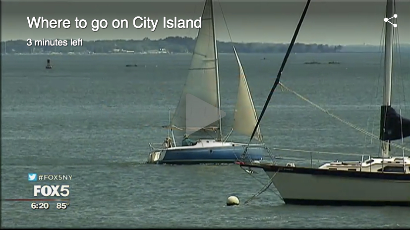
In that pic: New York’s Channel 5 did a series a few summers ago called “Closer Than You Think,” about things to see and do in NYC that were, well… yeah. Closer. They did a piece on City Island, and we got most of the air time as well as a lengthy thanks/mention in the studio segment with the reporters. We were featured, of course, but we were also very involved in all aspects of setting up the shoot: scenes from our pier (as in this pic), chase boat, and video from both. It’s a fun video; check it out here!
We absolutely love doing this stuff, whether it’s zooming around in our go-fast Carolina Skiff to chase down a sailboat in a shoot, cruising to a destination for scenery, or whatever actually. We still love just being on the water. Never grows old.