Olympics Day: on How Many Boats Did I Play?

Our Director reminisces about Olympic sailing class boats he’s raced, and how it helps teach you how to sail and learn to sail better.

Laser dinghy, stand-up style! On Lake Garda, Italy: from Gregorio Moreschi’s Instagram.

I’ve been at this for awhile. I started sailing as a small boy aboard whatever my parents were on, and sometimes boats that just my Dad and I were aboard. We were both relative latecomers to one thing: sailing dinghies. He started WAYYY late, and I started somewhat late (at 15). Some of my fondest memories are of the two of us on separate Dyer Dhows in the Mamaroneck Frostbiting Association winter series. I sailed ‘Dyer Straits;’ he joined the next season on ‘Apocalypse Dhow.’ We had mixed race records, with a modest rate of success (i.e, staying in A Division and taking home some plaques and platter) But we hands-down had the best punny names for our Dyers.

But, I digress. Apparently, yesterday was Olympics Day! I figured it out on my Insta feed. I’ve followed Olympic sailing to some degree for decades. While I never competed at the national or world level, I did compete to one degree or another in three different Olympic classes:
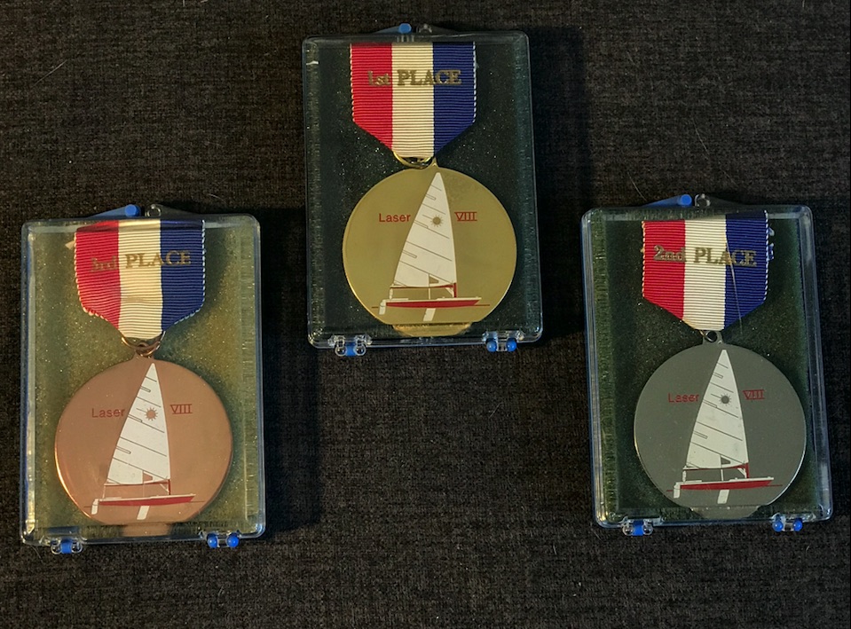
  • Laser
  • Soling
  • Star

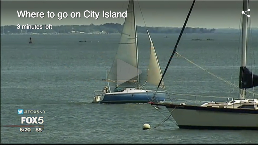
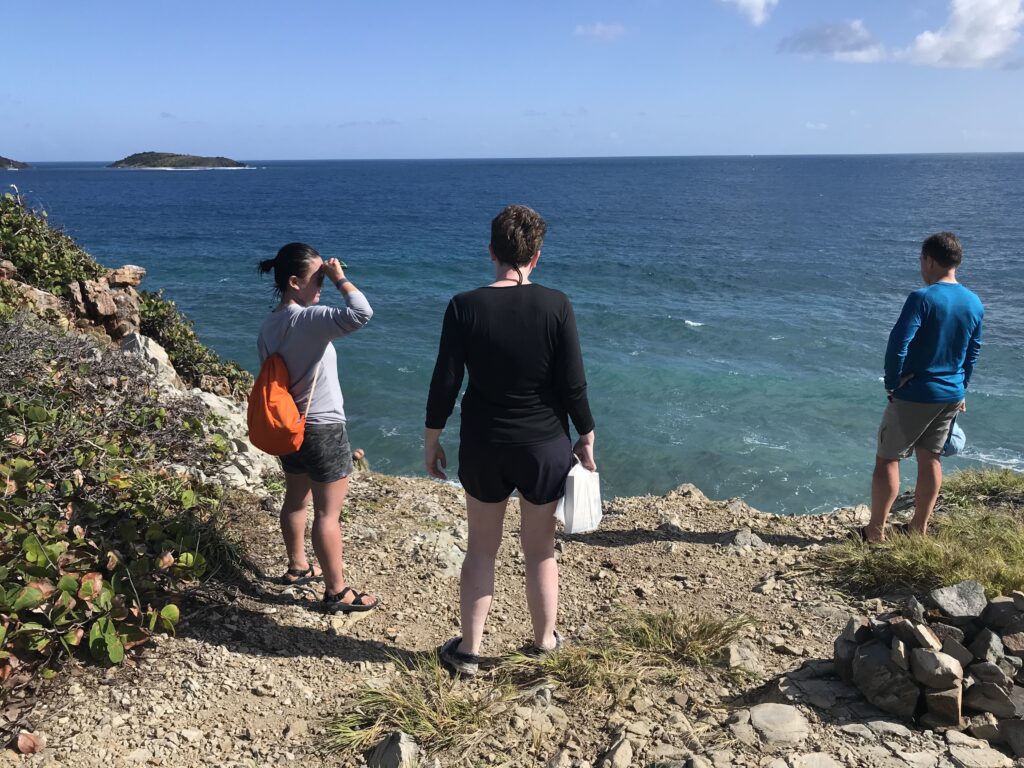
Sadly, I can’t find a single photo of me in any of those boats. There’s a great shot of me sitting on the rail of my capsized Laser in between races off City Island one day. In between races, one could sail by the committee boat and ask for a can of Coke. I flipped my boat so I could just relax with my feet on the daggerboard sipping my soda while others wasted energy sailing around for no reason. I won the regatta that day. I lost the photo. But, temporarily; it’s somewhere in family photo records.

Late 1970’s; a Soling converted for sailing instruction. This was when our family owned and operated New York Sailing School. We installed custom bench seats on two of the boats to make instruction and day sailing a little easier. Harsh boat otherwise, but oh, boy – did it sail! Almost all schools eventually switched to more student-friendly designs that were more effective for instruction. Almost. (We ditched them in the early 80’s for this purpose and never looked back.)

The Soling came first, as it was the teaching boat used at our family’s first sailing school (NYSS, or New York Sailing School). Dad sold that school in the winter of 86/87, and I started mine in the fall of 1997 with classes underway in the spring of ’98.

The Soling is a truly elegant, pedigree little yacht. 27 feet of purity and grace and zero creature comforts. It’s a racing machine, straight up. Yet, it’s fun to day sail and a surprisingly good teaching boat. However, the lack of seating, lifelines, etc and the wet nature of the boat really interfered with instruction and learning. So, when Dad found a better alternative, he took that tack away from the fleet of other schools.

I mostly raced Solings at the school. We had a Tuesday night series in the summer. No, not really very competitive – but still, super instructive as it was repetitive short-course racing with tight starting lines and put a premium on tactics and boat handling. And, we used spinnakers. My favorite was a solid black chute with a stark white steer skull in the middle.

Relatively recent action on a Soling: only the skipper stays on or in the boat on a windy day! Not just a venerable Olympic class, the Soling was heavily used by adult sailing school programs across the country if not the world.

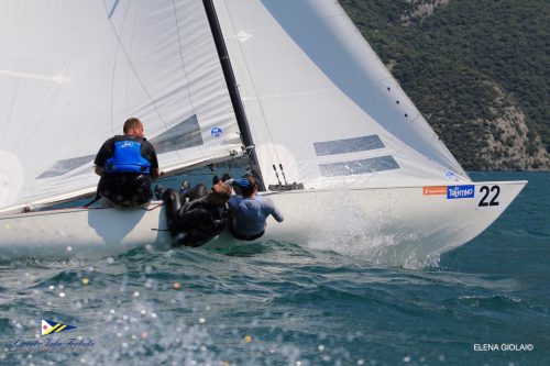
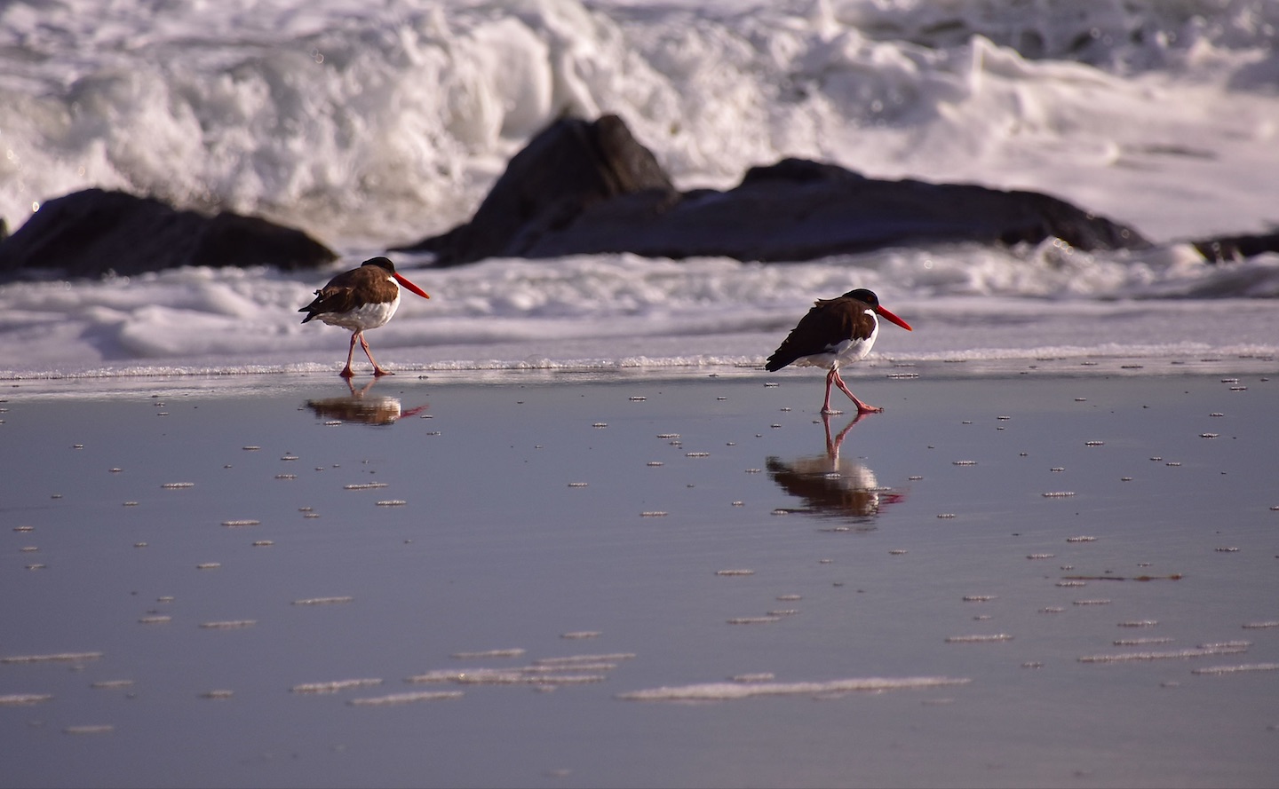
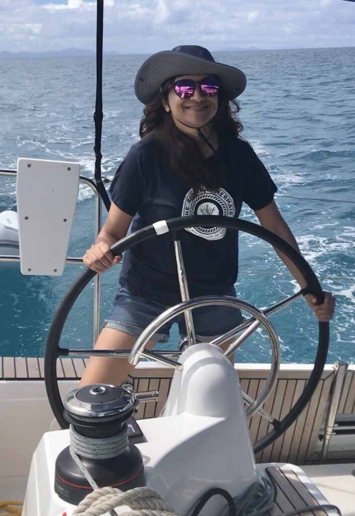
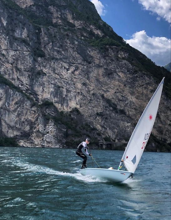
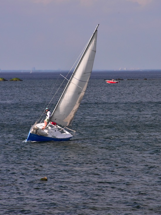
The highest level I raced a Soling? The East Coast Championships one fall out of Stamford Connecticut. I was crewing, not skippering. Perennial class champ Hans Fogh of Canada was the skipper to beat that time. We didn’t. Windy couple of days; I spent much of it hiked out over the side in the manner shown in the photo above.

The Soling was an Olympic class for quite awhile. Two veteran American racers who did well in Solings were Dave Perry and John Kostecki; Perry also excelled in the Laser. One of the best sailboat racers in history, Robert Scheidt of Brasil, won 5 Olympic medals combined in the Laser and the Star: 2 gold, 2 silver, and a bronze. Only man to win Olympic medals in both dinghy and keelboat classes. Hmmmmm….

1972 Olympic Gold Medalists: Australian style! Star Class.

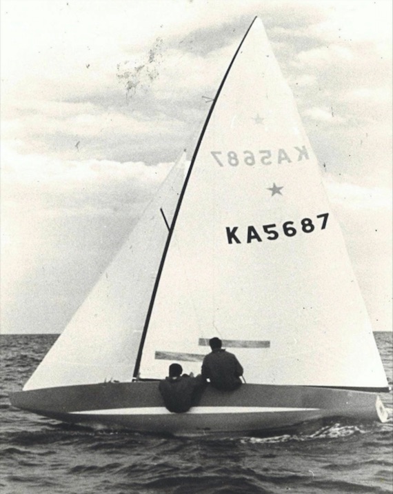
Then came the Star. The Stuyvesant Yacht Club on City Island, which was around from the late 1800’s, had a nice fleet of these sloops stored on trailers which they dry sailed by lowering and hoisting on a dedicated lift. I was invited to crew on a couple of occasions for Sunday afternoon racing. We had light winds, so it wasn’t too exciting – but it was fun and tactical. No spinnaker, so easier to shift gears on shifting winds in an instant and focus the whole time and tactics and strategy.

Star white room; typical recent scene for this low-riding, wet and athletic class that has seriously withstood the test of time.

The Star was in the Olympics for some time. It was the 2-person keelboat. One crew hikes over the side when needed; both sailors need to be decently sized to hold that boat down. It’s work. While no longer in the Olympics, the boat is still super competitive and used in series including the Bacardi Cup in Miami and the Star Sailors League Invitational regatta. Dennis Conner of America’s Cup fame was a world champion in the Star before he got involved in the Cup.

Next: the Laser, which came later to the Olympics but was already one of the world’s most widely sailed boats and is now the most. It’s a singlehanded performance dinghy with one sail (cat boat or uni rig), with three choices of sail size.

Olympic medalist Anna Tunnicliffe, from Steven Lippman’s shoot in ESPN’s In the Buff series. Note the cuts; this is an athletic boat to sail competitively.

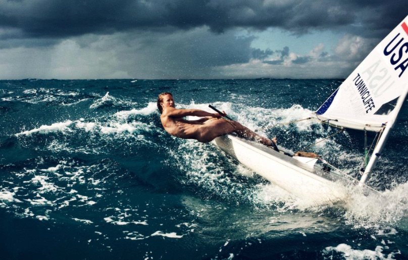
I started sailing these in the early 1980’s and raced them for a few years in the NYC/Long Island district of the Laser Class Association. I also qualified for the Empire State Games once and drove my Laser atop my Pontiac Ventura Hatchback up to Syracuse. I was only about 118 pounds soaking wet, and raced a full rig – but as we’re in a light wind region here, I got away with it. The one time I actually won a regatta saw 15-20 with some higher gusts, but some of the better racers in that district didn’t attend. But, I sailed hard and beat larger sailors. First race: chose not to jibe on the screaming reach to the jibe mark. I did a ‘chicken jibe:’ I lowered the board, spun around in a tack, and continued. The guy I was basically fighting the whole day for 1st place? He kept it real and jibed. He flipped. I won the regatta by a hair and his capsize spelled the difference.

Medals in the Laser Class, District 8 (NYC/Long Island). From back in the day when our Director actively raced the world’s most popular sailboat. It’s still in the Olympics despite recent challenges by upstart imitator classes.

So, sailing on some Olympic classes paid off. First, it made me a better sailor. Second, it made me better understand how boats relate to teaching beginners and intermediates. Our family started teaching on the Olympic Soling in 1968. Since then, we’ve used three more designs for teaching beginners, in this order:

  • J/24, in late 70’s (immediately abandoned and returned to Solings)
  • Sonar in 1980 or thereabouts, continuing until NYSS sold;
  • Beneteau First 21 with my new school in 1998

I could have gone out and bought a fleet of Solings, Sonars, or especially J/24’s to make a cheap fleet. You get what you pay for. Spare parts for our Beneteau First 21 sloops typically exceed the purchase price of a cheap used J/24 and often that of a Sonar. I leave that for the multitudes of other schools that don’t know or don’t care.

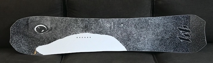
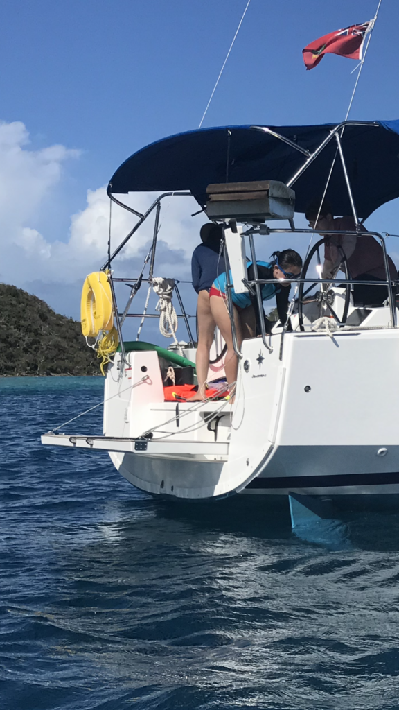
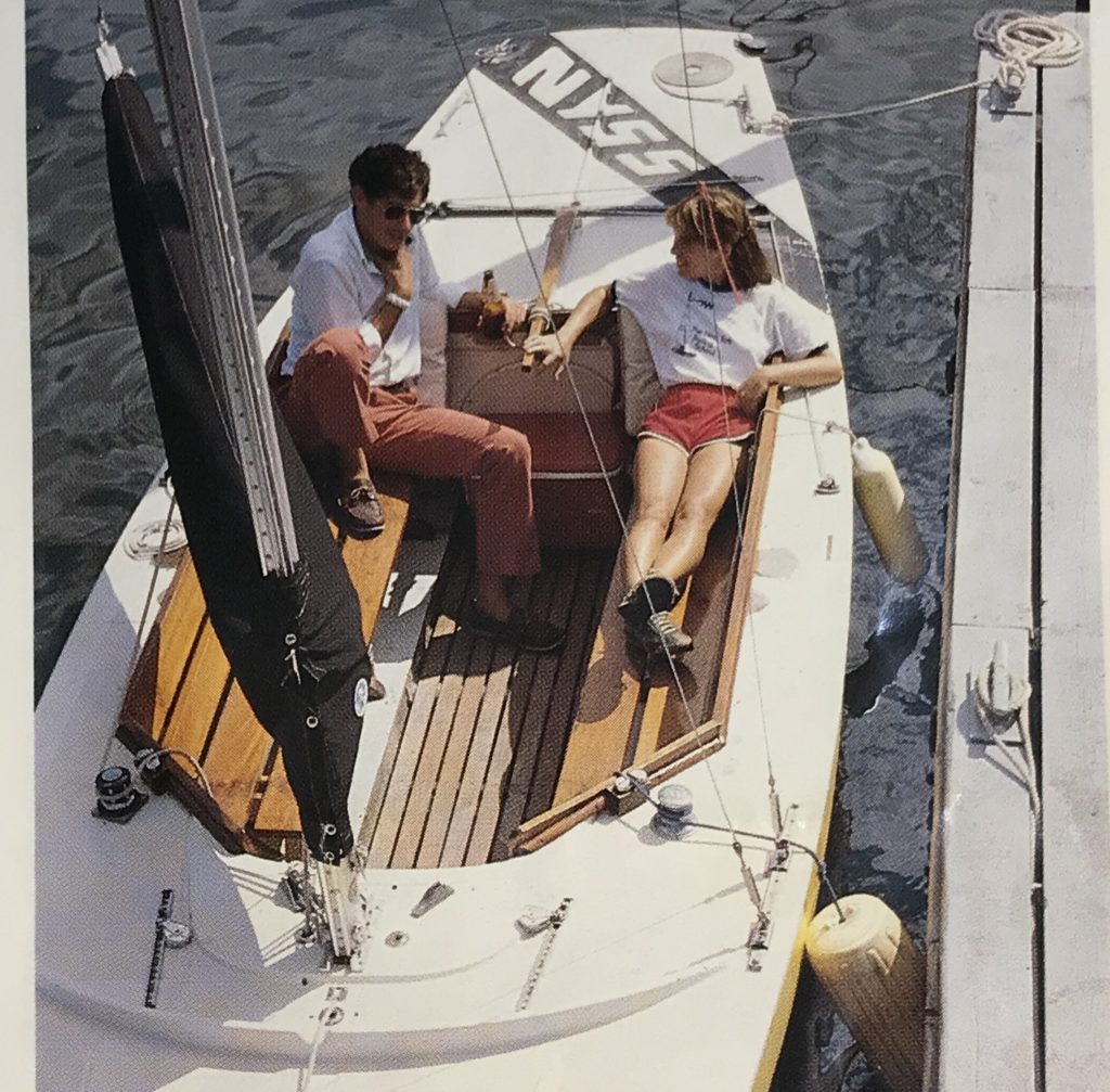
Our Beneteau First 21 sloops have an enviable distinction: they’re the only sailboat design ever endorsed by a national sailing school organization such as ASA or US Sailing. The First 21 is the same boat as the Beneteau 22 and the ASA First 22. What’s the only difference between them? The ASA First 22 had a longer cockpit and smaller cabin. It’s the same exact hull, keel, twin rudders, mast, etc. The only real difference is the cockpit to cabin ratio. The Beneteau models have plenty of room already, so no problem there. Guess we got it right in 1998!

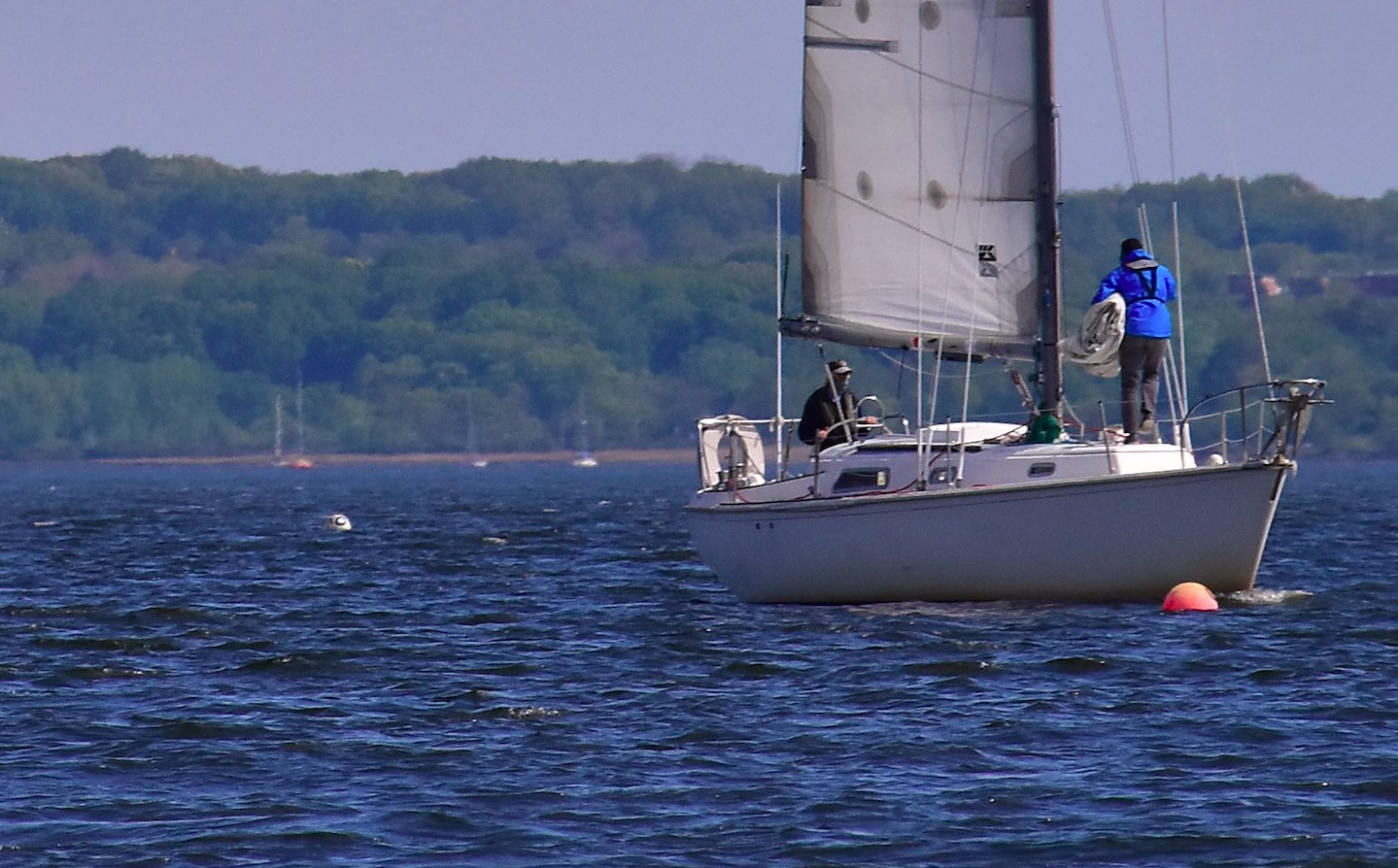
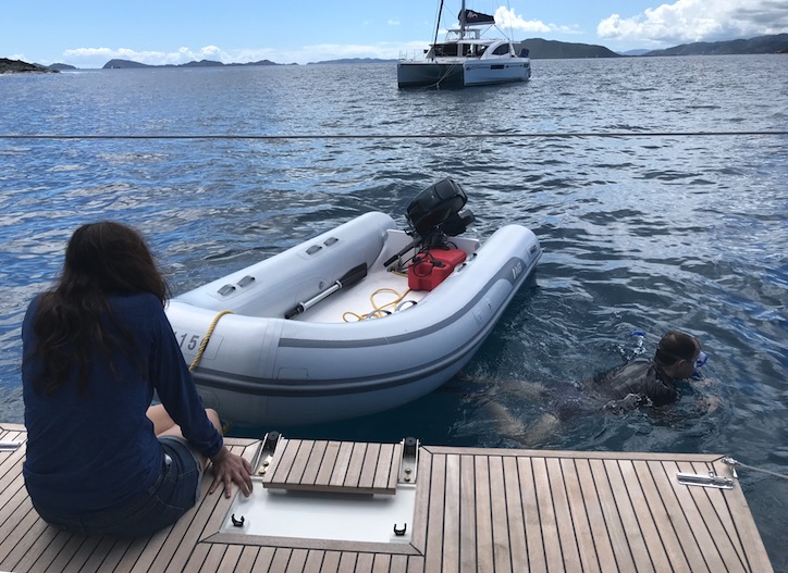
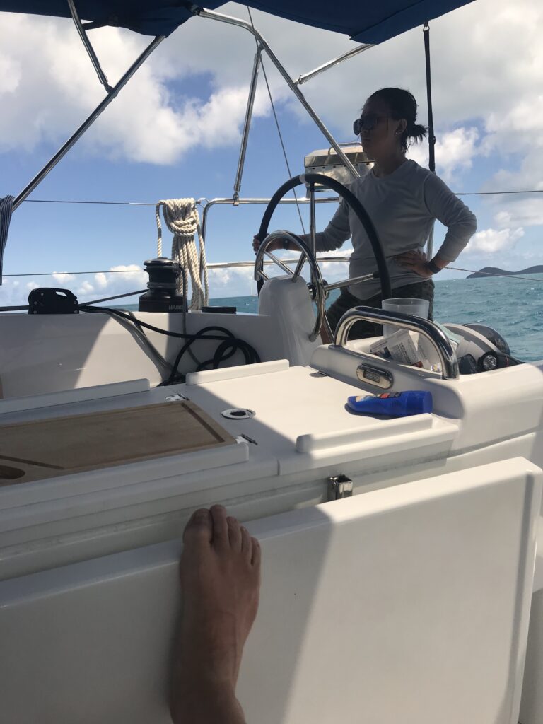
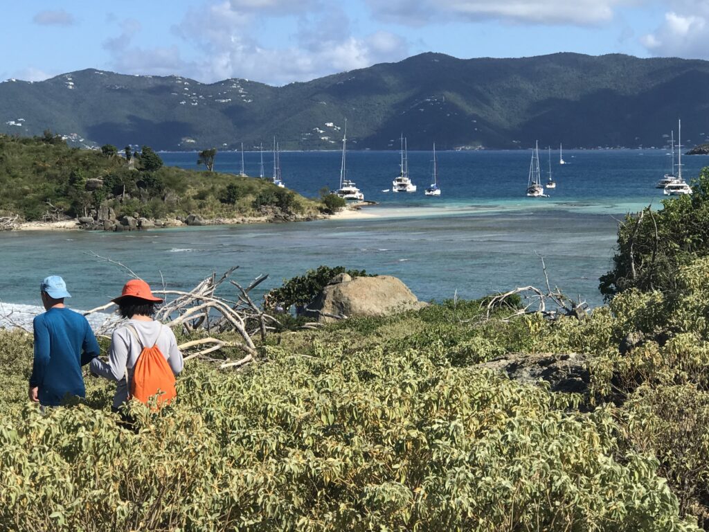
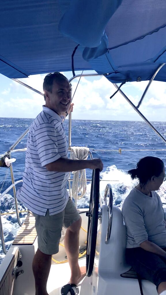
Here’s a couple sailing one back to our moorings on a windy day. This couple has a fair amount of experience: both raced J/24’s in NY Harbor; both sailed J/105’s. He did a Transatlantic! Also grew up cruising Maine. She did two levels of ASA courses in NY Harbor as well as an offshore delivery from Florida to New York.

Guess which Club they belong to now, and what their current favorite boat is? It’s ours – what many European sailors call the Baby Ben…

“At NY Sailing Center, we know a thing or two because we’ve sailed scores of boats, not just a few… including 3 Olympic classes.”

Captain Stephen Glenn Card, Director and HBIC (Head Bozo in Charge).

Living with Thunderstorms – & Not Dying in Them.

It’s that time of year; weather is warming up, and thunderstorm activity is heating up as sailing club, school and rental activity opens up. We revisit this topic every year as a public service. One reason: people still don’t seem to ‘get it.’

In that pic: screen capture of radar images on Wednesday, June 3, in the late AM. We had a private lesson booked that day with an experienced sailor. The forecast was for thunderstorms – not a chance, or a likelihood, but just… thunderstorms. And, they warned of potentially damaging winds and hail. Not a garden variety summer forecast, which is “chance of showers and thunderstorms” or similar language.

Oh, no… it’s ON!!!!

Below, I’ll share how the day of June 3 unfolded forecast wise, and also stories about two needless tragedies in the past that happened when people didn’t pay attention to the forecast.

The first step of the day is to check the forecast. That should be done several times as the day progresses to look for updates. The next step is to check the radar. Easier than you might think; just look at the pic above. Pretty clear that something is brewing. And, even if the forecast winds up being off, the radar doesn’t lie. It doesn’t take a meteorological degree to read a radar app. It just takes a little time and experience.

On two occasions since I’ve been operating New York Sailing Center, which I founded in the fall of 1997, there were particularly violent thunderstorm systems that passed through the region and resulted in a fatality at some other school/club. NOT AT MY SCHOOL/CLUB. At others.

The first was in 1998, before we all had smart phones and radar apps at our disposal. It was old school; check the forecast, check the sky, and listen to the VHF radio weather band for updates. The forecast was doom n gloom: thunderstorms, some of which could be severe, and which had a large outer perimeter of strong wind (meaning no way to see it coming). And, the storms had already started upstate and killed a few people.

Make no mistake; winter is coming…

Sky getting gray as we return to the mooring on Wednesday, June 3. Radar? Showed rain passing to north and east, and squalls approaching in the distance from the west and south. Might miss; might not. So, we cut the lesson short and played it safe.

So, I kept everything on a super tight leash that day in 1998. We had one class with a veteran instructor. We talked about it and decided to confine the boat to the anchorage. No further than the outskirts of the anchorage. The anchorage is small. More maneuvering, then! Marina customers were warned of the storms if they showed up. A few did and just turned around and went home. One woman chose to sit on her boat at the mooring for awhile and then go home.

Eventually, after frequently checking the sky to the north and west, I didn’t like the look and feel. I started radioing the instructor to come in, and saw he was already approaching the mooring. They took one shot, and fell short… and then it hit. BAM. Nothing to be seen in advance. Just wind laying the boat over and flogging the sails. They didn’t have a chance to sail back to the mooring; no way. The boat was basically blown down onto the next pier, and the instructor wisely off-loaded the students and left the boat. I went out with a few experienced people and two solid motor boats, and towed the sailboat off and moored it. It took two boats just to pull it off and suspend it into the winds, which were at least 60 knots and possibly as much as 70. When it subsided a bit, we moored the boat.

It was over quickly. It always is. But it takes little time to cause mayhem. We got away with a torn sail and a fright. Down in New York Harbor, they weren’t so lucky. One large club/school had allowed at least one member to go out with his family. The boat took a complete knockdown, and the man was in the water and separated from his family. He wasn’t wearing a PFD. His body was found a few days later in Gravesend Bay, Brooklyn.

Fast forward to August, 2010. Morning forecast: about the same as the 1998 incident. Thunderstorms. Severe. Moving fast. Clear band of strong winds. This time, however, we had smart phones and radar.

I kept the one class we had that day pretty close for our morning sail. I intended to do a short n sweet lesson, get off the water way early, and watch it all blow through during lunch and some extra classroom. While on the water, I got a call from a recent graduate hoping to come out for one of his practice sails that afternoon. Sorry; no. Bad forecast. He pushed; I explained the severity of the forecast. He tried some more.

“No fucking way! I’m not going to let you come out here just to die in some violent thunderstorm! You’ll come out another time – live to sail another day!” The first sentence is an exact quote; the second is approximate. The message is clear.

What happened then? We sailed back to be safe. Sky still looked fine. Checked the update radar while waiting for our launch ride. Whoah…. it was the largest Darth Vadar Death-Star-looking doom ‘n gloom ball of red, orange and yellow I’d ever seen – before or since – on a radar screen. It was moving south and clearly going to hit all of Western New Jersey, Westchester, NYC, and Nassau, Long Island. All of it; all at once.

Updated Radar imagery from Wednesday, June 3. Note the wall of band of red/orange just south of our area. That’s violent weather. The yellow with orange/red above? Not to be taken lightly either. Only takes a splash of red to dash your head on the rocks.

So, I shut down the operation until further notice. Told my launch operator to go somewhere inside for lunch on the avenue and stay there until I told him to return. I took my class to do the same, with some classroom props.

It did hit. We were basically done with lunch and b.s.-ing about other stuff. Suddenly, it was very dark. Stuff was flying around like that scene from the Wizard of Oz. Darker; windier. Eerily, we couldn’t really hear it as the place was well sound insulated and we were in the back looking down the hall at the front door. And, almost as soon as it started, it was over.

We paid up and walked back to the marina. None of us had ever seen so much random debris blown around by a squall. The waterfront was worse; the waterway itself was a shit show of stuff blown offshore by the storm. There was zero wind. Sun was back out. Surreal.

And then, I got a text from one of my instructors. He let me know that another school (again, not ours) had a class out during the storm. They lost one person. Literally. The body was found a day or two later. This was disturbingly close to home, in lower Westchester, within sight of my school on a clear day. it was day one of a learn to sail course (compared to day 3 for mine that day). They went out in the afternoon (as opposed to my coming in at around mid-day). No one aboard was wearing a life jacket, or PFD. (We spend extra money on comfortable automatic inflatables with manual overrides, and make people wear them.) The boat had no lifelines, which are wires or ropes that are elevated above the deck going around the boat. (Not all boat designs have them, but it’s riskier when they don’t – especially for beginners.) Everyone on that boat wound up in the water; all but one made it back to the boat.

All but one.

I knew several sailors who got caught out in that same storm. They all fared well, but got quite a fright. I heard of others who got caught as well (also survived). The common denominator? And, what was reported in the news regarding the fatality in Westchester?

“It happened so fast.” “You couldn’t see it coming.”

But, you could. On the bloody radar! And, you KNEW it was coming. Why wait to see it? Does that sound simplistic? Well, it really is that simple.

In that pic: all gone – out to sea, but I pity the fool who got caught out in that. It intensified as it neared shore and got over the water. Wednesday, June 3.

Remember the DUCK boat incident a few years ago? We did a blog rant about that. Same shit; different details. Only that time, many people died. I’ll link back to that blog post below.

The lesson: people don’t seem to learn the lesson. Here’s how I suggest you manage the risk of getting caught in a squall or thunderstorm on the water during the summer, which is when most of them happen, and also when most of you would likely do most of your boating.

  • start the day with the forecast online, cross referencing at least two sources.
  • If there’s some risk of thunderstorms, consider skipping boating that day.
  • If you go anyway, check the update forecast upon arrival at the marina.
  • Start checking the radar at that time as well. If it looks dicey, don’t go!
  • If it looks like it’s far off, or just not developed, stay close and check frequently – at least every 20′.
  • As soon as it’s looking worse, assume the worst. Head back. If you have an engine, turn it back on (yes, you should have checked it before). Stow sails.
  • Moor or dock the boat. Double check the radar and forecast.
  • If still no good go home! If the risk went away, it’s your call.

I’m not a meteorologist. I’m not a weather forecaster. I’m not a climate scientist (although I know one who’s a PhD candidate at Columbia). But, I am an expert and well-seasoned mariner. And, I have to make decisions all season that affect other people: whether they get to play or not that day. it comes down to whether they’re safe or at risk of death. And so, I check the weather and radar pretty obsessively.

“What do we say to the God of Death?”

“Not today.”

Arya was bad-ass enough to slay the Night King. But even she knew the universal truth:

“Don’t f*%! with Mother Nature!”

RESOURCES:

The Radar web site (not an app per se) that I like to use for the northeast…

www.pluff.com

Our Blog Rant about the DUCK boat tragedy…

Boats & Birds: It’s Summer on the Sound!

Most of us have had cabin fever during the COVID pandemic; some of us have weathered it better than others. And, the weather is better – and warmer – on average. So, more boats are out. Some of ours are too!

We’ve been sailing since April, albeit very sparingly for obvious reasons. Things are opening up gradually with select low-risk on water activities. We’ve managed some private classes and lessons for individuals or family who’ve quarantined together, and some of our Sailing Club members have gotten out.

In this pic: our Pearson 10M, Kilroy, with the ‘Gold Coast’ of Long Island in the background – and closer than you think (just as City Island is)!

Memorial Day Weekend is a benchmark of the beginning of the summer season. We usually ramp up for it. This weekend was quite slow, due both to weather and pandemic precautions. But, we got some folks out.

In that pic: teens enjoying a sail with the folks on the Sound recently. Memorial Day, in fact! Note the greenery surrounding the Sound. Plenty of bird sanctuary.

And, we got to simply observe. And we were reminded of one of the things that make City Island special as a sailing location and destination: wildlife. Fish and birds abound.

The sailing in Long Island Sound is arguably the best in the New York Tri-State region: gentle currents, abundant room, little commercial traffic, clean water one can swim in, scenery everywhere, tree lined shores, etc. It’s excellent for beginner and expert alike, with yacht clubs and sailing associations lining both coasts, and any number of one-design racing classes well represented. Junior programs; race weeks. Pick-up and JAM sails (Jib & Main). Coastal and the occasional National Championship. Cruising destination par excellence. Breeding ground of Olympians. And, perhaps the best place for people to just learn how to sail.

Plus, we have the plumage…

In that pic: a family, flock, or whatever one calls a gathering of snowy egrets. Eastchester Bay, on the west side of City Island, Memorial Day. S. Card, photo.

No, it’s not important to see birds to learn how to sail or enjoy quality Club sailing. But it is important to see them as a sign of a healthy ecosystem that’s clean and fun to play in. Plus, all other things being equal (and they’re not), why wouldn’t you want to see them? They’re one of the attractions of the Sound in general as well as City Island.

In that pic: Geese and goslings. Rodman’s Neck, off City Island, Memorial Day. Shot taken by our DP, Captain Card, while taking a quick fishing break. He did hook one weakfish and lost it. Signs of life…

Here are birds we see routinely or occasionally here…

  • Amazon parrots (no shit!)
  • Black capped night herons
  • Canada geese
  • Cormorants
  • Ducks
  • Egrets
  • Great herons
  • Gulls
  • Hawks
  • Osprey
  • Swans
  • Terns
In that pic: family returning from a sail aboard one of our boats on Saturday, May 30. Parents: grads of our program and now cruisers. Kids: taking a shine to the daysailing and cruising, and who knows… maybe future wave shredders on the race course!

Osprey attempt to nest each spring on the frame over our pier. The gulls always outsmart them and dash those dreams on the ramp and rocks. Amazon parrots are fairly well distributed around the region, surprisingly; City Island had a large population that appeared to have disappeared, but we’ve been seeing them again the last two seasons. They hang out right in our marina and are a hoot (ouch) to watch and listen to.

In that pic: a lone osprey captured doing a fly-by against the tall radio tower next to City Island – the single best beacon, or navigation aid, in Western Long Island Sound.

All the others? Seen along the shore, off our docks, from our boats, etc, etc.

So, if you want to mix some bird watching with your boating, or you just appreciate a calmer, healthier environment in which to enjoy top tier sailing….

Birds of a feather know what’s better.

In that pic: an egret or heron (who knows? who cares…). Picturesque, yet pedestrian… this kind of scenery is an everyday thing on the waters around City Island and Long Island Sound. Come capture your own scenes!

Which North are you? North 1 or North 2?

Scientists struggle to model the movement of the magnetic north pole. In our live, online ASA 105 coastal navigation course, a real instructor teaches you about this, and why you can basically ignore it.

We’re having a lot of fun with our “Live 105” classes on Zoom! Real instructor, real time, real students – in the same, small manageable class sizes we have for in-person courses. One of our current students sent a link to a BBC article related to the content of a 105 course, which is of course all about…

COASTAL NAVIGATION.

The link Cristina sent? A BBC piece about the movement, or wandering, of the magnetic north pole. We link to the piece at the end of this Rant. For now…

In that pic: the thin aqua line traces the approximate motion of the magnetic north pole from 1840 to 2019. It’s accelerated recently, creating a scientific buzz. (Pic is a still frame from a video in the BBC piece we link to below.)

THE IDEA: the magnetism of earth is both consistent and inconsistent. Compasses point to the same place on earth with minor wiggles. This is close to the geographic north pole, or the rotational axis of earth. If Atlas stopped shrugging, and spun earth on the tip of his finger like a Harlem Globetrotter, it would be on the South Pole, with the North Pole exactly at the other end – or “top.” But, “top” is arbitrary, ain’t it? Space has no direction. We’re floating in space. And, what’s more…

It might flip! Yup. Magnetic North and South have reversed from time to time. Maybe every few hundred thousand years. The question is whether this could happen within our lifetimes. And, partially due to accelerated movement of the Mag North Pole, scientists suspect it might.

1, 2, 3… SWITCH! Oops…

THE ARTICLE’S PATH: Scientists studying this have noted the acceleration of the drift of the Mag North Pole recently, and have updated the global model used for that as it relates to GPS, which is critical to precise navigation. That’s not always super critical itself; as we teach in Start Navigating ( ASA 105), it’s almost more important to check progress in real time than plan the path perfectly to begin with. Basically, they think they’ve identified two molten “hot spots” in the earth’s outer core that are having a tug of war over the magnetic north pole. Kewl! Or, very hot…

That gets into some chart nitty-gritty: the compass rose. It’s a tool to measure direction, and it looks pretty kewl too. Check it…

In that pic: a section of the 12363 chart of Western Long Island Sound, with City Island (“City I”) on the right, which is home to the Sailing Center. It’s about half the length of Manhattan away from it; northern MannyHanny is on the bottom left of the chart. It has a nice, large compass rose, or rings that measure direction. The outer ring is for true, or geographic, north – with a star at the top for Polaris, the actual North Star. The inner ring is for magnetic north, which is where compasses point more or less. In navigation classes, we teach how to use these to plot out a course to steer a boat.

THE CONVENTIONAL WISDOM: look at the annual increase/decrease in the variation as listed in rose (the pic below blows it up for you). It’s usually a few “minutes” a year. Each minute = ..? It’s a measly 1/60th of 1 degree of the compass. Yup; slicing hairs with razor blades. Anywho… if your chart is out of date, the idea is to multiply the number of years of ‘stale’ by the number of minutes of change, and add or subtract accordingly. And, get the +/- right!

ABOVE: blown-up crop of the compass rose from the same chart above. Variation: 13 degrees West as of 2016. Annual decrease: 2 minutes (2 out of 60, with each compass degree having 60!). Splitting hairs…

NYSC knows better… our Director and HBIC (Head Bozo in Charge), Captain Card, had a suspicion about something years ago. He compared every training chart the government produced, which are all frozen in time going back a far as the early 1980’s, to the updated, real-life versions of those charts. The conclusion? It’s silly to try to project any annual increase or decrease into the future. We expand on that and reveal the goods in class, and in our own in-house text book that we supply to students (and sell on the side). Despite what other books say, just skip this step. Much smarter move: get a current chart, for all the more obvious reasons.

Maybe we’ll be lucky (?) enough to see the poles flip in our lifetimes! Will planes drop from the sky, and cars run off the roads? Well, if they can’t figure that their GPS and compasses are basically pointing backward, we can’t help them.

Your takeaway? Use updated charts to plot courses to your destinations, and casually follow along with the progress of Mag North Pole’s wanderings across cold areas most of us will never visit.

And now, as promised, the link to the BBC piece…

https://www.bbc.com/news/science-environment-52550973

Happy hunting!

We’re not just IN the news… we help produce it!

When media needs a captained boat rental for tv, film, ad & photo shoots, we often get the call.

In that pic: USA Network journalists/drone pilots in action from our Carolina Skiff on Long Island Sound. The foredeck is like a drone heliport, and the open profile of the stable skiff facilitate shooting in any direction from on board. Here’s a sample of what they captured before their drone landed:

Still frame from video aired by USA Network on northjersey.com – an aerial piece about burials at NYC’s cemetery (potters field) on Hart Island, adjacent to City Island.

This isn’t anything new for New York Sailing Center. We’ve been featured on cable, network TV, and in print since soon after we opened in the fall of 1997 with on-water classes starting in April of 1998. And, we’ve helped produce the full spectrum of the same things for other purposes.

Our Director and HBIC (Head Bozo in Charge), Captain Stephen Glenn Card, is a solid photographer if slightly shakier on the video front. However, he’s an all-around rock star on setting things up – and then keeping clear – so pros get their shots: by still lens, video, and anything attached to a drone. Somehow it just comes naturally to him.

In that pic: a glassy calm photo session from City Island Harbor, looking out over Long Island Sound. That’s the ‘Gold Coast’ of Nassau County, Long Island in the background. This was a lengthy piece in New York Magazine last summer. We took NY Mag out for stills from our Carolina Skiff and aerials via drone, ranging from the Brother Islands in the East River out to some small islands off Westchester in the Sound. Foreground of pic: the Chimney Sweeps, large rock islets off City Island.

When the shoot calls for talent on a boat with a particular look and lighting, we can supply the boats and time the lighting. For one shoot, Captain Card was hired to captain a 40-foot sailboat for a few days that was the main location for a short independent movie. Departing Sag Harbor each morning, he drove the boat to wherever the director wanted the background to be, and oriented the sailboat for the best lighting. There was a go-fast chaseboat available for some of the shooting, and some crew and talent transfers, but most of it was from right on board the sailboat, and Captain Card brought them along from the dock

At anchor for one scene, the lighting wasn’t quite working out. So, he rigged a bridle from bow to stern which the anchor line could be slid along, letting him instantly and exactly change the boat’s angle to the sun as the DP needed in the moment. Brilliant! Idea, that is… the lighting was more subtle on purpose.

In that pic: New York’s Channel 5 did a series a few summers ago called Closer Than You Think,” about things to see and do in NYC that were, well… yeah. Closer. They did a piece on City Island, and we got most of the air time as well as a lengthy thanks/mention in the studio segment with the reporters. We were featured, of course, but we were also very involved in all aspects of setting up the shoot: scenes from our pier (as in this pic), chase boat, and video from both. It’s a fun video; check it out here!

We absolutely love doing this stuff, whether it’s zooming around in our go-fast Carolina Skiff to chase down a sailboat in a shoot, cruising to a destination for scenery, or whatever actually. We still love just being on the water. Never grows old.

Zoom. Boom. Learn nav live!

We’re rolling live with Zoom! Our interactive on-line Start Navigating courses (ASA 105, Coastal Navigation) are officially a hit. They have 100% social distance, are fun, and as if we’re right there with you.

(…but, of course, we’re NOT.) IN THAT PIC: Two tools! Err… instruments. ‘North:’ a pelorus we recently scored on eBay. They’re antiquated to obsolescent, but still critical to understanding radar. ‘South:’ hand-bearing compass, or “hockey puck.” Critical to taking bearings for proof of position on the water… and dealing with deviation on the boat’s steering compass! Yup. We teach you how to use both.

Students have been tending to sign up in groups for some reason. No problem! One group and done, and always room for singles and pairs. Some people are arranging social study-sessions in between classes to do some of the practice plotting together.

How does it work?

  1. You sign up. Imagine the Bobble Head version of Ray Liotta in “Goodfellas,” when he’s describing all the excuses people give when his character would go on his collection rounds. Any excuse… his answer’s the same: “F&%$ YOU PAY ME! F#@$ YOU PAY ME! F%*$ YOU PAY ME!” (Parenthetical aside, our Director and HBIC, Captain Card, who runs the Zooms sessions by the way, went to College with someone who was an extra in the movie and got listed in the cast. “Bar Patron.” If you have enough time on your hands, and send us his name, you get $25 off the course!)
  2. We send you the materials: chart, plotting tool, and dividers (nautical drafting compass). We also email the text book in advance as a PDF, although there’s no reading or other prep required. You might want to, however: our Director wrote it. It’s fun, easy to read, well illustrated with photos, color, and step-by-step diagrams. And, it’s effective.
  3. You log on with the invitation before class starts, and BOOM. ZOOM!! You’re learning live, and laughing too.

IN THAT PIC: Real-life, real-time. And, it was recent! From our Feb/March trip in the BVI (Virgin Islands). We were heading back to the main island chain from Anegada, barely visible top right. Anegada is barely above sea level, and can’t be seen from the rest of the BVI – not until almost half way across the passage to it! Critical to get it right… it’s surrounded by coral reefs except for a very small approach that must be made at the one safe angle. Or… boom. Aground and unhappy. We often use the example of plotting the passage to Anegada in our Start Navigating course.

What exactly is this course, anyway? “ It’s all about how to navigate a boat for day trips, overnights, and even extended cruises along a coast. You can even lose sight of land for awhile. Soup to nuts: you’ll be able to navigate in pea-soup fog once you’ve practiced on the water for awhile in more sane conditions.

“Who can take it?” Anyone who wants to learn. It’s great for getting stoked / psyched about going boating and sailing. No, there’s no experience or prior study or training required. It’s helpful to have done some boating for perspective but that’s about it.

“Who SHOULD take it?” Anyone who’s intrigued about boating and sailing, and wants to get a flavor of things to come right NOW. Even if you don’t yet sail. If taking this course now doesn’t compete with time or funds for more important things, just do it. If you plan to eventually do longer day sails, and/or overnight trips, especially chartering for a week abroad, then DEF do it. If you already sail, but have no short or mid-term plans to do anything more involved than you already do, then you’re fine skipping this course for now or maybe forever (unless you’re currently having trouble finding your way around). But, it’s fun… and might jump start the next phase of your sailing career.

What’s covered in this course?” Everything from… “this is a chart. We call it a chart, not a map. That’s for landlubbers!” to… proving position underway, compass deviation, proving what the current did to push you off course and fixing that going forward.

Very importantly even for day sailors, we break down the misleading oversimplification that is called “Red, Right, Returning” and prove what that’s “wRong!” Yup. We just said that; you just read that. It’s total BS, and we’ll prove it to you.

IN THAT PIC: From less socially distant times… early winter 2019, Manhattan: Start Navigating course. Of course, we had a surplus of hockey-puck compasses to play with that day as one sailor brought one from home! Yup – even with the on-line course, we can teach you how to handle the hockey puck.

“How is the scheduling done?” If you’re a group of two or more, THAT’S a schedule (unless of course it conflicts with one in progress). Joining alone? No problem. We’ll discuss what’s in the queue now, and if that doesn’t work, we’ll create another schedule. We don’t have to set the entire schedule in advance either.

The course takes 3-5 sessions to complete depending on how long each one is, and how quickly people pick up what we’re putting down. Sessions are typically between 2.5 and 3 hours with a break. We can do them any time of the day or evening, any day of the week, subject to existing obligations. (We are, of course, readying our fleet, with two boats in the water so far, and doing very limited on-water activities.)

“What does it cost? What’s included?” $275, which is $120 less than our normal full tuition for in-person courses. It’s all-inclusive: materials, tools, and certification.

“How do I pull the trigger?” Here are some links: one for the Start Navigating 105 page to learn more about the course, and one for just signing up. Feel free to call or write with any questions first; here’s how to hit us up.

Slipstreams & Slipping Sands

IN THIS RANT: the ‘slipstream’ phenomenon, and why we need to keep much greater social distance when exercising outside – sprinkled with beach pics and boating right-of-way bits.

I’m still driving to Breezy Point from time to time to slip the park crowds on nice days. Why? Social distancing doesn’t seem to apply to bikers and joggers.

Maybe it’s self-centered laziness. Maybe it’s a healthier-than-thou attitude. Hopefully, it’s lack of awareness of what I’m going to write about below. But regardless, just like “Red, Right, Returning,” it’s WRONG. No, that’s not about right-of-way, but still…

Cute birds slipping the surf at Breezy Point the other day. Even at high tide, when the surf encroaches on our social distance space, it’s easier to get in a good walk and maintain social distance than at some NYC parks… and this is still in NYC! Steve Card, photo.

The image below is from a post by Jurgen Thoelen on Medium, which describes how studies in Belgium and The Netherlands conclude we need to allow MUCH more distance between us when exercising in public by biking and running. Even just walking. Jurgen sums it up well:

When someone during a run breathes, sneezes or coughs, those particles stay behind in the air. The person running behind you in the so-called slip-stream goes through this cloud of droplets.

Jurgen Thoelen, “Belgian-Dutch Study: Why in times of COVID-19 you can not walk/run/bike close to each other.”
The slipstream effect: social distance has to increase exponentially (a LOT) when people are moving at jogging and particularly at bicycling speeds.

I’ve been bitching about bikers and runners zooming (or slogging) right past pedestrians since this crisis got real. They often don’t take any care to pass at any distance, breezing – literally – as close as a foot or two past others. They’re breathing harder, and exhaling it onto those they pass.

As a lifelong sailor and angler, I’m acutely aware of the breeze at all times. I take care to try to stay upwind of anyone talking, breathing harder for any reason, and now – at the near apex of the infection and body count in NYC – not wearing facial covering or a mask. I mostly walk for exercise, but when weather favors it I ride my bike in Riverside Park on the mid-level esplanade. That way there’s room to see what’s ahead, and astern – with no surprises. I had to all but give that up with the extra crowds on nicer days as more people have more time to get to the park. It’s the only bright side of things for many people.

One’s upwind of the other; the one-footed boob is in the ‘slipstream’ of the other as the wind is head on (from ‘bow’ of far bird coming back toward ‘aft’ or ‘astern’ bird and camera. But wait, you say – no slipstream as they’re not moving. Wrong… wind. Steve Card, photo.

So, when I’m to windward of them (upwind), I’m also aware of the breeze carrying my breath in their direction. I stay farther away. Same for walking down the street. Windward sailing vessels give way to leeward ones (downwind) when they have the wind coming from the same side. Right or left; starboard or port… doesn’t matter what you call it as long as they both have it on the same side of their vessel. The problem is that on the pavement or in the park, people aren’t meeting me – or others – half way in return.

(Meeting, for right of way, is when two power driven vessels are approaching each other head-on or nearly so. This rule doesn’t apply to sailing vessels.)

One day in Prospect Park, that caused me to politely call out a passing pair of peeps (couple) who didn’t make any effort to walk in-line rather than side by side, forcing my other half and I to leave the road and walk in the dirt. The response I got was inappropriate, and so the convo degenerated. Who needs that when trying to maintain social distance while maintaining mental and physical well-being? Sheesh…

Breeze blown surf foam at Breezy Point, with a few random peeps for perspective. Steve Card, photo.

I’ve actually given serious thought to speaking softly and carrying a social distance stick with a fuzzy soft end (like a long handled duster). That can’t be construed as a weapon if aimed at a crossing biker or runner who won’t keep clear, right? Eh… let’s not go there, and so I don’t take the stick with me. Yet.

(Crossing is when two power driven vessels encounter each other, and they’re not meeting. So, they’re each to the other’s side. Even if one is coming slightly from behind; just not mostly. Yes, this gets technical; no, we don’t need to fully elaborate here. If you’re coming mostly from behind, you’re overtaking and you keep clear of what’s ahead. Guess what? That applies to sailboats coming up on power boats! Yeah. Back to our health…

6 feet away, or 6 feet under!

Steve Card, frequent recent rant. I penned it, but later saw that someone else came up with a slight variation so I’m sure many others have.

…for walking, the distance of people moving in the same direction in 1 line should be at least 4–5 meter, for running and slow biking it should be 10 meters and for hard biking at least 20 meters. Also, when passing someone it is advised to already be in different lane at a considerable distance e.g. 20 meters for biking.

Jurgen Thoelen, in the Medium post we’ve referenced and will link to below.

So, 6 feet ain’t nearly enough! Not unless we’re walking slowly with no wind, or stationary.

That’s the takeaway. I bike; I get it. It’s hard to keep distance when people are everywhere, often moving at different speeds and directions, on foot or on a ‘vessel.’ That can’t be an excuse; it’s potentially dangerous to others…

  1. You might be infected and contagious and not know it.
  2. You might pass someone else who is.
  3. Forget SARS/COVID-19: you might hit someone!

So, if you can’t Overtake, Meet, or Cross responsibly… JUST DON’T DO IT.

Surf scenery, social distance style. Breezy Point. Steve Card, photo.
Here’s a link to Jurgen’s post on Medium with more insight into that study…

https://medium.com/@jurgenthoelen/belgian-dutch-study-why-in-times-of-covid-19-you-can-not-walk-run-bike-close-to-each-other-a5df19c77d08

Newton, Navigation, & the Plague

What would Newton do? (In a modern day pandemic.) Well, he actually did it, if one considers London’s Great Plague of 1665-66 modern enough. He did several things in fact.

Isaac Newton, eventually Sir Isaac, basically quarantined himself during this catastrophe, having recently completed undergraduate studies at the ripe old age of 23. He, like all privileged Londoners at the time, fled the city. At his family’s countryside retreat, he was a busy boy! What did he do that was relevant to navigation?

Newton, with some social distance from an apparently alarmed observer, as he experiments with prisms to understand the composition of light. Image shamelessly copped from stock.)

Well, truth be told, that’s a stretch – but we do need to stretch our imaginations to keep ourselves occupied during our social distancing and quarantining. We’ll try to get there. First, here is what Newton did with his time:

  1. He studied gravity. Yep; that apple crap. This led to his eventual creation of the laws of motion and his career-defining work, Principia.
  2. He started working on optics, proving that “white” light consisted of the complete color spectrum using a pair of prisms;
  3. He picked up where Descartes and de Fermat left off with universal equations of fluctuating quantities, solving that dilemma with a series of papers and formalizing what we now call Calculus!

That was Newton. And that was then. And now, we have to find things to do and learn while keeping social distance and isolating. One option: Start Navigating SM: ASA Coastal Navigation (105). But we have to do it with social distance. So, we have to do it from home via Zoom, FaceTime, etc. That’s the Staples part (where we get some of our 105 supplies); that’s easy.

But what about the math? Newton did some complex math during his tenure away from town. How much math is involved with Coastal Navigation? That depends on who you learn it from. It can be fairly complicated – or, you can do it our way:

Plot the path without the math!

Path; no math. No arithmetic or math used to plot this set & drift ‘triangle.’ The geometry is built in. This is our preferred method. Cuz, you know… trig sucks on a boat! 1210 Tr chart (training; not updated), Block Island to Martha’s Vineyard. This is the solution to a practice plot submitted to us to refresh a memory on this technique.

We use as little math as possible when doing – and teaching – navigation. We teach the little bit of algebra needed for deduced, or ‘dead,’ reckoning, and we make it easy with a visual aid that’s intuitive to use. We refresh peeps on their long-hand division when they forget how. Can’t rely on a calculator on the water. But for the serious stuff? Set and drift of current while underway with no current tables to consult?

That’s where we plot the path without the math. Not even basic arithmetic. Just draw lines based on the concept, representing what the boat and the current do, and measure the final answer: course to steer! We even give you some toys to play with in the process…

People plotting in one of our Start NavigatingSM courses this past winter. Pre-Corona. He’s working with a triangular protractor, or plotting tool. She’s manipulating the world’s finest one-handed dividers. Yes; she’s using two hands. Sometimes that’s helpful to set one point quickly and accurately. Then one rocks ’em with one hand! All being done on a real chart, not a training chart frozen in time to the 1980’s with incorrect coloring and needless extra clutter.

Here’s how it works – think of it as a sample of the 105 Nav course. Yes, it’s an advanced topic; no, there will be no quiz to you as the reader afterward, and I’m sure you can follow along!..

Step 1: Draw a line from “point A” to “point B.” That’s the path you want to sail. It’s like drawing your own road on a map; your only job after that is to stay on it. In the chart pic above, it’s the top line labeled “DR Course” (not A to B, but think of it that way).

Step 2: Now, draw a line from point A showing the path the current will flow. How do you know? Let’s just assume you knew how to look it up and find its speed and direction. (Yes, we teach you all that in the course.) Draw it in that direction, for the distance it moves in one hour. Tool used? Any straight edge such as a ruler, or the nautical plotting tool we send you in advance! Distance? Use the dividers, or nautical drafting compass, to mark this. (No math – we promise!) In the chart pic, it’s the bottom right line labeled “Set/Drift.” So, for example, if the current is 2 knots, set the dividers to 2 nautical miles – the distance it flows in one hour.

That shows were your boat will be if you just let it drift helplessly from point A for one hour. We don’t want that, do we? Of course not! So, we have to figure out how much to offset our course to fight the current and stay on our intended track. How?

Step 3: Figure out the boat’s speed in knots (nautical mph). Then, we set the dividers to that speed. How? Same as with the current in step 2 above. It’s all based on one hour: an hour of the current’s motion, and an hour of sailing (or motoring) while in that current.

Step 4: Now, set one point of the compass/divider on the spot where the current line ends. Swing the other end over to the DR, or nautical road map line, you drew from A to B. Set the point down; draw in that line. In the pic, that’s the third leg of the triangle formed, labeled “heading” and “boat speed.”

Step 5: Boom. That line is also the angle to steer by the boat’s compass to fight the current! Measure that with your plotting tool. Steer that when you sail, and you’re on track to point B.

Is it slightly more complicated than that in real life? No… but you do need to work up to it by starting with more basic info and practice, and then the steps above are very straightforward… just like your boat’s trajectory over ground in real life/real time to arrive at your point B!

And, yes – we can teach this to you live and interactively. We’ll do that for now; eventually, we’ll be cleared for takeoff on taking off the masks, cutting the social distance, and resuming life as normal as it gets post-pandemic. In the meantime, if Newton played with prisms, here is a prism for you to ponder navigationally…

Remember the porrtait of Newton playing with prisms? No? It’s literally at the top of…
Nevermind. Here’s a hand-held compass that’s one of the most popular models in use. It uses a prism! The funny metal thing on the right is a fancy-lad pair of dividers. Elegant but not as practical as the ones shown above. We teach you how to use a hand-held compass like this in the course.

For a nice piece about one author’s current state of isolation in the context of annus mirabilis, or year of miracles (yup, that’s what they called Newton’s time), here you go… https://www.washingtonpost.com/opinions/2020/03/20/newton-formulated-his-theory-gravity-time-plague-we-need-miracle-too/

For a bit more context and detail on Newton’s topics above, check out this one… https://www.biography.com/news/isaac-newton-quarantine-plague-discoveries

And, finally… for more about finding your path on the water, and our on-line navigation course, see our Coastal Nav page here…

Social Distancing? Yeah. We got that.

Sort of; kind of. A boat can be a small piece of real estate, but people certainly don’t have to be in each other’s laps. And, you can drive to us and avoid public transit. Which, we’re hearing, is often pretty empty. That alleviates the concern that it’s supposed to be a big petri-dish whirling cesspool of infectious spread. If we’re few and far between, we’re further from infectious.

Social distance: one knee and done! We had this beach side restaurant to ourselves that night (rare occurrence, as it’s popular and excellent). The ‘runway’ is a fixed pier for larger vessels and also dinghies. Our yacht is out there somewehre! Jost Van Dyke, BVI, from our March 2020 trip.

At least out on a boat with us, or on your own if you already know how to sail, you’re doing a relatively safe, healthy, outdoor activity in the scheme of all this. Brooklyn bier gardens and rave parties: they be gone. My GF and I pretty much closed down a kewl bar we discovered on Sunday night… Bier Wax. No one’s going in no time soon now. But you should check it out when things are stable. NY Sailing Center post-virus celebration? Yup.

The exterior of Bier Wax in Brooklyn. New York brews from Brooklyn to Upstate, all surrounded by shelves of vinyl that they play. First link on their front page? “Featured DJ’s”. Turntable spinning and taps spilling. Miguel Rivas, photo, with link on their site on the gallery page.

So, what to do with the spare time? Sailing does start soon. We hope it will start on Friday, with temps at or above 70! But the updated forecast spoke of rain, wind, and maybe some thunder. We’ll have to see.

The author is a fiend for snowboarding. All the mountains closed for coronavirus. So? He sold one his boards on eBay that had proven a little too large for him. It took three auctions, including one where the buyer basically blew off the purchase. But, on the third, people being home seemed to increase viewing, bidding, and in the end, the sale price. So, there’s that!

From the eye of the Orca! Lib Tech T.Rice Orca snowboard. Super popular board that can do almost “it all.” It’s an alternative freeride board that’s excellent in powder, but it also has magnetraction edges (wavy) for solid grip on hard pack and icy snow. Short/wide/surfy style board.

Right from home, people can learn navigation. We prefer to teach that as a classroom course with practice plots in between sessions as homework. But, we have one class in progress that might switch from classroom to video conference, and we will be doing that going forward on a super flexible schedule. Let us know if you want to discuss getting in on that stay-in option!

Plot the distance… recent Start NavigatingSM course (ASA 105, Coastal Nav). Two men. Current course? Two women. We always have low class density; helps with social distancing now in the age of coronavirus. And now, we’re going remote!

Most of us are at least a little concerned about the COVID-19 coronavirus thing. Some are very stressed and panicked. We’ll get through it as a communities and countries. Some thoughts to share on prevention efforts:

  • Put straight isopropyl alcohol into a simple spray bottle. Boom. You have a very efficient surface and object sanitizer. The broad mist spray gets a little of it all over. In my (not so often) humble opinion, that’s all that’s needed. No need to wipe down and rub around. My GF and I came up with that; no doubt others did as well.
  • Re-think all brick and mortar and in-person transactions, especially paying with cash in person. I love a coffee n bagel break in my hood, but had decided to cut this out of my routine. Today, I was sorely tempted in the late afternoon. I walked over, and there was only one other customer. The staff were using gloves. I paid with singles and said to keep the change. I disinfected. I felt safe.
  • Be prepared to walk away from any environment when you see careless behavior or lack of adherence to suggested safe practices. See someone touching their face in the store when they’re ahead of you, or the hired help doing that (especially without gloves)? Walk away. Leave. And disinfect.
  • Don’t just wash your hands “for 20 seconds” and use sanitizer. Consider how thoroughly your’re actually doing it, and the order in which you’ve touched things. We wash our hands to get rid of stuff on them. So, once we’ve touched a faucet or container of liquid soap, it’s contaminated! Wash those as well. Then, wash your hands with more soap. THEN turn off the faucet. Apply that “last touch” mentality to every relevant scenario.
  • Exercise, eat well, and take some supplements. It can’t possibly hurt. It will boost your immune system and may well be the deciding factor as to whether you get this virus, and if so, how severely. For example, I’m taking vitamin C, zinc, and echinacea. I’ve been advised that the echinacea ought to be one week on and one off so I’m putting that into play. I’ve also ordered some bio-active silver hydrosol by Sovereign Silver based on a recco from a trusted health care professional. The list could go on as far as reccos; do what you’re comfortable with. No point in stressing over it and defeating the purpose.
Keep your social distance – stroll alone on a deserted beach. Two other people you don’t see: me, the fotog, and Kalindi. We had a very bowl of a beach to our selves for the price of a fun bike ride. From our March 2020 BVI trip. This is on the north shore of Anegada in the late afternoon.

So… about that sailing. We got back from our March BVI trip (Virgin Islands) on the 7th as we previously wrote about. Advanced courses start in late April, and learn-to-sail in early May. Sailing Club sessions could start as early as… Friday? We shall see. But it’s coming soon!

If you join the Club, and you haven’t yet learned how to sail, we’ll find ways to get you out with us or other Club members. If you can sail, then you know how it goes.

The author, our Director and HBIC (Head Bozo in Charge) often drives out from the Upper West Side, and sometimes from Park Slope, Brooklyn. If that sounds better than public transit, he might be able to give you a ride. Of course, you’ll be asymptomatic and will have taken your temperature regularly for a few days leading up to that (and again that morning). Fever is by far the most common symptom, in the upper 80’s percentile wise. That’s why the White House had started taking temps of reporters and turning away those with spiked numbers. The second most common, in the 60’s, is a dry cough. Duane Reade was due to get more thermometers in. Find or order where you can.

Social distancing: boats spread out (except for the harmless dinghy). People spread out. Plenty of room to breathe and roam. Quick lunch/snorkel/swim stop, first day of our March 2020 Virgin Islands (BVI) trip.

We’re all put out by this as well as freaked out. I’m a silver-lining kind of guy. I deal with the harsh reality of some things. I accept what I can’t influence or change. And, I look on the bright side. What can I do with the time I have, in the place that I am, that’s productive and maybe even makes me happy? What can I appreciate that’s different about my surroundings or microcosm of existence? There’s usually something.

Welcome to the Irish Riviera! Dog took a walk with its human apparently. Back side of Breezy Point, Queens – the exact opposite of Montauk: The End. This is the Beginning. Great place to walk off the beaten path. The ocean side beaches had a fair amount of peeps that day, but social distancing was superb. This beach ends in a long jetty. If you go there, only walk on the dry parts. Once you see any sign of slime, DO NOT GO FURTHER. Unless you’re wearing cleats you’ll go down. Author used to rock hop out to the end wearing cleats and sporting his fly rod to catch striped bass and false albacore. It’s not for the casual caster.

If you’re not finding enough of that… come out sailing! We’ll be open soon. And we’ll keep our distance.

More on navigation courses, from your own private isolation situation, or in small groups: https://newyorksailing.club/start-navigating-asa-105/

More on all that we do, including private and small group sailing courses and club experiences: https://newyorksailing.club/what-we-do/

And our BVI Itin was…

We got back from the trip on Saturday and loved it. All a bit of a blur and a blend, and we detoured slightly from the plan. But, for what it’s worth, here’s the answer to the challenge we put to you: identify the “default itinerary” for our BVI trips.

Here’s that same DMA chart of the Virgins, with our default ITIN spots marked with my grandfather’s chess pawns (cuz, why not).

Same chart as in last post- this time, labeled with the spots. Go ahead; zoom it up! See some detail. In the meantime, here’s the list:

  1. Virgin Gorda: Spanish Town.
  2. Anegada. There’s just the one anchorage.
  3. Marina Cay. Again, the one spot.
  4. Jost Van Dyke: east end, between Jost and Little Jost.
  5. Norman Island: the Bight
  6. Cooper Island: just the one – Manchioneel Bay.

We deviated on this trip. Not by fucking up our compass, no. We just stayed two nights at Norman and skipped Cooper this time around. We adjust based on what the people who paid to play had to say. And, sometimes the weather. Here’s a synopsis of this trip!

Spanish Town, Virgin Gorda. We anchored there after a snorkel and lunch stop at Great Dog. Then, we dingied into the marina and called a taxi to the Baths. Always breathtaking; never disappointing (except when super crowded. Several in our group were first timers and blown away by it. We grilled aboard that night.

Two women enjoying the largest of the natural pools at the Baths of Virgin Gorda.
Ah, The Baths… this is the largest of the natural pools amongst the famous boulders randomly arranged aeons ago along the south shore of Virgin Gorda. It’s a delightful spot when it’s not crowded.
Not even done with the first day, and we have happy campers! Enjoying drinks at the bar atop the Baths National Park. That’s our Director up front with a Bush Slide (Bushwhacker with drizzels of choc syrup). Mmmmmm….

Anegada. Our personal favorite, where we often spend two nights. One did the trick on this trip as all were eager to see as much of the BVI as possible. We anchored, lunched, and went ashore to explore the north side beaches (mostly by bicycle; one sailor opted for a taxi). The bikers did a beach crawl. Dinner: Anegada Reef Hotel on the beach. Various dishes were accompanied by a nice NZ bottle of Sauv Blanc. Chess match: competitive game with Gregor, but Captain Card managed to find a way to win despite a kibitzing (but entertaining) audience.

Steering… nailing it… and loving it! Kalindi taking a turn at the helm en route to Anegada.
The stunning north side of Anegada. Shallow lagoon area behind the outer reef; plenty of little bommies to explore before that. Choose solitude or manageable shared areas where drinks and food (and some shade) are available. Excellent swimming and snorkeling; diving possible; care to kiteboard? They have that and SUP too!

Marina Cay. Got a mooring early; had to move when crowded by anchoring cats. No problem. Then, off to snorkel the Coral Gardens which didn’t disappoint beyond slightly silty water column. The fish didn’t seem to care. No one on board had been to the relatively new and, post-Irma, refurbished Scrub Island Resort. A friend on another charter supplied intel on the merits, so we hopped in the dinghy. No one on board had been to the relatively new and, post-Irma, refurbished Scrub Island Resort. A friend on another charter supplied intel on the merits, so we hopped in the dinghy. Nice spot; very expensive drinks that were disappointing to decent, but, hey – it’s a brand new fancy joint so we should have expected it. Dined aboard once more. Gregor whupped Captain Card’s ass at chess, straight up. So it goes. (nb: the fuel/water dock was supposed to be open, despite the rest of the island not offering anything anymore. The hurricanes totally trashed MC. However, it was closed all afternoon, and again in the morning. Two yachts had parked on the pier overnight after seemingly waiting all afternoon.)

Kalindi and Gregor plotting as we begin the sail back from Anegada to Marina Cay.

Transoms 🙂 Our home for the week moored at Marina Cay. We had just returned from snorkeling the Coral Gardens. Note the change in water color toward the shore of Great Camanoe in the background, and also the starboard of our twin rudders. This boat was BALANCED heeling over in a breeze! Very light helm. Just like our Beneteau 21 sloops back home.
The swim-up at Scrub Island. Worth a shot at least once to see how they’re pourin’ em on any given day. Nice spot!

Jost Van Dyke. We did a quick snack/snorkel stop at Monkey Point on Guana Island first; surf wasn’t up too much, but water clarity sucked. Nothing special in the fish life department, but it was fun to see them regardless and the cave had a school of likeminded fin fish on display as well.

On to Jost/Little Jost, which gave us a downwind sail in swells and a few jibes for good measure and balance. We moored at the back of the bay, close to the shallows and flats and also the dinghy dock at Foxy’s Taboo (yes, offshoot of the famous Foxy’s around the corner x 2 at Great Harbor). We usually anchor here, but there was a prime mooring spot so we took it.

My college fencing coach tried hard to get me to put my back hand on my hip when swinging sabre. He gave up. Here? It just works. Chie sailing us part of the way with wind and some swells to Jost Van Dyke by way of Guana Island.

After some lunch we dinghied in to shore and made dinner reservations before trekking to the Bubbly Pool, a must-see spot that’s a light walk/hike from the dinghy dock. BVI Tourism aptly calls it “the East End’s natural sea-formed Jacuzzi.” I agree! As usual, we had it to ourselves briefly upon arrival before the hordes arrived. Just the way the luck rolls for us here.

The Bubbly Pool, about to be replenished! Still frame from a clip we shot upon arrival. For the full effect, see our Instagram with a video last year (and possible another to come from this trip!).

A wave crashes into the “hot gate” leading to the Bubbly Pool, which is behind the fotog, and sends a geyser up at him.
Gregor and Chie heading back toward the dinghy dock and anchorage. Our yacht is the monohull to the right of two cats (3rd out from the point that’s roughly center pic).

Dinner was only for us. They’d let us know when we reserved that we were the only boat/table thus far, and to be sure to advise if we changed our plans. We negotiated a time of arrival, and we showed up. This is rare for this spot; it’s usually somewhere between happening and hopping. Easy night and early closing for them. But they took great care of us. Food was exceptional for BVI; we’ve eaten there before and enjoyed it, but everything was top notch including my baby backs, which were some of the best I’ve ever had.

Rough group selfie while riding the dink after drinks at Scrub Island. You get the picture… happy campers.
Kate and Chie having hammock antics and shenanigans before dinner at Foxy’s Taboo.

Norman Island. Before stormin Norman, we stopped at Sandy Cay right off Jost. We had it to ourselves briefly as usual being the first to arrive. We did a hot drop with the dinghy, and Sir Gregor volunteered to drop it off at the yacht and swim in. nb: it’s seldom calm enough to safely beach the dink here; don’t risk it. Swim or snorkel in from the day moorings. The attractions here are to beach comb and hike the path up through the woods to several elevated plateaus with stunning vistas. It’s way higher up than it looks from shore or afar. Pro tip: hit it early in the AM before heading to your next destination. The alternative, late afternoon, is often too late for securin’ your berthin.’ (This works at many popular BVI day stops before the crowds arrive.)

Sandy Cay, almost in its entirety, as seen from under our Bimini on the boat. Some beach at each end is cut off but this is the whole island. Flat, right? It’s higher than it looks. Check it…
Open water as far as the eye can see… right after that little Island to the left! View from most of the way up Sandy Cay.
Looking down at the moored yachts, and out toward the western Virgin Islands, from part way up Sandy Cay. Our yacht is one of the last two on the right.

We enjoyed Norman itself enough to stay two nights! That’s a first on our trips. Anegada and Virgin Gorda are other spots where we’ve lingered an extra day & night sometimes. We anchored at the Bight in a spot we can usually get away with that strikes a nice balance of serenity and equal opportunity to get to where we want to play here. We snorkeled, chilled, etc and then BBQ’d for din din.

Captain Caffeine, or just a true Coffee Achiever? Either way… totally works. En route to Norman Island, which was an upwind leg with plenty of tacking practice through Thatch Cut and then Sir Frances Drake Channel, and eventually right up to the entrance to the Bight. Boom.

The next day, we chose to do the moderate hike up the ridge for amazing vistas, and then day sail around Norman before grabbing a mooring at Benures Bay for the day. Yup; both Benures and Soldiers now have some moorings; this wasn’t the case when we were last here a year ago.

Sir Gregor at the helm as we circumnavigate Norman Island for a fun sail. We’re on the south side, looking south here, with some swells. This is a still frame from a video clip we’ll probably post on our Instagram (links to all social media are on all pages and posts).

We enjoyed the day here; Gregor did a second hike to another location. Then, back to our anchor spot and drinks and Danger Jenga ashore at Pirate’s Bight before a last supper aboard.

The next morning was both gloomy and beautiful as we motored back to the base and prepared to head home. We got lucky; as soon as the boat was docked and the engine off, it rained. But, as is usual, it was brief and we didn’t get soaked before we departed, and we wished we could have stayed just a little longer.

Looks like a heart, right! Well, those who came for the first time did fall in love. Those who returned, rekindled. Final ride: back to the base at dawn and sunrise, looking roughly east.

For more about these trips…

see our Sailing Vacation Course page, and visit our Instagram!