We moved the sailing school, and skied a new hill, so we updated one map and checked out another!
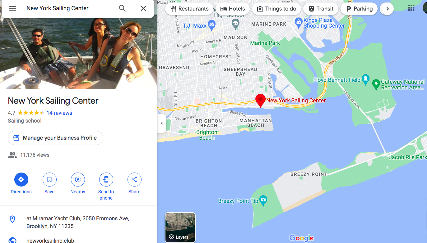
It’s official: New York Sailing Center has moved to Sheepshead Bay, Brooklyn. We are no longer on City Island. We’ve given out some snippets about that, but thought we’d wait to make the full announcement until Google believed it too and updated our listing and map pin.
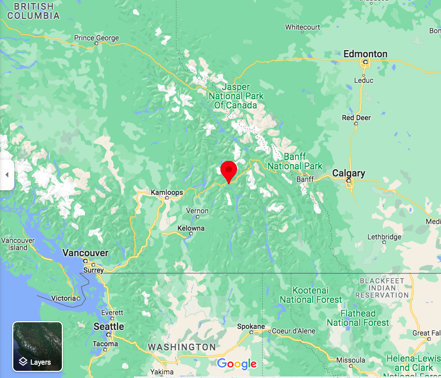
I tried to update that while on vacation last week in Revelstoke, British Columbia. I’ve wanted to snowboard there for awhile. Many people haven’t heard of it; many more have heard of Whistler-Blackcomb, which is also in B.C. and is larger. And, more crowded. Less Ikonic. (No; not misspelled – at least not in the sense of multi-mountain access passes that many of you know and use.)
While up there, I got the expected text: a photo of the postcard that Google sent to the new location. It had a code I needed to enter when logged in. Forgot the password, of course, so instead of risking loss of our Google account messing around, I just waited until I got back to a device Google associated us with. And, in minutes, Google believed what I’d been saying for awhile: we moved to Sheepshead Bay, Brooklyn! And, it updated the map.
Why the move?
We tried out a satellite branch there last season on a limited basis. Still NYC; still sailing off moorings; still not worried about commercial traffic and strong currents. They wanted a school presence; we wanted to experiment.
Weather has become worse for sailing in much of the Tri-State region over the last few years, and City Island was no exception. More volatility in wind speeds (too little or too much, and more often the former). More consistent risk and occurrence of thunderstorms.
City Island is a great place to visit, but painful on the B 2 B side of things. We had some hope that our new hosts at Sheepshead Bay would be a welcome change of pace.
One season sold us, and that was that with that. Sailing in Sheepshead Bay, and Rockaway Inlet, with the Atlantic Ocean just beyond Breezy Point, was a game changer. Zero low-wind cancellations. One late afternoon cut slightly short when a building sea breeze became a little too much for day 2 students who’d already been put through their paces. One early evening when everyone started heading back to port when it looked like a thunderstorm was approaching. It missed – and hit the north shores of Queens/Long Island and the Sound. Other than that, no weather delays. Incredible record in this time of climate change.
Add to that a great host facility with all the parts, easy access by car or public transit, and a welcoming and super inclusive sailing environment. And, add dolphins. Yup; it’s hard to sail there a few times and NOT see some. Whales? Not uncommon further out or around the corner. All this makes us almost not want to wait for the new season to begin.
But first, another map, and another experiment! Off to Revelstoke, B.C, for a mostly ski/ride trip with a side hit to friends in Seattle on the way back.
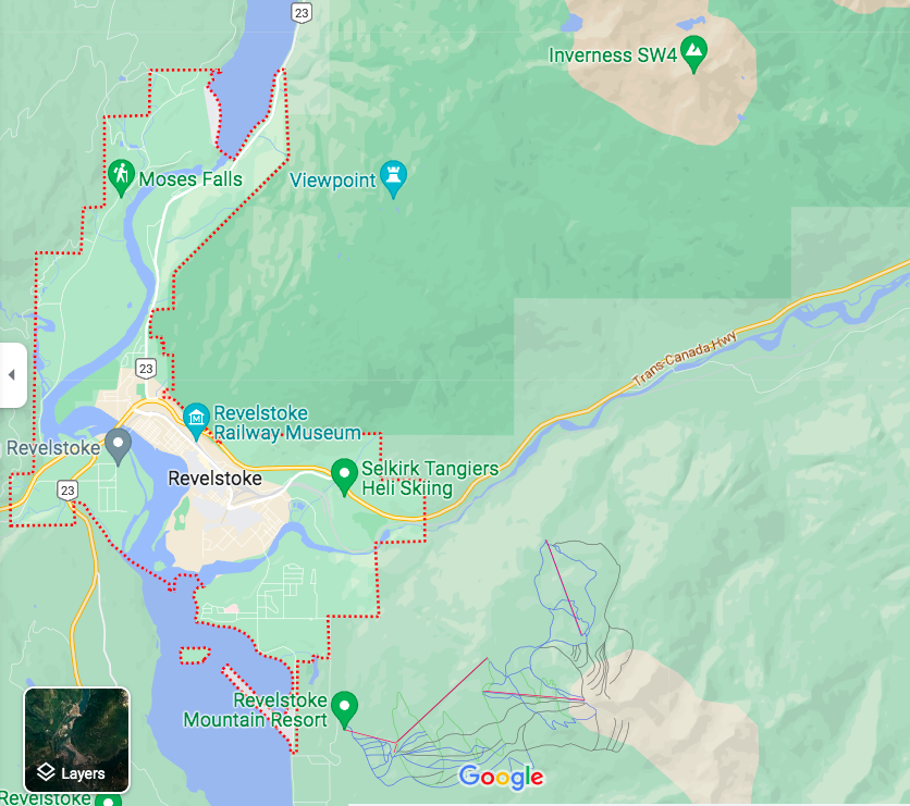
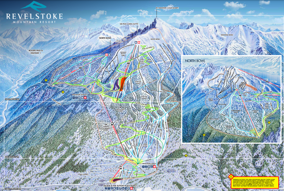
Revelstoke has a history of timber and rail. They do go hand in hand. What many people don’t realize, even if they’re aware of Revelstoke Mountain Resort, is that skiing has a long history there… about a century of it. You can look it all up on your own. The current resort only started up in 2007, after a troubled history of trying to keep a ski hill open in that area. The new investors got permits to operate a resort on a large tract of Mount McKenzie. (There’s a Mount Revelstoke, and park named after it, nearby.)
Revelstoke Mountain Resort (hereinafter just Revy) occupies a little over 3,100 acres, which is large if not gigantic. But it has the longest vertical descent of any ski resort in North America, and also the longest trail: 5,600 in round figures, and 9.5 miles in actual ones. The 9.5 one winds back and forth a lot to be that long. But some of the straight top to bottom runs are quite long as well, especially compared to other mountains with less vertical.
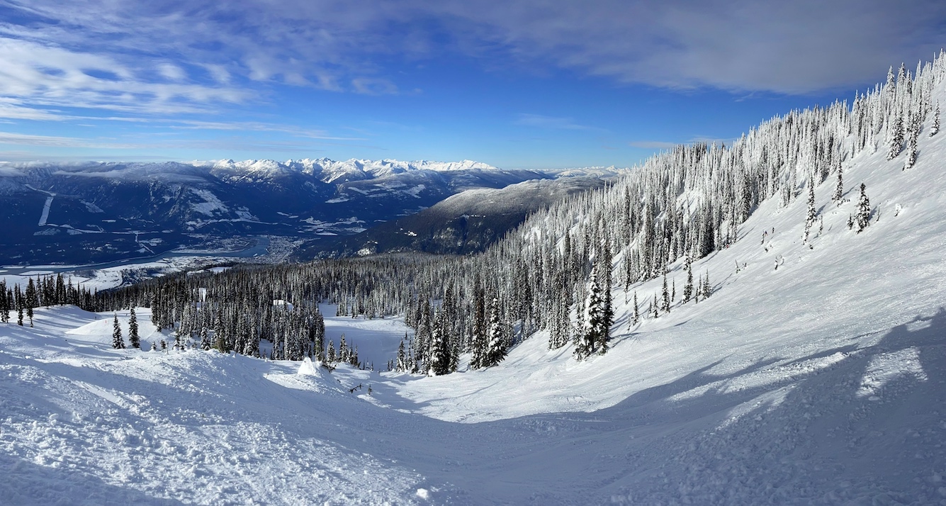
it also has a lot of snow, and ridiculously stunning views and scenery (considered a rival to Telluride – or is it the other way around?). Endless rows of conifers create spectacular glades to ski or ride, and also delineate most trails Three bowls with various degrees of difficulty to access and/or ski make for excellent terrain variety. And, from the highest lift-served areas, anyone can get down. Beginners and true experts, and in between, have choices. But, not crowds. Probably due to the hassle of getting there, it just doesn’t get crowded.
I did a heli day. Had to; rare opportunity as BC in general has so much heli territory, and Revelstoke might be the capital of BC heli skiing. We almost got tired of turning corners in town and seeing yet another heli operation represented. My day was not the best example, as poor visibility severely restricted terrain options and later shut down heli ops early. But, I got blower smoke powder for a run and a half before getting into trees that started off great and became too difficult for most of my group (yes, including me) as we progressed. Taking a helicopter to two different areas to drop in and snowboard was good enough for me.
Also, in the spirit of trying new things, I figured I’d set my sight on dropping cliffs. I booked a private lesson with a highly certified and recommended instructor there (Level 3 Snowboard; Level 4 Alpine). Mike M is an excellent instructor. He knew from observation that I wasn’t ready to drop any serious cliffs (I suspected as much myself, rather than expecting to drop one.) We worked on the skill sets that I’d need on various natural terrain features, and a few in the park. I did do one steep drop that wasn’t too long and ran out nicely, despite often failing at getting off the ground for small hits. My body doesn’t do well at the motions needed, especially when locked onto a board.

But, a good instructor can also just work on fixing bad habits or techniques observed in the student. I know; I was a Level I Snowboard Instructor for a few years, pursuing my Level II before I ran out of time to commit to teaching. I did it part time for a variety of reasons, one of which was some instructional cross training for the sailing school, and which paid large dividends in how we operate courses. Mike saw something and got me to fix it, and it was another game changer. (I was having trouble with heelside edge-hold on steep, icy trails. He fixed my problem; I’d made strides on my own in the past, but he really fixed it. That alone was worth it, yet I got so much more out of the lesson. And yes – an older dog with an open, motivated mind CAN learn new tricks!
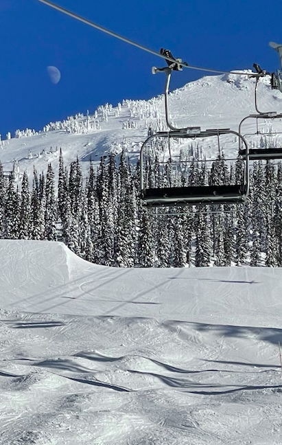
And, I found some small cliff drops where I least expected to later in the trip – mid mountain, on a blue, under their shortest chair ride. First drop perfect! Second, not so much… but down safe. Part of the fun is looking at the trail map, poking around, and exploring a large mountain from both the chairlifts and on the snow.. You’ll find stuff you didn’t know you were looking for.
Maps new to us to look at; old maps updated for others. Still learning the areas out of Sheepshead Bay by using the new charts. Will still need the trail map at Revy to know how to get to the next glades on the next trip (yes, I’ll go back). Sailing from Sheepshead Bay, and riding & skiing at Revelstoke? Two scenarios that we can honestly recommend you bust out maps for.
Want more on NY Sailing Center and our new location? Follow our menu links from the side or bottom of this post and every other page.
Want to learn and see more about Revelstoke? Here you go!..