Which North are you? North 1 or North 2?

Scientists struggle to model the movement of the magnetic north pole. In our live, online ASA 105 coastal navigation course, a real instructor teaches you about this, and why you can basically ignore it.

We’re having a lot of fun with our “Live 105” classes on Zoom! Real instructor, real time, real students – in the same, small manageable class sizes we have for in-person courses. One of our current students sent a link to a BBC article related to the content of a 105 course, which is of course all about…

COASTAL NAVIGATION.

The link Cristina sent? A BBC piece about the movement, or wandering, of the magnetic north pole. We link to the piece at the end of this Rant. For now…
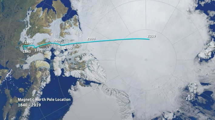
In that pic: the thin aqua line traces the approximate motion of the magnetic north pole from 1840 to 2019. It’s accelerated recently, creating a scientific buzz. (Pic is a still frame from a video in the BBC piece we link to below.)

THE IDEA: the magnetism of earth is both consistent and inconsistent. Compasses point to the same place on earth with minor wiggles. This is close to the geographic north pole, or the rotational axis of earth. If Atlas stopped shrugging, and spun earth on the tip of his finger like a Harlem Globetrotter, it would be on the South Pole, with the North Pole exactly at the other end – or “top.” But, “top” is arbitrary, ain’t it? Space has no direction. We’re floating in space. And, what’s more…

It might flip! Yup. Magnetic North and South have reversed from time to time. Maybe every few hundred thousand years. The question is whether this could happen within our lifetimes. And, partially due to accelerated movement of the Mag North Pole, scientists suspect it might.

1, 2, 3… SWITCH! Oops…

THE ARTICLE’S PATH: Scientists studying this have noted the acceleration of the drift of the Mag North Pole recently, and have updated the global model used for that as it relates to GPS, which is critical to precise navigation. That’s not always super critical itself; as we teach in Start Navigating ( ASA 105), it’s almost more important to check progress in real time than plan the path perfectly to begin with. Basically, they think they’ve identified two molten “hot spots” in the earth’s outer core that are having a tug of war over the magnetic north pole. Kewl! Or, very hot…

That gets into some chart nitty-gritty: the compass rose. It’s a tool to measure direction, and it looks pretty kewl too. Check it…
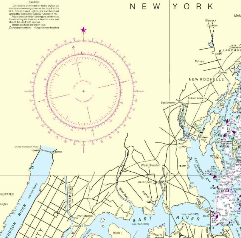
In that pic: a section of the 12363 chart of Western Long Island Sound, with City Island (“City I”) on the right, which is home to the Sailing Center. It’s about half the length of Manhattan away from it; northern MannyHanny is on the bottom left of the chart. It has a nice, large compass rose, or rings that measure direction. The outer ring is for true, or geographic, north – with a star at the top for Polaris, the actual North Star. The inner ring is for magnetic north, which is where compasses point more or less. In navigation classes, we teach how to use these to plot out a course to steer a boat.

THE CONVENTIONAL WISDOM: look at the annual increase/decrease in the variation as listed in rose (the pic below blows it up for you). It’s usually a few “minutes” a year. Each minute = ..? It’s a measly 1/60th of 1 degree of the compass. Yup; slicing hairs with razor blades. Anywho… if your chart is out of date, the idea is to multiply the number of years of ‘stale’ by the number of minutes of change, and add or subtract accordingly. And, get the +/- right!
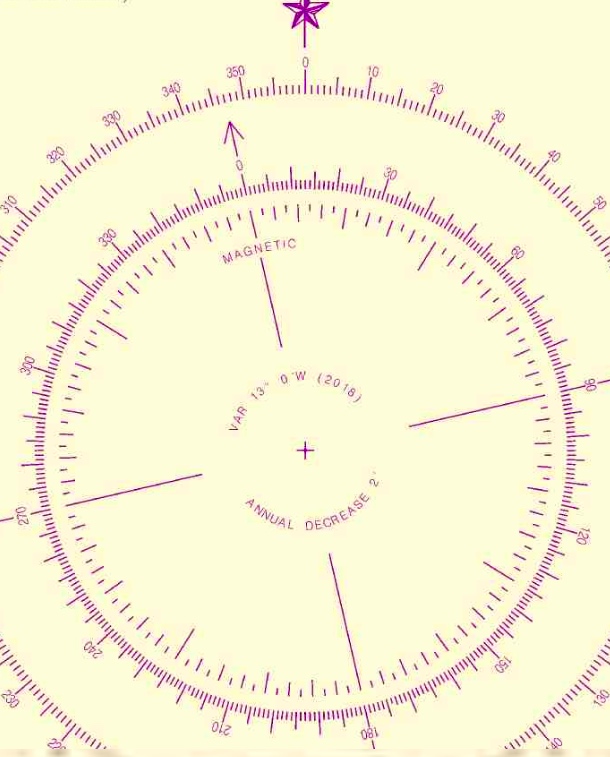
ABOVE: blown-up crop of the compass rose from the same chart above. Variation: 13 degrees West as of 2016. Annual decrease: 2 minutes (2 out of 60, with each compass degree having 60!). Splitting hairs…

NYSC knows better… our Director and HBIC (Head Bozo in Charge), Captain Card, had a suspicion about something years ago. He compared every training chart the government produced, which are all frozen in time going back a far as the early 1980’s, to the updated, real-life versions of those charts. The conclusion? It’s silly to try to project any annual increase or decrease into the future. We expand on that and reveal the goods in class, and in our own in-house text book that we supply to students (and sell on the side). Despite what other books say, just skip this step. Much smarter move: get a current chart, for all the more obvious reasons.

Maybe we’ll be lucky (?) enough to see the poles flip in our lifetimes! Will planes drop from the sky, and cars run off the roads? Well, if they can’t figure that their GPS and compasses are basically pointing backward, we can’t help them.

Your takeaway? Use updated charts to plot courses to your destinations, and casually follow along with the progress of Mag North Pole’s wanderings across cold areas most of us will never visit.

And now, as promised, the link to the BBC piece…

https://www.bbc.com/news/science-environment-52550973

Happy hunting!
Zoom. Boom. Learn nav live!

We’re rolling live with Zoom! Our interactive on-line Start Navigating courses (ASA 105, Coastal Navigation) are officially a hit. They have 100% social distance, are fun, and as if we’re right there with you.

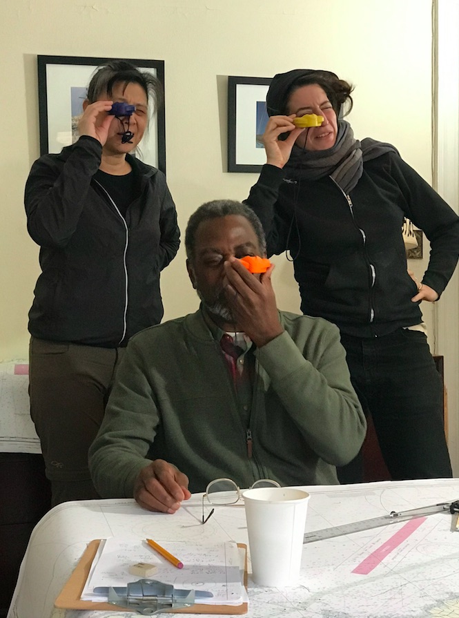
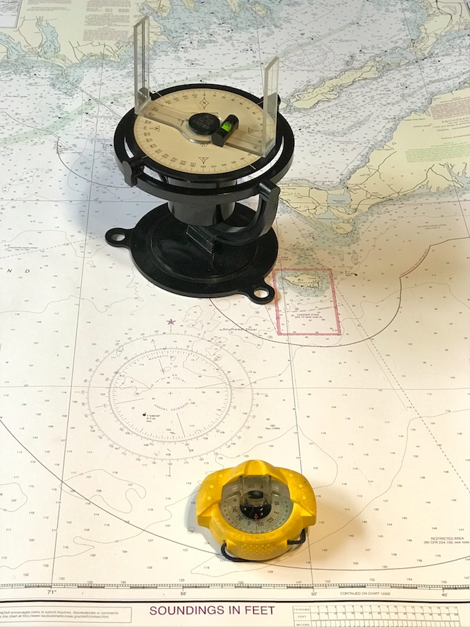
(…but, of course, we’re NOT.) IN THAT PIC: Two tools! Err… instruments. ‘North:’ a pelorus we recently scored on eBay. They’re antiquated to obsolescent, but still critical to understanding radar. ‘South:’ hand-bearing compass, or “hockey puck.” Critical to taking bearings for proof of position on the water… and dealing with deviation on the boat’s steering compass! Yup. We teach you how to use both.

Students have been tending to sign up in groups for some reason. No problem! One group and done, and always room for singles and pairs. Some people are arranging social study-sessions in between classes to do some of the practice plotting together.

How does it work?

  1. You sign up. Imagine the Bobble Head version of Ray Liotta in “Goodfellas,” when he’s describing all the excuses people give when his character would go on his collection rounds. Any excuse… his answer’s the same: “F&%$ YOU PAY ME! F#@$ YOU PAY ME! F%*$ YOU PAY ME!” (Parenthetical aside, our Director and HBIC, Captain Card, who runs the Zooms sessions by the way, went to College with someone who was an extra in the movie and got listed in the cast. “Bar Patron.” If you have enough time on your hands, and send us his name, you get $25 off the course!)
  2. We send you the materials: chart, plotting tool, and dividers (nautical drafting compass). We also email the text book in advance as a PDF, although there’s no reading or other prep required. You might want to, however: our Director wrote it. It’s fun, easy to read, well illustrated with photos, color, and step-by-step diagrams. And, it’s effective.
  3. You log on with the invitation before class starts, and BOOM. ZOOM!! You’re learning live, and laughing too.

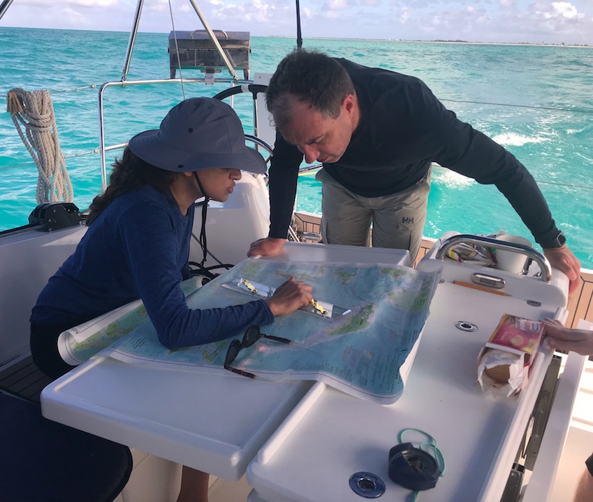
IN THAT PIC: Real-life, real-time. And, it was recent! From our Feb/March trip in the BVI (Virgin Islands). We were heading back to the main island chain from Anegada, barely visible top right. Anegada is barely above sea level, and can’t be seen from the rest of the BVI – not until almost half way across the passage to it! Critical to get it right… it’s surrounded by coral reefs except for a very small approach that must be made at the one safe angle. Or… boom. Aground and unhappy. We often use the example of plotting the passage to Anegada in our Start Navigating course.

What exactly is this course, anyway? “ It’s all about how to navigate a boat for day trips, overnights, and even extended cruises along a coast. You can even lose sight of land for awhile. Soup to nuts: you’ll be able to navigate in pea-soup fog once you’ve practiced on the water for awhile in more sane conditions.

“Who can take it?” Anyone who wants to learn. It’s great for getting stoked / psyched about going boating and sailing. No, there’s no experience or prior study or training required. It’s helpful to have done some boating for perspective but that’s about it.

“Who SHOULD take it?” Anyone who’s intrigued about boating and sailing, and wants to get a flavor of things to come right NOW. Even if you don’t yet sail. If taking this course now doesn’t compete with time or funds for more important things, just do it. If you plan to eventually do longer day sails, and/or overnight trips, especially chartering for a week abroad, then DEF do it. If you already sail, but have no short or mid-term plans to do anything more involved than you already do, then you’re fine skipping this course for now or maybe forever (unless you’re currently having trouble finding your way around). But, it’s fun… and might jump start the next phase of your sailing career.

What’s covered in this course?” Everything from… “this is a chart. We call it a chart, not a map. That’s for landlubbers!” to… proving position underway, compass deviation, proving what the current did to push you off course and fixing that going forward.

Very importantly even for day sailors, we break down the misleading oversimplification that is called “Red, Right, Returning” and prove what that’s “wRong!” Yup. We just said that; you just read that. It’s total BS, and we’ll prove it to you.

IN THAT PIC: From less socially distant times… early winter 2019, Manhattan: Start Navigating course. Of course, we had a surplus of hockey-puck compasses to play with that day as one sailor brought one from home! Yup – even with the on-line course, we can teach you how to handle the hockey puck.

“How is the scheduling done?” If you’re a group of two or more, THAT’S a schedule (unless of course it conflicts with one in progress). Joining alone? No problem. We’ll discuss what’s in the queue now, and if that doesn’t work, we’ll create another schedule. We don’t have to set the entire schedule in advance either.

The course takes 3-5 sessions to complete depending on how long each one is, and how quickly people pick up what we’re putting down. Sessions are typically between 2.5 and 3 hours with a break. We can do them any time of the day or evening, any day of the week, subject to existing obligations. (We are, of course, readying our fleet, with two boats in the water so far, and doing very limited on-water activities.)

“What does it cost? What’s included?” $275, which is $120 less than our normal full tuition for in-person courses. It’s all-inclusive: materials, tools, and certification.

“How do I pull the trigger?” Here are some links: one for the Start Navigating 105 page to learn more about the course, and one for just signing up. Feel free to call or write with any questions first; here’s how to hit us up.